Category:Bloomfield, Connecticut
Jump to navigation
Jump to search
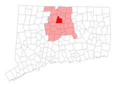
town in Hartford County, Connecticut, USA | |||||
| Upload media | |||||
| Instance of | |||||
|---|---|---|---|---|---|
| Location |
| ||||
| Inception |
| ||||
| Population |
| ||||
| Area |
| ||||
| Elevation above sea level |
| ||||
| Different from | |||||
| official website | |||||
 | |||||
Subcategories
This category has the following 14 subcategories, out of 14 total.
A
B
C
- Captain Oliver Filley House (4 F)
F
- Francis Gillette House (2 F)
N
O
- Old Farm Schoolhouse (2 F)
P
- Penwood State Park (26 F)
T
V
Media in category "Bloomfield, Connecticut"
The following 27 files are in this category, out of 27 total.
-
Art located at the Cigna business park, Bloomfield, Connecticut LCCN2012631579.tif 4,096 × 6,144; 144.03 MB
-
Bell by Meneely Bell Foundry - Bloomfield, Connecticut - DSC09397.JPG 3,240 × 4,320; 4.9 MB
-
Bloomfield CT lg.PNG 1,824 × 1,374; 110 KB
-
Bloomfield Greenway Multi Use Trail along CT 189, Bloomfield CT.jpg 4,032 × 3,024; 4.22 MB
-
Bloomfield High School original.JPG 2,848 × 2,144; 1.17 MB
-
Bloomfield High School.JPG 2,818 × 1,210; 143 KB
-
Bloomfield streetcar bridge.jpg 1,133 × 453; 87 KB
-
Business tour of Hooker Brewing Company in Bloomfield (5537356763).jpg 1,952 × 3,264; 1.06 MB
-
Business tour of Hooker Brewing Company in Bloomfield (5537357087).jpg 1,952 × 3,264; 1.15 MB
-
Business tour of Hooker Brewing Company in Bloomfield (5537935720).jpg 1,952 × 3,264; 1.22 MB
-
Business tour of Hooker Brewing Company in Bloomfield (5537935824).jpg 1,952 × 3,264; 1.07 MB
-
CNZR 3760 southbound in Bloomfield.png 944 × 890; 2.12 MB
-
Copaco Shopping Center sign, Bloomfield CT.jpg 4,032 × 3,024; 4.4 MB
-
CVS Pharmacy Bloomfield, CT (14638872955).jpg 2,328 × 1,587; 798 KB
-
Doosan Hirail Excavator.jpg 3,024 × 4,032; 2.95 MB
-
Gillette Golf Course, at Cigna business park, Bloomfield, Connecticut LCCN2012631571.tif 6,144 × 4,096; 144.03 MB
-
Gillette Golf Course, at Cigna business park, Bloomfield, Connecticut LCCN2012631572.tif 6,144 × 4,096; 144.03 MB
-
Gillette Golf Course, at Cigna business park, Bloomfield, Connecticut LCCN2012631573.tif 6,144 × 4,096; 144.03 MB
-
Gillette Golf Course, at Cigna business park, Bloomfield, Connecticut LCCN2012631574.tif 4,096 × 6,144; 144.03 MB
-
Gillette Golf Course, at Cigna business park, Bloomfield, Connecticut LCCN2012631576.tif 6,144 × 4,096; 144.03 MB
-
Gillette Golf Course, at Cigna business park, Bloomfield, Connecticut LCCN2012631581.tif 6,144 × 4,096; 144.03 MB
-
Gillette Golf Course, at Cigna business park, Bloomfield, Connecticut LCCN2012631585.tif 6,144 × 4,096; 144.03 MB
-
Home Depot (Bloomfield, Connecticut) (51688036059).jpg 5,152 × 3,864; 6.01 MB
-
Kamatics Corporation Headquarters.jpg 3,648 × 2,736; 1.98 MB
-
Land Jet bus in Bloomfield.jpg 1,927 × 1,148; 693 KB
-
McDonald's PlayPlace Bloomfield CT (14454762068).jpg 2,503 × 1,154; 1.94 MB
-
Ruby Tuesday 848 Cottage Grove Rd, Bloomfield, CT 3 (51350682816).jpg 4,032 × 1,960; 3 MB


