Category:Blutbuche beim Haus Kemnade
Jump to navigation
Jump to search
| Object location | | View all coordinates using: OpenStreetMap |
|---|
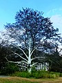
Deutsch: Naturdenkmal 3.3.18
Media in category "Blutbuche beim Haus Kemnade"
The following 7 files are in this category, out of 7 total.
-
 2017-09-10 Haus Kemnade, Hattingen (NRW) 01.jpg 3,758 × 2,503; 7.13 MB
-
 Bauernhausmuseum Blutbuche am Haus Kemnade 2015.jpg 4,288 × 2,848; 3.56 MB
-
 Hattingen - Weiße Buche von Kemnade - panoramio.jpg 3,240 × 4,320; 4.47 MB
-
 Hattingen Blankenstein - Bauernhausmuseum 01 ies.jpg 3,888 × 2,592; 2.7 MB
-
 Hattingen Blankenstein - Haus Kemnade 51 ies.jpg 3,888 × 2,592; 2.24 MB
-
 Hattingen Blankenstein - Haus Kemnade 52 ies.jpg 3,888 × 2,592; 1.93 MB
-
 Hattingen Blankenstein - Haus Kemnade 53 ies.jpg 2,592 × 3,888; 2.15 MB
_01.jpg)

