Category:Bodenfelde
Jump to navigation
Jump to search
municipality of Germany    | |||||
| Upload media | |||||
| Instance of |
| ||||
|---|---|---|---|---|---|
| Location | Northeim, Lower Saxony, Germany | ||||
| Population |
| ||||
| Area |
| ||||
| Elevation above sea level |
| ||||
| official website | |||||
 | |||||
English: Bodenfelde is a village and a municipality in the district of Northeim, in Lower Saxony, Germany. It is situated on the right bank of the Weser, approx. 35 km north of Kassel, and 30 km northwest of Göttingen.
Nederlands: Bodenfelde is een plaats in de Duitse deelstaat Nedersaksen, gelegen in het district Northeim. De stad heeft ongeveer 3800 inwoners.
Subcategories
This category has the following 15 subcategories, out of 15 total.
B
- Bodenfelde in art (1 F)
D
E
H
I
M
- Mühlengraben (Bodenfelde) (18 F)
N
S
- Schuettenhoff (14 F)
T
V
- Views of Bodenfelde (11 F)
Media in category "Bodenfelde"
The following 9 files are in this category, out of 9 total.
-
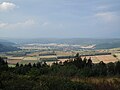 Blick auf Bodenfelde und Lippoldsberg.jpg 4,320 × 3,240; 4.98 MB
-
 Blick vom Heuberg auf Lippoldsberg und Bodenfelde.jpg 4,320 × 3,240; 4.01 MB
-
 Bodenfelde 02.jpg 3,648 × 2,736; 2.82 MB
-
 Bodenfelde in NOM.svg 950 × 858; 421 KB
-
 DEU Bodenfelde COA.svg 512 × 612; 2 KB
-
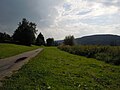 Landschaft bei Bodenfelde.jpg 4,320 × 3,240; 4.4 MB
-
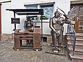
 Polier 1986.jpg 2,736 × 2,736; 881 KB
-
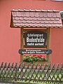 Tafel „Erholungsort Bodenfelde staatlich anerkannt“.jpg 3,240 × 4,320; 5.04 MB
-
 Willkommensschild Erholungsort Bodenfelde.jpg 4,320 × 3,240; 2.76 MB


