Category:Bolton, East Lothian (civil parish)
Jump to navigation
Jump to search
Scottish parish in East Lothian, Scotland, UK | |||||
| Upload media | |||||
| Instance of | |||||
|---|---|---|---|---|---|
| Part of |
| ||||
| Named after | |||||
| Location |
| ||||
| Population |
| ||||
| Area |
| ||||
 | |||||
Media in category "Bolton, East Lothian (civil parish)"
The following 200 files are in this category, out of 209 total.
(previous page) (next page)-

-

-

-
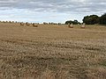
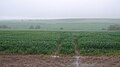
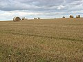
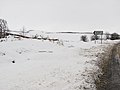
 Arable land near Bolton - geograph.org.uk - 4399560.jpg 800 × 533; 227 KB
-
 Arable land, Howden - geograph.org.uk - 2907598.jpg 640 × 360; 167 KB
-
 Arable land, Kirklands - geograph.org.uk - 5552546.jpg 800 × 531; 225 KB
-
 B6355 through Bolton Muir Wood - geograph.org.uk - 5478598.jpg 640 × 480; 98 KB
-
 B6368 - geograph.org.uk - 4968623.jpg 1,024 × 683; 300 KB
-
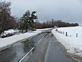
 B6368 heading south - geograph.org.uk - 4492196.jpg 640 × 480; 40 KB
-
 B6368 towards Bolton - geograph.org.uk - 4492191.jpg 640 × 480; 82 KB
-
 B6368, Upper Bolton - geograph.org.uk - 2907590.jpg 640 × 360; 233 KB
-
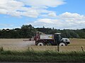
 Baling straw - geograph.org.uk - 4816003.jpg 1,024 × 768; 272 KB
-
 Barley near Ewingston - geograph.org.uk - 4108928.jpg 640 × 360; 214 KB
-
 Barley straw bales near Petersmuir - geograph.org.uk - 2072530.jpg 1,024 × 768; 155 KB
-
 Beside Begbie Wood - geograph.org.uk - 5552731.jpg 800 × 531; 284 KB
-
 Beugh Burn - geograph.org.uk - 4696482.jpg 800 × 600; 549 KB
-
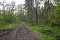
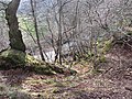
 Bolton Muir Wood - geograph.org.uk - 3452511.jpg 640 × 480; 358 KB
-
 Bolton Muir Wood - geograph.org.uk - 3452515.jpg 640 × 480; 361 KB
-
 Bolton Muir Wood - geograph.org.uk - 3878671.jpg 640 × 360; 273 KB
-
 Bolton Muir Wood - geograph.org.uk - 3878702.jpg 640 × 480; 288 KB
-
 Bolton Muir Wood - geograph.org.uk - 3888668.jpg 640 × 480; 338 KB
-
 Bolton Muir Wood - geograph.org.uk - 4968608.jpg 1,024 × 683; 454 KB
-
 Bolton Muir Wood - geograph.org.uk - 4968616.jpg 1,024 × 683; 499 KB
-
 Bolton Muir Wood - geograph.org.uk - 5809746.jpg 1,024 × 683; 567 KB
-
 Bolton Muir Wood - geograph.org.uk - 5809747.jpg 1,024 × 683; 479 KB
-
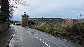
 Bolton Steadings - geograph.org.uk - 2723877.jpg 640 × 360; 210 KB
-
 Bolton Steadings - geograph.org.uk - 2725467.jpg 640 × 360; 180 KB
-
 Bolton to Gifford road - geograph.org.uk - 4229384.jpg 640 × 480; 137 KB
-
 Bolton, East Lothian - geograph.org.uk - 4968635.jpg 1,024 × 576; 331 KB
-
 Bridge by Begbie Wood - geograph.org.uk - 3599610.jpg 640 × 480; 337 KB
-
 Bridge, Bolton - geograph.org.uk - 2725484.jpg 640 × 360; 238 KB
-
 Cauldshiel cottages - geograph.org.uk - 2078554.jpg 3,072 × 2,304; 1,018 KB
-
 Cereal crop, Cauldshiels - geograph.org.uk - 4968628.jpg 1,024 × 576; 229 KB
-
 Cereals near Cauldshiels - geograph.org.uk - 2383421.jpg 2,592 × 1,944; 2.5 MB
-
 Clearing, Bolton Muir Wood - geograph.org.uk - 3878696.jpg 640 × 480; 310 KB
-
 Clearing, Bolton Muir Wood - geograph.org.uk - 3880543.jpg 640 × 360; 237 KB
-
 Colstoun Water - geograph.org.uk - 2723890.jpg 640 × 360; 259 KB
-
 Colstoun Water - geograph.org.uk - 2725487.jpg 640 × 360; 243 KB
-
 Colstoun Water - geograph.org.uk - 2942183.jpg 640 × 480; 374 KB
-
 Colstoun Water - geograph.org.uk - 2942201.jpg 640 × 480; 377 KB
-
 Country road heading past Bankrugg Farm - geograph.org.uk - 2056370.jpg 640 × 480; 100 KB
-
 Country road in East Lothian - geograph.org.uk - 2383382.jpg 2,592 × 1,944; 2.69 MB
-
 Country road on Bohomy Hill - geograph.org.uk - 2383694.jpg 2,592 × 1,944; 2.54 MB
-
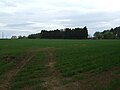 Crop field and woodland - geograph.org.uk - 4478793.jpg 640 × 480; 49 KB
-

-
 Crop field beside woodland - geograph.org.uk - 4478792.jpg 640 × 480; 73 KB
-
 Crop field north of Bolton - geograph.org.uk - 4478791.jpg 640 × 480; 55 KB
-
 Crop spraying, Bolton - geograph.org.uk - 5991006.jpg 1,024 × 768; 309 KB
-
 Cropped cereal ^ straw bales in East Lothian - geograph.org.uk - 2078513.jpg 3,072 × 2,304; 993 KB
-
 Doocot, Bolton - geograph.org.uk - 2725480.jpg 640 × 360; 207 KB
-
 Drainage channel alongside the B6368 - geograph.org.uk - 2376262.jpg 2,592 × 1,944; 3.18 MB
-
 Driveway, Eaglescairnie - geograph.org.uk - 4235942.jpg 800 × 600; 490 KB
-
 Eaglescairnie driveway - geograph.org.uk - 1288768.jpg 640 × 480; 109 KB
-
 Eaglescairnie House - geograph.org.uk - 1022081.jpg 640 × 480; 73 KB
-
 East Lothian Architecture , Bolton Muir, Near Gifford - geograph.org.uk - 4131300.jpg 1,600 × 1,200; 320 KB
-

-
 East Lothian Farm Signs , Kirklands Farm, Near Gifford - geograph.org.uk - 4131167.jpg 1,200 × 1,600; 655 KB
-
 East Lothian Landscape , 93m Trig Point near Bolton - geograph.org.uk - 2773317.jpg 1,600 × 1,200; 357 KB
-
 East Lothian Landscape , Fieldscene Near Bolton Muir - geograph.org.uk - 4131242.jpg 1,600 × 1,200; 344 KB
-
 East Lothian Landscape , Fieldscene Near Pilmuir - geograph.org.uk - 4131077.jpg 1,600 × 1,200; 328 KB
-
 East Lothian Landscape , prairie highway - geograph.org.uk - 4130775.jpg 1,600 × 1,200; 273 KB
-
 East Lothian Landscape , Summer Field Scene Near Pilmuir - geograph.org.uk - 4131020.jpg 1,600 × 1,200; 501 KB
-
 East Lothian Landscape , Telegraph Road - geograph.org.uk - 4131144.jpg 1,200 × 1,600; 306 KB
-

-
 Ewelie Wood - geograph.org.uk - 2942177.jpg 640 × 480; 343 KB
-
 Farmland at Bolton, East Lothian - geograph.org.uk - 2290276.jpg 640 × 370; 186 KB
-
 Farmland in the valley of the How Burn - geograph.org.uk - 2383413.jpg 2,592 × 1,944; 2.16 MB
-
 Farmland on the north side of Bohomy Hill - geograph.org.uk - 2383719.jpg 2,592 × 1,944; 2.91 MB
-
 Farmland view to the SE of Cauldshiel - geograph.org.uk - 2078557.jpg 3,072 × 2,304; 658 KB
-
 Field and hedge on Bohomy Hill - geograph.org.uk - 2383676.jpg 2,592 × 1,944; 2.83 MB
-
 Field being ploughed - geograph.org.uk - 3604577.jpg 640 × 360; 241 KB
-
 Field corner, Bolton - geograph.org.uk - 3516554.jpg 640 × 480; 293 KB
-
 Field corner, Bolton - geograph.org.uk - 3516561.jpg 640 × 480; 308 KB
-
 Field edge boundary at Howden Wood - geograph.org.uk - 2078582.jpg 3,072 × 2,304; 995 KB
-
 Field edge, Eaglescarnie - geograph.org.uk - 4697309.jpg 800 × 600; 548 KB
-
 Field entrance off the B6355 - geograph.org.uk - 5478602.jpg 640 × 480; 88 KB
-
 Field near Cauldshiel - geograph.org.uk - 5756708.jpg 1,024 × 576; 294 KB
-
 Field, Bolton - geograph.org.uk - 4398263.jpg 800 × 533; 188 KB
-
 Field, Eaglescairnie - geograph.org.uk - 5552737.jpg 800 × 531; 208 KB
-
 Fields and drainage between Parkend and West Lodge - geograph.org.uk - 2376259.jpg 2,592 × 1,944; 2.7 MB
-
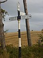
 Finger post, Bolton - geograph.org.uk - 5552734.jpg 531 × 800; 144 KB
-
 Freshly ploughed ^ rollered field in East Lothian - geograph.org.uk - 2078585.jpg 3,072 × 2,304; 846 KB
-
 Gate and stile - geograph.org.uk - 2376266.jpg 2,592 × 1,944; 3.41 MB
-
 Gifford and Garvald Railway - geograph.org.uk - 5756703.jpg 1,024 × 576; 400 KB
-
 Gifford and Garvald Railway - geograph.org.uk - 5756704.jpg 1,024 × 576; 436 KB
-
 Gifford and Garvald Railway - geograph.org.uk - 5756705.jpg 1,024 × 576; 343 KB
-
 Gilbert Burns's family memorial, Bolton Church, East Lothian.jpg 2,037 × 3,137; 1.31 MB
-
 Hedgerow with trees - geograph.org.uk - 2383724.jpg 2,592 × 1,944; 2.97 MB
-
 House sign at How Knowe - geograph.org.uk - 2078577.jpg 3,072 × 2,304; 1.43 MB
-
 Howden - geograph.org.uk - 2383436.jpg 2,592 × 1,944; 2.47 MB
-
 Howden Wood - geograph.org.uk - 2078588.jpg 3,072 × 2,304; 1.37 MB
-
 Howden Wood - geograph.org.uk - 4968619.jpg 1,024 × 683; 371 KB
-
 Left to Petersmuir - geograph.org.uk - 2072515.jpg 1,024 × 768; 148 KB
-
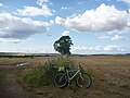
 Little Pilmuir - geograph.org.uk - 4399487.jpg 800 × 600; 267 KB
-
 March gate - geograph.org.uk - 4691923.jpg 800 × 450; 415 KB
-
 Minor road beside South Port Plantation - geograph.org.uk - 4492207.jpg 640 × 480; 107 KB
-
-
 Minor road heading south of the B6368 in East Lothian - geograph.org.uk - 2078573.jpg 2,304 × 3,072; 1.04 MB
-
 Minor road, Pilmuir - geograph.org.uk - 4399590.jpg 800 × 450; 206 KB
-
 Mountpleasant Cottage - geograph.org.uk - 5478591.jpg 640 × 480; 72 KB
-
 New farm building at Howden - geograph.org.uk - 2383440.jpg 2,592 × 1,944; 2.58 MB
-
 New hedge at Upper Bolton - geograph.org.uk - 2383508.jpg 2,592 × 1,944; 2.91 MB
-
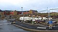
 New houses, Bolton - geograph.org.uk - 4815366.jpg 1,024 × 768; 247 KB
-

-
 New pavement, Bolton - geograph.org.uk - 2907442.jpg 640 × 360; 197 KB
-
 Newly ploughed field, Kirklands - geograph.org.uk - 3599590.jpg 640 × 360; 243 KB
-
 Oaks, Bolton Muir Wood - geograph.org.uk - 3888630.jpg 640 × 480; 351 KB
-
 Oilseed rape crop, Bolton Muir - geograph.org.uk - 5478482.jpg 640 × 480; 61 KB
-
 Oilseed Rape near Bolton - geograph.org.uk - 2383576.jpg 2,592 × 1,944; 3.06 MB
-
 Oilseed rape, Bolton - geograph.org.uk - 4968632.jpg 1,024 × 576; 322 KB
-
 Oilseed rape, Howden - geograph.org.uk - 4968625.jpg 1,024 × 683; 288 KB
-
 One of the East Lothian spring colours - geograph.org.uk - 2383397.jpg 2,592 × 1,944; 3.27 MB
-
 Pasture at Eaglescairnie - geograph.org.uk - 4409232.jpg 3,264 × 2,448; 3.84 MB
-
 Pasture at Hay Dean - geograph.org.uk - 4409242.jpg 3,264 × 2,448; 4.65 MB
-
 Pasture near Leehouses - geograph.org.uk - 2383687.jpg 2,592 × 1,944; 2.63 MB
-
 Path by field edge - geograph.org.uk - 1288781.jpg 480 × 640; 109 KB
-
 Path sign by the How Burn - geograph.org.uk - 5756710.jpg 1,024 × 576; 416 KB
-
 Path sign, Eaglescairnie - geograph.org.uk - 4697317.jpg 800 × 450; 433 KB
-
 Path, Bolton Muir Wood - geograph.org.uk - 3878686.jpg 640 × 360; 264 KB
-
 Path, Bolton Muir Wood - geograph.org.uk - 3880550.jpg 640 × 480; 347 KB
-
 Path, Bolton Muir Wood - geograph.org.uk - 3880556.jpg 640 × 480; 308 KB
-
 Path, Bolton Muir Wood - geograph.org.uk - 3880569.jpg 640 × 480; 335 KB
-
 Path, Bolton Muir Wood - geograph.org.uk - 3888661.jpg 640 × 480; 336 KB
-
 Path, Eaglescairnie - geograph.org.uk - 4235937.jpg 800 × 600; 466 KB
-
 Path, Eaglescarnie - geograph.org.uk - 4697314.jpg 800 × 450; 389 KB
-
 Petersmuir Wood - geograph.org.uk - 3465938.jpg 640 × 480; 364 KB
-
 Petersmuir Wood - geograph.org.uk - 3466761.jpg 640 × 480; 347 KB
-
 Pheasant feeder - geograph.org.uk - 4235934.jpg 800 × 600; 530 KB
-
 Plaque, Bolton Church - geograph.org.uk - 2725474.jpg 360 × 640; 64 KB
-
 Playground, Bolton - geograph.org.uk - 2907585.jpg 640 × 387; 219 KB
-
 Policy woodland, Colstoun - geograph.org.uk - 3776824.jpg 640 × 480; 387 KB
-
 Road junction between Bolton and Upper Bolton - geograph.org.uk - 2383524.jpg 2,592 × 1,944; 2.2 MB
-
 Road junction on the B6355 - geograph.org.uk - 5478589.jpg 640 × 480; 72 KB
-
 Road junction, Gilchriston - geograph.org.uk - 1820403.jpg 640 × 480; 57 KB
-
 Road junction, Gilchriston - geograph.org.uk - 1820407.jpg 640 × 480; 86 KB
-
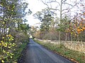
 Road out of Bolton - geograph.org.uk - 3516548.jpg 640 × 480; 240 KB
-
 Road sign near Howden Wood - geograph.org.uk - 2078568.jpg 3,072 × 2,304; 722 KB
-

-
 Road to Gifford - geograph.org.uk - 3888676.jpg 640 × 480; 329 KB
-
 Road to Kirklands - geograph.org.uk - 4399557.jpg 800 × 533; 300 KB
-
 Roadside plantation at Howden - geograph.org.uk - 2383447.jpg 2,592 × 1,944; 3.26 MB
-
 Roadside strip, Bolton Muir - geograph.org.uk - 5552739.jpg 800 × 531; 342 KB
-
 Rural East Lothian , Approaching Bolton From The South - geograph.org.uk - 2776198.jpg 1,600 × 1,200; 248 KB
-
 Rural East Lothian , Approaching Bolton Muir - geograph.org.uk - 4131281.jpg 1,600 × 1,200; 547 KB
-
 Rural East Lothian , Approaching Kirklands From The West - geograph.org.uk - 4131088.jpg 1,600 × 1,200; 480 KB
-
 Rural East Lothian , Approaching Marvingston - geograph.org.uk - 4183953.jpg 1,600 × 1,200; 346 KB
-

-

-

-

-
 Rural East Lothian , Choices, Choices - geograph.org.uk - 4131187.jpg 1,600 × 1,200; 366 KB
-
 Rural East Lothian , Colstoun Bridge - geograph.org.uk - 4130727.jpg 1,600 × 1,200; 767 KB
-
 Rural East Lothian , Colstoun Bridge - geograph.org.uk - 4130732.jpg 1,600 × 1,200; 519 KB
-
 Rural East Lothian , Driveway To Pilmuir - geograph.org.uk - 4131065.jpg 1,600 × 1,200; 612 KB
-

-
-
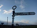 Rural East Lothian , ELCC Fingerpost near Bolton - geograph.org.uk - 2773339.jpg 1,600 × 1,200; 151 KB
-
 Rural East Lothian , End Of The Road At Pilmuir - geograph.org.uk - 4131053.jpg 1,600 × 1,200; 493 KB
-
 Rural East Lothian , Field Entrance Near Marvingston - geograph.org.uk - 4183959.jpg 1,600 × 1,200; 473 KB
-
 Rural East Lothian , Houses At Parkend - geograph.org.uk - 4130782.jpg 1,600 × 1,200; 259 KB
-
 Rural East Lothian , Kirklands Farm Road-end - geograph.org.uk - 4131161.jpg 1,600 × 1,200; 453 KB
-
 Rural East Lothian , Looking Back At Kirklands - geograph.org.uk - 4131153.jpg 1,600 × 1,200; 326 KB
-
 Rural East Lothian , Marvingston Crossroads (Looking SE) - geograph.org.uk - 4184080.jpg 1,600 × 1,200; 433 KB
-
 Rural East Lothian , Marvingston Crossroads - geograph.org.uk - 4184084.jpg 1,200 × 1,600; 439 KB
-

-
 Rural East Lothian , North Lodge, Colstoun Estate - geograph.org.uk - 4130739.jpg 1,600 × 1,200; 666 KB
-

-
 Rural East Lothian , Road NW From Marvingston - geograph.org.uk - 4183966.jpg 1,600 × 1,200; 295 KB
-
 Rural East Lothian , Road To Pilmuir - geograph.org.uk - 4131044.jpg 1,600 × 1,200; 702 KB
-

-
 Rural East Lothian , Roadside Mirror Near Pilmuir - geograph.org.uk - 4131032.jpg 1,600 × 1,200; 358 KB
-
 Rural East Lothian , The Road From Kirklands - geograph.org.uk - 4131135.jpg 1,600 × 1,200; 328 KB
-
 Rural East Lothian , The Road To Pilmuir - geograph.org.uk - 4131015.jpg 1,600 × 1,200; 388 KB
-
 Rural East Lothian , The Track From Kirklands To Pilmuir - geograph.org.uk - 4131104.jpg 1,600 × 1,200; 499 KB
-
 Rural East Lothian , West Lodge, Colstoun Estate - geograph.org.uk - 4130743.jpg 1,600 × 1,200; 614 KB
-
 Scots pines, Bolton Muir Wood - geograph.org.uk - 3880572.jpg 640 × 480; 342 KB
-
 Sheep grazing on a hillside in East Lothian - geograph.org.uk - 2078517.jpg 3,072 × 2,304; 951 KB
-
 Shelter belt thinnings - geograph.org.uk - 4409211.jpg 3,264 × 2,448; 5.5 MB
-
 Small bridge, Eaglescairne - geograph.org.uk - 4229374.jpg 800 × 450; 135 KB
-
 Spring barley at Upper Bolton - geograph.org.uk - 2383502.jpg 2,592 × 1,944; 2.72 MB
-
 Spring sun in Bolton Muir Wood - geograph.org.uk - 4409213.jpg 3,264 × 2,448; 6.55 MB
-
 Staggered Crossroads on the B6355 - geograph.org.uk - 3062313.jpg 640 × 480; 80 KB
-
 Strip wood, Bolton Muir - geograph.org.uk - 4229394.jpg 800 × 600; 546 KB
-
 Suffolk sheep, Eaglescairnie - geograph.org.uk - 4697319.jpg 800 × 450; 367 KB
-
 Telecommunications mast near Greenlaw farm - geograph.org.uk - 2078597.jpg 3,072 × 2,304; 571 KB
-
 The B6368 at Howden Wood - geograph.org.uk - 2078590.jpg 3,072 × 2,304; 1.13 MB
-
 The B6368 heading NE at Cauldshiel - geograph.org.uk - 2078563.jpg 3,072 × 2,304; 692 KB
-
 The Burns Headstone - geograph.org.uk - 2383568.jpg 2,592 × 1,944; 2.45 MB
-
 The Eaglescairnie Burn - geograph.org.uk - 975623.jpg 640 × 480; 101 KB
-
 The entrance to Colstoun House - geograph.org.uk - 1414250.jpg 640 × 480; 125 KB
-

-
 The road through Bolton Wood - geograph.org.uk - 1044465.jpg 640 × 480; 90 KB
-

-
 The road to Petersmuir - geograph.org.uk - 4389775.jpg 3,264 × 2,448; 3.98 MB
-
 Thinned shelter belt on Bolton Muir - geograph.org.uk - 4409266.jpg 3,264 × 2,448; 5.39 MB
-

-
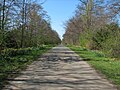
 Track through Bolton Muir Wood - geograph.org.uk - 5478594.jpg 640 × 480; 103 KB
-
 Tree shadows and Woodrush - geograph.org.uk - 4409222.jpg 3,264 × 2,448; 6.51 MB
-
 Upland grazing in East Lothian - geograph.org.uk - 2078510.jpg 3,072 × 2,304; 723 KB
-
 Upper Bolton - geograph.org.uk - 2383505.jpg 2,592 × 1,944; 2.76 MB


_-_geograph.org.uk_-_4184080.jpg)


&filefrom=Upper+Bolton+Strip+-+geograph.org.uk+-+4409260.jpg#mw-category-media)