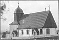
Category:Bondstorps kyrka
Jump to navigation
Jump to search
| Object location | | View all coordinates using: OpenStreetMap |
|---|
church building in Vaggeryd Municipality, Jönköping County, Sweden    | |||||
| Upload media | |||||
| Instance of | |||||
|---|---|---|---|---|---|
| Location | Bondstorp, Vaggeryd Municipality, Jönköping County, Sweden | ||||
| Diocese | |||||
| Connects with | |||||
| Has use |
| ||||
| Occupant |
| ||||
| Heritage designation |
| ||||
| Inception |
| ||||
 | |||||
Svenska: Bondstorps kyrka tillhör Byarum-Bondstorps församling, Östbo-Västbo kontrakt, Växjö stift / Diocese of Växjö.
|
This is a category about an ecclesiastical monument in Sweden, number 21300000004443 (sub-number: 21400000442880) in the RAÄ buildings database.
|
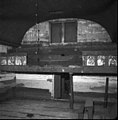
Subcategories
This category has the following 2 subcategories, out of 2 total.
B
- Bondstorps kyrkogård (4 F)
I
- Interior of Bondstorps kyrka (5 F)
Media in category "Bondstorps kyrka"
The following 38 files are in this category, out of 38 total.
-
 Bondstorps ka v.JPG 1,180 × 1,154; 319 KB
-
 Bondstorps ka.JPG 1,273 × 1,168; 378 KB
-
 Bondstorps kyrka - KMB - 16000200068491.jpg 578 × 600; 34 KB
-
 Bondstorps kyrka - KMB - 16000200068492.jpg 575 × 600; 31 KB
-
 Bondstorps kyrka - KMB - 16000200068493.jpg 826 × 560; 33 KB
-
 Bondstorps kyrka - KMB - 16000200068494.jpg 575 × 600; 35 KB
-
 Bondstorps kyrka - KMB - 16000200068495.jpg 578 × 600; 31 KB
-
 Bondstorps kyrka - KMB - 16000200068496.jpg 577 × 600; 40 KB
-
 Bondstorps kyrka - KMB - 16000200068497.jpg 579 × 600; 49 KB
-
 Bondstorps kyrka - KMB - 16000200068499.jpg 588 × 600; 27 KB
-
 Bondstorps kyrka - KMB - 16000200068500.jpg 579 × 600; 36 KB
-
 Bondstorps kyrka - KMB - 16000200068501.jpg 826 × 588; 37 KB
-
 Bondstorps kyrka - KMB - 16000200068502.jpg 826 × 593; 40 KB
-
 Bondstorps kyrka - KMB - 16000200068503.jpg 826 × 590; 32 KB
-
 Bondstorps kyrka - KMB - 16000200068504.jpg 447 × 600; 22 KB
-
 Bondstorps kyrka - KMB - 16000200068505.jpg 433 × 600; 18 KB
-
 Bondstorps kyrka - KMB - 16000200068506.jpg 442 × 600; 21 KB
-
 Bondstorps kyrka - KMB - 16000200068507.jpg 447 × 600; 19 KB
-
 Bondstorps kyrka - KMB - 16000200068508.jpg 592 × 600; 21 KB
-
 Bondstorps kyrka - KMB - 16000200068509.jpg 582 × 600; 16 KB
-
 Bondstorps kyrka - KMB - 16000200068510.jpg 581 × 600; 16 KB
-
 Bondstorps kyrka - KMB - 16000200068511.jpg 577 × 600; 26 KB
-
 Bondstorps kyrka - KMB - 16000200068512.jpg 579 × 600; 22 KB
-
 Bondstorps kyrka - KMB - 16000200068513.jpg 580 × 600; 28 KB
-
 Bondstorps kyrka - KMB - 16000200068514.jpg 576 × 600; 29 KB
-
 Bondstorps kyrka - KMB - 16000200068515.jpg 575 × 600; 33 KB
-
 Bondstorps kyrka - KMB - 16000200068516.jpg 442 × 600; 17 KB
-
 Bondstorps kyrka - KMB - 16000200068517.jpg 471 × 600; 17 KB
-
 Bondstorps kyrka - KMB - 16000200068518.jpg 520 × 600; 18 KB
-
 Bondstorps kyrka - KMB - 16000200068519.jpg 512 × 600; 14 KB
-
 Bondstorps kyrka - KMB - 16000200068520.jpg 512 × 600; 13 KB
-
 Bondstorps kyrka - KMB - 16000200068521.jpg 826 × 584; 26 KB
-
 Bondstorps kyrka - KMB - 16000200068522.jpg 411 × 600; 9 KB
-
 Bondstorps kyrka - KMB - 16000200068523.jpg 432 × 600; 9 KB
-
 Bondstorps kyrka - KMB - 16000200068524.jpg 447 × 600; 21 KB
-
 0315Bondstorps kyrka.jpg 4,256 × 2,832; 3.11 MB
-
 0176Bondstorp kyrka.jpg 3,783 × 2,517; 2.06 MB
-
 Bondstorps kyrkas kyrkosal 2016.jpg 4,928 × 3,264; 1.5 MB


Categories:
- Buildings in Bondstorp
- Built in Vaggeryd Municipality in 1695
- Churches in the Diocese of Växjö
- Churches in Vaggeryd Municipality
- Churches in Småland
- Churches in Sweden built in 1695
- Listed churches in Vaggeryd Municipality
- Red churches in Sweden
- Wooden buildings in Småland
- Wooden churches in Jönköping County