Category:Boreček (Ralsko)
Jump to navigation
Jump to search
part of Ralsko  Okraj severní části obce od silnice 270 | |||||
| Upload media | |||||
| Instance of | |||||
|---|---|---|---|---|---|
| Location | Ralsko, Česká Lípa District, Liberec Region, Czechia | ||||
| Population |
| ||||
| Area |
| ||||
 | |||||
Subcategories
This category has the following 2 subcategories, out of 2 total.
M
- Meandry Ploučnice u Mimoně (25 F)
Media in category "Boreček (Ralsko)"
The following 12 files are in this category, out of 12 total.
-
 Boreček 1.jpg 3,648 × 2,432; 3.56 MB
-
 Boreček 2.jpg 3,648 × 2,432; 3.5 MB
-
 Boreček 4.jpg 3,648 × 2,432; 3.55 MB
-
 Eustachova kaple v lese západně od Borečku (Q104873358) 01.jpg 1,200 × 801; 235 KB
-
 Eustachova kaple v lese západně od Borečku (Q104873358) 02.jpg 876 × 1,200; 216 KB
-
 Kříž na rozcestí v Borečku (Q104873357).jpg 1,200 × 822; 247 KB
-
 Ploucnice.jpg 1,600 × 1,200; 477 KB
-
 Pomník Josefa Mati na rozcestí v Borečku (Q104873355) 01.jpg 1,200 × 817; 359 KB
-
 Pomník Josefa Mati na rozcestí v Borečku (Q104873355) 02.jpg 874 × 1,200; 239 KB
-
 Pomník osvobození v Borečku (Q104873354) 01.jpg 1,200 × 821; 308 KB
-
 Pomník osvobození v Borečku (Q104873354) 02.jpg 1,200 × 960; 205 KB
-
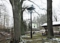 Zvonička na rozcestí v Borečku (Q104873356).jpg 1,200 × 862; 250 KB


_01.jpg)
_02.jpg)
.jpg)

_01.jpg)
_02.jpg)
_01.jpg)
_02.jpg)
.jpg)