Category:Borough of Scarborough
Jump to navigation
Jump to search
former non-metropolitan district and borough of North Yorkshire, England   | |||||
| Upload media | |||||
| Instance of | |||||
|---|---|---|---|---|---|
| Location | North Yorkshire, Yorkshire and the Humber, England | ||||
| Capital | |||||
| Legislative body |
| ||||
| Inception |
| ||||
| Dissolved, abolished or demolished date |
| ||||
| Population |
| ||||
| Area |
| ||||
| official website | |||||
 | |||||
Subcategories
This category has the following 60 subcategories, out of 60 total.
- Fields in the Borough of Scarborough (181 F)
A
B
- Barnby, North Yorkshire (178 F)
- Borrowby, Scarborough (39 F)
C
D
E
- Eastfield, North Yorkshire (138 F)
- Ellerby, North Yorkshire (76 F)
F
G
H
- Hutton Mulgrave (44 F)
I
L
M
- Mickleby (54 F)
N
O
R
S
- Silpho (32 F)
U
W
Media in category "Borough of Scarborough"
The following 200 files are in this category, out of 2,065 total.
(previous page) (next page)-
 "The Spaw for the Townspeople" - geograph.org.uk - 3746107.jpg 2,000 × 1,500; 2.38 MB
-
 "Tuscany Too" at ^6 Filey Road - geograph.org.uk - 2799965.jpg 640 × 480; 119 KB
-
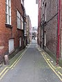
 'Gillys Steps To Town' name plate - geograph.org.uk - 1976594.jpg 640 × 480; 33 KB
-
-
 1 Newborough, Scarborough - geograph.org.uk - 3753345.jpg 1,919 × 1,280; 441 KB
-
 18th century buildings, Queen Street - geograph.org.uk - 4387782.jpg 2,710 × 1,936; 828 KB
-
 1914 Vickers Pattern 13 Pdr Gun - geograph.org.uk - 3764480.jpg 2,000 × 1,500; 2.1 MB
-
 2 Belgrave Crescent - geograph.org.uk - 3752861.jpg 1,765 × 1,177; 487 KB
-
 32 and 33 Sandside, Scarborough - geograph.org.uk - 2698266.jpg 1,024 × 768; 238 KB
-
 4-6 Huntriss Row - geograph.org.uk - 3768642.jpg 2,256 × 1,496; 778 KB
-
 45690 Leander at Scarborough Station - geograph.org.uk - 5785493.jpg 800 × 600; 107 KB
-
 86 Newborough - geograph.org.uk - 3756554.jpg 2,008 × 1,339; 631 KB
-
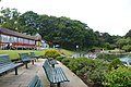
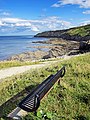
 A bench with a view - geograph.org.uk - 3833810.jpg 1,200 × 1,600; 1.92 MB
-
 A Bend in Marine Drive - geograph.org.uk - 3958639.jpg 640 × 424; 31 KB
-
 A Blustery Day by the Spa Complex - geograph.org.uk - 3958397.jpg 640 × 424; 50 KB
-
 A catch of crabs, Scarborough Harbour - geograph.org.uk - 3667247.jpg 640 × 640; 188 KB
-

-
 A couple on the beach, Scarborough - geograph.org.uk - 3813890.jpg 480 × 640; 38 KB
-
 A cycle path leading to the town centre - geograph.org.uk - 2178628.jpg 800 × 600; 269 KB
-
 A footpath above Rowbrow Wood - geograph.org.uk - 2233343.jpg 800 × 600; 217 KB
-

-

-
 A glimpse of the sea - geograph.org.uk - 3850402.jpg 1,500 × 2,000; 2.67 MB
-

-
 A Hole in The Wall - geograph.org.uk - 3958402.jpg 436 × 640; 54 KB
-
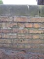
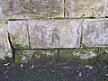
 A mouldy bench mark in Mountside, Scarborough - geograph.org.uk - 4619101.jpg 4,320 × 3,240; 2.44 MB
-
 A new road leading to Eastfield - geograph.org.uk - 2498891.jpg 800 × 600; 205 KB
-
 A pigeon in Scarborough - geograph.org.uk - 3955767.jpg 1,024 × 700; 144 KB
-
 A play area off Woodland Ravine (road) - geograph.org.uk - 2178643.jpg 800 × 600; 219 KB
-
 A Pretty Flower Bed In Scarborough - geograph.org.uk - 5769261.jpg 2,048 × 1,536; 1.51 MB
-
 A Scarborough View (geograph 5932010).jpg 6,032 × 4,014; 4.75 MB
-

-

-

-

-
 A view from Valley Bridge, Scarborough - geograph.org.uk - 5676837.jpg 5,158 × 2,901; 5.57 MB
-

-
 A view to the Grand Hotel, Scarborough - geograph.org.uk - 4602993.jpg 3,648 × 2,736; 3.89 MB
-
 A walk-cycle track to the town centre - geograph.org.uk - 2178665.jpg 800 × 600; 283 KB
-
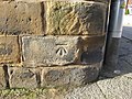
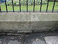
 A wall and a bench mark in Westwood - geograph.org.uk - 2508106.jpg 640 × 481; 115 KB
-
 A165 - geograph.org.uk - 5391026.jpg 640 × 443; 56 KB
-
 A165 - geograph.org.uk - 5391041.jpg 640 × 426; 62 KB
-
 A170 from A171 junction - geograph.org.uk - 3988789.jpg 640 × 389; 60 KB
-
 A64-A165 junction - geograph.org.uk - 5391062.jpg 640 × 426; 64 KB
-
 Aberdeen Walk - Castle Road - geograph.org.uk - 2060740.jpg 640 × 460; 63 KB
-
 Aberdeen Walk - Westborough - geograph.org.uk - 2059658.jpg 640 × 480; 69 KB
-

-
 Above the 'Spaw' at Scarborough - geograph.org.uk - 4600820.jpg 3,648 × 2,736; 3.53 MB
-
 Access lane behind St Nicholas Cliff - geograph.org.uk - 4577380.jpg 480 × 640; 99 KB
-
 Across North Bay - geograph.org.uk - 4456857.jpg 640 × 428; 77 KB
-
 Across the beach towards Knipe Point - geograph.org.uk - 3692448.jpg 2,736 × 3,289; 7.1 MB
-
 Aka 'The Royal' - geograph.org.uk - 4022124.jpg 640 × 480; 50 KB
-
 Albemarle Crescent - geograph.org.uk - 2001469.jpg 800 × 600; 252 KB
-
 Albemarle Crescent - geograph.org.uk - 2059645.jpg 640 × 480; 99 KB
-
 Albert Road - geograph.org.uk - 4038942.jpg 2,816 × 2,112; 1.1 MB
-
 Albion Rd - geograph.org.uk - 1909740.jpg 640 × 430; 139 KB
-
 Albion Road - geograph.org.uk - 3935250.jpg 2,111 × 1,408; 672 KB
-
 Albion Road, Scarborough - geograph.org.uk - 4828633.jpg 640 × 480; 78 KB
-
 Albion Road, Scarborough - geograph.org.uk - 4843179.jpg 640 × 480; 80 KB
-
 Alley towards Lifeboat Steps - geograph.org.uk - 2507407.jpg 480 × 640; 161 KB
-
 Alleyway behind York Place - geograph.org.uk - 5518825.jpg 1,024 × 753; 152 KB
-
 Alligator in a playground^ - geograph.org.uk - 4594185.jpg 640 × 480; 124 KB
-
-
 Alma Square - geograph.org.uk - 1909711.jpg 640 × 430; 152 KB
-
 Alma Square - geograph.org.uk - 3350734.jpg 1,024 × 768; 394 KB
-
 Alma Square - geograph.org.uk - 3921265.jpg 2,091 × 1,394; 1.05 MB
-
 Alma Square, Scarborough - geograph.org.uk - 4843184.jpg 640 × 480; 100 KB
-
 Along the prom - geograph.org.uk - 3878233.jpg 1,024 × 1,024; 768 KB
-
 Along the shore towards the Spa Complex - geograph.org.uk - 5242779.jpg 4,223 × 2,576; 1.7 MB
-
 Amazing sunset above Scarborough - geograph.org.uk - 3749243.jpg 640 × 480; 123 KB
-
 Amusement arcade, Scarborough - geograph.org.uk - 2785384.jpg 1,024 × 956; 270 KB
-
 Amusement arcade, Scarborough - geograph.org.uk - 3657876.jpg 3,264 × 2,448; 2.66 MB
-
 Amusement arcade, Scarborough - geograph.org.uk - 4040473.jpg 640 × 480; 67 KB
-
 Amusements, Scarborough - geograph.org.uk - 3059883.jpg 640 × 486; 109 KB
-
 An old mine, Sandside - geograph.org.uk - 1908256.jpg 640 × 430; 112 KB
-
 Anchor, Scarborough Harbour, Yorkshire - geograph.org.uk - 4115102.jpg 1,024 × 768; 183 KB
-
 Angela and Rosie - geograph.org.uk - 3350728.jpg 768 × 1,024; 382 KB
-
 Anne Bronte's grave - geograph.org.uk - 2996819.jpg 1,600 × 1,200; 459 KB
-
 Antique Market, Scarborough, Yorkshire - geograph.org.uk - 4115229.jpg 768 × 1,024; 258 KB
-
 Apartments on Esplanade, Scarborough - geograph.org.uk - 4840999.jpg 640 × 480; 84 KB
-

-

-

-

-
 Approaching A64-B1427 Junction - geograph.org.uk - 1937255.jpg 427 × 640; 258 KB
-

-
 Aquarium Top from Spa Bridge - geograph.org.uk - 2410786.jpg 3,270 × 2,336; 3.89 MB
-
 Architectural detail, former prison Dean Road - geograph.org.uk - 3787939.jpg 1,332 × 1,718; 438 KB
-
 Ark House Rehab, Scarborough, - geograph.org.uk - 4835832.jpg 640 × 480; 88 KB
-
-
 Ashburn Road and Weaponness Valley Road - geograph.org.uk - 3770809.jpg 2,021 × 1,348; 994 KB
-
 Ashville Avenue - Dean Road - geograph.org.uk - 2061189.jpg 640 × 480; 71 KB
-
 Asquith Avenue from Quarry Mount Park - geograph.org.uk - 3822354.jpg 1,935 × 1,290; 498 KB
-
 At the Tea Kiosk - geograph.org.uk - 3995623.jpg 2,000 × 1,500; 846 KB
-
 Auborough Street - Castle Road - geograph.org.uk - 2060702.jpg 640 × 480; 68 KB
-
 Autumn Light - geograph.org.uk - 3130500.jpg 958 × 1,600; 687 KB
-
 Autumn, Columbus Ravine - geograph.org.uk - 3217055.jpg 1,024 × 768; 457 KB
-
 Ayckbourn Chapters - geograph.org.uk - 4478993.jpg 3,264 × 2,448; 4.06 MB
-
 Backlit poppy - geograph.org.uk - 4058285.jpg 782 × 1,024; 522 KB
-
 Bait sheds off Long Greece Steps - geograph.org.uk - 4044722.jpg 2,816 × 2,112; 1.06 MB
-
 Band marching on Foreshore Road - geograph.org.uk - 4049307.jpg 640 × 480; 100 KB
-
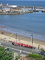 Band marching on Foreshore Road - geograph.org.uk - 4049320.jpg 480 × 640; 87 KB
-
 Bar Street, Scarborough - geograph.org.uk - 4040467.jpg 480 × 640; 72 KB
-
 Bar Street,Scarborough - geograph.org.uk - 2019417.jpg 800 × 600; 231 KB
-
 Barrowcliff Estate - geograph.org.uk - 3802472.jpg 1,840 × 1,227; 502 KB
-
 Barrowcliffe Drive - geograph.org.uk - 1903745.jpg 640 × 430; 165 KB
-
 Barwick Street - Victoria Road - geograph.org.uk - 2060893.jpg 640 × 480; 65 KB
-
 BBC Broadcasting Bus - geograph.org.uk - 4456833.jpg 640 × 428; 89 KB
-
 BBC bus - geograph.org.uk - 4456836.jpg 640 × 428; 108 KB
-
 Beach Huts, Scarborough - geograph.org.uk - 2840430.jpg 480 × 640; 43 KB
-

-
 Beach safety education, Scarborough - geograph.org.uk - 4519122.jpg 640 × 577; 208 KB
-
 Bedford Street - Castle Road - geograph.org.uk - 2060734.jpg 640 × 480; 90 KB
-
 Bedford Street, Scarborough - geograph.org.uk - 3921406.jpg 640 × 480; 69 KB
-
 Beechville Avenue - Dean Road - geograph.org.uk - 2061191.jpg 640 × 480; 67 KB
-
 Belgrave Crescent - geograph.org.uk - 3921281.jpg 1,867 × 1,245; 462 KB
-
 Belgrave Crescent, Scarborough - geograph.org.uk - 2178670.jpg 800 × 600; 302 KB
-
 Belgrave Terrace - Westborough - geograph.org.uk - 2062070.jpg 640 × 480; 71 KB
-
 Belle Vue Terrace - Westborough - geograph.org.uk - 2062080.jpg 640 × 480; 76 KB
-
 Belmont Road, Scarborough - geograph.org.uk - 4839544.jpg 640 × 480; 81 KB
-
 Below Valley Bridge - geograph.org.uk - 3344725.jpg 640 × 480; 172 KB
-
 Belvedere Rd - geograph.org.uk - 1909752.jpg 640 × 431; 61 KB
-
 Belvedere Road, Scarborough - geograph.org.uk - 3557238.jpg 3,755 × 2,710; 2.81 MB
-
 Belvoir Terrace, Scarborough - geograph.org.uk - 4520338.jpg 436 × 640; 222 KB
-
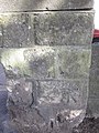
 Bench mark above the South Sands slipway - geograph.org.uk - 4602965.jpg 2,736 × 3,648; 3.75 MB
-
 Bench mark above the Spa Suncourt - geograph.org.uk - 1975237.jpg 480 × 640; 54 KB
-
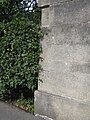
 Bench mark alongside Cliff Bridge Terrace - geograph.org.uk - 4604604.jpg 3,115 × 2,331; 3.16 MB
-

-
 Bench mark alongside Queens Parade, Scarborough - geograph.org.uk - 4603190.jpg 2,736 × 3,648; 4.36 MB
-
-
-
 Bench mark behind ^19 St Nicholas Cliff - geograph.org.uk - 4577373.jpg 480 × 640; 124 KB
-
 Bench mark below Wilson's Mariners Homes - geograph.org.uk - 4603282.jpg 3,194 × 2,391; 2.99 MB
-
 Bench mark between 2-3 Oriel Crescent, Scarborough - geograph.org.uk - 4619406.jpg 3,648 × 2,736; 6.02 MB
-

-
 Bench mark by slipway to South Sands - geograph.org.uk - 4624572.jpg 3,000 × 4,000; 4.99 MB
-
 Bench mark by ^3 Holbeck Road - geograph.org.uk - 4607920.jpg 3,000 × 4,000; 4.27 MB
-
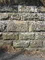
 Bench mark in Belmont Road, Scarborough - geograph.org.uk - 4604565.jpg 3,648 × 2,736; 5.96 MB
-
 Bench mark in Birdcage Walk-Ramshill Road - geograph.org.uk - 4622426.jpg 3,000 × 4,000; 4.81 MB
-
 Bench mark in Garlands Hill, Scarborough - geograph.org.uk - 4619533.jpg 2,736 × 3,648; 5.41 MB
-

-
 Bench mark in Mountside, Scarborough - geograph.org.uk - 4616510.jpg 3,000 × 4,000; 4.97 MB
-
 Bench mark in Mountside, Scarborough - geograph.org.uk - 4616607.jpg 4,000 × 3,000; 4.14 MB
-
 Bench mark in Oriel Crescent - geograph.org.uk - 2806428.jpg 480 × 640; 173 KB
-
 Bench mark in Prince of Wales Gardens - geograph.org.uk - 4622230.jpg 2,207 × 2,948; 2.9 MB
-
 Bench Mark in Queen Margaret's Road - B1427 - geograph.org.uk - 4617135.jpg 4,000 × 3,000; 2.15 MB
-

-
 Bench mark in St Nicholas Cliff - geograph.org.uk - 1975323.jpg 640 × 480; 57 KB
-
 Bench mark in Trafalgar Street West - geograph.org.uk - 2011241.jpg 640 × 480; 187 KB
-
 Bench mark in Valley Bridge Road, Scarborough - geograph.org.uk - 4620561.jpg 2,736 × 3,648; 5.51 MB
-
 Bench mark in Vernon Road - geograph.org.uk - 1976756.jpg 480 × 640; 67 KB
-
 Bench mark next to Gillys Steps - geograph.org.uk - 1976524.jpg 480 × 640; 42 KB
-
 Bench mark on a wall south of the cliff railway - geograph.org.uk - 4603399.jpg 2,294 × 3,059; 3.52 MB
-
 Bench mark on Albert Road - geograph.org.uk - 1966822.jpg 480 × 640; 60 KB
-
 Bench mark on Dean Road Cemetery wall - geograph.org.uk - 2016124.jpg 640 × 480; 193 KB
-
 Bench mark on Dean Road Cemetery wall - geograph.org.uk - 4597211.jpg 480 × 640; 189 KB
-

-
 Bench mark on Manor Road Cemetery wall - geograph.org.uk - 4594667.jpg 640 × 480; 133 KB
-
 Bench mark on Manor Road mortuary chapel - geograph.org.uk - 4594594.jpg 480 × 640; 136 KB
-
 Bench mark on May Lodge wall, ^29 Filey Road, Scarborough - geograph.org.uk - 4618696.jpg 3,240 × 4,320; 2.39 MB
-
-

-
 Bench mark on the east pier - geograph.org.uk - 2507301.jpg 480 × 640; 169 KB
-

-
 Bench mark on the north side of the Spa lift incline - geograph.org.uk - 4890846.jpg 4,000 × 3,000; 3.17 MB
-
 Bench mark on the wall below Holbeck Gardens shelter - geograph.org.uk - 4607860.jpg 3,000 × 4,000; 5.56 MB
-
 Bench mark on Valley Bridge - geograph.org.uk - 4620668.jpg 2,736 × 3,648; 5.07 MB
-
 Bench mark on ^5 Beulah Terrace - geograph.org.uk - 2250970.jpg 480 × 640; 135 KB
-

-
 Bench mark outside the Prince of Wales Apartments - geograph.org.uk - 4619725.jpg 2,935 × 2,201; 2.38 MB
-
 Bench mark outside ^10 Royal Avenue - geograph.org.uk - 2249783.jpg 640 × 480; 135 KB
-
 Bench mark outside ^169 Columbus Ravine - geograph.org.uk - 4604460.jpg 2,735 × 2,050; 2.25 MB
-
 Bench mark ^1 in Clifton Street, Scarborough - geograph.org.uk - 4617585.jpg 2,736 × 3,648; 4.83 MB
-
 Bench mark ^2 in Clifton Street, Scarborough - geograph.org.uk - 4617591.jpg 2,736 × 3,648; 4.78 MB
-
 Benches and cafe - geograph.org.uk - 4106381.jpg 640 × 427; 115 KB
-
 Benny's - geograph.org.uk - 3763013.jpg 2,000 × 1,341; 1.83 MB
-
 Bethel Place, Scarborough Harbour, Yorkshire - geograph.org.uk - 4115186.jpg 768 × 1,024; 210 KB
-
 Bethel Place, Scarborough Harbour, Yorkshire - geograph.org.uk - 4115189.jpg 1,024 × 768; 215 KB
-
 Big plant on the beach - geograph.org.uk - 3980660.jpg 1,500 × 2,000; 1.22 MB
-

-
 Bikers on Marine Drive - geograph.org.uk - 3958643.jpg 640 × 424; 33 KB
-
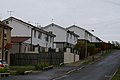 BISF houses in Springhill Lane - geograph.org.uk - 3761008.jpg 2,020 × 1,347; 443 KB
-
 Black Rocks - geograph.org.uk - 2827527.jpg 1,024 × 641; 252 KB
-
 Black Rocks to White Nab - geograph.org.uk - 3833825.jpg 1,200 × 1,600; 2.13 MB
-
 Black Rocks under Wheatcroft Cliff - geograph.org.uk - 3833841.jpg 1,600 × 1,186; 2.03 MB
-
 Black Rocks ^ Sea Showers - geograph.org.uk - 3833750.jpg 1,203 × 1,600; 544 KB
-
 Black Rocks, Scarborough - geograph.org.uk - 4519128.jpg 640 × 454; 197 KB
-
 Black-headed gull, preening - geograph.org.uk - 3878252.jpg 1,024 × 1,024; 765 KB
-
 Black-headed gull, summer plumage - geograph.org.uk - 3878247.jpg 1,600 × 1,600; 353 KB
-
 Black-headed gull, winter plumage - geograph.org.uk - 3218111.jpg 1,024 × 683; 175 KB
-
 Black-headed gull, winter plumage - geograph.org.uk - 3846258.jpg 640 × 873; 369 KB
-
 Bland's Cliff - Eastborough - geograph.org.uk - 2060085.jpg 480 × 640; 66 KB
-
 Bland's Cliff - Foreshore Road - geograph.org.uk - 2060117.jpg 480 × 640; 59 KB
-
 Bland's Cliff ^ Foreshore Road - geograph.org.uk - 3774932.jpg 1,600 × 1,061; 304 KB
-
 Blenheim Street - Castle Road - geograph.org.uk - 2060713.jpg 640 × 480; 57 KB
-
 Blocked arch on the Spa lift incline - geograph.org.uk - 4890855.jpg 4,000 × 3,000; 4.02 MB
-
 Blooming laburnum - geograph.org.uk - 3978840.jpg 2,000 × 2,000; 2.15 MB
-
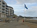 Blue Flag and Quality Coast Award, 2011 - geograph.org.uk - 2614026.jpg 1,024 × 768; 122 KB
-
-
 Blue plaque Odeon Cinema - geograph.org.uk - 3756580.jpg 1,162 × 1,020; 255 KB


_-_geograph.org.uk_-_2178643.jpg)

.jpg)


