Category:Grosmont, North Yorkshire
Jump to navigation
Jump to search
village and civil parish in North Yorkshire, UK  | |||||
| Upload media | |||||
| Instance of | |||||
|---|---|---|---|---|---|
| Location | Scarborough, North Yorkshire, Yorkshire and the Humber, England | ||||
| Said to be the same as | Grosmont (Wikimedia duplicated page, civil parish) | ||||
 | |||||
English: Grosmont (pronounced "grow-mont") is a small village and civil parish situated in the Scarborough district of North Yorkshire, England and is within the North York Moors National Park. The village is named after the Grandmontines Priory (1204-1536)
Subcategories
This category has the following 4 subcategories, out of 4 total.
G
Media in category "Grosmont, North Yorkshire"
The following 200 files are in this category, out of 345 total.
(previous page) (next page)-
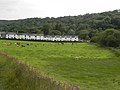
 A patchwork of fields, below Lease Rigg - geograph.org.uk - 4454234.jpg 1,024 × 768; 131 KB
-
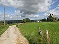
 Access road for Grosmont Farm - geograph.org.uk - 3733334.jpg 1,500 × 994; 1.25 MB
-
 Access road from Fairhead Farm to Fairhead Lane - geograph.org.uk - 5753644.jpg 4,606 × 3,452; 5.42 MB
-
 After the day is done - geograph.org.uk - 4173980.jpg 3,872 × 2,592; 3.81 MB
-
 Animal feeder alongside the railway, Eskdale - geograph.org.uk - 4452870.jpg 1,024 × 768; 165 KB
-
 Approaching Grosmont - geograph.org.uk - 5138663.jpg 1,800 × 1,012; 1.8 MB
-
 Approaching Grosmont Farm - geograph.org.uk - 3295333.jpg 640 × 483; 79 KB
-
 Approaching Grosmont Farm - geograph.org.uk - 5317580.jpg 1,600 × 1,200; 687 KB
-
 Approaching Grosmont Farm - geograph.org.uk - 810349.jpg 640 × 480; 139 KB
-
 Approaching Moor Lane Farm - geograph.org.uk - 2753855.jpg 640 × 400; 197 KB
-
 Barn at Grosmont Farm - geograph.org.uk - 3733356.jpg 1,500 × 1,125; 2.06 MB
-
 Bedford flatbed truck - geograph.org.uk - 5577644.jpg 5,376 × 3,024; 2.53 MB
-
 Behind the engine sheds at Grosmont - geograph.org.uk - 5880187.jpg 1,024 × 683; 150 KB
-
 Behind the sheds at Grosmont (1) - geograph.org.uk - 5880689.jpg 800 × 533; 147 KB
-
 Behind the sheds at Grosmont (2) - geograph.org.uk - 5880690.jpg 800 × 533; 120 KB
-
 Behind the sheds at Grosmont (3) - geograph.org.uk - 5880691.jpg 800 × 533; 82 KB
-

-
 Boundary wall at the edge of the moor on Black Brow - geograph.org.uk - 4576098.jpg 1,600 × 1,067; 1.1 MB
-
 BR Standard Class 4 locomotive 76079 - geograph.org.uk - 3106291.jpg 2,592 × 1,936; 1.49 MB
-
 Bridge over the Esk at Grosmont - geograph.org.uk - 277287.jpg 640 × 480; 110 KB
-
 Bridge over the Esk at Grosmont - geograph.org.uk - 4173979.jpg 3,872 × 2,592; 5.31 MB
-
 Bridge over the Murk Esk at Grosmont - geograph.org.uk - 5880678.jpg 1,024 × 683; 161 KB
-
 Bridge over the River Esk at Grosmont.jpg 3,264 × 2,448; 2.32 MB
-
 Bridge pillar, River Esk - geograph.org.uk - 4276056.jpg 2,634 × 1,882; 925 KB
-

-
 Cattle grid on Fair Head Lane - geograph.org.uk - 2813283.jpg 640 × 406; 48 KB
-
 Cattle Grid, Fair Head Lane - geograph.org.uk - 2554016.jpg 1,280 × 960; 631 KB
-
 Cattle grid, Fair Head Lane, Grosmont - geograph.org.uk - 4575241.jpg 1,600 × 640; 670 KB
-
 Cattle in the Esk Valley - geograph.org.uk - 5880176.jpg 800 × 533; 132 KB
-
 Cattle pasture, below Lease Rigg - geograph.org.uk - 4454220.jpg 1,024 × 768; 134 KB
-
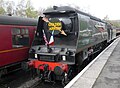
 City of Wells 34092 badges and all - geograph.org.uk - 6113120.jpg 4,388 × 3,404; 4.23 MB
-
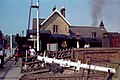
 City of Wells 34092 changing ends at Grosmont station - geograph.org.uk - 6113097.jpg 3,747 × 2,756; 3.22 MB
-
 City of Wells 34092 huffing and puffing at Grosmont station - geograph.org.uk - 6113158.jpg 4,608 × 3,456; 3.45 MB
-
 City of Wells 34092 pulling into Grosmont station platform 2 - geograph.org.uk - 6112333.jpg 4,608 × 3,456; 5.33 MB
-
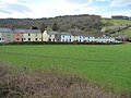
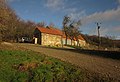
 Cottages - geograph.org.uk - 1907400.jpg 1,600 × 1,200; 474 KB
-
 Cottages at Esk Valley - geograph.org.uk - 2606130.jpg 2,048 × 1,536; 284 KB
-
 Cottages at Esk Valley - geograph.org.uk - 4159727.jpg 3,872 × 2,592; 3.99 MB
-
 Cottages at Esk Valley, from the north-east - geograph.org.uk - 4473871.jpg 1,024 × 768; 129 KB
-
 Cottages at Esk Valley, from the south-east - geograph.org.uk - 4473876.jpg 1,024 × 768; 141 KB
-
 Cottages in Front Street, Grosmont - geograph.org.uk - 5360565.jpg 640 × 427; 109 KB
-
 Crag Cliff Wood - geograph.org.uk - 4583332.jpg 1,600 × 1,066; 1.21 MB
-
 Cricket pavilion, Grosmont - geograph.org.uk - 5882714.jpg 1,024 × 768; 235 KB
-
 Crossing The River Esk - geograph.org.uk - 2914394.jpg 640 × 463; 116 KB
-
 Cut bench mark, St Matthew's Church, Grosmont - geograph.org.uk - 2606594.jpg 2,736 × 3,648; 1.1 MB
-
 Côte de Grosmont - geograph.org.uk - 6141004.jpg 640 × 427; 173 KB
-
 Deck of tramway bridge - geograph.org.uk - 4276065.jpg 1,870 × 2,618; 860 KB
-
 Departure from Grosmont - geograph.org.uk - 2621053.jpg 572 × 640; 264 KB
-
 Departure from Grosmont - geograph.org.uk - 2621062.jpg 640 × 427; 216 KB
-
 Derelict brick kiln, Grosmont (northern end) - geograph.org.uk - 4452618.jpg 1,024 × 768; 291 KB
-
 Derelict brick kiln, Grosmont (southern end) - geograph.org.uk - 4452614.jpg 1,024 × 615; 235 KB
-
 Diesel Unit on the Esk Valley line to Whitby - geograph.org.uk - 6113075.jpg 4,608 × 3,456; 4.61 MB
-
 Disused quarry off Fairhead Lane - geograph.org.uk - 2753850.jpg 640 × 401; 259 KB
-
 Down Fairhead Lane from Quarry access road - geograph.org.uk - 5753686.jpg 4,608 × 3,456; 6.36 MB
-
 Down The Hill At Grosmont - geograph.org.uk - 2914375.jpg 640 × 473; 120 KB
-
 DV307 no.134 Tapping the furnaces, Grosmont Oct 7 1865.png 1,507 × 830; 3.59 MB
-
 Eller Beck - geograph.org.uk - 700005.jpg 640 × 430; 123 KB
-
 End of the track on Spa Hill - geograph.org.uk - 5318966.jpg 1,600 × 1,200; 399 KB
-

-
 Eroded bank of the Murk Esk - geograph.org.uk - 2606326.jpg 3,648 × 2,736; 1.39 MB
-
 Esk Dale - geograph.org.uk - 3294898.jpg 640 × 443; 81 KB
-
 Esk Dale at Grosmont - geograph.org.uk - 3295682.jpg 504 × 640; 97 KB
-
 Esk Valley - geograph.org.uk - 2545419.jpg 1,280 × 960; 643 KB
-
 Esk Valley - geograph.org.uk - 2553930.jpg 1,280 × 960; 621 KB
-
 Esk Valley - geograph.org.uk - 3609275.jpg 3,968 × 2,232; 5.51 MB
-
 Esk Valley - geograph.org.uk - 5826295.jpg 1,024 × 768; 159 KB
-
 Esk Valley Cottages - geograph.org.uk - 2084281.jpg 1,024 × 768; 139 KB
-
 Esk Valley cottages - geograph.org.uk - 4586635.jpg 1,600 × 1,067; 1.03 MB
-

-
 Esk Valley line out of Grosmont - geograph.org.uk - 3153850.jpg 1,400 × 2,088; 1.02 MB
-
 Esk Valley terrace - geograph.org.uk - 5229601.jpg 4,320 × 2,513; 2.86 MB
-
 Esk Valley Walk above Fotherleys Farm - geograph.org.uk - 3294809.jpg 480 × 640; 125 KB
-

-
 Esk Valley Walk at Fotherleys Farm - geograph.org.uk - 3295031.jpg 507 × 640; 104 KB
-
 Esk Valley Walk in Cote Bank Woods - geograph.org.uk - 3294982.jpg 480 × 640; 134 KB
-
 Esk Valley Walk in Dorsley Bank Wood - geograph.org.uk - 3294767.jpg 480 × 640; 130 KB
-
 Esk Valley Walk in Dorsley Bank Wood - geograph.org.uk - 3294778.jpg 480 × 640; 142 KB
-
 Esk Valley Walk near Fotherleys Farm - geograph.org.uk - 3281877.jpg 640 × 481; 129 KB
-
 Eskdale views from Lowther's Crag - geograph.org.uk - 810441.jpg 640 × 480; 179 KB
-
 Every schoolboys dream. Drive a steam train - geograph.org.uk - 6113133.jpg 4,608 × 3,456; 4.44 MB
-
 Fair Head Lane - geograph.org.uk - 5914928.jpg 1,024 × 768; 708 KB
-
 Fair Head Lane on Sleights Moor - geograph.org.uk - 2934245.jpg 1,500 × 1,000; 158 KB
-
 Fairhead Farm - geograph.org.uk - 2753852.jpg 640 × 434; 233 KB
-
 Fairhead Farm - geograph.org.uk - 5360556.jpg 640 × 427; 83 KB
-
 Fairhead farm. - geograph.org.uk - 6219432.jpg 1,024 × 768; 186 KB
-
 Farm lane to Fotherleys Farm - geograph.org.uk - 3295088.jpg 500 × 640; 111 KB
-
 Farm track in the Esk Valley - geograph.org.uk - 4176389.jpg 3,872 × 2,592; 5.11 MB
-
 Farm track to Grosmont - geograph.org.uk - 3295367.jpg 640 × 415; 58 KB
-
 Farmland and woodland, Esk Valley - geograph.org.uk - 3111714.jpg 640 × 480; 101 KB
-
 Farmland, Esk Dale - geograph.org.uk - 2671539.jpg 800 × 600; 51 KB
-
 Farmland, Esk Dale - geograph.org.uk - 2671545.jpg 800 × 600; 58 KB
-
-
 Field above Grosmont Haggs - geograph.org.uk - 3295741.jpg 640 × 434; 82 KB
-
 Field access under the North Yorks Moors Railway - geograph.org.uk - 2606138.jpg 1,024 × 768; 250 KB
-
 Field at Fotherleys Farm - geograph.org.uk - 3295046.jpg 640 × 402; 61 KB
-
 Field at Fotherleys Farm - geograph.org.uk - 3295065.jpg 640 × 429; 68 KB
-
 Field below Dorsley Bank Wood - geograph.org.uk - 3294822.jpg 640 × 465; 118 KB
-
 Field between River Esk and railway - geograph.org.uk - 4583336.jpg 1,600 × 1,067; 1.14 MB
-
 Field boundary near Priory Wood - geograph.org.uk - 3281900.jpg 640 × 480; 73 KB
-
 Field by Esk Valley Walk - geograph.org.uk - 3295324.jpg 640 × 452; 98 KB
-
 Field near Moor Lane Farm - geograph.org.uk - 5360554.jpg 640 × 427; 81 KB
-
 Fields at Grosmont - geograph.org.uk - 3295484.jpg 640 × 448; 83 KB
-
 Fields by Esk Valley Walk - geograph.org.uk - 3295375.jpg 640 × 450; 76 KB
-
 First ford on the road to Dale End - geograph.org.uk - 2652126.jpg 1,000 × 750; 254 KB
-
 Flooded farmland, Eskdale - geograph.org.uk - 4452877.jpg 1,024 × 768; 150 KB
-
 Footbridge over Lythe Beck - geograph.org.uk - 5752652.jpg 4,536 × 3,358; 7.62 MB
-
 Footbridge over the river at Grosmont - geograph.org.uk - 5880658.jpg 1,024 × 683; 222 KB
-
 Footbridge over the River Esk near Grosmont - geograph.org.uk - 5317575.jpg 1,600 × 1,200; 850 KB
-
 Footpath above Lythe Beck - geograph.org.uk - 2753858.jpg 640 × 425; 269 KB
-
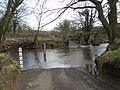
 Ford at Grosmont - geograph.org.uk - 3807359.jpg 3,872 × 2,592; 4.8 MB
-
 Ford at Grosmont - geograph.org.uk - 3807369.jpg 3,872 × 2,592; 4.65 MB
-
 Ford at Grosmont - geograph.org.uk - 3807376.jpg 3,872 × 2,592; 4.77 MB
-
 Ford near The Alders, Grosmont - geograph.org.uk - 1865923.jpg 640 × 426; 300 KB
-
 Ford on the minor road into Grosmont - geograph.org.uk - 3878944.jpg 2,560 × 1,920; 2.03 MB
-

-
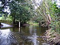 Ford over River Esk near Grosmont - geograph.org.uk - 561204.jpg 640 × 480; 164 KB
-
 Ford Sign, Grosmont - geograph.org.uk - 1297278.jpg 640 × 427; 93 KB
-
 Ford through the Murk Esk - geograph.org.uk - 2606311.jpg 3,648 × 2,736; 1.4 MB
-
 Ford, Grosmont - geograph.org.uk - 289939.jpg 640 × 480; 90 KB
-
 Former School, Grosmont - geograph.org.uk - 1297290.jpg 621 × 373; 50 KB
-
 Fotherleys Farm - geograph.org.uk - 3281883.jpg 640 × 438; 73 KB
-
 Free-range chickens at Grosmont Farm - geograph.org.uk - 4176658.jpg 3,872 × 2,592; 5.21 MB
-
 From railway sheds toward Grosmont through tunnel - geograph.org.uk - 6112316.jpg 3,312 × 4,504; 5.42 MB
-
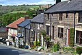
 Front Street - geograph.org.uk - 2752203.jpg 640 × 427; 188 KB
-
 Front Street - geograph.org.uk - 985894.jpg 640 × 427; 260 KB
-
 Front Street heading east, Grosmont - geograph.org.uk - 3107766.jpg 640 × 480; 58 KB
-
 Front Street, Grosmont - geograph.org.uk - 2606191.jpg 1,024 × 768; 156 KB
-
 Front Street, Grosmont - geograph.org.uk - 4159661.jpg 3,872 × 2,592; 3.52 MB
-
 Gardens by the railway - geograph.org.uk - 5215525.jpg 640 × 427; 191 KB
-
 GR postbox, Grosmont - geograph.org.uk - 2607236.jpg 2,736 × 3,648; 849 KB
-
 Granite boulder information - geograph.org.uk - 2606565.jpg 2,048 × 1,536; 547 KB
-
 Grass field and Fairhead Farm - geograph.org.uk - 5881698.jpg 1,024 × 768; 225 KB
-
 Grassed track to Low Fairhead - geograph.org.uk - 5752658.jpg 4,540 × 3,364; 5.94 MB
-
 Grassy track into Moor Lane Farm - geograph.org.uk - 5360548.jpg 640 × 427; 117 KB
-
 Grosmont (30106634180).jpg 4,608 × 3,072; 1.69 MB
-
 Grosmont - 1985 - geograph.org.uk - 2981816.jpg 2,272 × 1,515; 627 KB
-
 Grosmont - 1985 - geograph.org.uk - 2981818.jpg 2,272 × 1,514; 571 KB
-
 Grosmont - 1985 - geograph.org.uk - 2981822.jpg 2,272 × 1,514; 744 KB
-
 Grosmont - 1985 - geograph.org.uk - 2981823.jpg 2,272 × 1,515; 778 KB
-
 Grosmont - geograph.org.uk - 5215520.jpg 640 × 427; 184 KB
-
 Grosmont and Eskdale - geograph.org.uk - 4159698.jpg 3,872 × 2,592; 4.35 MB
-
 Grosmont Bridge - geograph.org.uk - 5575517.jpg 5,320 × 2,922; 3.05 MB
-
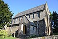 Grosmont Church - geograph.org.uk - 5764870.jpg 1,600 × 1,067; 463 KB
-
 Grosmont coaling stage - geograph.org.uk - 5474454.jpg 3,465 × 5,202; 2.97 MB
-
 Grosmont cricket ground - geograph.org.uk - 5474495.jpg 5,202 × 3,465; 2.99 MB
-
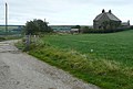
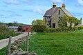
 Grosmont Farm - geograph.org.uk - 810347.jpg 640 × 480; 135 KB
-
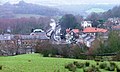
 Grosmont from above - geograph.org.uk - 2752190.jpg 640 × 425; 202 KB
-
 Grosmont From Lease Rigg - geograph.org.uk - 298000.jpg 640 × 384; 78 KB
-
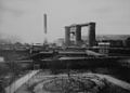 Grosmont Iron Works, circa 1880.jpg 1,024 × 736; 152 KB
-
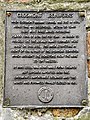 Grosmont Ironworks (plaque) - geograph.org.uk - 2545305.jpg 640 × 853; 414 KB
-
 Grosmont Level Crossing - geograph.org.uk - 5697761.jpg 1,024 × 686; 139 KB
-
 Grosmont level crossing from the east. - geograph.org.uk - 5474423.jpg 5,202 × 3,465; 2.49 MB
-
 Grosmont Loco Shed - geograph.org.uk - 5608206.jpg 640 × 416; 52 KB
-
 Grosmont Railway Bridge - geograph.org.uk - 3605759.jpg 3,968 × 2,232; 5.73 MB
-
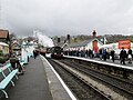
 Grosmont railway station - geograph.org.uk - 3105031.jpg 1,936 × 2,592; 2.02 MB
-
 Grosmont Station - geograph.org.uk - 5787334.jpg 4,176 × 2,784; 3.3 MB
-
 Grosmont Station - geograph.org.uk - 5880184.jpg 1,024 × 683; 113 KB
-

-
 Grosmont Station, North Yorkshire Moors Railway - geograph.org.uk - 5846635.jpg 2,560 × 1,440; 1.76 MB
-
 Grosmont station. The line to Middlesbrough - geograph.org.uk - 5474441.jpg 5,202 × 3,465; 3.14 MB
-
 Grosmont train station. - geograph.org.uk - 6219427.jpg 1,024 × 768; 199 KB
-
 Grosmont UK parish locator map.svg 1,425 × 1,037; 4.3 MB
-
 Grosmont village and railway station - geograph.org.uk - 700022.jpg 640 × 430; 78 KB
-
 Grosmont Village Centre - geograph.org.uk - 1077130.jpg 640 × 480; 101 KB
-
 Grosmont village sign - geograph.org.uk - 5474503.jpg 640 × 363; 96 KB
-
 Grosmont, North York Moors Railway - geograph.org.uk - 2852585.jpg 4,000 × 2,672; 2.67 MB
-
 Grosmont, North Yorkshire Moors Railway, engine shed - geograph.org.uk - 2798397.jpg 1,066 × 1,600; 310 KB
-
 Grosmont. A very unusual visitor. - geograph.org.uk - 5474433.jpg 5,202 × 3,465; 3.11 MB
-
 Grosmont. Footbridge over the River Esk - geograph.org.uk - 5474482.jpg 5,202 × 3,465; 3.34 MB
-
 Grosmont. Ford through the river Esk - geograph.org.uk - 5474477.jpg 5,202 × 3,465; 3.39 MB
-
 Grosmont. Pickering train - geograph.org.uk - 5474457.jpg 5,202 × 3,465; 3.3 MB
-
 Grosmont. The Station Tavern - geograph.org.uk - 5474425.jpg 5,202 × 3,465; 2.74 MB
-
 Grosmont.jpg 4,608 × 3,456; 9.86 MB
-
 Hedgerow in Eskdale - geograph.org.uk - 4176578.jpg 3,872 × 2,592; 5.06 MB
-
 House alongside disused quarry, Esk Valley - geograph.org.uk - 4454241.jpg 1,024 × 768; 126 KB
-
 Houses above field near River Esk - geograph.org.uk - 3728551.jpg 1,500 × 1,125; 1.28 MB
-
 Houses in Grosmont - geograph.org.uk - 2813273.jpg 640 × 353; 52 KB
-
 Impressive chimney, Front Street - geograph.org.uk - 2606347.jpg 1,536 × 2,048; 422 KB
-
 Information about the Rail Trail - geograph.org.uk - 2606186.jpg 2,736 × 3,648; 1.08 MB
-
 Inside the disabled toilet at Grosmont - geograph.org.uk - 5710582.jpg 6,000 × 4,000; 6.29 MB
-
 Inside the men's toilet at Grosmont - geograph.org.uk - 5710476.jpg 6,000 × 4,000; 6.35 MB
-
 Inside the women's toilet at Grosmont - geograph.org.uk - 5710537.jpg 6,000 × 4,000; 6.45 MB
-
 Island in the River Esk near Grosmont - geograph.org.uk - 4686384.jpg 1,024 × 768; 241 KB
-
 Junction of lanes above Grosmont. - geograph.org.uk - 6219430.jpg 1,024 × 768; 152 KB
-
 Lambton Colliery No. 29 - geograph.org.uk - 5697764.jpg 1,024 × 689; 131 KB
-
 Lane past Priory Farm - geograph.org.uk - 3295494.jpg 507 × 640; 64 KB
-
 Lane past Priory Wood - geograph.org.uk - 3295452.jpg 480 × 640; 100 KB
-
 Lease Rigg - geograph.org.uk - 5880200.jpg 1,024 × 683; 168 KB
-
 Level crossing, Grosmont - geograph.org.uk - 5914922.jpg 1,024 × 754; 662 KB
-

-
 Loading coal at Grosmont - geograph.org.uk - 5880685.jpg 800 × 533; 92 KB
-
 Locomotives at Grosmont - geograph.org.uk - 2484694.jpg 3,296 × 2,472; 1.87 MB
-
 Locomotives in the yard at Grosmont - geograph.org.uk - 2664359.jpg 1,296 × 968; 555 KB
-
 Looking down Fair Head Lane to the cattle grid - geograph.org.uk - 2934243.jpg 1,500 × 1,000; 212 KB
-
 Meadow beside the River Esk - geograph.org.uk - 5359268.jpg 640 × 427; 73 KB
-
 Murk Esk Gorge in Grosmont - geograph.org.uk - 5764873.jpg 1,600 × 1,067; 637 KB
-
 Near Grosmont - geograph.org.uk - 5973908.jpg 1,245 × 1,600; 707 KB
-
 Near Moor Lane Farm - geograph.org.uk - 2753856.jpg 640 × 429; 231 KB
-
 Network SouthEast - a long way from home - geograph.org.uk - 2606177.jpg 2,048 × 1,536; 489 KB
-
 New hedging near Priory Wood, Grosmont - geograph.org.uk - 5317578.jpg 1,600 × 1,200; 518 KB
-
 New Houses near Grosmont - geograph.org.uk - 730582.jpg 640 × 426; 89 KB


_-_geograph.org.uk_-_5880689.jpg)
_-_geograph.org.uk_-_5880690.jpg)
_-_geograph.org.uk_-_5880691.jpg)


_-_geograph.org.uk_-_4452618.jpg)
_-_geograph.org.uk_-_4452614.jpg)


.jpg)


_-_geograph.org.uk_-_2545305.jpg)


