Category:Borough of Bedford
Zur Navigation springen
Zur Suche springen
unitary authority area with the status of a borough in the ceremonial county of Bedfordshire, England   | |||||
| Medium hochladen | |||||
| Ist ein(e) | |||||
|---|---|---|---|---|---|
| Ort | Bedfordshire, East of England, England | ||||
| Hauptstadt | |||||
| Gesetzgebende Körperschaft |
| ||||
| Datum der Gründung, Erstellung, Entstehung, Erbauung | |||||
| Einwohnerzahl |
| ||||
| Fläche |
| ||||
| Höhe über dem Meeresspiegel |
| ||||
| offizielle Website | |||||
 | |||||
Unterkategorien
Es werden 51 von insgesamt 51 Unterkategorien in dieser Kategorie angezeigt:
In Klammern die Anzahl der enthaltenen Kategorien (K), Seiten (S), Dateien (D)
Seiten in der Kategorie „Borough of Bedford“
Diese Kategorie enthält nur die folgende Seite.
B
Medien in der Kategorie „Borough of Bedford“
Folgende 200 Dateien sind in dieser Kategorie, von 385 insgesamt.
(vorherige Seite) (nächste Seite)-
 A421 Bedford Southern Bypass - geograph.org.uk - 3665993.jpg 2.347 × 2.158; 900 KB
-
 A421 Bedford Southern Bypass - geograph.org.uk - 3666011.jpg 2.824 × 2.142; 1,03 MB
-
 A421 Bedford Southern Bypass - geograph.org.uk - 3667492.jpg 1.883 × 2.215; 684 KB
-
 A421 northbound - geograph.org.uk - 4431376.jpg 640 × 480; 47 KB
-
 A421, southbound - geograph.org.uk - 5448690.jpg 640 × 426; 40 KB
-
 A4280 Bromham Road, Bedford - geograph.org.uk - 3186134.jpg 3.072 × 2.304; 1,27 MB
-
 A6, Bedford - geograph.org.uk - 4971565.jpg 640 × 426; 81 KB
-
 Above Cardington sluice gates - geograph.org.uk - 4543162.jpg 3.264 × 2.448; 5,38 MB
-
 Access Bridge, A421 - geograph.org.uk - 5005190.jpg 640 × 426; 52 KB
-
 Adelaide Square - geograph.org.uk - 5508086.jpg 640 × 426; 67 KB
-
 Adelaide Square, Bedford - geograph.org.uk - 2947864.jpg 1.600 × 1.200; 400 KB
-
 Air Condition Unit ^ Adhoc sign - geograph.org.uk - 4608195.jpg 2.304 × 3.072; 2,45 MB
-
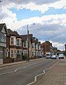
 Ampthill Road (A6) Bedford - geograph.org.uk - 5624358.jpg 640 × 428; 103 KB
-
 Ampthill Road Car Sales - geograph.org.uk - 5537299.jpg 640 × 395; 70 KB
-
 Ashburnham Court, Ashburnham Road, Bedford - geograph.org.uk - 3282993.jpg 4.000 × 3.000; 2,22 MB
-
 Ashburnham Road - geograph.org.uk - 1866126.jpg 640 × 421; 110 KB
-
 Ashburnham Road, Bedford - geograph.org.uk - 1833424.jpg 1.280 × 960; 173 KB
-
 Autumn colour, Bedford - geograph.org.uk - 3188056.jpg 640 × 480; 96 KB
-
 B ^ W Damp ^ Preservation sign - geograph.org.uk - 4608295.jpg 3.072 × 2.304; 1,79 MB
-
 Bandstand in Bedford Park - geograph.org.uk - 4666668.jpg 2.000 × 1.500; 383 KB
-
 Barker's Lane Recycling Centre at Bedford - geograph.org.uk - 1834234.jpg 1.024 × 768; 90 KB
-
 Barker's Lane Recycling Centre at Bedford - geograph.org.uk - 1834237.jpg 1.024 × 768; 128 KB
-
 Bedford Academy - geograph.org.uk - 6003997.jpg 1.600 × 1.200; 485 KB
-
 Bedford Athletic RUFC Building - geograph.org.uk - 4120800.jpg 3.072 × 2.304; 897 KB
-
 Bedford Athletic RUFC Building - geograph.org.uk - 4121003.jpg 3.072 × 2.304; 1,94 MB
-
 Bedford Athletic RUFC Building - geograph.org.uk - 4122771.jpg 3.072 × 2.304; 2,14 MB
-
 Bedford Athletic RUFC Ground - geograph.org.uk - 4120996.jpg 3.072 × 2.304; 1,88 MB
-
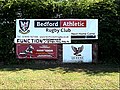 Bedford Athletic Rugby Club sign - geograph.org.uk - 4122770.jpg 3.049 × 2.290; 1,97 MB
-
 Bedford Borough Council composition.svg 360 × 185; 3 KB
-
 Bedford bypass - Meadow Lane - geograph.org.uk - 2677685.jpg 640 × 480; 48 KB
-
 Bedford Cemetery - geograph.org.uk - 5470416.jpg 640 × 426; 100 KB
-
 Bedford Cemetery Chapel. - geograph.org.uk - 2664557.jpg 683 × 1.024; 261 KB
-
 Bedford Cemetery Entrance - geograph.org.uk - 5470452.jpg 640 × 425; 77 KB
-
 Bedford Cemetery Entrance - geograph.org.uk - 5470456.jpg 640 × 416; 66 KB
-
 Bedford College of Education, 1972 - geograph.org.uk - 2307014.jpg 1.848 × 1.484; 1,85 MB
-
 Bedford College of Education, 1972 - geograph.org.uk - 2307029.jpg 1.860 × 1.884; 2,75 MB
-
 Bedford from the College Tower, 1971 - geograph.org.uk - 2307038.jpg 1.860 × 1.536; 1,91 MB
-
 Bedford household waste recycling centre - geograph.org.uk - 4740365.jpg 3.264 × 2.448; 4,05 MB
-
 Bedford Park - geograph.org.uk - 4667792.jpg 2.000 × 1.500; 308 KB
-
 Bedford Park - geograph.org.uk - 5002019.jpg 640 × 426; 59 KB
-
 Bedford Park - geograph.org.uk - 5002020.jpg 640 × 426; 67 KB
-
 Bedford Park - geograph.org.uk - 5002021.jpg 640 × 426; 59 KB
-
 Bedford Park - geograph.org.uk - 5002024.jpg 640 × 426; 65 KB
-
 Bedford Park - geograph.org.uk - 5470475.jpg 640 × 426; 50 KB
-
 Bedford Park - geograph.org.uk - 5470480.jpg 640 × 426; 47 KB
-
 Bedford Park - geograph.org.uk - 5470513.jpg 640 × 426; 54 KB
-
 Bedford Park - geograph.org.uk - 5470522.jpg 640 × 426; 60 KB
-
 Bedford saw and tool co - geograph.org.uk - 6004058.jpg 1.600 × 1.066; 475 KB
-
 Bedford Sixth Form College - geograph.org.uk - 5507864.jpg 640 × 426; 79 KB
-
 Bedford Sixth Form College - geograph.org.uk - 5507866.jpg 640 × 425; 86 KB
-
 Bedford Travelodge - geograph.org.uk - 5470402.jpg 640 × 425; 49 KB
-
 BerryWoodUnderpass.JPG 4.000 × 3.000; 4,42 MB
-
 BHS (closed) - geograph.org.uk - 5506903.jpg 640 × 425; 54 KB
-
 Bikes in the business park - geograph.org.uk - 3683029.jpg 1.600 × 1.069; 421 KB
-
 Boating lake - geograph.org.uk - 5537327.jpg 640 × 480; 72 KB
-
 Bourns - geograph.org.uk - 4971556.jpg 640 × 426; 63 KB
-
 Brickhill Drive - geograph.org.uk - 4971560.jpg 640 × 426; 65 KB
-
 Brickhill Drive - geograph.org.uk - 4988135.jpg 640 × 426; 61 KB
-
 Brickhill Drive - geograph.org.uk - 5470406.jpg 640 × 426; 79 KB
-
 Brickhill Drive - geograph.org.uk - 5508116.jpg 640 × 426; 83 KB
-
 Bridge to Abbey School - geograph.org.uk - 6004034.jpg 1.600 × 1.066; 556 KB
-
 Bridge to the country park - geograph.org.uk - 3683021.jpg 1.600 × 1.068; 419 KB
-
 Bridleway off the A4280 - geograph.org.uk - 3589550.jpg 1.600 × 1.073; 598 KB
-
 Bridleway sign off Wentworth Drive - geograph.org.uk - 4120808.jpg 2.304 × 3.072; 1,73 MB
-
 Bridleway sign off Wentworth Drive - geograph.org.uk - 4608276.jpg 2.240 × 2.978; 4,4 MB
-
 Bridleway to Ravensden Road - geograph.org.uk - 4120806.jpg 3.072 × 2.304; 1,32 MB
-
 Bridleway to Ravensden Road - geograph.org.uk - 4120810.jpg 3.072 × 2.304; 1,35 MB
-
 Bridleway to Ravensden Road - geograph.org.uk - 4120814.jpg 3.072 × 2.304; 1,16 MB
-
 Bridleway to Ravensden Road - geograph.org.uk - 4607865.jpg 3.072 × 2.304; 1,86 MB
-
 Bridleway to Ravensden Road - geograph.org.uk - 4607903.jpg 3.072 × 2.304; 1,85 MB
-
 Bridleway to Ravensden Road - geograph.org.uk - 4608278.jpg 3.072 × 2.304; 1,83 MB
-
 Bridleway to Renhold - geograph.org.uk - 4178396.jpg 1.600 × 1.065; 512 KB
-
 Bridleway to Wentworth Drive - geograph.org.uk - 4607874.jpg 3.072 × 2.304; 1,77 MB
-
 Bridleway to Wentworth Drive - geograph.org.uk - 4607897.jpg 3.072 × 2.304; 1,85 MB
-
 Bridleway towards Bedford - geograph.org.uk - 4178402.jpg 1.600 × 1.067; 513 KB
-
 Bridleway towards Willington - geograph.org.uk - 3589547.jpg 1.600 × 1.068; 708 KB
-
 Bromham Road, Bedford - geograph.org.uk - 5854214.jpg 1.024 × 768; 187 KB
-
 Buckfast Avenue sign - geograph.org.uk - 4607957.jpg 3.072 × 2.304; 1,8 MB
-
 Buckfast Avenue, Salph End - geograph.org.uk - 4608225.jpg 3.072 × 2.304; 1,77 MB
-
 Bus Stop sign on Wentworth Drive - geograph.org.uk - 4607933.jpg 2.304 × 3.072; 2,59 MB
-
 Bus stop, Mile Road, Bedford - geograph.org.uk - 5626237.jpg 640 × 480; 113 KB
-
 Byron Crescent, Bedford - geograph.org.uk - 3530822.jpg 4.000 × 3.000; 5,14 MB
-
 Camping in Priory Park - geograph.org.uk - 4542638.jpg 3.264 × 2.448; 5,02 MB
-
 Canoe portage at Priory Park - geograph.org.uk - 4543145.jpg 3.264 × 2.448; 5,75 MB
-
 Canoe portage point - geograph.org.uk - 4542651.jpg 3.264 × 2.448; 3,43 MB
-
 Canoe portage point, Priory Country Park - geograph.org.uk - 3631804.jpg 1.024 × 768; 229 KB
-
 Canoe slalom course in Priory Park - geograph.org.uk - 3682980.jpg 1.600 × 1.068; 418 KB
-
 Canoe slalom course, Priory Country Park - geograph.org.uk - 3631776.jpg 1.024 × 768; 169 KB
-
 Car park - geograph.org.uk - 4786181.jpg 640 × 426; 52 KB
-
 Car park off Brickhill Lane - geograph.org.uk - 5470460.jpg 640 × 426; 68 KB
-
 Cardington Lock - geograph.org.uk - 4543101.jpg 3.264 × 2.448; 4,3 MB
-
 Cardington Lock Bridge - geograph.org.uk - 4543116.jpg 3.264 × 2.448; 5 MB
-
 Cardington Lock, River Great Ouse - geograph.org.uk - 3631795.jpg 1.024 × 768; 114 KB
-
 Cardington Lock, upper gate - geograph.org.uk - 4543131.jpg 3.264 × 2.448; 4,94 MB
-
 Cardington sluice gates - geograph.org.uk - 4543157.jpg 3.264 × 2.448; 5,27 MB
-
 Carlton Church 1.jpg 3.264 × 2.448; 751 KB
-
 Carved bench by the footpath towards Harrowden - geograph.org.uk - 6004040.jpg 1.600 × 1.200; 688 KB
-
 Changing Rooms in Mowsbury Park - geograph.org.uk - 4607901.jpg 3.072 × 2.304; 1,87 MB
-
 Changing Rooms in Mowsbury Park - geograph.org.uk - 4608214.jpg 3.072 × 2.304; 1,76 MB
-
 Changing Rooms in Mowsbury Park - geograph.org.uk - 4608226.jpg 3.072 × 2.304; 1,98 MB
-
 Charity emporium on Ampthill Road - geograph.org.uk - 5998305.jpg 1.600 × 1.066; 287 KB
-
 Charles Wells Water Pumping Station - geograph.org.uk - 3756504.jpg 480 × 640; 80 KB
-
 Chiltern Avenue - geograph.org.uk - 3589649.jpg 1.600 × 1.066; 506 KB
-
 Christmas trees for the chop - geograph.org.uk - 2776908.jpg 640 × 480; 124 KB
-
 Church of the Holy Trinity, Bedford - geograph.org.uk - 5132675.jpg 3.264 × 2.448; 2,07 MB
-
 Common blue damselfly - geograph.org.uk - 4542632.jpg 2.888 × 2.156; 2,14 MB
-
 Course of old railway, Bedford - geograph.org.uk - 5626294.jpg 640 × 480; 128 KB
-
 Cycle sign in Mowsbury Park - geograph.org.uk - 4607970.jpg 2.137 × 2.841; 4,26 MB
-
 D' Parys - geograph.org.uk - 5502848.jpg 640 × 426; 83 KB
-
 D' Parys - geograph.org.uk - 5502858.jpg 640 × 425; 81 KB
-
 De Parys - geograph.org.uk - 5002037.jpg 426 × 640; 109 KB
-
 De Parys Avenue - geograph.org.uk - 5002029.jpg 640 × 426; 90 KB
-
 De Parys Avenue - geograph.org.uk - 5502845.jpg 640 × 426; 96 KB
-
 De Parys Avenue - geograph.org.uk - 5503015.jpg 640 × 426; 99 KB
-
 Disabled Parking Spaces - geograph.org.uk - 4608666.jpg 3.072 × 2.304; 1,8 MB
-
 Dom Polski, Polish House, Ashburnham Road, Bedford - geograph.org.uk - 3283007.jpg 4.000 × 3.000; 1,8 MB
-
 Dover Crescent, Woodside - geograph.org.uk - 2473953.jpg 2.592 × 1.944; 2,27 MB
-
 Duck feeding beach at Priory Park - geograph.org.uk - 3682973.jpg 1.600 × 1.069; 517 KB
-
 Electricity Pylon in Mowsbury Park - geograph.org.uk - 4607892.jpg 2.304 × 3.072; 1,87 MB
-
 Electricity Pylon in Mowsbury Park - geograph.org.uk - 4607965.jpg 3.072 × 2.304; 1,88 MB
-
 Electricity Pylon in Mowsbury Park - geograph.org.uk - 4607977.jpg 2.304 × 3.072; 2,69 MB
-
 Electricity substation on Chiltern Avenue - geograph.org.uk - 3589647.jpg 1.600 × 1.067; 420 KB
-
 Electricity Wires ^ Pylon in Mowsbury Park - geograph.org.uk - 4607927.jpg 3.072 × 2.304; 1,75 MB
-
 Emmanuel Pentecostal Italian Church - geograph.org.uk - 1866135.jpg 640 × 450; 97 KB
-
 Entering Bedford on the A428 St.Neots Road - geograph.org.uk - 4123522.jpg 1.734 × 1.621; 263 KB
-
 Entering Bedford, A4280 - geograph.org.uk - 4988105.jpg 640 × 324; 35 KB
-
 Entrance into Putnoe Wood - geograph.org.uk - 4608289.jpg 2.304 × 3.072; 4,18 MB
-
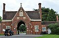
 Entrance Lodge, Bedford Park - geograph.org.uk - 5502827.jpg 640 × 426; 98 KB
-
 Entrance Lodge, Bedford Park - geograph.org.uk - 5502832.jpg 640 × 426; 84 KB
-
 Entrance of Bedford Athletic RUFC - geograph.org.uk - 4120802.jpg 3.072 × 2.304; 1,85 MB
-
 Entrance of Bedford Athletic Rugby Club Ground - geograph.org.uk - 4608678.jpg 3.072 × 2.304; 1,85 MB
-
 Entrance of Putnoe Wood - geograph.org.uk - 4607849.jpg 3.072 × 2.304; 1,85 MB
-
 Entrance onto Bedford Athletic RUFC Ground - geograph.org.uk - 4122896.jpg 2.233 × 2.980; 810 KB
-
 Entrance to Bedford Cemetery - geograph.org.uk - 4988170.jpg 640 × 426; 78 KB
-
 Entrance to Fenlake Meadows Local Nature Reserve - geograph.org.uk - 2742649.jpg 1.600 × 1.200; 634 KB
-
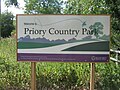 Entrance to Priory Country Park - geograph.org.uk - 4543151.jpg 3.264 × 2.448; 5,14 MB
-
 Entrance to Priory Marina - geograph.org.uk - 2608968.jpg 1.600 × 1.200; 489 KB
-
-
 Faraday community centre - geograph.org.uk - 6004009.jpg 1.600 × 1.066; 357 KB
-
 Farmland south of the A4280 - geograph.org.uk - 3589585.jpg 1.600 × 1.067; 551 KB
-
 Fenlake Meadows, Bedford - geograph.org.uk - 5570312.jpg 1.946 × 1.388; 844 KB
-
 Fields near Longholme Bridge, Bedford - geograph.org.uk - 2948402.jpg 1.600 × 1.200; 795 KB
-
 Flats on London Road, Bedford - geograph.org.uk - 6606220.jpg 1.729 × 1.017; 907 KB
-
 Footbridge over a stream - geograph.org.uk - 4542659.jpg 3.264 × 2.448; 6,46 MB
-
 Footpath beside the Great Ouse - geograph.org.uk - 5834779.jpg 1.600 × 1.066; 558 KB
-

-

-
 Footpath on the east side of the Priory Wall - geograph.org.uk - 3631704.jpg 1.024 × 768; 213 KB
-
 Footpath over the railway - geograph.org.uk - 6004055.jpg 1.600 × 1.066; 353 KB
-
 Footpath through the winter woods - geograph.org.uk - 6004043.jpg 1.600 × 1.066; 747 KB
-
 Footpath to Ampthill Road - geograph.org.uk - 6004017.jpg 1.600 × 1.066; 402 KB
-
 Footpath to Dover Crescent - geograph.org.uk - 4178601.jpg 1.600 × 1.066; 495 KB
-
 Footpath to Queens Park - geograph.org.uk - 5834748.jpg 1.600 × 1.066; 493 KB
-
 Footpath to Queens Park - geograph.org.uk - 5834760.jpg 1.066 × 1.600; 632 KB
-
 Footpath to Queens Park from the Ouse path - geograph.org.uk - 5834769.jpg 1.600 × 1.066; 459 KB
-
 Ford at Priory Country Park - geograph.org.uk - 5206262.jpg 4.032 × 3.024; 5,08 MB
-
 Ford End Road, Queen's Park - geograph.org.uk - 2475537.jpg 2.592 × 1.944; 2,38 MB
-
 Former railway bridge over the River Great Ouse - geograph.org.uk - 4596183.jpg 2.000 × 1.500; 590 KB
-
 Foster Hill Rd - geograph.org.uk - 5002015.jpg 640 × 426; 67 KB
-
 Foster Hill Rd - geograph.org.uk - 5005159.jpg 640 × 426; 53 KB
-
 Foster Hill Rd - geograph.org.uk - 5005160.jpg 640 × 426; 42 KB
-
 Foster Hill Rd - geograph.org.uk - 5005162.jpg 640 × 426; 64 KB
-
 Foster Hill Rd - geograph.org.uk - 5005163.jpg 640 × 426; 69 KB
-
 Foster Hill Rd - geograph.org.uk - 5005166.jpg 640 × 426; 77 KB
-
 Foster Hill Rd - geograph.org.uk - 5508112.jpg 640 × 500; 81 KB
-
 Foster Hill Rd - geograph.org.uk - 5508115.jpg 640 × 426; 83 KB
-
 Gasholder, Bedford - geograph.org.uk - 4741127.jpg 640 × 349; 62 KB
-
 Gate Lodge, Bedford Park - geograph.org.uk - 5002022.jpg 640 × 426; 83 KB
-
 Gate Lodge, Bedford Park - geograph.org.uk - 5002025.jpg 640 × 458; 82 KB
-
 Gates, Bedford Park - geograph.org.uk - 5502836.jpg 640 × 426; 78 KB
-
 Goldington Road, Bedford - geograph.org.uk - 2582855.jpg 2.048 × 1.536; 1,02 MB
-
 Goldington Road, Bedford, 1971 - geograph.org.uk - 2307056.jpg 1.860 × 1.632; 1,9 MB
-
 Grange Road, Goldington, Bedford - geograph.org.uk - 2582858.jpg 2.048 × 1.536; 1.006 KB
-
 Great Ouse and Fenlake Meadows beyond - geograph.org.uk - 3682959.jpg 1.600 × 1.067; 388 KB
-
 Greyfriars, Bedford - geograph.org.uk - 5854219.jpg 1.024 × 768; 183 KB
-
 Hotel on the Great Ouse - geograph.org.uk - 3682970.jpg 1.600 × 1.067; 453 KB
-
 Houses on Ashburnham Road - geograph.org.uk - 2947176.jpg 1.256 × 1.600; 273 KB
-
 Houses on Brackley Road, Bedford - geograph.org.uk - 5626272.jpg 640 × 428; 102 KB
-
 Houses on Mile Road, Bedford - geograph.org.uk - 5624371.jpg 640 × 428; 120 KB
-
 Houses, De Parys Avenue - geograph.org.uk - 5002030.jpg 426 × 640; 68 KB
-
 Housing terrace on Union Street, Bedford - geograph.org.uk - 5854224.jpg 1.024 × 768; 199 KB
-
 Information Board in Putnoe Wood - geograph.org.uk - 4607803.jpg 3.072 × 2.304; 1,92 MB
-
 Information Board in Putnoe Wood - geograph.org.uk - 4607805.jpg 3.072 × 2.304; 1,77 MB
-
 Information Board in Putnoe Wood - geograph.org.uk - 4607810.jpg 3.072 × 2.304; 1,95 MB
-
 John Bunyan Trail - geograph.org.uk - 4988151.jpg 640 × 426; 103 KB
-
 John Bunyan Trail - geograph.org.uk - 4988154.jpg 640 × 426; 84 KB
-
 John Bunyan Trail - geograph.org.uk - 4988159.jpg 640 × 426; 104 KB
-
 John Bunyan Trail - geograph.org.uk - 4988162.jpg 640 × 426; 100 KB
-
 John Bunyan Trail - geograph.org.uk - 4988166.jpg 640 × 426; 89 KB
-
 John Bunyan Trail - geograph.org.uk - 5470412.jpg 640 × 426; 96 KB
-
 John Bunyan Trail - geograph.org.uk - 5470420.jpg 640 × 426; 89 KB
-
 John Bunyan Trail - geograph.org.uk - 5470431.jpg 640 × 426; 100 KB
-
 John Bunyan Trail - geograph.org.uk - 5470450.jpg 640 × 425; 82 KB
-
 KFC, Tavistock Street - geograph.org.uk - 5508089.jpg 640 × 426; 66 KB
-
 Lake and sailor in Priory Park - geograph.org.uk - 3682985.jpg 1.600 × 1.068; 330 KB
-
 Lake in Priory Business Park - geograph.org.uk - 3683026.jpg 1.600 × 1.067; 537 KB
-
 Lake, Bedford Park - geograph.org.uk - 3539388.jpg 1.600 × 1.200; 410 KB
-
 LakeInRidgewayCountryPark.JPG 4.000 × 3.000; 4,13 MB
-
 Local playground - geograph.org.uk - 6004019.jpg 1.600 × 1.066; 523 KB
-
 Lodge, Bedford Park - geograph.org.uk - 5002018.jpg 640 × 426; 85 KB


_Bedford_-_geograph.org.uk_-_5624358.jpg)


_-_geograph.org.uk_-_5506903.jpg)


