Category:Borough of Dartford
Vai alla navigazione
Vai alla ricerca
local government district and borough in north west Kent, England   | |||||
| Carica un file multimediale | |||||
| Istanza di |
| ||||
|---|---|---|---|---|---|
| Luogo | Kent, Sud Est dell'Inghilterra, Inghilterra | ||||
| Capitale | |||||
| Organo legislativo |
| ||||
| Popolazione |
| ||||
| Superficie |
| ||||
| sito web ufficiale | |||||
 | |||||
English: Dartford is a district in the county of Kent, England.
Sottocategorie
Questa categoria contiene le 11 sottocategorie indicate di seguito, su un totale di 11.
B
L
S
W
File nella categoria "Borough of Dartford"
Questa categoria contiene 200 file, indicati di seguito, su un totale di 916.
(pagina precedente) (pagina successiva)-
 "High Speed 1" railway line south of Ebbsfleet station - geograph.org.uk - 5136241.jpg 1 600 × 1 200; 399 KB
-
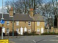
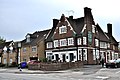 'Fox and Hounds' - Lowfield Street, Dartford - geograph.org.uk - 3973138.jpg 4 288 × 2 848; 7,32 MB
-
 'The Foresters' - Great Queen Street, Dartford - geograph.org.uk - 2009480.jpg 2 848 × 4 288; 6,44 MB
-
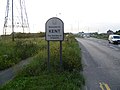 'Welcome to Kent' - geograph.org.uk - 2532843.jpg 4 000 × 3 000; 3,96 MB
-
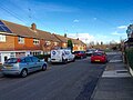
 1-2 Copperfields, Spital Street - geograph.org.uk - 6327296.jpg 2 448 × 3 264; 2,36 MB
-
 20, High Street - geograph.org.uk - 6327301.jpg 2 448 × 3 264; 2,23 MB
-
 46-56, Lowfield Street - geograph.org.uk - 6329794.jpg 3 264 × 2 448; 3,51 MB
-
 53, High Street - geograph.org.uk - 6330599.jpg 2 448 × 3 264; 2,14 MB
-
 62-64, High Street - geograph.org.uk - 6330596.jpg 2 448 × 3 264; 1,92 MB
-

-
 A Thameside View - geograph.org.uk - 5360323.jpg 640 × 424; 71 KB
-
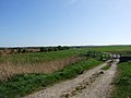
 A track across Dartford Heath - geograph.org.uk - 2475468.jpg 4 000 × 3 000; 4,07 MB
-
 A track across Dartford Heath - geograph.org.uk - 2475475.jpg 4 000 × 3 000; 4,27 MB
-
 A2 , Dartford Heath - geograph.org.uk - 2833589.jpg 640 × 428; 66 KB
-
 A2 - Dover 64 - geograph.org.uk - 2833575.jpg 640 × 428; 62 KB
-
 A2 - geograph.org.uk - 2735295.jpg 640 × 430; 74 KB
-
 A2 - leaving London - geograph.org.uk - 2833469.jpg 640 × 428; 63 KB
-
 A2 at Junction 2, M25 - geograph.org.uk - 3736876.jpg 640 × 430; 58 KB
-
 A2 Passing Under the M25 - geograph.org.uk - 3631573.jpg 640 × 480; 261 KB
-
 A2 Watling Street - geograph.org.uk - 4138878.jpg 3 488 × 2 616; 2,27 MB
-
 A2 Watling Street - geograph.org.uk - 4138880.jpg 3 488 × 2 616; 3,44 MB
-
 A2, Dartford Heath Interchange - geograph.org.uk - 3631599.jpg 640 × 480; 252 KB
-
 A2. Dartford Heath - geograph.org.uk - 3919440.jpg 3 488 × 2 616; 1,71 MB
-
 A2018 Shepherds Lane - geograph.org.uk - 6161368.jpg 1 024 × 768; 507 KB
-
 A2018 turning, A2 - geograph.org.uk - 3827655.jpg 640 × 430; 34 KB
-
 A206 bridge, A282 - geograph.org.uk - 5729132.jpg 640 × 426; 53 KB
-
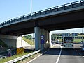
 A226 bridge over the A282 - geograph.org.uk - 2028547.jpg 640 × 467; 98 KB
-
 A226 bridge over the A282 - geograph.org.uk - 3735555.jpg 640 × 430; 54 KB
-
 A226 Bridge, A282 - geograph.org.uk - 2735280.jpg 640 × 418; 58 KB
-
 A228, northbound, A206 bridge - geograph.org.uk - 3735551.jpg 640 × 374; 52 KB
-

-
 A282 - geograph.org.uk - 3729638.jpg 640 × 401; 50 KB
-
 A282 - geograph.org.uk - 5729128.jpg 640 × 366; 42 KB
-
-
 A282 approaching Dartford Crossing - geograph.org.uk - 3646850.jpg 640 × 360; 68 KB
-
 A282 approaching the Dartford crossing - geograph.org.uk - 3617772.jpg 1 600 × 961; 235 KB
-
 A282 bridge, M25 - geograph.org.uk - 3729676.jpg 640 × 475; 43 KB
-
 A282 Canterbury Way, Dartford - geograph.org.uk - 2036861.jpg 2 048 × 1 536; 910 KB
-
 A282 Canterbury Way, Dartford - geograph.org.uk - 2036874.jpg 2 048 × 1 536; 1,04 MB
-
 A282 near Temple Hill - geograph.org.uk - 5582215.jpg 1 024 × 768; 112 KB
-
 A282 Trunk Road approaching Dartford Tunnel - geograph.org.uk - 5084412.jpg 2 620 × 1 804; 2,24 MB
-
 A282 Trunk Road at Dartford - geograph.org.uk - 5942765.jpg 4 000 × 2 874; 2,8 MB
-
 A282, Dartford - geograph.org.uk - 3748594.jpg 3 488 × 2 616; 2,24 MB
-
 A282, Dartford - geograph.org.uk - 4682166.jpg 2 272 × 1 704; 748 KB
-
 A282, junction 1b - geograph.org.uk - 2028558.jpg 640 × 403; 78 KB
-
 A282, junction 1b - geograph.org.uk - 2584868.jpg 640 × 430; 72 KB
-
 A282, southbound - geograph.org.uk - 3729651.jpg 640 × 430; 45 KB
-
 A296 bridge over the A282 - geograph.org.uk - 3735561.jpg 640 × 444; 52 KB
-
 A296 bridge, A282 - geograph.org.uk - 3729658.jpg 640 × 385; 45 KB
-
 A296 bridge, A282 - geograph.org.uk - 3729666.jpg 640 × 396; 46 KB
-
 Access Road to Darenth Country Park - geograph.org.uk - 4648726.jpg 2 304 × 1 728; 823 KB
-
 Ackers Drive, Swanscombe - geograph.org.uk - 6300158.jpg 1 696 × 1 280; 1 017 KB
-
 Ackers Drive, Swanscombe - geograph.org.uk - 6300868.jpg 1 696 × 1 280; 1,01 MB
-
 Alan Close, Dartford - geograph.org.uk - 4838029.jpg 3 264 × 2 448; 1,72 MB
-
 Alkerden Farm - geograph.org.uk - 2376443.jpg 1 280 × 960; 658 KB
-
 Alkerden Farm, Swanscombe - geograph.org.uk - 2376441.jpg 1 280 × 960; 624 KB
-
 Alkerden Lane, Swanscombe - geograph.org.uk - 3963655.jpg 2 560 × 1 920; 1,98 MB
-
 Alleyway off Lowfield Street, Dartford - geograph.org.uk - 5161055.jpg 1 024 × 768; 143 KB
-
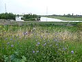
 Allotments near Trolling Down Hill - geograph.org.uk - 2828802.jpg 4 000 × 3 000; 4,06 MB
-
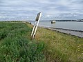 An old warning notice by the Thames - geograph.org.uk - 2552328.jpg 4 000 × 3 000; 4,22 MB
-
 Angie Mews, Dartford - geograph.org.uk - 4884813.jpg 3 264 × 2 448; 1,63 MB
-
 Approach to Dartford Tunnel - geograph.org.uk - 3916194.jpg 800 × 445; 63 KB
-
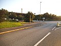
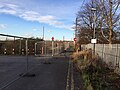
 Approach to Ebbsfleet International - geograph.org.uk - 3103693.jpg 800 × 514; 66 KB
-
 Approaching Dartford Station - geograph.org.uk - 5170343.jpg 1 600 × 1 067; 230 KB
-
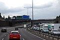
 Approaching the Dartford Crossing - geograph.org.uk - 2584904.jpg 640 × 430; 66 KB
-
 Approaching the Dartford Crossing - geograph.org.uk - 4069592.jpg 1 600 × 1 117; 1,2 MB
-
 Approaching the Dartford Tunnel - geograph.org.uk - 5581662.jpg 1 024 × 768; 107 KB
-

-
 Area of scrub near the A2 - geograph.org.uk - 2851827.jpg 4 000 × 3 000; 4,09 MB
-
 Arjo Wiggins - Paper Mill demolished - August 2010 - geograph.org.uk - 3106060.jpg 4 288 × 2 848; 5,86 MB
-
 Attlee Drive, Dartford - geograph.org.uk - 3962001.jpg 2 560 × 1 920; 1,99 MB
-
 Attlee Drive, Temple Hill - geograph.org.uk - 4821022.jpg 3 264 × 2 448; 1,93 MB
-
 Austen Gardens, Temple Hill - geograph.org.uk - 3935829.jpg 3 488 × 2 616; 2,14 MB
-
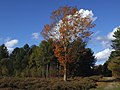 Autumn oak, Joydens Wood - geograph.org.uk - 4229688.jpg 1 024 × 768; 197 KB
-
 B2500 Bridge over A282 - geograph.org.uk - 5729126.jpg 640 × 425; 60 KB
-
 B2500 bridge, A282 - geograph.org.uk - 3729655.jpg 640 × 430; 54 KB
-
 B2500 bridge, A282 - geograph.org.uk - 3735558.jpg 640 × 386; 53 KB
-
 B260 bridge, M25 - geograph.org.uk - 3729669.jpg 640 × 430; 56 KB
-
 B260 bridge, M25 - geograph.org.uk - 3736894.jpg 640 × 430; 41 KB
-
 B260 Bridge, M25 - geograph.org.uk - 5729119.jpg 640 × 425; 42 KB
-
 B280 bridge, M25 - geograph.org.uk - 2584861.jpg 640 × 483; 64 KB
-
 Baldwyn's Road, Bexley - geograph.org.uk - 3919409.jpg 3 488 × 2 616; 2,12 MB
-
 Ballast train heading east through Swanscombe - geograph.org.uk - 6226108.jpg 1 024 × 768; 399 KB
-
 Ballast train heading east through Swanscombe - geograph.org.uk - 6226113.jpg 1 024 × 768; 400 KB
-
 Bandstand in Central Park, Dartford - geograph.org.uk - 2824361.jpg 4 000 × 3 000; 4,17 MB
-
 Bandstand in Central Park, Dartford - geograph.org.uk - 2824367.jpg 4 000 × 3 000; 3,93 MB
-
 Barham Road, Dartford - geograph.org.uk - 4682179.jpg 2 272 × 1 704; 643 KB
-
 Barnwell Road, Joyce Green - geograph.org.uk - 4821089.jpg 3 264 × 2 448; 2,07 MB
-
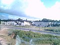
 Bay at low tide - geograph.org.uk - 2552257.jpg 4 000 × 3 000; 4,23 MB
-
 Bayly Road, Dartford - geograph.org.uk - 4682197.jpg 2 272 × 1 704; 626 KB
-
 Bayly Road, Dartford - geograph.org.uk - 4821058.jpg 3 264 × 2 448; 1,11 MB
-
 Beach by Dartford Marshes - geograph.org.uk - 2552234.jpg 4 000 × 3 000; 4 MB
-
 Beaconsfield Road, Bexley - geograph.org.uk - 3919415.jpg 3 488 × 2 616; 2,16 MB
-
 Beadles Volkswagen car dealership, Princes Road, Dartford - geograph.org.uk - 2010836.jpg 2 048 × 1 536; 1,19 MB
-
 Bell Terrace, Dartford - geograph.org.uk - 4885063.jpg 3 264 × 2 448; 1,43 MB
-
 Binnie Road, Dartford - geograph.org.uk - 4885041.jpg 3 264 × 2 448; 1,75 MB
-
 Binnie Road, Dartford - geograph.org.uk - 4885050.jpg 3 264 × 2 448; 1,93 MB
-
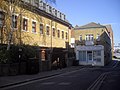
 Bird in Hand, Dartford - geograph.org.uk - 3860359.jpg 3 488 × 2 616; 1,92 MB
-
 Birdwood Avenue, Dartford - geograph.org.uk - 4884764.jpg 3 264 × 2 448; 1,73 MB
-
 Bollard by Dartford Creek - geograph.org.uk - 4521137.jpg 4 000 × 2 664; 1,32 MB
-
 Bow Arrow Lane, Dartford - geograph.org.uk - 4682200.jpg 2 272 × 1 704; 849 KB
-
 Brent Lane, Dartford - geograph.org.uk - 4680577.jpg 2 272 × 1 704; 977 KB
-
 Brent Lane, Dartford - geograph.org.uk - 4680593.jpg 2 272 × 1 704; 669 KB
-
 Brentfield Road, Dartford - geograph.org.uk - 3748596.jpg 3 488 × 2 616; 1,97 MB
-
 Briar Road, Joydens Wood - geograph.org.uk - 4874598.jpg 3 264 × 2 448; 2,22 MB
-
 Briar Road, Joydens Wood - geograph.org.uk - 4874603.jpg 3 264 × 2 448; 2,94 MB
-
 Bridge in Priory Road, Dartford - geograph.org.uk - 2333588.jpg 1 280 × 960; 611 KB
-
 Bridge over Dartford Creek - geograph.org.uk - 2827941.jpg 640 × 480; 82 KB
-
 Bridge over the A282, junction 1b - geograph.org.uk - 2028587.jpg 640 × 420; 69 KB
-
 Bridge, A282 - geograph.org.uk - 2584885.jpg 640 × 388; 61 KB
-
 Bridges Drive, Temple Hill - geograph.org.uk - 4821068.jpg 3 264 × 2 448; 1,49 MB
-
 Bridges over the A282 - geograph.org.uk - 3729662.jpg 640 × 430; 60 KB
-
 Bridleway bridge over A206 - geograph.org.uk - 2827964.jpg 640 × 428; 64 KB
-
 Bronte Grove, Temple Hill - geograph.org.uk - 3935826.jpg 3 488 × 2 616; 2,19 MB
-
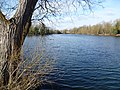 Brookland Lakes - geograph.org.uk - 2818581.jpg 4 000 × 3 000; 4,43 MB
-
 Brookland Lakes - geograph.org.uk - 2818592.jpg 4 000 × 3 000; 4,11 MB
-
 Brookland Lakes - geograph.org.uk - 5349632.jpg 4 000 × 3 000; 4,8 MB
-
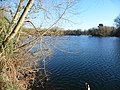
 Brooklands Lake - geograph.org.uk - 5170330.jpg 1 600 × 1 067; 615 KB
-
 Browning Road, Temple Hill - geograph.org.uk - 3935825.jpg 3 488 × 2 616; 1,96 MB
-
 Brunel Way, Dartford - geograph.org.uk - 4885057.jpg 3 264 × 2 448; 1,48 MB
-
 Brussels bound Eurostar - Ebbsfleet - geograph.org.uk - 3103692.jpg 800 × 600; 164 KB
-
 Burnham Crescent, Dartford - geograph.org.uk - 4838019.jpg 3 264 × 2 448; 1,47 MB
-
 Burnham Road, Dartford - geograph.org.uk - 4837996.jpg 3 264 × 2 448; 3,46 MB
-
 Burnham Terrace, Dartford - geograph.org.uk - 3908555.jpg 3 488 × 2 616; 2,14 MB
-
 Burroughs Drive, Dartford - geograph.org.uk - 4814393.jpg 3 264 × 2 448; 1,8 MB
-
 Burroughs Drive, Dartford - geograph.org.uk - 4821296.jpg 3 264 × 2 448; 1,81 MB
-
 By the Thames at Dartford Marshes - geograph.org.uk - 2552187.jpg 4 000 × 3 000; 4,05 MB
-
 Byron Road, Temple Hill - geograph.org.uk - 4821081.jpg 3 264 × 2 448; 1,98 MB
-
 B^Q, Prospect Retail Park, Dartford - geograph.org.uk - 4475714.jpg 3 904 × 2 928; 2,54 MB
-
 B^Q, Prospect Retail Park, Dartford - geograph.org.uk - 4475715.jpg 4 000 × 3 000; 2,94 MB
-
 Cafe, Central Park, Dartford - geograph.org.uk - 2827957.jpg 640 × 480; 117 KB
-
 Cameron Drive, Dartford - geograph.org.uk - 4884772.jpg 3 264 × 2 448; 2,45 MB
-
 Candy Dene, Ebbsfleet - geograph.org.uk - 5517036.jpg 3 264 × 2 448; 2,57 MB
-
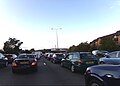
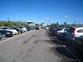 Car park A - Ebbsfleet - geograph.org.uk - 3103698.jpg 800 × 600; 95 KB
-
 Car park A - Ebbsfleet International - geograph.org.uk - 3106952.jpg 640 × 480; 93 KB
-

-
 Carlisle Road, Dartford - geograph.org.uk - 4682194.jpg 2 272 × 1 704; 769 KB
-
 Carrington Road, Dartford - geograph.org.uk - 4682288.jpg 2 272 × 1 704; 771 KB
-
 Carved owl in Joydens Wood - geograph.org.uk - 4229659.jpg 1 024 × 768; 242 KB
-
 Cavell Crescent, Temple Hill - geograph.org.uk - 4821079.jpg 3 264 × 2 448; 2,01 MB
-
 Central Park - geograph.org.uk - 4111918.jpg 3 872 × 2 592; 1,35 MB
-
 Central Park - geograph.org.uk - 4111922.jpg 2 592 × 3 872; 3,04 MB
-
 Central Park, Dartford - geograph.org.uk - 5170322.jpg 1 600 × 1 067; 498 KB
-
 Central Road, Dartford - geograph.org.uk - 4814399.jpg 3 264 × 2 448; 1,69 MB
-
 Central Road, Dartford - geograph.org.uk - 4821281.jpg 3 264 × 2 448; 3,02 MB
-
 Central Road, Dartford - geograph.org.uk - 4821290.jpg 3 264 × 2 448; 1,63 MB
-
 Central Road, Dartford - geograph.org.uk - 4821291.jpg 3 264 × 2 448; 1,16 MB
-
 Chalk workings near Ebbsfleet International Station - geograph.org.uk - 2997517.jpg 2 048 × 1 536; 577 KB
-

-
 Channel Tunnel Rail Link, near Ebbsfleet - geograph.org.uk - 4138865.jpg 3 488 × 2 616; 2,94 MB
-
 Chatsworth Road, Dartford - geograph.org.uk - 4838015.jpg 3 264 × 2 448; 1,8 MB
-
 Chaucer Way, Temple Hill - geograph.org.uk - 4821088.jpg 3 264 × 2 448; 1,2 MB
-
 Christ Church, Dartford - geograph.org.uk - 2840006.jpg 640 × 480; 104 KB
-
 Christ Church, Dartford - geograph.org.uk - 6161665.jpg 1 024 × 768; 357 KB
-
 Christchurch Road, Dartford - geograph.org.uk - 3919530.jpg 3 488 × 2 616; 1,57 MB
-
 Cloud Close, Dartford - geograph.org.uk - 4884829.jpg 3 264 × 2 448; 1,7 MB
-

-
 Coleridge Road, Temple Hill - geograph.org.uk - 4821078.jpg 3 264 × 2 448; 1,66 MB
-
 Colney Road, Dartford - geograph.org.uk - 4682294.jpg 2 272 × 1 704; 758 KB
-
 Connect Three Orchard Street, Dartford - geograph.org.uk - 2886399.jpg 4 000 × 3 000; 3,73 MB
-
 Converted church on West Hill, Dartford - geograph.org.uk - 3962264.jpg 2 560 × 1 920; 1,99 MB
-
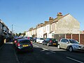
 Cottages on A226, Crayford - geograph.org.uk - 6161361.jpg 1 024 × 768; 541 KB
-
 Crayford Creek - geograph.org.uk - 5172952.jpg 1 600 × 1 067; 365 KB
-
 Crayford Creek Panorama - geograph.org.uk - 5361417.jpg 640 × 218; 38 KB
-
 Creek Barrier And Warning Light - geograph.org.uk - 5360330.jpg 424 × 640; 46 KB
-
 Crossing Control Offices, M25 - geograph.org.uk - 3215068.jpg 4 288 × 3 216; 5,67 MB
-
 Cumberland Drive, Dartford - geograph.org.uk - 4680584.jpg 2 272 × 1 704; 684 KB
-
 Cycle path alongside the A2 - geograph.org.uk - 2533093.jpg 1 024 × 768; 247 KB
-
 Dale Street, Dartford - geograph.org.uk - 4821294.jpg 3 264 × 2 448; 1,75 MB
-
 Darent Valley - geograph.org.uk - 3766609.jpg 640 × 430; 54 KB
-
 Darent Valley Path - geograph.org.uk - 5360352.jpg 640 × 424; 75 KB
-
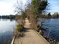 Darent Valley Path across Brooklands Lakes - geograph.org.uk - 2818559.jpg 4 000 × 3 000; 4,05 MB
-
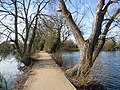 Darent Valley Path crossing Brooklands Lakes - geograph.org.uk - 2818566.jpg 4 000 × 3 000; 4,31 MB
-
 Dartford Civic Centre, January 2024.jpg 2 388 × 1 791; 1,21 MB
-
 Dartford Creek - geograph.org.uk - 2827947.jpg 640 × 480; 91 KB
-
 Dartford Creek at low tide - geograph.org.uk - 1947748.jpg 1 280 × 960; 641 KB
-
 Dartford Creek at low tide - geograph.org.uk - 1955453.jpg 1 280 × 960; 650 KB
-
 Dartford Creek Barrier - geograph.org.uk - 5730143.jpg 1 600 × 1 484; 536 KB
-
 Dartford Crossing - geograph.org.uk - 2003570.jpg 4 288 × 2 848; 4,4 MB
-
 Dartford Crossing - geograph.org.uk - 3935888.jpg 3 488 × 2 616; 1,99 MB
-

-
 Dartford Drainage - geograph.org.uk - 5360289.jpg 424 × 640; 64 KB
-
 Dartford Fresh Marshes - geograph.org.uk - 2277975.jpg 640 × 480; 86 KB
-
 Dartford Fresh Marshes - geograph.org.uk - 2860787.jpg 1 280 × 856; 198 KB
-
 Dartford Fresh Marshes - geograph.org.uk - 2861048.jpg 1 280 × 856; 153 KB
-
 Dartford Fresh marshes - geograph.org.uk - 5360295.jpg 640 × 424; 58 KB
-
 Dartford Freshwater Marshes - geograph.org.uk - 3629894.jpg 640 × 480; 109 KB
-
 Dartford Freshwater Marshes - geograph.org.uk - 3629905.jpg 640 × 480; 130 KB
-
 Dartford Freshwater Marshes - geograph.org.uk - 3629943.jpg 640 × 480; 85 KB
-
 Dartford Freshwater Marshes - geograph.org.uk - 3630004.jpg 640 × 480; 87 KB
-
 Dartford Heath - geograph.org.uk - 2475486.jpg 4 000 × 3 000; 4,09 MB
-
 Dartford Heath - geograph.org.uk - 2628471.jpg 4 000 × 3 000; 4,4 MB
-
 Dartford Heath - geograph.org.uk - 3887509.jpg 640 × 360; 46 KB
-
 Dartford Heath looking towards Maypole - geograph.org.uk - 2475463.jpg 4 000 × 3 000; 4,06 MB
-
 Dartford Heath, Footbridge Over the A2 - geograph.org.uk - 3631642.jpg 640 × 480; 251 KB
-
 Dartford Marshes - geograph.org.uk - 3935852.jpg 3 488 × 2 616; 2,16 MB
-
 Dartford Marshes - geograph.org.uk - 4427319.jpg 1 600 × 1 039; 345 KB
-
 Dartford Marshes from University Way - geograph.org.uk - 2532634.jpg 4 000 × 3 000; 4,15 MB
-
 Dartford Marshes from University Way - geograph.org.uk - 2532641.jpg 4 000 × 3 000; 4,36 MB
-
 Dartford Marshes from University Way - geograph.org.uk - 2532645.jpg 4 000 × 3 000; 4,36 MB


