Category:Borrowby, Scarborough
Jump to navigation
Jump to search
village and civil parish in Scarborough, North Yorkshire, UK  | |||||
| Upload media | |||||
| Instance of | |||||
|---|---|---|---|---|---|
| Location | Scarborough, North Yorkshire, Yorkshire and the Humber, England | ||||
| Different from | |||||
 | |||||
English: Borrowby is a village and civil parish in the Scarborough district of North Yorkshire, England. According to the 2001 UK census, Borrowby parish had a population of 56.cite web
Media in category "Borrowby, Scarborough"
The following 39 files are in this category, out of 39 total.
-
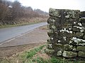
 A good time to check your brakes - geograph.org.uk - 4587403.jpg 640 × 480; 64 KB
-
 Across fields to Borrowby Grange Farm - geograph.org.uk - 3424483.jpg 4,000 × 3,000; 2.57 MB
-
 Bench Mark on Dry Stone Wall Moor Lane - geograph.org.uk - 3424398.jpg 4,000 × 3,000; 3.09 MB
-
 Birk Dale - geograph.org.uk - 6257970.jpg 640 × 360; 90 KB
-
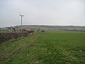
 Borrowby Dale - geograph.org.uk - 4372986.jpg 640 × 360; 175 KB
-
 Borrowby Lane - geograph.org.uk - 4587362.jpg 640 × 480; 83 KB
-
 Borrowby Lane - geograph.org.uk - 4587396.jpg 640 × 480; 69 KB
-
 Borrowby Lane - geograph.org.uk - 4587420.jpg 640 × 480; 65 KB
-
 Borrowby Lane - geograph.org.uk - 4587426.jpg 640 × 480; 79 KB
-
 Borrowby Lane near Cooper House - geograph.org.uk - 1994393.jpg 2,048 × 1,536; 1.2 MB
-
 Borrowby Lane near Keld Hill - geograph.org.uk - 1994373.jpg 2,048 × 1,536; 1.11 MB
-
 Borrowby near Scarborough.jpg 640 × 474; 114 KB
-
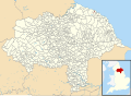 Borrowby, Scarborough UK parish locator map.svg 1,425 × 1,037; 4.3 MB
-
 Bridge over Roxby Beck - geograph.org.uk - 6213515.jpg 1,024 × 683; 219 KB
-
 Cottage, Borrowby - geograph.org.uk - 4587358.jpg 640 × 480; 120 KB
-
 Cottages on Borrowby Lane - geograph.org.uk - 4587429.jpg 640 × 480; 89 KB
-
 Downhill towards Low Borrowby - geograph.org.uk - 4587365.jpg 640 × 480; 86 KB
-
 Edge of Oakrigg Wood - geograph.org.uk - 1145610.jpg 640 × 427; 67 KB
-
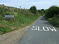 Entering Borrowby - geograph.org.uk - 4587355.jpg 640 × 480; 80 KB
-
 Farm track off Moor Lane - geograph.org.uk - 4587350.jpg 640 × 448; 100 KB
-
 Field entrance off Borrowby Lane - geograph.org.uk - 4587392.jpg 640 × 480; 70 KB
-
 Field entrance on Moor Lane - geograph.org.uk - 1992503.jpg 2,048 × 1,536; 822 KB
-
 Footpath back to Borrowby Grange - geograph.org.uk - 3424713.jpg 4,000 × 3,000; 2.52 MB
-
 Footpath near Low Borrowby - geograph.org.uk - 4587367.jpg 640 × 480; 99 KB
-
 Gate on Roxby Low Moor - geograph.org.uk - 2414729.jpg 640 × 427; 252 KB
-
 Grazing Keld Hill - geograph.org.uk - 4587407.jpg 640 × 480; 78 KB
-
 Grazing off Borrowby Lane - geograph.org.uk - 4587417.jpg 640 × 480; 62 KB
-
 Grazing towards Copper House Farm - geograph.org.uk - 4587423.jpg 640 × 480; 67 KB
-
 Lane off Borrowby Lane - geograph.org.uk - 4587364.jpg 640 × 480; 106 KB
-
 Low Borrowby - geograph.org.uk - 2414773.jpg 427 × 640; 237 KB
-
 Moor Lane - geograph.org.uk - 4587353.jpg 640 × 480; 80 KB
-
 On Keld Hill - geograph.org.uk - 1145594.jpg 640 × 427; 63 KB
-
 On Keld Hill - geograph.org.uk - 4372991.jpg 640 × 360; 102 KB
-
 Plum Tree Farm - geograph.org.uk - 6108503.jpg 1,024 × 576; 196 KB
-
 Resting place on Borrowby Lane - geograph.org.uk - 4587395.jpg 640 × 480; 78 KB
-
 Sheep at Borrowby Grange - geograph.org.uk - 3424705.jpg 4,000 × 3,000; 1.89 MB
-
 Steep descent on Borrowby Lane - geograph.org.uk - 4587414.jpg 640 × 480; 97 KB
-
 Stile, Borrowby Dale - geograph.org.uk - 1145636.jpg 640 × 427; 61 KB
-
 The only way is up Borrowby Moor - geograph.org.uk - 3424361.jpg 3,000 × 4,000; 2.56 MB


