Category:Boterstraat 10, The Hague
Jump to navigation
Jump to search
| Object location | | View all coordinates using: OpenStreetMap |
|---|
building in The Hague, Netherlands  | |||||
| Upload media | |||||
| Instance of | |||||
|---|---|---|---|---|---|
| Location | The Hague, South Holland, Netherlands | ||||
| Street address |
| ||||
| Located on street | |||||
| Heritage designation |
| ||||
 | |||||
|
This is a category about rijksmonument number 17482
|
| Address |
|
Media in category "Boterstraat 10, The Hague"
The following 3 files are in this category, out of 3 total.
-
 DenHaag Boterstraat10.jpg 2,736 × 3,648; 5.12 MB
-
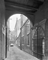 Inkijk en overzicht Boterstraat - 's-Gravenhage - 20088237 - RCE.jpg 952 × 1,200; 225 KB
-
 Inkijk en overzicht Boterstraat - 's-Gravenhage - 20088239 - RCE.jpg 951 × 1,200; 269 KB

