Category:Bothamsall
Jump to navigation
Jump to search
English: Bothamsall is a village and civil parish in the Bassetlaw district of Nottinghamshire, England.
village in United Kingdom  | |||||
| Upload media | |||||
| Instance of | |||||
|---|---|---|---|---|---|
| Location | Bassetlaw, Nottinghamshire, East Midlands, England | ||||
 | |||||
Subcategories
This category has the following 2 subcategories, out of 2 total.
C
- Crookford Ford (3 F)
Media in category "Bothamsall"
The following 200 files are in this category, out of 326 total.
(previous page) (next page)-
 1960s farmhouse - geograph.org.uk - 4808289.jpg 5,500 × 3,667; 5.9 MB
-
 A public footpath off Main Street - geograph.org.uk - 3051199.jpg 800 × 600; 123 KB
-
 A track entering Normanton Larches - geograph.org.uk - 3051241.jpg 800 × 600; 162 KB
-
 A very small house - geograph.org.uk - 2456828.jpg 1,024 × 768; 118 KB
-
 Abandoned road at the former Bevercotes Colliery - geograph.org.uk - 4322054.jpg 1,024 × 756; 212 KB
-
 Approaching Haughton Park House Farm - geograph.org.uk - 5974520.jpg 5,183 × 3,718; 4.6 MB
-
 Beggar's Nest - geograph.org.uk - 4418463.jpg 1,280 × 664; 815 KB
-
 Beggar's Rest - geograph.org.uk - 2576295.jpg 640 × 480; 98 KB
-
 Beggar's Rest by Elkesley Wood - geograph.org.uk - 4409659.jpg 800 × 533; 116 KB
-
 Beggar's Rest, Elkesley Wood - geograph.org.uk - 1252192.jpg 640 × 480; 72 KB
-
 Bench mark, Bothamsall Church - geograph.org.uk - 4701026.jpg 917 × 1,280; 354 KB
-
 Beside the River Meden - geograph.org.uk - 4411186.jpg 4,000 × 2,248; 2.56 MB
-
 Between the pines - geograph.org.uk - 4412608.jpg 4,000 × 2,248; 6.69 MB
-
 Between the River Maun and the River Meden - geograph.org.uk - 5989426.jpg 5,137 × 3,426; 4.28 MB
-
 Bevercotes Colliery - geograph.org.uk - 1932945.jpg 640 × 426; 74 KB
-
 Bevercotes Colliery site - geograph.org.uk - 2582508.jpg 640 × 480; 104 KB
-
 Bevercotes Colliery site - geograph.org.uk - 2582512.jpg 640 × 480; 101 KB
-
 Bevercotes Colliery site - geograph.org.uk - 2582520.jpg 640 × 480; 110 KB
-

-

-

-
 Bevercotes Colliery site, aerial 2018 (3) - geograph.org.uk - 5811443.jpg 1,024 × 683; 145 KB
-

-

-

-
 Bothamsall Castle - geograph.org.uk - 4805510.jpg 5,500 × 3,667; 6.39 MB
-
 Bothamsall Church - geograph.org.uk - 4686498.jpg 1,536 × 1,200; 900 KB
-
 Bothamsall farmland - geograph.org.uk - 2467730.jpg 640 × 427; 115 KB
-
 Bothamsall Hall.jpg 1,280 × 960; 294 KB
-
 Bothamsall motte - geograph.org.uk - 2467735.jpg 640 × 427; 71 KB
-
 Bothamsall motte - geograph.org.uk - 2729383.jpg 640 × 480; 103 KB
-
 Bothamsall Motte and Bailey - geograph.org.uk - 4805509.jpg 5,500 × 3,667; 7.05 MB
-
 Bothamsall village sign - geograph.org.uk - 1928932.jpg 791 × 1,024; 492 KB
-
 Bothamsall village sign - geograph.org.uk - 4409159.jpg 533 × 800; 116 KB
-
 Bothamsall village sign - geograph.org.uk - 4409162.jpg 533 × 800; 90 KB
-
 Bridge over River Meden.jpg 4,981 × 3,583; 4.4 MB
-
 Bridge over the River Maun - geograph.org.uk - 3891411.jpg 640 × 427; 90 KB
-
 Bridge over the River Maun at Milton - geograph.org.uk - 4322134.jpg 1,024 × 768; 343 KB
-
 Bridge over the River Meden - geograph.org.uk - 1252254.jpg 640 × 480; 114 KB
-
 Bridleway to Crookford - geograph.org.uk - 4474373.jpg 1,024 × 683; 233 KB
-
 Bridleway to Crookford - geograph.org.uk - 4474995.jpg 1,024 × 683; 224 KB
-
 Bridleway to Crookford - geograph.org.uk - 5180796.jpg 1,024 × 683; 258 KB
-
 Bridleway to Milton - geograph.org.uk - 2576354.jpg 640 × 480; 157 KB
-
 Bridleway towards Crookford - geograph.org.uk - 4686278.jpg 1,600 × 1,200; 579 KB
-
 Building range at Manor Farm - geograph.org.uk - 4701075.jpg 1,280 × 912; 276 KB
-
 Buildings at Church Farm - geograph.org.uk - 4806452.jpg 5,500 × 3,667; 3.72 MB
-
 Buildings at Manor Farm - geograph.org.uk - 4808102.jpg 5,500 × 3,667; 4.24 MB
-
 Buildings at Manor Farm - geograph.org.uk - 4808104.jpg 5,500 × 3,667; 4.63 MB
-
 Bungalow with post box - geograph.org.uk - 4808285.jpg 5,500 × 3,667; 3.62 MB
-
 By the River Maun - geograph.org.uk - 4322121.jpg 1,024 × 768; 251 KB
-
 By The River Meden - geograph.org.uk - 5975399.jpg 3,888 × 5,184; 5.2 MB
-
 Castle on the Hilltop - geograph.org.uk - 4805511.jpg 5,500 × 3,667; 5.31 MB
-
 Church Farm, Bothamsall - geograph.org.uk - 4701008.jpg 1,280 × 960; 331 KB
-
 Church Farmhouse, Bothamsall.jpg 5,067 × 3,646; 4.64 MB
-
 Church Lane, looking east - geograph.org.uk - 4701062.jpg 1,280 × 960; 636 KB
-
 Church of Our Lady and St Peter - geograph.org.uk - 4701014.jpg 942 × 1,280; 331 KB
-
 Church of Our Lady and St Peter - geograph.org.uk - 4701031.jpg 1,051 × 1,280; 313 KB
-
 Church of Our Lady and St Peter - geograph.org.uk - 4701034.jpg 1,280 × 960; 281 KB
-
 Church of Our Lady and St Peter - geograph.org.uk - 4701046.jpg 1,280 × 1,280; 403 KB
-
 Church of Our Lady and St Peter, Bothamsall - geograph.org.uk - 5974282.jpg 5,067 × 3,687; 3.83 MB
-
 Church of St Peter and St Mary, Bothamsall - geograph.org.uk - 4806449.jpg 5,500 × 3,667; 3.8 MB
-
 Church, sign, and fingerpost - geograph.org.uk - 4805538.jpg 3,667 × 5,500; 1.78 MB
-
 Conjure Alders bridge - geograph.org.uk - 2729507.jpg 480 × 640; 112 KB
-
 Conjure Alders footpath - geograph.org.uk - 2729412.jpg 640 × 480; 151 KB
-
 Converted building - geograph.org.uk - 4808296.jpg 5,500 × 3,667; 3.65 MB
-
 Cottages - geograph.org.uk - 4806439.jpg 5,500 × 3,667; 3.87 MB
-
 Cottages and windpump - geograph.org.uk - 4808101.jpg 5,500 × 3,667; 3.33 MB
-
 Cottages on Main Street - geograph.org.uk - 4701023.jpg 1,280 × 960; 324 KB
-
 Crookford - geograph.org.uk - 2728049.jpg 640 × 480; 126 KB
-
 Crookford Ford in the Snow - geograph.org.uk - 2792954.jpg 3,872 × 2,592; 2.39 MB
-
 Crookford Ford on the River Poulter at Elkesley - geograph.org.uk - 2574237.jpg 3,872 × 2,592; 2.4 MB
-
 Dead tree - geograph.org.uk - 2467728.jpg 640 × 427; 85 KB
-

-
 Decorative brickwork - geograph.org.uk - 4805539.jpg 5,500 × 3,667; 4.65 MB
-
 Derelict barn - geograph.org.uk - 4409170.jpg 800 × 533; 105 KB
-
 Derelict barns - geograph.org.uk - 4409167.jpg 800 × 533; 124 KB
-
-

-

-
 Drain in water meadows near Milton - geograph.org.uk - 4322131.jpg 1,024 × 768; 230 KB
-
 Drain near Milton - geograph.org.uk - 2576363.jpg 480 × 640; 145 KB
-

-
 Early morning on the River Maun - geograph.org.uk - 2961483.jpg 1,024 × 768; 303 KB
-
 Entrance to Bevercotes Country Park - geograph.org.uk - 4322613.jpg 1,024 × 768; 246 KB
-
 Entrance to parkland at Lound Hall - geograph.org.uk - 4625969.jpg 864 × 1,152; 323 KB
-
 Farm track away from Haughton Park House Farm - geograph.org.uk - 1928106.jpg 1,024 × 757; 434 KB
-
 Farmland off West Drayton Avenue - geograph.org.uk - 2270091.jpg 640 × 427; 103 KB
-
 Farmland south of Elkesley - geograph.org.uk - 1928125.jpg 1,024 × 779; 483 KB
-
 Farmyard at Church Farm - geograph.org.uk - 4701064.jpg 1,280 × 885; 335 KB
-

-
 Field corner by track junction - geograph.org.uk - 1928900.jpg 1,024 × 729; 524 KB
-
 Fields between Normanton Hill and Bothamsall - geograph.org.uk - 1928878.jpg 1,024 × 768; 448 KB
-
 Fields north of Bothamsall - geograph.org.uk - 1928095.jpg 1,024 × 740; 482 KB
-
 Fields towards the B6387 - geograph.org.uk - 1928115.jpg 1,024 × 768; 449 KB
-
 Fingerpost - geograph.org.uk - 4805537.jpg 5,500 × 3,667; 3.32 MB
-
 Fingerpost near Bothamsall - geograph.org.uk - 4701084.jpg 960 × 1,280; 379 KB
-
 Fingerpost, Bothamsall - geograph.org.uk - 4701010.jpg 960 × 1,280; 461 KB
-
 Fingerposts near Bothamsall - geograph.org.uk - 4701093.jpg 960 × 1,280; 445 KB
-
 Fishing pond beside the River Meden at Bothamsall - geograph.org.uk - 4417700.jpg 1,280 × 960; 1.26 MB
-
 Fishponds Cottage - geograph.org.uk - 5974523.jpg 3,705 × 4,941; 5.2 MB
-
 Footbridge across River Meden - geograph.org.uk - 4417695.jpg 1,280 × 939; 1.59 MB
-
 Footbridge across River Poulter - geograph.org.uk - 4412993.jpg 4,000 × 2,248; 6.44 MB
-
 Footbridge across the Meden. - geograph.org.uk - 4037901.jpg 640 × 383; 112 KB
-
 Footbridge across the River Poulter - geograph.org.uk - 1928136.jpg 1,024 × 768; 587 KB
-
 Footbridge over a drain - geograph.org.uk - 4322108.jpg 1,024 × 768; 276 KB
-
 Footbridge over River Poulter - geograph.org.uk - 6360759.jpg 1,024 × 768; 311 KB
-
 Footbridge over the River Maun - geograph.org.uk - 1261214.jpg 640 × 480; 130 KB
-
 Footbridge over the River Poulter - geograph.org.uk - 4409657.jpg 800 × 533; 179 KB
-
 Footbridge over the River Poulter south of Elkesley - geograph.org.uk - 4686485.jpg 1,600 × 1,200; 815 KB
-
 Footpath across fields towards Bothamsall - geograph.org.uk - 1928924.jpg 1,024 × 755; 500 KB
-
 Footpath alongside a drain - geograph.org.uk - 4322608.jpg 1,024 × 768; 206 KB
-
 Footpath in front of Hall - geograph.org.uk - 2693836.jpg 640 × 480; 108 KB
-
 Ford and footbridge at Crookford - geograph.org.uk - 4686375.jpg 1,600 × 1,200; 779 KB
-

-

-
 Former estate cottages, Main Street - geograph.org.uk - 4701082.jpg 1,280 × 960; 311 KB
-
 Former farm buildings, Bothamsall - geograph.org.uk - 4701079.jpg 1,280 × 960; 259 KB
-
 Former post office, Bothamsall - geograph.org.uk - 4805525.jpg 5,500 × 3,667; 3.83 MB
-
 Frozen furrows - geograph.org.uk - 3262236.jpg 640 × 427; 113 KB
-
 Garage with a difference - geograph.org.uk - 4701071.jpg 948 × 1,280; 309 KB
-
 Gentrification - geograph.org.uk - 4805541.jpg 5,500 × 3,667; 4.72 MB
-
 Haughton Chapel - geograph.org.uk - 1072953.jpg 640 × 480; 161 KB
-
 Haughton Hall Farm - geograph.org.uk - 1319867.jpg 640 × 480; 66 KB
-
 Haughton Hall Farm Track bridge sign - geograph.org.uk - 3891490.jpg 640 × 427; 39 KB
-
 Haughton Park House Farm - geograph.org.uk - 1252232.jpg 640 × 480; 59 KB
-
 Haughton Park House Farm - geograph.org.uk - 4409676.jpg 800 × 533; 146 KB
-
 Haughton Park House Farm - geograph.org.uk - 4418482.jpg 1,280 × 751; 742 KB
-
 Haughton Park House Farm - geograph.org.uk - 4686493.jpg 1,600 × 1,200; 397 KB
-
 Haughton Park House.jpg 1,024 × 768; 221 KB
-
 Haughton Watermill - geograph.org.uk - 560145.jpg 427 × 640; 142 KB
-
 House at Nineteen Acre Wood - geograph.org.uk - 4686750.jpg 1,600 × 1,200; 429 KB
-
 House in Bothamsall - geograph.org.uk - 4806427.jpg 5,500 × 3,667; 5.24 MB
-
 House with landscaped garden - geograph.org.uk - 4808294.jpg 5,500 × 3,667; 4.31 MB
-
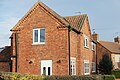
 Houses at west end of Main Street, Bothamsall - geograph.org.uk - 4418400.jpg 1,280 × 960; 1.1 MB
-
 Houses by the Church - geograph.org.uk - 1433805.jpg 640 × 415; 82 KB
-
 In the thick of it - geograph.org.uk - 4413004.jpg 3,986 × 2,222; 6.69 MB
-
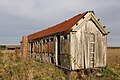
 Interior of derelict old railway carriage - geograph.org.uk - 4418422.jpg 1,280 × 960; 1.19 MB
-
 Interior of former railway carriage - geograph.org.uk - 4426976.jpg 1,280 × 960; 1.16 MB
-
 Lane south of Normanton Larches - geograph.org.uk - 5974298.jpg 3,695 × 4,932; 6.67 MB
-
 Little red Fergie - geograph.org.uk - 4805552.jpg 5,500 × 3,667; 5.3 MB
-

-
 Looking north towards to A614 - geograph.org.uk - 3051203.jpg 800 × 600; 115 KB
-
 Looking towards Spittlemoor Plantation - geograph.org.uk - 2456725.jpg 1,024 × 768; 147 KB
-
 Lound Hall (West Wing) - geograph.org.uk - 2868156.jpg 1,600 × 1,200; 605 KB
-
 Lound Hall Christmas - geograph.org.uk - 4624886.jpg 1,024 × 1,024; 444 KB
-
 Lound Hall lane - geograph.org.uk - 1933193.jpg 640 × 426; 134 KB
-
 Lound Hall lane - geograph.org.uk - 1933197.jpg 640 × 426; 128 KB
-
 Lound Hall Mining Museum - geograph.org.uk - 879830.jpg 640 × 423; 61 KB
-
 Lound Hall, Bothamsall. (geograph 4625392).jpg 1,280 × 960; 501 KB
-
 Main Street, Bothamsall - geograph.org.uk - 1928935.jpg 1,024 × 644; 438 KB
-
 Main Street, Bothamsall - geograph.org.uk - 4701067.jpg 1,280 × 928; 312 KB
-
 Manor farm - geograph.org.uk - 4808099.jpg 5,500 × 3,667; 2.57 MB
-

-
 Meden valley - geograph.org.uk - 2729388.jpg 640 × 480; 101 KB
-
 Meden Valley - geograph.org.uk - 4414793.jpg 1,024 × 768; 300 KB
-
 Men at work - geograph.org.uk - 4806436.jpg 5,500 × 3,667; 5.5 MB
-

-

-
 Minor road to Bothamsall - geograph.org.uk - 1834020.jpg 640 × 480; 114 KB
-
 Modern bungalow - geograph.org.uk - 4808287.jpg 5,500 × 3,667; 4.33 MB
-
 Motte - geograph.org.uk - 4805507.jpg 5,500 × 3,667; 6.93 MB
-
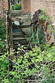
 Mucky owd thing - geograph.org.uk - 4805550.jpg 5,500 × 3,667; 3.8 MB
-
 National Mining Museum Lound Hall - geograph.org.uk - 2733437.jpg 640 × 440; 55 KB
-
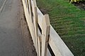
 New fence - geograph.org.uk - 4805542.jpg 5,500 × 3,667; 4.84 MB
-
 New oak - geograph.org.uk - 4805545.jpg 5,500 × 3,667; 2.84 MB
-
 No through Roads - geograph.org.uk - 841641.jpg 640 × 505; 70 KB
-
 Nodding Donkey - geograph.org.uk - 415727.jpg 640 × 427; 34 KB
-
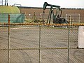
 Nodding donkey pumping oil west of Bothamsall - geograph.org.uk - 4686739.jpg 1,600 × 1,200; 374 KB
-
 Normanton Larches - geograph.org.uk - 2178899.jpg 640 × 480; 193 KB
-
 Normanton Larches - geograph.org.uk - 2178909.jpg 640 × 480; 200 KB
-
 Normanton Larches - geograph.org.uk - 2270178.jpg 640 × 427; 160 KB
-
 Normanton Larches - geograph.org.uk - 3262228.jpg 640 × 427; 168 KB
-
 Normanton Larches Farm - geograph.org.uk - 4686752.jpg 1,600 × 1,200; 368 KB
-

-
 Not a phone box - geograph.org.uk - 4805529.jpg 3,333 × 5,000; 1.48 MB
-
 Notice board at the Village Hall - geograph.org.uk - 4805535.jpg 5,500 × 3,667; 3.7 MB
-
 Nottinghamshire Landscape - geograph.org.uk - 5975396.jpg 5,184 × 3,888; 3.48 MB
-
 Oil well and view towards Bothamsall - geograph.org.uk - 2733526.jpg 1,024 × 768; 189 KB
-
 Oil Well in rural Notts - geograph.org.uk - 2740424.jpg 640 × 427; 73 KB
-
 Oil well in the parish of Bothamsall - geograph.org.uk - 5974294.jpg 4,663 × 3,294; 3.83 MB
-
 Oil well near Bothamsall - geograph.org.uk - 724507.jpg 640 × 480; 101 KB
-
 Old barn and footpath sign - geograph.org.uk - 1928907.jpg 1,024 × 579; 353 KB
-
 Old barns by footpath junction - geograph.org.uk - 1928902.jpg 1,024 × 768; 459 KB
-
 Old Post Office, Bothamsall - geograph.org.uk - 4701077.jpg 1,280 × 913; 286 KB
-
 Old railway carriage - geograph.org.uk - 4474361.jpg 1,024 × 697; 259 KB
-
 Old railway carriage - geograph.org.uk - 4474364.jpg 1,024 × 683; 263 KB
-
 Old railway carriage - geograph.org.uk - 4474406.jpg 1,024 × 683; 247 KB
-
 Old railway carriage - geograph.org.uk - 4474411.jpg 1,024 × 683; 257 KB
-
 Old railway carriage - geograph.org.uk - 5180807.jpg 1,024 × 683; 229 KB
-
 Old railway carriage - geograph.org.uk - 5180818.jpg 1,024 × 683; 262 KB
-
 Old railway carriage now a derelict shell - geograph.org.uk - 4418410.jpg 1,280 × 943; 1.12 MB
-
 Once upon a time this was a railway carriage - geograph.org.uk - 4418406.jpg 1,280 × 960; 1.08 MB
-
 Open view towards a massive pig farm in the distance - geograph.org.uk - 4411396.jpg 4,000 × 2,248; 1.9 MB
-
 Ordnance Survey Cut Mark - geograph.org.uk - 4970056.jpg 640 × 581; 122 KB
-
 Our Lady ^ St Peter's Church - geograph.org.uk - 4409679.jpg 510 × 800; 140 KB
-
 Path in Bevercotes Country Park - geograph.org.uk - 4322089.jpg 1,024 × 768; 188 KB
-
 Path in Elkesley Wood - geograph.org.uk - 4409179.jpg 800 × 533; 159 KB
-
 Path in Elkesley Wood - geograph.org.uk - 4409182.jpg 800 × 533; 195 KB
-
 Path to a field - geograph.org.uk - 848419.jpg 640 × 427; 109 KB
-


_-_geograph.org.uk_-_5811423.jpg)
_-_geograph.org.uk_-_5811425.jpg)
_-_geograph.org.uk_-_5811443.jpg)


,_aerial_2013_-_geograph.org.uk_-_3596857.jpg)


_-_geograph.org.uk_-_2868156.jpg)


.jpg)


