Category:Boundary Mark On Canal Towpath To South Of Castle Lock, Nottingham
Jump to navigation
Jump to search
boundary marker in City of Nottingham, Nottinghamshire, UK  | |||||
| Upload media | |||||
| Instance of | |||||
|---|---|---|---|---|---|
| Part of |
| ||||
| Location | City of Nottingham, Nottinghamshire, East Midlands, England | ||||
| Located in or next to body of water | |||||
| Heritage designation |
| ||||
 | |||||
Media in category "Boundary Mark On Canal Towpath To South Of Castle Lock, Nottingham"
The following 5 files are in this category, out of 5 total.
-
-
 Parish boundary marker, alongside Castle Lock - geograph.org.uk - 3060567.jpg 1,280 × 960; 188 KB
-
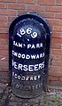
 1869 Parish Boundary in Nottingham - geograph.org.uk - 3175151.jpg 676 × 1,024; 206 KB
-
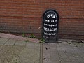
 Marker beside the Nottingham Canal - geograph.org.uk - 5029522.jpg 418 × 640; 85 KB
-
 Boundary Mark On Canal Towpath To South Of Castle Lock.jpg 2,408 × 3,612; 1.81 MB
.jpg)


