Category:Bournbrook
Jump to navigation
Jump to search
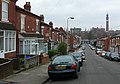
English: Bournbrook Bournbrook is a neighbourhood in the Council Ward and Parliamentary District of Selly Oak as determined by the Boundary Commission for England. Prior to the Local Government Provisional Order (No 13) Bill, commonly termed the Greater Birmingham Act, which came into effect on 9 November 1911, Bournbrook was the North Eastern boundary of Worcestershire and was locally governed by the King’s Norton and Northfield Urban District Council.
Gaeilge: Is ceantar suite i m Birmingham é Bournbrook.
area in Birmingham, England | |||||
| Upload media | |||||
| Instance of | |||||
|---|---|---|---|---|---|
| Location | Birmingham, West Midlands, England | ||||
 | |||||
Subcategories
This category has the following 2 subcategories, out of 2 total.
B
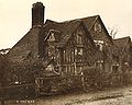
- Bournbrook Hotel (2 F)
S
- Selly Manor (35 F)
Media in category "Bournbrook"
The following 30 files are in this category, out of 30 total.
-
 2022 Commonwealth Games Hockey.jpg 5,149 × 2,285; 2.68 MB
-
 641 Bristol Road, Selly Oak in September 2019.jpg 3,497 × 2,623; 2.75 MB
-
 659 Bristol Road, Selly Oak in September 2019.jpg 4,242 × 2,831; 2.98 MB
-
 Alton Rd Selly Oak - geograph.org.uk - 1188218.jpg 640 × 446; 73 KB
-
 Alton Rd Selly Oak - geograph.org.uk - 1188219.jpg 640 × 454; 80 KB
-
 48 Alton Road.jpg 296 × 480; 127 KB
-
 Birmingham University - geograph.org.uk - 673136.jpg 640 × 412; 55 KB
-
 Bournbrook Fire Station.jpg 3,648 × 2,736; 2.73 MB
-
 Bournbrook High Street.jpg 480 × 360; 135 KB
-
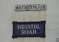 Bournbrook Market Place.jpg 955 × 677; 76 KB
-
 Bournbrook sign, A38.JPG 3,648 × 2,736; 3.63 MB
-
 Bournbrook Tram.jpg 1,024 × 608; 96 KB
-
 Bournbrook Walk 11 07 (N205) (2077093264).jpg 1,744 × 1,944; 1.67 MB
-
 Bristol Pear pub, Selly Oak.JPG 3,648 × 2,736; 3.56 MB
-

-
 Bristol Road, Bournbrook.JPG 3,648 × 2,736; 3.53 MB
-
 BristolRoad.JPG 980 × 735; 167 KB
-
 Dawlish Rd Selly Oak Birmingham - geograph.org.uk - 1044341.jpg 640 × 428; 68 KB
-
 Goose at the OVT, Bournbrook.JPG 3,648 × 2,736; 3.58 MB
-

-

-

-
 Rear of Rich Bitch Studios - Bournbrook by Phil Champion.jpg 800 × 536; 151 KB
-
 Rookery Cottages.jpg 1,008 × 661; 281 KB
-
 Selly Oak Centre - geograph.org.uk - 1967882.jpg 480 × 640; 113 KB
-
 Selly Oak Library - geograph.org.uk - 759999.jpg 640 × 480; 64 KB
-
 The Rookeries.jpg 920 × 735; 197 KB
-
 Town and Gown - Grange Rd Bournbrook. - geograph.org.uk - 555940.jpg 640 × 543; 112 KB
-

-
 Winter on campus and Bournbrook - geograph.org.uk - 1631319.jpg 640 × 314; 55 KB


_(2077093264).jpg)

_near_Selly_Park_-_Bournbrook_-_geograph.org.uk_-_127662.jpg)


196.jpg)


_Selly_Oak_-_geograph.org.uk_-_1100505.jpg)
