Category:Brönnti Flue
Jump to navigation
Jump to search
| Object location | | View all coordinates using: OpenStreetMap |
|---|
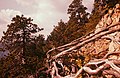
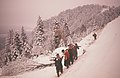
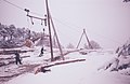
Brönnti Flue nördlich des Niederwiler Stierenberg, auf Gemeindegebiet von Balm bei Günsberg
Media in category "Brönnti Flue"
The following 8 files are in this category, out of 8 total.
-
 Zentralbibliothek Solothurn Ernst Klöti 0053.jpg 6,415 × 4,184; 21.83 MB
-
 Zentralbibliothek Solothurn Ernst Klöti 0105.jpg 6,415 × 4,184; 21.82 MB
-
 Zentralbibliothek Solothurn Ernst Klöti 0135.jpg 6,415 × 4,184; 19.21 MB
-
 Zentralbibliothek Solothurn Ernst Klöti 0150.jpg 6,415 × 4,184; 20.56 MB
-
 Zentralbibliothek Solothurn Ernst Klöti 0165.jpg 6,415 × 4,184; 21.13 MB
-
 Zentralbibliothek Solothurn Ernst Klöti 0168.jpg 6,415 × 4,184; 18.49 MB
-
 Zentralbibliothek Solothurn Ernst Klöti 0309 Brönnti Fluh.jpg 6,415 × 4,184; 21.13 MB
-
 Zentralbibliothek Solothurn Ernst Klöti 0480 Welschenrohr.jpg 6,415 × 4,184; 20.32 MB


