Category:Brackley, Northamptonshire
Jump to navigation
Jump to search
town and civil parish in Northamptonshire, England Mar2006.jpg) | |||||
| Upload media | |||||
| Pronunciation audio | |||||
|---|---|---|---|---|---|
| Instance of | |||||
| Location | West Northamptonshire, Northamptonshire, East Midlands, England | ||||
| Located in or next to body of water | |||||
| Population |
| ||||
| Area |
| ||||
| Said to be the same as | Brackley (Wikimedia duplicated page, civil parish) | ||||
| official website | |||||
 | |||||
Subcategories
This category has the following 12 subcategories, out of 12 total.
B
- Brackley Central railway station (12 F)
- Brackley Town Hall (30 F)
- Brackley War Memorial (1 F)
J
P
- St. Peter's Church, Brackley (15 F)
S
Media in category "Brackley, Northamptonshire"
The following 200 files are in this category, out of 218 total.
(previous page) (next page)-
 'The Greyhound' public house, ^101 High Street - geograph.org.uk - 3428402.jpg 1,024 × 683; 128 KB
-
 32 Market Place, Brackley - geograph.org.uk - 5646077.jpg 1,024 × 768; 262 KB
-

-
 A422 by-passing Brackley - geograph.org.uk - 6283481.jpg 640 × 480; 91 KB
-
 A43 bridge carrying Turweston Road - geograph.org.uk - 2538096.jpg 3,648 × 2,470; 1.23 MB
-
 A43 bypassing Brackley - geograph.org.uk - 6192068.jpg 1,024 × 684; 291 KB
-
 A43 east of Brackley - geograph.org.uk - 3342497.jpg 3,493 × 2,570; 1.16 MB
-
 A43 northbound near Brackley - geograph.org.uk - 2987694.jpg 640 × 480; 56 KB
-
 A43 northbound towards Brackley - geograph.org.uk - 4644529.jpg 1,600 × 1,156; 587 KB
-
 A43 northbound towards Brackley - geograph.org.uk - 4644537.jpg 1,600 × 1,200; 491 KB
-
 A43 roundabout north of Brackley - geograph.org.uk - 6192098.jpg 1,024 × 684; 244 KB
-
 A43 south of Brackley - geograph.org.uk - 3342491.jpg 3,569 × 2,570; 1.2 MB
-
 A43 towards Northampton - geograph.org.uk - 2987691.jpg 640 × 480; 59 KB
-
 A43 towards Northampton - geograph.org.uk - 2987699.jpg 640 × 480; 57 KB
-
 Activity station near the Rugby Club - geograph.org.uk - 2225191.jpg 640 × 480; 126 KB
-
 AlexanderDennis Dart Enviro200 MMC YX65 PXS Brackley.jpg 1,147 × 645; 564 KB
-
 Allotments by the church - geograph.org.uk - 5704198.jpg 1,600 × 1,066; 454 KB
-
 Another A43 roundabout - geograph.org.uk - 599133.jpg 640 × 378; 45 KB
-
 Another view of public open space, Brackley - geograph.org.uk - 1892629.jpg 1,600 × 1,200; 1.34 MB
-

-
 Banbury Road - Brackley - geograph.org.uk - 4074843.jpg 640 × 480; 76 KB
-
 Banbury Road Cottages - geograph.org.uk - 327139.jpg 640 × 436; 58 KB
-
 Banbury Road, Brackley - geograph.org.uk - 6283475.jpg 800 × 600; 137 KB
-
 Bannerman Drive - Coles Rise - geograph.org.uk - 4072516.jpg 640 × 476; 67 KB
-
 Behind the High Street, Brackley - geograph.org.uk - 1013240.jpg 640 × 383; 51 KB
-

-
 Benchmark on Brackley Cottage Hospital - geograph.org.uk - 3428481.jpg 683 × 1,024; 301 KB
-
 Benchmark on school on Manor Road - geograph.org.uk - 3441827.jpg 1,024 × 683; 232 KB
-
 Benchmark on stone hut near reservoir - geograph.org.uk - 3442095.jpg 683 × 1,024; 292 KB
-
 Benchmark on the old Fire Engine House (geograph 3428566).jpg 683 × 1,024; 299 KB
-
 Benchmark on Winchester House School (geograph 3429582).jpg 683 × 1,024; 235 KB
-
 Benchmark on ^127 Halse Road - geograph.org.uk - 3424626.jpg 683 × 1,024; 254 KB
-
 Benchmark on ^4 Bridge Street - geograph.org.uk - 3427980.jpg 683 × 1,024; 293 KB
-
 Benchmark on ^4 Edgewood - geograph.org.uk - 3428301.jpg 758 × 1,024; 276 KB
-
 Benchmark on ^76 Manor Road - geograph.org.uk - 3461020.jpg 732 × 1,024; 225 KB
-
 Benchmark on ^94 Halse Road - geograph.org.uk - 3425446.jpg 683 × 1,024; 254 KB
-
 Blencowe Drive - Cartwright Crescent - geograph.org.uk - 4072539.jpg 640 × 480; 109 KB
-
 Boarded up in Brackley - geograph.org.uk - 2225107.jpg 640 × 480; 122 KB
-
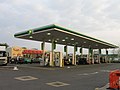 BP Filling Station, Brackley - geograph.org.uk - 1813315.jpg 640 × 480; 51 KB
-
 Brackley 1.jpg 835 × 555; 578 KB
-
 Brackley by pass A43 looking north - geograph.org.uk - 2742911.jpg 640 × 485; 92 KB
-
 Brackley Cemetery, Halse Road - geograph.org.uk - 420412.jpg 640 × 480; 115 KB
-
 Brackley Cottage Hospital, Pebble Lane (geograph 3428523).jpg 1,024 × 683; 199 KB
-
Brackley en gb.ogg 1.3 s; 36 KB
-
 Brackley fire station (original section) - geograph.org.uk - 629567.jpg 640 × 427; 245 KB
-
 Brackley Fire Station - geograph.org.uk - 5087200.jpg 1,600 × 1,200; 505 KB
-
 Brackley fire station - geograph.org.uk - 629559.jpg 640 × 427; 276 KB
-
 Brackley Grange entrance - geograph.org.uk - 2225173.jpg 640 × 480; 115 KB
-
 Brackley High Street - geograph.org.uk - 1012813.jpg 592 × 640; 125 KB
-
 Brackley High Street - geograph.org.uk - 4074842.jpg 800 × 600; 108 KB
-
 Brackley Market Place - geograph.org.uk - 5087197.jpg 1,592 × 1,600; 549 KB
-
 Brackley Market Place and High Street - geograph.org.uk - 143509.jpg 640 × 427; 102 KB
-
 Brackley Methodist Church - geograph.org.uk - 143523.jpg 640 × 427; 118 KB
-
 Brackley Methodist church - geograph.org.uk - 5429088.jpg 1,024 × 768; 213 KB
-
 Brackley Methodist Church - geograph.org.uk - 5704183.jpg 1,600 × 1,067; 335 KB
-
 Brackley OxfordRd 30.jpg 960 × 768; 466 KB
-
 Brackley park 2004.jpg 855 × 588; 102 KB
-
 Brackley Railway Station (Former) - geograph.org.uk - 2225055.jpg 640 × 480; 114 KB
-
 Brackley Rugby Union Football Club - geograph.org.uk - 2225143.jpg 3,648 × 2,736; 2.18 MB
-
 Brackley Rugby Union Football Club - geograph.org.uk - 2225155.jpg 640 × 480; 92 KB
-
 Brackley Telephone Exchange, Northants - geograph.org.uk - 2346483.jpg 3,072 × 2,304; 1.79 MB
-
 Brackley Town FC main stand, July 2015.jpg 960 × 576; 71 KB
-
 Brackley Town Football Club - St James Park .jpg 4,000 × 3,000; 3.23 MB
-

-
 Bridleway Sign, The Worlidge - geograph.org.uk - 420423.jpg 480 × 640; 94 KB
-
 Buckingham Road - geograph.org.uk - 5704191.jpg 1,600 × 1,066; 283 KB
-
 Buckingham Road Industrial Estate - geograph.org.uk - 312059.jpg 640 × 480; 66 KB
-
 Buckingham Road, Brackley - geograph.org.uk - 6283434.jpg 800 × 600; 150 KB
-
 Buckingham Road, Brackley - geograph.org.uk - 6285193.jpg 5,184 × 3,888; 6.4 MB
-
 Business park on Buckingham road - geograph.org.uk - 5704189.jpg 1,600 × 1,066; 262 KB
-
 Businesses on Market Place, Brackley - geograph.org.uk - 6285196.jpg 5,184 × 3,888; 5.18 MB
-

-
 Champions - geograph.org.uk - 1542836.jpg 640 × 427; 34 KB
-
 Chapel, Magdalen College School, Brackley - geograph.org.uk - 4247775.jpg 4,320 × 3,240; 5.43 MB
-
 Church of St Peter with St James - geograph.org.uk - 5704200.jpg 1,200 × 1,600; 385 KB
-
 Churchyard of St Peter with St James - geograph.org.uk - 5704199.jpg 1,600 × 1,066; 282 KB
-
 Clearing land by the stream ready for new building - geograph.org.uk - 5917717.jpg 1,600 × 1,066; 315 KB
-
 Coles Rise - geograph.org.uk - 4072510.jpg 1,024 × 772; 193 KB
-
 Covered reservoir NW of Manor Road - geograph.org.uk - 3442471.jpg 1,024 × 683; 117 KB
-
 Cupola. Winchester House. Brackley. - panoramio.jpg 2,372 × 1,916; 488 KB
-
 Cut mark on the gate post, Brackley - geograph.org.uk - 2225168.jpg 640 × 480; 127 KB
-

-
 Derelict house off Northampton Road - geograph.org.uk - 3424638.jpg 1,024 × 683; 201 KB
-
 Draymans Walk, Brackley - geograph.org.uk - 5646054.jpg 1,024 × 761; 154 KB
-
 Elizabeth II postbox on Buckingham Road, Brackley - geograph.org.uk - 6285192.jpg 3,888 × 5,184; 5.33 MB
-
 Elizabeth II postbox on Market Place, Brackley - geograph.org.uk - 6285194.jpg 2,412 × 4,513; 1.54 MB
-
 Entering Bannerman Drive - geograph.org.uk - 4072545.jpg 640 × 481; 73 KB
-
 Evening 1 - panoramio.jpg 3,568 × 1,900; 992 KB
-
 F*ne Lady **eld, Brackley - geograph.org.uk - 2225223.jpg 480 × 640; 106 KB
-
 Flush bracket benchmark, High Street - geograph.org.uk - 3461150.jpg 662 × 1,024; 191 KB
-
 Footpath - geograph.org.uk - 441361.jpg 640 × 419; 106 KB
-
 Footpath behind Brackley Park - geograph.org.uk - 5704182.jpg 1,600 × 1,066; 633 KB
-
 Footpath to Turweston Road - geograph.org.uk - 5368439.jpg 1,024 × 768; 156 KB
-
 Ford Anglia BonnetBadge.jpg 719 × 1,280; 333 KB
-
 Ford Anglia BonnetLouvre.jpg 1,280 × 815; 369 KB
-
 Ford Anglia BootBadge.jpg 1,280 × 960; 802 KB
-
 Foxhill Way, Brackley - geograph.org.uk - 6193587.jpg 1,024 × 768; 286 KB
-
 Gardner Rise - Brackley - geograph.org.uk - 4072549.jpg 640 × 473; 67 KB
-

-
 Halls Lane, Brackley - geograph.org.uk - 1012609.jpg 640 × 471; 65 KB
-
 House on Hans Apel Drive, Brackley - geograph.org.uk - 6283469.jpg 640 × 480; 101 KB
-
 Houses along Cartwright Crescent - geograph.org.uk - 4072542.jpg 640 × 464; 60 KB
-
 Houses in Bannerman Drive - geograph.org.uk - 4072547.jpg 640 × 484; 58 KB
-
 Houses in Bannerman Drive - geograph.org.uk - 4072548.jpg 640 × 464; 54 KB
-
 Houses in Blencowe Drive - geograph.org.uk - 4072535.jpg 800 × 591; 91 KB
-
 Houses in Blencowe Drive - geograph.org.uk - 4072536.jpg 800 × 571; 102 KB
-
 Houses in Blencowe Drive - geograph.org.uk - 4072538.jpg 800 × 580; 100 KB
-
 Houses in Blencowe Drive - geograph.org.uk - 4072556.jpg 640 × 476; 61 KB
-
 Houses off Hans Apel Drive - geograph.org.uk - 4072554.jpg 640 × 439; 69 KB
-
 Houses on Banbury Road, Brackley - geograph.org.uk - 6283466.jpg 800 × 600; 109 KB
-
 Houses on Westminster Croft, Brackley - geograph.org.uk - 6283416.jpg 800 × 600; 101 KB
-
 Houses under construction, Brackley - geograph.org.uk - 4247809.jpg 4,320 × 3,240; 4.24 MB
-
 How many more before the M40 - geograph.org.uk - 599135.jpg 640 × 379; 52 KB
-
 Humphries Drive, Brackley - geograph.org.uk - 1892913.jpg 1,600 × 1,200; 1.18 MB
-
 Humphries Drive, Brackley - geograph.org.uk - 363864.jpg 640 × 480; 60 KB
-
 Junction of Church Road and Pebble Lane (geograph 3425584).jpg 1,024 × 683; 205 KB
-
 Junction of Oak Road with Halse Road - geograph.org.uk - 3424619.jpg 1,024 × 683; 174 KB
-
 Junction of Turweston Road and Northampton Road - geograph.org.uk - 3428290.jpg 1,024 × 683; 167 KB
-
 Keep out, the old wood yard, Brackley - geograph.org.uk - 2225116.jpg 640 × 480; 101 KB
-
 Lay-by on northbound A43 - geograph.org.uk - 6192075.jpg 1,024 × 684; 298 KB
-
 Left turn A43 south - geograph.org.uk - 599132.jpg 640 × 371; 43 KB
-
 Magdalen Building - geograph.org.uk - 1012587.jpg 480 × 640; 84 KB
-
 Magdalen College School - geograph.org.uk - 1012842.jpg 640 × 533; 61 KB
-
 Magdalen College School - geograph.org.uk - 5704164.jpg 1,600 × 1,066; 391 KB
-
 Magdalen College School chapel - geograph.org.uk - 5704179.jpg 1,600 × 1,066; 447 KB
-

-

-

-

-
 Meeting of two bridleways - geograph.org.uk - 428849.jpg 640 × 480; 136 KB
-
 Methodist Church, Brackley - geograph.org.uk - 2610834.jpg 2,816 × 2,112; 2 MB
-
 Montabaur, Rastplatz gegenüber Amtsgericht, Wappen Brackley.JPG 654 × 690; 353 KB
-
 New developments on the edge of Brackley - geograph.org.uk - 5368445.jpg 1,024 × 768; 99 KB
-
 New developments on the edge of Brackley - geograph.org.uk - 5917709.jpg 1,600 × 1,066; 256 KB
-
 New house, Brackley Fields Cottages - geograph.org.uk - 2482155.jpg 640 × 480; 98 KB
-
 New housing, Brackley - geograph.org.uk - 6193580.jpg 1,024 × 768; 374 KB
-
 New housing, Brackley - geograph.org.uk - 6193582.jpg 1,024 × 768; 318 KB
-
 New shops and flats in Brackley High Street - geograph.org.uk - 2083563.jpg 2,048 × 1,536; 1.3 MB
-
 Oak Road, Brackley - geograph.org.uk - 420415.jpg 640 × 480; 78 KB
-
 Orchid Dental Centre, ^4 Bridge Street - geograph.org.uk - 3427996.jpg 683 × 1,024; 148 KB
-
 Ordnance Survey One-Inch Sheet 145 Banbury, Published 1946.jpg 10,915 × 12,798; 15.92 MB
-
 Ordnance Survey One-Inch Sheet 145 Banbury, Published 1953.jpg 8,349 × 9,987; 11.03 MB
-
 Ordnance Survey One-Inch Sheet 145 Banbury, Published 1968.jpg 8,330 × 9,889; 10.51 MB
-
 Ordnance Survey One-Inch Sheet 146 Buckingham, Published 1947.jpg 10,967 × 12,804; 15.89 MB
-
 Ordnance Survey One-Inch Sheet 146 Buckingham, Published 1954.jpg 8,324 × 9,956; 10 MB
-
 Ordnance Survey One-Inch Sheet 146 Buckingham, Published 1968.jpg 8,385 × 9,940; 10.2 MB
-
 Ordnance Survey One-Inch Sheet 94 Bicester, Published 1919.jpg 11,956 × 8,890; 9.65 MB
-
 Pasture by the A422 - geograph.org.uk - 5704116.jpg 1,600 × 1,066; 290 KB
-
 Path along the course of the dismantled railway - geograph.org.uk - 5704137.jpg 1,600 × 1,066; 439 KB
-
 Path to Bannerman Drive - geograph.org.uk - 4072506.jpg 640 × 474; 80 KB
-
 Path towards the town centre - geograph.org.uk - 5704196.jpg 1,066 × 1,600; 538 KB
-
 Pretty High Street, Brackley - geograph.org.uk - 1013220.jpg 640 × 530; 109 KB
-
 Public footpath to Manor Farm - geograph.org.uk - 5704134.jpg 1,600 × 1,066; 394 KB
-
 Public open space, Brackley - geograph.org.uk - 1892625.jpg 1,600 × 1,199; 1.22 MB
-
 Recent roundabout on Radstone Road - geograph.org.uk - 5917711.jpg 1,600 × 1,066; 205 KB
-

-
 Redundant timber yard, Brackley - geograph.org.uk - 2225085.jpg 640 × 480; 105 KB
-
 Residents parking - Bannerman Drive - geograph.org.uk - 4072518.jpg 640 × 469; 64 KB
-
 Residents parking - Bannerman Drive - geograph.org.uk - 4072551.jpg 640 × 484; 69 KB
-
 RIGHTANGLE, gallery and shop - geograph.org.uk - 5646039.jpg 1,024 × 768; 172 KB
-
 Rose Drive, Brackley - geograph.org.uk - 1892614.jpg 1,600 × 1,200; 1.01 MB
-
 Rose Drive, Brackley - geograph.org.uk - 363867.jpg 480 × 640; 100 KB
-
 Roundabout and Humphries Drive, Brackley - geograph.org.uk - 1891638.jpg 1,600 × 1,200; 634 KB
-
 Roundabout on Banbury Road, Brackley - geograph.org.uk - 6283473.jpg 800 × 574; 112 KB
-
 Royal Mail business box on Market Place, Brackley - geograph.org.uk - 6285195.jpg 2,944 × 4,724; 1.59 MB
-
 School on Manor Road - geograph.org.uk - 3441842.jpg 1,024 × 683; 139 KB
-
 Scots Pine beside the Northampton Road - geograph.org.uk - 2225073.jpg 640 × 480; 110 KB
-
 Sign for the Crown Hotel, Brackley - geograph.org.uk - 6283461.jpg 800 × 531; 122 KB
-

-
 South-east along Rose Drive, Brackley - geograph.org.uk - 1892619.jpg 1,600 × 1,199; 963 KB
-
 Spice Lounge restaurant - geograph.org.uk - 5704142.jpg 1,600 × 1,200; 474 KB
-
 St Peter with St James Church, Brackley - geograph.org.uk - 2610828.jpg 2,112 × 2,816; 1.33 MB
-
 Stile - geograph.org.uk - 428844.jpg 480 × 640; 178 KB
-
 Suburban Brackley - geograph.org.uk - 4072529.jpg 1,024 × 770; 221 KB
-
 Tesco store Brackley - geograph.org.uk - 2463603.jpg 1,024 × 762; 154 KB
-
 The A43 Brackley by-pass - geograph.org.uk - 3452747.jpg 640 × 427; 95 KB
-
 The A43 Brackley by-pass - geograph.org.uk - 3452777.jpg 640 × 427; 97 KB
-
 The A43 Brackley by-pass - geograph.org.uk - 3452790.jpg 640 × 427; 96 KB
-
 The A43 eastbound - geograph.org.uk - 4644516.jpg 1,600 × 1,176; 597 KB
-
 The A43 with blackthorn blossom - geograph.org.uk - 3452768.jpg 640 × 427; 138 KB
-

-
 The Bell Tower.jpg 899 × 1,202; 432 KB
-
 The Cemetery, Halse Road, Brackley - geograph.org.uk - 420413.jpg 640 × 480; 106 KB
-
 The co-op on the High Street - geograph.org.uk - 5704177.jpg 1,600 × 1,066; 461 KB
-
 The Crown Hotel, Brackley - geograph.org.uk - 143514.jpg 640 × 427; 94 KB
-
 The Crown Hotel, Brackley - geograph.org.uk - 6283458.jpg 800 × 600; 94 KB
-
 The Crown Hotel, Brackley, entrance hall - geograph.org.uk - 738769.jpg 640 × 418; 160 KB
-
 The Fire Engine House, ^37 High Street - geograph.org.uk - 3428942.jpg 683 × 1,024; 180 KB
-
 The former Brackley Central station - geograph.org.uk - 5368434.jpg 1,024 × 768; 174 KB
-
 The former Feed My Lambs School, Brackley - geograph.org.uk - 143520.jpg 640 × 427; 120 KB
-
 The Fox Inn - geograph.org.uk - 327133.jpg 640 × 567; 90 KB
-
 The Fox Inn - geograph.org.uk - 327141.jpg 640 × 480; 76 KB
-
 The Manor, Brackley - geograph.org.uk - 703803.jpg 640 × 480; 64 KB
-
 The New Locomotive, Brackley - geograph.org.uk - 670249.jpg 640 × 480; 51 KB
-
 The old A422 - geograph.org.uk - 441343.jpg 640 × 480; 87 KB
-
 The old A422 - geograph.org.uk - 441345.jpg 640 × 480; 97 KB
-
 The Old Fire Station (geograph 2302021).jpg 640 × 480; 107 KB
-
 The Old Glebe - geograph.org.uk - 3425543.jpg 1,024 × 683; 144 KB
-
 The old police station and court - geograph.org.uk - 5704146.jpg 1,600 × 1,066; 342 KB
-
 The Plough Inn, Brackley - geograph.org.uk - 5646088.jpg 1,024 × 768; 174 KB


.jpg)
.jpg)


.jpg)
_-_geograph.org.uk_-_629567.jpg)


_-_geograph.org.uk_-_2225055.jpg)


.jpg)


.jpg)


