Category:Bradford Road, Leeds
Jump to navigation
Jump to search
Bradford Road runs from the junction of Richardshaw Lane with Town Street, Stanningley, as B6157 west along the southern parts of Farsley, via Dawsons Corner roundabout and then as part of A647 until the boundary of the City of Leeds and the City of Bradford where it becomes Leeds Road.
Subcategories
This category has the following 6 subcategories, out of 6 total.
G
- Go Outdoors, Farsley (2 F)
O
- Olivet Chapel, Leeds (3 F)
S
- Stanningley Viaduct (12 F)
T
- The Oak Church, Stanningley (11 F)
W
- Wickes, Bramley, Leeds (1 F)
Media in category "Bradford Road, Leeds"
The following 81 files are in this category, out of 81 total.
-
 A647 & CS1, Pudsey, Leeds.jpg 2,048 × 1,536; 1.22 MB
-

-
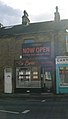
 Active Workwear - Bradford Road - geograph.org.uk - 1520552.jpg 640 × 541; 100 KB
-
 Alan Carnall Windows - Bradford Road - geograph.org.uk - 1520554.jpg 640 × 503; 110 KB
-
 Alan Carnall windows, Stanningley - geograph.org.uk - 4532991.jpg 1,024 × 768; 174 KB
-

-

-
 Banjo's Deli - Bradford Road - geograph.org.uk - 1513192.jpg 424 × 640; 72 KB
-

-

-
-

-
 Bradford Road - Pudsey - geograph.org.uk - 557240.jpg 640 × 364; 26 KB
-

-

-

-
 Bradford Road at Wood Nook Terrace - geograph.org.uk - 4062833.jpg 640 × 482; 62 KB
-
 Bradford Road heading west - geograph.org.uk - 4062836.jpg 640 × 480; 64 KB
-
 Bradford Road towards Pudsey - geograph.org.uk - 3979685.jpg 1,600 × 1,064; 761 KB
-
 Bradford Road, Leeds - geograph.org.uk - 4996730.jpg 1,280 × 853; 465 KB
-
 Bradford Road, Pudsey - geograph.org.uk - 351218.jpg 634 × 476; 44 KB
-
 Business on Leeds Road, Thornbury - geograph.org.uk - 6748761.jpg 1,024 × 768; 148 KB
-
-
 Cartridge Link - Bradford Road - geograph.org.uk - 1520564.jpg 392 × 640; 46 KB
-

-
 Catalina, Bradford Road, Stanningley - geograph.org.uk - 6091473.jpg 1,024 × 768; 164 KB
-
 Chapel Studios Bradford Rd Farsley 1 September 2017.jpg 2,628 × 2,301; 2.5 MB
-
 City Cycles - Bradford Road - geograph.org.uk - 4250868.jpg 640 × 480; 78 KB
-
 Co-op - Bradford Road, Pudsey - geograph.org.uk - 557242.jpg 640 × 416; 30 KB
-
 Confetti and Lace - Bradford Road - geograph.org.uk - 3916909.jpg 640 × 572; 94 KB
-
 Cycle Superhighway at Thornbury roundabout - geograph.org.uk - 4772950.jpg 1,024 × 768; 145 KB
-
 Cycle superhighway, Woodhall Lane roundabout - geograph.org.uk - 5020079.jpg 1,024 × 768; 173 KB
-
 Desi Sweet Centre - Bradford Road - geograph.org.uk - 1513185.jpg 480 × 640; 62 KB
-

-

-

-

-

-
 Hong Kong Chef - Bradford Road - geograph.org.uk - 1513182.jpg 436 × 640; 69 KB
-

-
 Howdy - Bradford Road (geograph 5756122).jpg 640 × 480; 72 KB
-
 Indus Takeaway - Bradford Road - geograph.org.uk - 1513190.jpg 427 × 640; 75 KB
-
 Kwik Fit - Bradford Road - geograph.org.uk - 1520593.jpg 640 × 386; 59 KB
-

-

-
 Mazhar House, Bradford Road, Stanningley - geograph.org.uk - 4533000.jpg 1,024 × 767; 159 KB
-

-
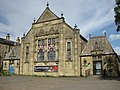 Oak Church, Stanningley 1 September 2017.jpg 3,264 × 2,448; 2.21 MB
-
 Peckover Lodge, Bradford Road, Pudsey - geograph.org.uk - 348081.jpg 638 × 361; 78 KB
-
 Playing field, Thornbury - geograph.org.uk - 3268677.jpg 640 × 480; 81 KB
-
 Playing Fields - Bradford Road - geograph.org.uk - 1945526.jpg 640 × 424; 61 KB
-
 Playing Fields - Bradford Road - geograph.org.uk - 1951045.jpg 640 × 480; 82 KB
-
 Playing Fields - Bradford Road - geograph.org.uk - 1951048.jpg 640 × 469; 90 KB
-

-
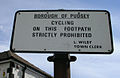 Public footpath sign - Bradford Road - geograph.org.uk - 412763.jpg 640 × 417; 56 KB
-

-
-
 Stanningley (24978670756).jpg 2,662 × 2,662; 5.03 MB
-
 Station Court - Bradford Road - geograph.org.uk - 684251.jpg 640 × 480; 66 KB
-
 Station Court - Bradford Road - geograph.org.uk - 684254.jpg 640 × 480; 62 KB
-
 Subway under Bradford Road - geograph.org.uk - 684289.jpg 640 × 480; 30 KB
-
 The Corner Cafe - Bradford Road - geograph.org.uk - 1520576.jpg 342 × 640; 67 KB
-
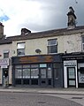
 The Corner Shop - Bradford Road - geograph.org.uk - 1520582.jpg 640 × 475; 85 KB
-
 The Farmer's Inn, Bradford Road - geograph.org.uk - 351290.jpg 639 × 419; 36 KB
-
 The Leeds and Bradford Cycleway at Thornbury Barracks - geograph.org.uk - 6111370.jpg 2,000 × 1,500; 650 KB
-
 The Thornhill Arms - Bradford Road - geograph.org.uk - 366702.jpg 636 × 444; 44 KB
-
 The Wok - Bradford Road - geograph.org.uk - 1520567.jpg 393 × 640; 55 KB
-
 Thornbury Barracks - Bradford Road - geograph.org.uk - 712394.jpg 640 × 434; 79 KB
-

-
 Wasp Publications - Bradford Road - geograph.org.uk - 1520572.jpg 320 × 640; 80 KB
-

-
 Why Eat - geograph.org.uk - 596226.jpg 640 × 464; 124 KB
-
 Wood Nook Fisheries - Stanningley - geograph.org.uk - 458503.jpg 629 × 640; 110 KB
-
 Wood Nook Terrace - geograph.org.uk - 502897.jpg 640 × 486; 50 KB
-
 Woodhall Post Office - Bradford Road - geograph.org.uk - 366681.jpg 637 × 497; 56 KB
-
 Yorkshire Vets - Bradford Road - geograph.org.uk - 376644.jpg 635 × 307; 39 KB
-
 Aagrah Restaurant - Bradford Road - geograph.org.uk - 440182.jpg 640 × 342; 42 KB
-
 Bradford Road - Pudsey - geograph.org.uk - 557237.jpg 640 × 395; 36 KB
-

-
 Hong Fook - geograph.org.uk - 596230.jpg 640 × 443; 98 KB
-


_-_geograph.org.uk_-_5753958.jpg)


.jpg)


.jpg)


