Category:Braintree District
둘러보기로 이동
검색으로 이동
영국 에식스 주에 위치한 도시  | |||||
| 미디어 올리기 | |||||
| 다음 종류에 속함 | |||||
|---|---|---|---|---|---|
| 위치 | Essex, 에식스주, 이스트오브잉글랜드, 잉글랜드 | ||||
| 정부 소재지 | |||||
| 입법부 |
| ||||
| 인구수 |
| ||||
| 면적 |
| ||||
| 공식 웹사이트 | |||||
 | |||||
"Braintree District" 분류에 속하는 미디어
다음은 이 분류에 속하는 파일 204개 가운데 200개입니다.
(이전 페이지) (다음 페이지)-
 "Leahurst", Braintree - geograph.org.uk - 5391276.jpg 1,600 × 1,324; 627 KB
-
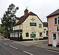
 "The Boar's Head" public house, Braintree - geograph.org.uk - 5379421.jpg 1,600 × 1,123; 421 KB
-
 "The Nag's Head" public house, Braintree - geograph.org.uk - 5386828.jpg 1,407 × 1,600; 606 KB
-
 "The Swan" public house, Braintree - geograph.org.uk - 5386744.jpg 1,600 × 1,141; 396 KB
-
 "Wagon and Horses" public house, South Street, Braintree - geograph.org.uk - 5386911.jpg 1,600 × 1,496; 592 KB
-
 'Fountain', Braintree - geograph.org.uk - 5589443.jpg 851 × 1,280; 164 KB
-
 239-241 Coggeshall Road, Braintree - geograph.org.uk - 6090864.jpg 1,892 × 1,236; 1.17 MB
-
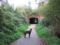
 A pleasant byway - geograph.org.uk - 6308553.jpg 1,024 × 685; 511 KB
-
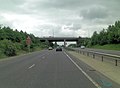
 A120 approaches intersection with B1256 - geograph.org.uk - 3545451.jpg 3,235 × 2,381; 1.7 MB
-
 A120 at Notley Road bridge - geograph.org.uk - 3480958.jpg 640 × 480; 106 KB
-
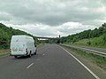
 A120 Braintree Bypass - geograph.org.uk - 4102451.jpg 2,387 × 1,869; 453 KB
-
 A120 descends into the valley of the River Brain - geograph.org.uk - 3545437.jpg 3,648 × 2,736; 1.44 MB
-
 A120 footbridge north of Hayeswood Farm - geograph.org.uk - 3544575.jpg 3,475 × 2,452; 1.03 MB
-
 A120 north of Park Farm - geograph.org.uk - 3545428.jpg 3,648 × 2,736; 1.23 MB
-
 A120 Overbridge - geograph.org.uk - 4964176.jpg 640 × 264; 23 KB
-
 A120 overbridge carries Millennium Way - geograph.org.uk - 3545439.jpg 3,558 × 2,620; 1.24 MB
-
 A120 overbridge carries Notley Road - geograph.org.uk - 3545420.jpg 3,562 × 2,638; 1.18 MB
-
 A120 sliproad leaves for B1256 - geograph.org.uk - 3544566.jpg 3,591 × 2,631; 1.07 MB
-
 A131 northbound - geograph.org.uk - 3299131.jpg 640 × 448; 36 KB
-
 A131 northbound - geograph.org.uk - 3299133.jpg 640 × 480; 48 KB
-
 A131 northbound - geograph.org.uk - 3299135.jpg 640 × 480; 51 KB
-
 An East Anglian Farm Ride - geograph.org.uk - 3375986.jpg 640 × 480; 156 KB
-
 Autumn Sunset 2.jpg 3,648 × 2,736; 1.83 MB
-
 B1256 Pod's Brook Rd - geograph.org.uk - 6181370.jpg 1,024 × 678; 177 KB
-
 B1256 Pods Brook Road - geograph.org.uk - 2118720.jpg 4,000 × 3,000; 2.84 MB
-
 Bank Street - geograph.org.uk - 4304148.jpg 640 × 480; 59 KB
-
 Beckwith's Farm - geograph.org.uk - 6308529.jpg 1,024 × 685; 284 KB
-
 Belchamp Walter Post Office 1978 - Flickr - sludgegulper.jpg 4,479 × 2,901; 775 KB
-

-
-

-
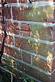
 Benchmark on the railway bridge over Mill Hill - geograph.org.uk - 2390388.jpg 683 × 1,024; 256 KB
-
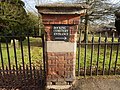
 Benchmark on the railway station - geograph.org.uk - 2387927.jpg 683 × 1,024; 216 KB
-
 Benchmark on the side of ^21 Duggers Lane - geograph.org.uk - 2390409.jpg 683 × 1,024; 254 KB
-

-

-
 Benchmark on ^40 Rose Hill - geograph.org.uk - 2388148.jpg 533 × 800; 116 KB
-
 Benchmark on ^51 Duggers Lane - geograph.org.uk - 2390428.jpg 683 × 1,024; 218 KB
-
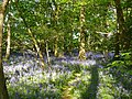 Bluebells in Lyonshall Wood - geograph.org.uk - 3480780.jpg 640 × 480; 216 KB
-
 Bocking Cemetery - geograph.org.uk - 4389201.jpg 640 × 480; 142 KB
-
 Bocking Cemetery - geograph.org.uk - 4389205.jpg 640 × 480; 95 KB
-
 Bocking Cemetery gateway - geograph.org.uk - 4389202.jpg 640 × 480; 139 KB
-
 Bocking Cemetery sign - geograph.org.uk - 4389208.jpg 480 × 640; 78 KB
-

-
 Bocking Mill Bovindon Road Bocking - geograph.org.uk - 2607261.jpg 4,000 × 3,000; 3.99 MB
-
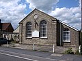
 Bocking Village Hall, Bocking Churchstreet - geograph.org.uk - 2607238.jpg 4,000 × 3,000; 3.16 MB
-
 Bovingdon Road - geograph.org.uk - 3376386.jpg 640 × 480; 182 KB
-
 BP petrol station on Rayne Road, Braintree - geograph.org.uk - 6089113.jpg 1,892 × 1,236; 950 KB
-
 Bradford Street - geograph.org.uk - 4388947.jpg 640 × 480; 70 KB
-
 Bradford Street, Bocking - geograph.org.uk - 3375871.jpg 640 × 480; 121 KB
-
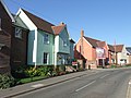
 Bradford Street, Bocking in 1984 - geograph.org.uk - 2641401.jpg 1,093 × 735; 125 KB
-
 Braintree - Sculpture - geograph.org.uk - 4167497.jpg 900 × 565; 139 KB
-
 Braintree Cage - geograph.org.uk - 6181298.jpg 1,024 × 678; 185 KB
-
 Braintree District Council composition (2015).svg 360 × 185; 3 KB
-
 Braintree fire station - geograph.org.uk - 1910212.jpg 640 × 427; 181 KB
-
 Braintree Freeport - geograph.org.uk - 3538154.jpg 1,024 × 732; 127 KB
-
 Braintree Freeport railway station, Essex - geograph.org.uk - 3538148.jpg 1,024 × 768; 275 KB
-
 Braintree High Street - geograph.org.uk - 6181310.jpg 1,024 × 678; 152 KB
-
 Braintree Market - geograph.org.uk - 4304165.jpg 640 × 480; 62 KB
-
 Braintree music - geograph.org.uk - 4304169.jpg 640 × 480; 77 KB
-
 Braintree old fire station - geograph.org.uk - 1910207.jpg 640 × 427; 258 KB
-
 Braintree Public Library - geograph.org.uk - 5386869.jpg 1,316 × 1,600; 539 KB
-
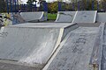 Braintree Skatepark - geograph.org.uk - 5589383.jpg 1,280 × 851; 426 KB
-
 Braintree Station - geograph.org.uk - 5597765.jpg 1,280 × 830; 280 KB
-
 Braintree Swimming Centre Charter Way Braintree - geograph.org.uk - 2607479.jpg 4,000 × 3,000; 3.15 MB
-
 Bridge carrying London Road over the Flitch Way - geograph.org.uk - 2118723.jpg 4,000 × 3,000; 2.93 MB
-
 Bridge carrying the Flitch Way over Notley Road - geograph.org.uk - 2118728.jpg 4,000 × 3,000; 2.92 MB
-
 Broad Road at the junction of Thistley Green Road - geograph.org.uk - 6092010.jpg 1,920 × 1,280; 1.29 MB
-
 Broad Road, High Garrett - geograph.org.uk - 6092584.jpg 1,248 × 800; 615 KB
-
 Bus stop at Bocking Churchstreet - geograph.org.uk - 2607245.jpg 4,000 × 3,000; 3.91 MB
-
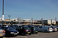 Car park and retail park, Freeport - geograph.org.uk - 2883081.jpg 640 × 426; 54 KB
-
 Car park entrance on Deanery Hill, Bocking - geograph.org.uk - 3497549.jpg 2,048 × 1,534; 1.05 MB
-
 Charter Way, Braintree Freeport - geograph.org.uk - 3538152.jpg 1,024 × 768; 148 KB
-
-
 Church Lane - geograph.org.uk - 4389185.jpg 640 × 480; 64 KB
-
 Church Lane-Deanery Hill junction - geograph.org.uk - 4389210.jpg 640 × 480; 94 KB
-
 Church Meadows mini roundabout - geograph.org.uk - 4389196.jpg 640 × 480; 65 KB
-
 Church Street at the junction of Bovingdon Lane - geograph.org.uk - 3497572.jpg 1,600 × 1,200; 651 KB
-
 Church Street, Bocking - geograph.org.uk - 3497394.jpg 2,048 × 1,536; 1.57 MB
-
 Church Street, Bocking - geograph.org.uk - 3497541.jpg 2,046 × 1,534; 833 KB
-
 Church Street, Bocking - geograph.org.uk - 3497571.jpg 1,600 × 1,200; 518 KB
-
 Church Street, Bocking - geograph.org.uk - 3497885.jpg 2,048 × 1,536; 1.52 MB
-
 Church Street, Bocking, Essex - geograph.org.uk - 2496054.jpg 1,600 × 1,200; 358 KB
-
 Churchill Road - geograph.org.uk - 4389224.jpg 640 × 480; 58 KB
-
 Coggeshall Road - geograph.org.uk - 4304129.jpg 640 × 480; 97 KB
-
 Coggeshall Road - geograph.org.uk - 4304137.jpg 640 × 480; 108 KB
-
 Coggeshall Road, Braintree - geograph.org.uk - 2485042.jpg 640 × 480; 68 KB
-
 Coggeshall Road, Braintree - geograph.org.uk - 5597981.jpg 1,280 × 851; 339 KB
-
 Coggeshall Road, Braintree - geograph.org.uk - 6089121.jpg 1,920 × 1,280; 1.11 MB
-
 Colchester Institute entrance - geograph.org.uk - 4389183.jpg 640 × 480; 86 KB
-
 Coldnailhurst Road at the junction of Church Lane - geograph.org.uk - 3497519.jpg 2,048 × 1,536; 1.45 MB
-
 Common by Broad Road, Bocking - geograph.org.uk - 6092013.jpg 1,838 × 1,144; 1.73 MB
-
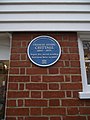 Crittall Blue Plaque - geograph.org.uk - 2288233.jpg 1,200 × 1,600; 300 KB
-

-
 Downstream On The River Brain - geograph.org.uk - 6181372.jpg 678 × 1,024; 248 KB
-
 Eagle Lane - geograph.org.uk - 4389188.jpg 640 × 480; 69 KB
-
 Eagle Lane sign - geograph.org.uk - 4389193.jpg 640 × 480; 91 KB
-
 Entrance to buildings - geograph.org.uk - 4389218.jpg 640 × 480; 77 KB
-
 Entrance to Home Farm Fennes Lane - geograph.org.uk - 2607254.jpg 4,000 × 3,000; 4.02 MB
-
 Evangelical Church Braintree Essex - geograph.org.uk - 2185531.jpg 640 × 480; 93 KB
-
 Eye catching advertising - geograph.org.uk - 6556719.jpg 1,216 × 820; 287 KB
-
 Faggot Yard - geograph.org.uk - 4389181.jpg 640 × 480; 84 KB
-
 Faggot Yard sign - geograph.org.uk - 4389180.jpg 640 × 480; 107 KB
-
 Fennes Road - geograph.org.uk - 6308533.jpg 1,024 × 685; 449 KB
-
 Field edge track - geograph.org.uk - 3375989.jpg 640 × 480; 206 KB
-
 Flagfinders Coaches, Braintree - geograph.org.uk - 6089119.jpg 1,872 × 1,204; 1,007 KB
-
 Flagfinders Coaches, Braintree - geograph.org.uk - 6089120.jpg 1,892 × 1,236; 1.14 MB
-
 Footbridge on the River Brain - geograph.org.uk - 6181381.jpg 678 × 1,024; 279 KB
-
 Footpath Sign in Fennes Lane - geograph.org.uk - 2607252.jpg 4,000 × 3,000; 4.47 MB
-
 Footpath to High Garrett - geograph.org.uk - 6308559.jpg 1,024 × 685; 540 KB
-
 Footpath to New Road - geograph.org.uk - 6181392.jpg 678 × 1,024; 208 KB
-
 Former post office, Braintree - geograph.org.uk - 5386810.jpg 1,600 × 1,521; 604 KB
-
 Fountain Cottages, Braintree - geograph.org.uk - 5387092.jpg 1,600 × 1,023; 521 KB
-
 Freeport Shopping Centre - geograph.org.uk - 2883080.jpg 640 × 426; 69 KB
-
 Giraffe sculpture at Freeport Braintree - geograph.org.uk - 3611763.jpg 3,648 × 2,736; 2.62 MB
-
 Great Notley CM77, UK - panoramio.jpg 4,128 × 2,322; 2.17 MB
-
 Halstead To Braintree - geograph.org.uk - 2288137.jpg 1,200 × 1,600; 697 KB
-
 High Garrett, High Garrett - geograph.org.uk - 2228296.jpg 640 × 480; 70 KB
-
 High Street - geograph.org.uk - 4304152.jpg 640 × 480; 78 KB
-
-
 House with pargetting, Convent Hill, Bocking - geograph.org.uk - 4619974.jpg 1,024 × 772; 128 KB
-
 Houses from Deanery Hill - geograph.org.uk - 4389318.jpg 640 × 480; 55 KB
-
 Houses on Nayling Road, Braintree - geograph.org.uk - 5296807.jpg 640 × 428; 93 KB
-
 Houses on Wheatley Avenue - geograph.org.uk - 3480901.jpg 640 × 480; 103 KB
-
 Houses, Bocking Churchstreet - geograph.org.uk - 3375999.jpg 640 × 480; 115 KB
-
 Housing development, Perryfields - geograph.org.uk - 2798430.jpg 640 × 480; 70 KB
-
 Industrial Estate, Braintree - geograph.org.uk - 2485039.jpg 640 × 480; 80 KB
-
 John Ray Fitness Trail - geograph.org.uk - 6181342.jpg 1,024 × 678; 196 KB
-
 Layby on the A131 Braintree Bypass - geograph.org.uk - 6092561.jpg 1,872 × 1,204; 1.02 MB
-
 Lodge on Fennes Lane at entrance to Fennes Farm - geograph.org.uk - 2607248.jpg 4,000 × 3,000; 4.24 MB
-
 London Road, Great Notley - geograph.org.uk - 2945798.jpg 1,600 × 1,200; 659 KB
-
 Lyons Hall Lane, off Broad Road - geograph.org.uk - 2228292.jpg 640 × 480; 90 KB
-
 Lyons Hall Road - geograph.org.uk - 3480788.jpg 640 × 480; 160 KB
-

-
 National speed limit applies - geograph.org.uk - 4389214.jpg 640 × 480; 117 KB
-
 New housing, Braintree - geograph.org.uk - 3482752.jpg 640 × 480; 92 KB
-
 Notley Cross Services - geograph.org.uk - 6087699.jpg 1,880 × 1,218; 1.4 MB
-

-
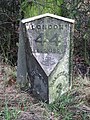 Old Milepost - geograph.org.uk - 2288141.jpg 1,200 × 1,600; 770 KB
-
 Open space by Brook Close - geograph.org.uk - 3479786.jpg 640 × 480; 106 KB
-

-
 Panfield Lane, Bocking - geograph.org.uk - 3497524.jpg 2,048 × 1,536; 1.49 MB
-
 Panners Junction, A120 - geograph.org.uk - 4964170.jpg 640 × 352; 24 KB
-
 Parkhall Wood - geograph.org.uk - 3244342.jpg 640 × 428; 116 KB
-
 Path from Church Lane - geograph.org.uk - 4388986.jpg 640 × 480; 94 KB
-
 Playing Field - geograph.org.uk - 4304124.jpg 640 × 480; 138 KB
-
 Playing Field - geograph.org.uk - 4388942.jpg 640 × 480; 132 KB
-
 Pod's Brook Road, Braintree - geograph.org.uk - 5597865.jpg 1,280 × 851; 549 KB
-

-

-

-
 Queenborough Lane at the junction of London Road - geograph.org.uk - 2945805.jpg 1,600 × 1,200; 633 KB
-
 Radio mast near Gosfield - geograph.org.uk - 3480813.jpg 640 × 480; 77 KB
-
 Railway Station, Braintree - geograph.org.uk - 5379485.jpg 1,600 × 1,067; 425 KB
-
 Rayne Bound on The Flitch Way - geograph.org.uk - 6181384.jpg 678 × 1,024; 276 KB
-
 Rayne Road, Braintree - geograph.org.uk - 5589388.jpg 1,280 × 851; 398 KB
-
 River Blackwater, Bocking Churchstreet - geograph.org.uk - 3375967.jpg 640 × 480; 109 KB
-
 Road junction - geograph.org.uk - 4304159.jpg 640 × 480; 67 KB
-

-
-
 Royal Almshouses, Deans Walk, Bocking Churchstreet - geograph.org.uk - 2607264.jpg 4,000 × 3,000; 3.78 MB
-
 Sign at Braintree Station-Flitch Way - geograph.org.uk - 2118729.jpg 2,671 × 2,000; 1.31 MB
-
 Slough House Farm - geograph.org.uk - 3376027.jpg 640 × 480; 138 KB
-
 Small housing development on Church Street - geograph.org.uk - 3497513.jpg 2,048 × 1,536; 1.57 MB
-
 Southerly view of part of Foulden Common - geograph.org.uk - 6160721.jpg 1,024 × 768; 293 KB
-
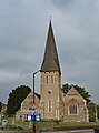 St Michael's Church, Braintree - geograph.org.uk - 5379409.jpg 2,583 × 3,496; 2.13 MB
-
 St Michael's Church, Braintree - geograph.org.uk - 5589437.jpg 851 × 1,280; 341 KB
-
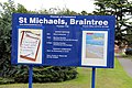 St Michael, Braintree - Notice board - geograph.org.uk - 4167502.jpg 900 × 600; 210 KB
-
 St Michel's Primary School - geograph.org.uk - 6181360.jpg 1,024 × 678; 189 KB
-
 Station Field Allotments - geograph.org.uk - 6181355.jpg 1,024 × 678; 181 KB
-
 Stour Valley Path, Baythorne Mill - panoramio.jpg 1,600 × 1,200; 833 KB
-
 Stour Valley Path, Baythorne Park - panoramio (1).jpg 1,800 × 1,140; 877 KB
-
 Stour Valley Path, Baythorne Park - panoramio (2).jpg 1,900 × 1,032; 603 KB
-
 Stour Valley Path, Baythorne Park - panoramio.jpg 1,600 × 1,200; 700 KB
-
 Stour Valley Path, Baythorne Park entrance - panoramio.jpg 1,600 × 1,200; 764 KB
-
 Strange sculptures, Braintree - geograph.org.uk - 3375918.jpg 640 × 480; 169 KB
-
 Sunnyfields Road, High Garrett - geograph.org.uk - 2228303.jpg 640 × 480; 67 KB
-
 The A131 Braintree Bypass - geograph.org.uk - 6092560.jpg 1,892 × 1,236; 1.06 MB
-
 The B1053, Panfield - geograph.org.uk - 3497544.jpg 2,048 × 1,536; 1.54 MB
-
 The B1053, Panfield - geograph.org.uk - 3497545.jpg 2,048 × 1,536; 1.45 MB
-
 The Birthplace Of Crittall Windows - geograph.org.uk - 2288222.jpg 1,600 × 1,200; 410 KB
-
 The Boar's Head, Braintree - geograph.org.uk - 5589448.jpg 1,280 × 851; 461 KB
-
-
 The end of Churchill Road - geograph.org.uk - 4389227.jpg 640 × 480; 69 KB
-
 The entrance to Kingsmead Park, Braintree - geograph.org.uk - 6092562.jpg 1,920 × 1,280; 1.06 MB
-
 The entrance to Kingsmead Park, Braintree - geograph.org.uk - 6384649.jpg 1,920 × 1,280; 1.02 MB
-
 The Flitch Way - geograph.org.uk - 6181364.jpg 678 × 1,024; 279 KB
-
 The Kelloggs in the Old world and the New (1903) (14596246297).jpg 1,808 × 1,436; 419 KB
-
 The Orange Tree - inn sign - geograph.org.uk - 3480885.jpg 428 × 640; 112 KB
-
 The Orange Tree, Braintree - geograph.org.uk - 3480862.jpg 640 × 480; 109 KB
-
 The River Brain - geograph.org.uk - 6181348.jpg 678 × 1,024; 263 KB
-
 Three Counties Crematorium Entrance - geograph.org.uk - 2075178.jpg 640 × 480; 77 KB
-
 Toby Carvery at Notley Cross Services - geograph.org.uk - 6087700.jpg 1,882 × 1,222; 1.21 MB
-
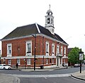 Town hall, Braintree - geograph.org.uk - 5379507.jpg 1,600 × 1,574; 590 KB
-
 Track with barrier - geograph.org.uk - 3376370.jpg 640 × 480; 120 KB
-
 Traffic lights on Cressing Road, Braintree - geograph.org.uk - 2496067.jpg 1,600 × 1,200; 531 KB
-
 UK Braintree Council 2019.svg 360 × 185; 3 KB
-
 United Reformed Church Bocking Essex - geograph.org.uk - 2185517.jpg 640 × 480; 89 KB
-
 View south-west from Bradford Bridge, Bocking - geograph.org.uk - 4620470.jpg 1,024 × 800; 175 KB
-
 Warner Mill - geograph.org.uk - 6181329.jpg 1,024 × 678; 162 KB


.svg)


.jpg)
.jpg)


_(14596246297).jpg)


