Category:Witham
Jump to navigation
Jump to search
English: Witham ( Wittum) is a town in the county of Essex, in the south east of England with a population (2001 census) of 22,500. It is part of the District of Braintree and is twinned with the town of Waldbröl, Germany. Witham stands between the larger towns of Chelmsford (7 miles to the south-west) and Colchester (15 miles to the north-east). The River Brain runs through the town and joins the River Blackwater shortly outside it.
Español: Abreviatura científica para el botánico Henry Thomas Maire Silvertop Witham 1779-1844
Nederlands: Witham is een plaats in het bestuurlijke gebied Braintree, in het Engelse graafschap Essex. De plaats telt 28.000 inwoners.
Polski: Witham - miasto w Wielkiej Brytanii, w Anglii, w regionie East of England, w hrabstwie Essex. W 2001r. miasto to zamieszkiwało 22 500 osób.
Română: Witham (pronounced ) este un oraş în comitatul Essex, regiunea East, Anglia. Oraşul se află în districtul Braintree.
town in Essex, United Kingdom  | |||||
| Upload media | |||||
| Instance of | |||||
|---|---|---|---|---|---|
| Location | Braintree, Essex, East of England, England | ||||
| Different from | |||||
| Said to be the same as | Witham (Wikimedia duplicated page, civil parish) | ||||
| official website | |||||
 | |||||
 | |||||


Subcategories
This category has the following 18 subcategories, out of 18 total.
- St Nicholas' church, Witham (8 F)
A
- The Albert, Witham (1 F)
C
- Cherry Tree, Witham (1 F)
- The Crown Inn, Witham (1 F)
G
- The George, Witham (1 F)
J
- Jack and Jenny, Witham (1 F)
M
P
R
- Red Lion, Witham (1 F)
S
- Spread Eagle, Witham (2 F)
V
- The Victoria, Witham (2 F)
W
- Whet Mead (16 F)
- White Hart Hotel, Witham (1 F)
- The White Horse, Witham (1 F)
- Witham Town Hall (4 F)
- Witham War Memorial (3 F)
- The Woolpack Inn, Witham (1 F)
Media in category "Witham"
The following 177 files are in this category, out of 177 total.
-

-
 57 008 is tail-end Charlie this time.jpg 4,753 × 3,151; 2.61 MB
-
 57008 and 009 GE RHTT 121115.jpg 4,516 × 3,333; 2.24 MB
-
 57008 GE mainline.jpg 3,956 × 3,021; 1.77 MB
-
 57008 Witham Motts Lane.jpg 3,921 × 2,601; 1.47 MB
-
 6th November 2023 Rivenhall 01.jpg 5,341 × 1,861; 2.45 MB
-
 84 - 91 Allectus Way, Witham - geograph.org.uk - 4534040.jpg 640 × 480; 110 KB
-
 90001 Norwich-Liverpool St.jpg 3,277 × 2,653; 1.24 MB
-
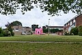 A bouncy castle, Witham - geograph.org.uk - 4534072.jpg 640 × 428; 151 KB
-
 A modern ford, Witham - geograph.org.uk - 4534652.jpg 640 × 480; 178 KB
-
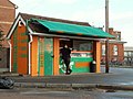 A takeaway kiosk at Witham, Essex - geograph.org.uk - 286020.jpg 640 × 480; 70 KB
-
 A12 bridge over Maldon Road, Witham - geograph.org.uk - 5381720.jpg 640 × 480; 61 KB
-
 A12 Coleman's Bridge - geograph.org.uk - 3256899.jpg 640 × 382; 39 KB
-
 A12 Culvert - geograph.org.uk - 3066903.jpg 640 × 428; 114 KB
-
 A12, layby on the Witham bypass - geograph.org.uk - 3256887.jpg 640 × 430; 55 KB
-
 A12, Witham bypass - geograph.org.uk - 3256880.jpg 640 × 430; 57 KB
-
 A12, Witham bypass - geograph.org.uk - 3256891.jpg 640 × 428; 48 KB
-
 A12, Witham bypass - geograph.org.uk - 3256895.jpg 640 × 430; 39 KB
-
 A12, Witham bypass - geograph.org.uk - 3880890.jpg 640 × 395; 30 KB
-
 Across Whet Mead - geograph.org.uk - 3066896.jpg 640 × 429; 58 KB
-
 Annisons Funeral Directors and Livery Stables.jpg 2,560 × 1,592; 692 KB
-
 Asda on Spa Road, Witham - geograph.org.uk - 5339816.jpg 2,304 × 1,728; 882 KB
-
 Avenue House, Witham - geograph.org.uk - 5405133.jpg 1,600 × 1,254; 596 KB
-
 B1389 Bridge, A12 - geograph.org.uk - 2677805.jpg 640 × 390; 47 KB
-
 B1389 Hatfield Road bridge over A12 - geograph.org.uk - 4083326.jpg 1,598 × 1,600; 1.32 MB
-
 Bairds Malt Company, Witham, Essex - geograph.org.uk - 2016717.jpg 640 × 327; 57 KB
-
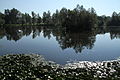 Benton Hall, Witham (6200431283).jpg 5,184 × 3,456; 7 MB
-
 Blue Mills Bridge - geograph.org.uk - 2170384.jpg 640 × 480; 101 KB
-
 Blue Mills Hill - geograph.org.uk - 286034.jpg 640 × 395; 69 KB
-
 Blunts Hall Farm, Witham, Essex - geograph.org.uk - 2014911.jpg 638 × 318; 65 KB
-
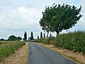 Blunts Hall Road - geograph.org.uk - 4534089.jpg 640 × 480; 125 KB
-
 Blunts Hall Road, Witham, from the railway - geograph.org.uk - 5752494.jpg 1,600 × 1,142; 187 KB
-

-
 Brain ^ Blackwater - geograph.org.uk - 3066320.jpg 640 × 429; 111 KB
-
 Braintree Road, Witham - geograph.org.uk - 5381701.jpg 640 × 480; 67 KB
-
 Branch line at Witham - geograph.org.uk - 4950462.jpg 800 × 488; 100 KB
-
 Bridge over River Brain, Witham - geograph.org.uk - 4816462.jpg 640 × 480; 168 KB
-
 Bridge Street, Witham, Essex - geograph.org.uk - 65402.jpg 640 × 480; 91 KB
-
 Bungalows on Maldon Road, Witham - geograph.org.uk - 5381717.jpg 640 × 480; 65 KB
-

-

-
 Clearing and path in James Cooke Wood, Witham - geograph.org.uk - 4367367.jpg 3,648 × 2,736; 4.9 MB
-
 Close up, Edward VII postbox on The Avenue, Witham - geograph.org.uk - 5382108.jpg 1,071 × 2,051; 444 KB
-
 Close up, Elizabeth II postbox on Maldon Road, Witham - geograph.org.uk - 5382111.jpg 1,410 × 2,764; 908 KB
-
 Collingwood Road, Witham - geograph.org.uk - 5381708.jpg 640 × 480; 69 KB
-
 Collingwood Road, Witham, Essex - geograph.org.uk - 2044268.jpg 640 × 405; 79 KB
-
 Crofters Wine Bar, Witham - geograph.org.uk - 4534624.jpg 640 × 480; 120 KB
-

-
 Cross Road, Witham - geograph.org.uk - 2228279.jpg 640 × 480; 57 KB
-
 Crusader Mini Cab Co. Witham, Essex - geograph.org.uk - 2012400.jpg 639 × 341; 92 KB
-
 Devil's-bit Scabious - geograph.org.uk - 3066282.jpg 429 × 640; 43 KB
-

-
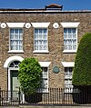 Dorothy L. Sayers house, Witham - geograph.org.uk - 5404548.jpg 1,341 × 1,600; 832 KB
-

-
 Edward VII postbox on The Avenue, Witham - geograph.org.uk - 5382107.jpg 640 × 480; 112 KB
-
 Elizabeth II postbox on Maldon Road, Witham - geograph.org.uk - 5382109.jpg 1,888 × 2,689; 1.02 MB
-
 Field south of Whitehead's Farm - geograph.org.uk - 4534534.jpg 640 × 480; 141 KB
-
 Fields and railway near Witham (2) - geograph.org.uk - 2504492.jpg 1,600 × 1,006; 522 KB
-
 Fields and railway near Witham - geograph.org.uk - 2504491.jpg 1,600 × 757; 287 KB
-
 Fields outside Witham, from the railway - geograph.org.uk - 5755160.jpg 1,600 × 959; 157 KB
-
 Flora Road, Witham - geograph.org.uk - 5339818.jpg 2,304 × 1,728; 929 KB
-
 Footpath junction near Tarecroft Wood - geograph.org.uk - 4534149.jpg 640 × 480; 217 KB
-
 Freebournes Industrial Estate - geograph.org.uk - 3066255.jpg 640 × 429; 81 KB
-
 Freightliner Class 86 614 & 86 605 on Witham Viaduct.jpg 5,335 × 3,439; 3.73 MB
-
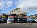 Glovers Motors, Newland Street, Witham - geograph.org.uk - 2150000.jpg 4,000 × 3,000; 2.92 MB
-
 Grazing near Oliver's Farm - geograph.org.uk - 5381721.jpg 640 × 480; 51 KB
-
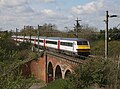 Greater Anglia DVT 82139 Witham viaduct.jpg 4,194 × 3,124; 2.07 MB
-
 Greater Anglia Railway - geograph.org.uk - 5330009.jpg 3,648 × 2,736; 2.24 MB
-

-
 Hatfield Road, Witham - geograph.org.uk - 5339815.jpg 2,262 × 1,670; 863 KB
-
 Holy Family ^ All Saints Catholic Church, Witham - geograph.org.uk - 5403719.jpg 1,507 × 1,600; 614 KB
-

-
 House on The Avenue, Witham - geograph.org.uk - 5381714.jpg 640 × 480; 81 KB
-
 Houses at Newlands Street, Witham - geograph.org.uk - 2111612.jpg 4,000 × 3,000; 2.9 MB
-
 Houses on Braintree Road, Witham - geograph.org.uk - 5381699.jpg 640 × 480; 53 KB
-
 Houses on Guithavon Valley, Witham - geograph.org.uk - 5381706.jpg 640 × 480; 115 KB
-
 Houses on Hatfield Road, Witham - geograph.org.uk - 5339813.jpg 2,304 × 1,728; 869 KB
-
 Houses on Hatfield Road, Witham - geograph.org.uk - 5339814.jpg 2,304 × 1,728; 812 KB
-
 Houses on Saul's Avenue, Witham - geograph.org.uk - 5381718.jpg 640 × 480; 58 KB
-
 I hate the A12 in the Mornings - panoramio.jpg 2,728 × 1,684; 2.47 MB
-

-

-

-
 Kingdom Hall, Witham, Essex - geograph.org.uk - 2051250.jpg 640 × 324; 47 KB
-
 Layby on the A12 Witham bypass - geograph.org.uk - 6183460.jpg 1,600 × 1,200; 329 KB
-
 Library, Witham, Essex - geograph.org.uk - 2044844.jpg 640 × 439; 78 KB
-
 Looking south into a field off the Witham bypass - geograph.org.uk - 6183459.jpg 1,600 × 1,200; 387 KB
-
 Maldon Road (B1018) - geograph.org.uk - 5381727.jpg 640 × 480; 69 KB
-
 Maldon Road, Witham - geograph.org.uk - 5381719.jpg 640 × 480; 54 KB
-
 Maldon Road, Witham - geograph.org.uk - 5382113.jpg 640 × 480; 72 KB
-

-
 Methodist Church, Witham, Essex. - geograph.org.uk - 2011930.jpg 640 × 497; 78 KB
-

-

-
 Nurseries near Witham - geograph.org.uk - 4349373.jpg 640 × 480; 110 KB
-
 Oast House, Witham, Essex - geograph.org.uk - 2194123.jpg 640 × 441; 66 KB
-
 Old Railway Hut - geograph.org.uk - 3066266.jpg 640 × 429; 100 KB
-
 Old Railway to Maldon - geograph.org.uk - 3066254.jpg 429 × 640; 111 KB
-
 Old Track in Whitham - geograph.org.uk - 3066259.jpg 640 × 429; 104 KB
-
 Oliver's Nurseries, Witham, Essex - geograph.org.uk - 208255.jpg 640 × 480; 73 KB
-
 Ordnance Survey Flush Bracket G516 - geograph.org.uk - 4496547.jpg 4,000 × 3,000; 3.21 MB
-

-
 Path in James Cooke Wood - geograph.org.uk - 4349363.jpg 640 × 480; 180 KB
-
 Peg Millar's Lane - geograph.org.uk - 3294640.jpg 640 × 480; 134 KB
-
 Police Station, Witham, Essex - geograph.org.uk - 2044275.jpg 480 × 640; 137 KB
-
 Police Station, Witham, Essex - geograph.org.uk - 2044860.jpg 640 × 480; 98 KB
-
 Rainbow in Witham Essex - geograph.org.uk - 2135495.jpg 4,000 × 3,000; 3.42 MB
-
 Rape Seed Field - geograph.org.uk - 2371759.jpg 800 × 344; 93 KB
-
 Relic of a former enterprise - geograph.org.uk - 4613822.jpg 640 × 480; 183 KB
-

-
 River Blackwater water meadow through the trees - geograph.org.uk - 2969717.jpg 3,008 × 2,000; 2.92 MB
-
 River Brain - geograph.org.uk - 3066298.jpg 428 × 640; 113 KB
-
 River Brain, Whet Mead Local Nature Reserve, Witham - geograph.org.uk - 4367328.jpg 3,648 × 2,736; 4.09 MB
-
 River Brain, Witham - geograph.org.uk - 4534593.jpg 640 × 480; 199 KB
-
 Roundabout on Spa Road, Witham - geograph.org.uk - 5339817.jpg 2,304 × 1,728; 1.04 MB
-
 September Rainbow - geograph.org.uk - 2063098.jpg 640 × 480; 118 KB
-
 Sharp bend in Maldon Road, Witham - geograph.org.uk - 5381723.jpg 640 × 480; 73 KB
-
 Shelly's Meadow - geograph.org.uk - 3066296.jpg 640 × 429; 101 KB
-

-
 Sports Ground at Witham - geograph.org.uk - 4948927.jpg 800 × 405; 66 KB
-
 Suburban Witham - geograph.org.uk - 4367095.jpg 640 × 428; 77 KB
-
 Teasles ^ Purple Loosetrife - geograph.org.uk - 3066877.jpg 429 × 640; 86 KB
-
 Telephone and Post boxes in Grove Shopping Centre, Witham - geograph.org.uk - 2235211.jpg 4,000 × 3,000; 2.73 MB
-
 Templar's Green sales information centre - geograph.org.uk - 4536669.jpg 640 × 480; 106 KB
-

-
 Terling Road - geograph.org.uk - 3247178.jpg 640 × 428; 103 KB
-
 Terling Road enters Witham - geograph.org.uk - 4534112.jpg 640 × 480; 114 KB
-
 The A12 - geograph.org.uk - 2677809.jpg 640 × 430; 52 KB
-
 The A12 at Witham - geograph.org.uk - 2490749.jpg 1,600 × 1,200; 470 KB
-
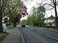 The Avenue, Witham - geograph.org.uk - 5381715.jpg 640 × 480; 112 KB
-
 The Cherry Tree on Cressing Road, Witham - geograph.org.uk - 5336569.jpg 2,304 × 1,728; 847 KB
-

-
 The Grove Shopping Centre, Witham - geograph.org.uk - 2878879.jpg 640 × 426; 83 KB
-
 The Labour Party Hall, Witham - geograph.org.uk - 5381712.jpg 640 × 442; 66 KB
-
 The Little Elms pub, Witham - geograph.org.uk - 4367074.jpg 640 × 480; 96 KB
-
 The Railway public house, Witham - geograph.org.uk - 5381697.jpg 640 × 480; 59 KB
-
 The River Blackwater - geograph.org.uk - 3066330.jpg 640 × 435; 115 KB
-
 The River Brain - geograph.org.uk - 2878897.jpg 640 × 425; 143 KB
-
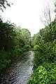 The River Brain - geograph.org.uk - 3066300.jpg 429 × 640; 89 KB
-
 The way to the church at Witham - geograph.org.uk - 811048.jpg 640 × 468; 85 KB
-
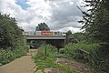 Towards Whet Mead - geograph.org.uk - 3066304.jpg 640 × 429; 83 KB
-
 Track on arable field near Latney's, Hatfield Peverel - geograph.org.uk - 4367354.jpg 2,334 × 1,556; 1.16 MB
-
 Trackworker and 57008 on 3U18 Railhead Treatment Train (RHTT).jpg 4,327 × 2,863; 1.79 MB
-
-

-
 Village Glass Stadium, Witham - geograph.org.uk - 5077789.jpg 2,560 × 1,536; 1.19 MB
-
 Wet field corner - geograph.org.uk - 3294667.jpg 640 × 480; 108 KB
-
 Whet Mead - geograph.org.uk - 3066326.jpg 640 × 429; 75 KB
-
 Willows and River Brain - geograph.org.uk - 3066310.jpg 429 × 640; 94 KB
-
 Witham - Braintree branch line - geograph.org.uk - 4367114.jpg 640 × 480; 137 KB
-
 Witham cemetery - newer part - geograph.org.uk - 4367054.jpg 640 × 480; 141 KB
-
 Witham fire station - geograph.org.uk - 1910239.jpg 640 × 427; 220 KB
-

-
 Witham old fire station - geograph.org.uk - 1910243.jpg 640 × 427; 299 KB
-
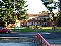 Witham Police Station, Essex - geograph.org.uk - 65401.jpg 640 × 480; 152 KB
-
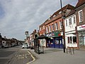 Witham Post Office - geograph.org.uk - 1862969.jpg 800 × 600; 119 KB
-
 Witham Public Library (geograph 5405138).jpg 1,600 × 1,061; 539 KB
-
 Witham Railway Station - geograph.org.uk - 5381704.jpg 640 × 480; 51 KB
-
 Witham United Reformed Church - geograph.org.uk - 5403841.jpg 1,600 × 1,535; 834 KB
-
 Witham UR Church - geograph.org.uk - 1863001.jpg 640 × 480; 76 KB
-
 Witham, concrete bridge - geograph.org.uk - 1863119.jpg 800 × 600; 133 KB
-
 Witham, cottages - geograph.org.uk - 2850433.jpg 1,024 × 768; 151 KB
-
 Witham, disused school - geograph.org.uk - 2850404.jpg 1,024 × 768; 169 KB
-
 Witham, ducks - geograph.org.uk - 1863071.jpg 1,024 × 768; 277 KB
-
 Witham, Methodist Church - geograph.org.uk - 1863145.jpg 800 × 600; 86 KB
-

-
 Witham, Roman Catholic Church - geograph.org.uk - 1863038.jpg 600 × 800; 102 KB
-
 Witham, skateboard park and open space from the railway - geograph.org.uk - 5931569.jpg 1,600 × 1,200; 273 KB
-
 Witham, urn - geograph.org.uk - 2850443.jpg 1,024 × 768; 210 KB
-
 Woodlands by Cressing Road, White Notley - geograph.org.uk - 5340103.jpg 2,304 × 1,728; 825 KB
-
 Woodlands by Cressing Road, Witham - geograph.org.uk - 5340112.jpg 2,304 × 1,728; 859 KB
-
 Yarrow - geograph.org.uk - 3066272.jpg 429 × 640; 59 KB
-
 Blunts Hall Road - geograph.org.uk - 413007.jpg 640 × 480; 82 KB
-
 Catholic Parish Church, Witham, Essex - geograph.org.uk - 65403.jpg 640 × 480; 82 KB
-
 Lodge Farm - geograph.org.uk - 286014.jpg 640 × 395; 61 KB
-
 Old Maltings, Witham, Essex - geograph.org.uk - 196824.jpg 640 × 480; 55 KB
-
 Road to Coleman's Farm - geograph.org.uk - 286031.jpg 640 × 480; 115 KB


.jpg)


_Whet_Mead_Local_Nature_Reserve,_Witham_-_geograph.org.uk_-_4367341.jpg)


_-_geograph.org.uk_-_5381726.jpg)


_-_geograph.org.uk_-_2504492.jpg)


_-_geograph.org.uk_-_5381727.jpg)


.jpg)


.jpg)


