Category:Brancaster Staithe
Jump to navigation
Jump to search
village in Norfolk, England  | |||||
| Upload media | |||||
| Instance of | |||||
|---|---|---|---|---|---|
| Location | Brancaster, King's Lynn and West Norfolk, Norfolk, East of England, England | ||||
 | |||||
Subcategories
This category has the following 3 subcategories, out of 3 total.
Media in category "Brancaster Staithe"
The following 185 files are in this category, out of 185 total.
-
 "The Crab Hut", Brancaster Staithe - geograph.org.uk - 5536226.jpg 5,024 × 3,764; 3.6 MB
-
-
 A149 leaving Brancaster Staithe - geograph.org.uk - 4170472.jpg 1,024 × 683; 425 KB
-
 A149 through Brancaster Staithe - geograph.org.uk - 5023899.jpg 2,095 × 1,295; 1.86 MB
-
 A149 west of Brancaster Staithe - geograph.org.uk - 5023912.jpg 1,998 × 1,329; 1.87 MB
-
 A149, Brancaster Staithe - geograph.org.uk - 5585174.jpg 640 × 480; 60 KB
-
 AA box at Brancaster Staithe - geograph.org.uk - 2842085.jpg 1,024 × 768; 190 KB
-
 Abandoned boat at Brancaster Staithe in Norfolk - geograph.org.uk - 5176933.jpg 4,320 × 3,240; 5.43 MB
-
 All the colours of the rainbow at Brancaster Staithe - geograph.org.uk - 2651091.jpg 4,320 × 3,240; 5.78 MB
-
 Bags of mussels - geograph.org.uk - 852557.jpg 640 × 427; 96 KB
-
 Boat at Brancaster Staithe harbour - geograph.org.uk - 5539793.jpg 800 × 552; 96 KB
-
 Boat on a tidal creek at Brancaster Staithe - geograph.org.uk - 5176965.jpg 4,320 × 3,240; 5.38 MB
-

-
 Boat storage, Brancaster Staithe - geograph.org.uk - 5578003.jpg 640 × 480; 59 KB
-
 Boats aground at Brancaster Staithe - geograph.org.uk - 852568.jpg 640 × 427; 70 KB
-

-
 Boats at Brancaster Staithe - geograph.org.uk - 4237662.jpg 1,024 × 468; 35 KB
-
 Boats at Brancaster Staithe - geograph.org.uk - 4237669.jpg 640 × 366; 22 KB
-
 Boats at Brancaster Staithe - geograph.org.uk - 5447918.jpg 640 × 409; 82 KB
-
 Boats at Brancaster Staithe harbour - geograph.org.uk - 5578763.jpg 800 × 566; 140 KB
-
 Boats at Brancaster Staithe harbour - geograph.org.uk - 5580428.jpg 800 × 495; 83 KB
-

-
 Boats on Mow Creek, Brancaster - geograph.org.uk - 5539796.jpg 800 × 600; 101 KB
-
 Brancaster Staithe - geograph.org.uk - 11545.jpg 640 × 480; 77 KB
-
 Brancaster Staithe - geograph.org.uk - 4670550.jpg 2,560 × 1,920; 1.11 MB
-
 Brancaster Staithe - geograph.org.uk - 5294905.jpg 1,024 × 683; 87 KB
-
 Brancaster Staithe - geograph.org.uk - 5295459.jpg 1,024 × 683; 178 KB
-
 Brancaster Staithe - geograph.org.uk - 5295495.jpg 1,024 × 683; 267 KB
-
 Brancaster Staithe - geograph.org.uk - 5295538.jpg 1,024 × 683; 169 KB
-
 Brancaster Staithe - geograph.org.uk - 852355.jpg 427 × 640; 70 KB
-
 Brancaster Staithe - geograph.org.uk - 949271.jpg 640 × 480; 95 KB
-
 Brancaster Staithe - the new quay - geograph.org.uk - 838434.jpg 640 × 480; 164 KB
-
 Brancaster Staithe - the old quay - geograph.org.uk - 838416.jpg 640 × 480; 178 KB
-
 Brancaster Staithe and marshes - geograph.org.uk - 1093341.jpg 640 × 190; 29 KB
-
 Brancaster Staithe quay - geograph.org.uk - 1961179.jpg 2,592 × 1,944; 1.34 MB
-
 Brancaster Staithe Quay - geograph.org.uk - 2565325.jpg 3,785 × 2,757; 1.49 MB
-
 Brancaster Staithe quay - geograph.org.uk - 4660001.jpg 2,560 × 1,920; 898 KB
-
 Brancaster Staithe Quay information board - geograph.org.uk - 4670585.jpg 2,560 × 1,992; 1.26 MB
-
 Brancaster Staithe Sailing Club - geograph.org.uk - 4670575.jpg 2,560 × 1,920; 1.25 MB
-

-
 Brancaster Staithe, Mow Creek - geograph.org.uk - 1961184.jpg 2,360 × 1,714; 746 KB
-

-

-
 Brent Geese at Brancaster Staithe. - geograph.org.uk - 1680162.jpg 2,048 × 1,536; 1.38 MB
-
 Bungalow on the A149 at Brancaster Staithe - geograph.org.uk - 5965701.jpg 1,600 × 1,049; 748 KB
-
 Buoys in a boat at Brancaster Staithe - geograph.org.uk - 2651046.jpg 4,320 × 3,240; 5.49 MB
-
 Calm as a mill pond - Harbour at Brancaster Staithe - geograph.org.uk - 5176835.jpg 4,320 × 3,240; 5.45 MB
-
 Channel to Brancaster Staithe - geograph.org.uk - 852562.jpg 640 × 427; 103 KB
-
 Clearing storm debris at Brancaster Staithe Activity Centre - geograph.org.uk - 3775418.jpg 4,320 × 3,240; 4.83 MB
-

-
 Common Lane, Brancaster Staithe - geograph.org.uk - 3137439.jpg 4,320 × 3,240; 5.69 MB
-
 Cottages at Brancaster Staithe - geograph.org.uk - 1463364.jpg 640 × 337; 69 KB
-
 Cottages at Brancaster Staithe - geograph.org.uk - 5578751.jpg 800 × 540; 120 KB
-
 Cottages, Brancaster Staithe - geograph.org.uk - 5577925.jpg 640 × 480; 52 KB
-
 Crab pots near Brancaster Staithe - geograph.org.uk - 2653467.jpg 4,320 × 3,240; 5.5 MB
-
 Creek, Deepdale marsh - geograph.org.uk - 389112.jpg 640 × 480; 80 KB
-

-

-

-
 Elizabeth II postbox on the A149, Brancaster Staithe - geograph.org.uk - 5585169.jpg 1,532 × 1,829; 624 KB
-

-
 Entering Brancaster Staithe - geograph.org.uk - 5577920.jpg 640 × 480; 72 KB
-
 Environment Agency 110922 093937.jpg 4,288 × 2,848; 5.01 MB
-
 Environment Agency 110922 093949.jpg 4,288 × 2,848; 3.81 MB
-
 Fishing boat aground at low water - geograph.org.uk - 852561.jpg 640 × 427; 64 KB
-
 Fishing boat LN47 moored at Brancaster Staithe - geograph.org.uk - 5176803.jpg 4,320 × 3,240; 5.55 MB
-

-
 Fishing boats and paraphernalia - geograph.org.uk - 852566.jpg 640 × 427; 108 KB
-
 Fishing boats at Brancaster Staithe - geograph.org.uk - 852571.jpg 640 × 437; 82 KB
-
 Fishing boats at Brancaster Staithe sitting on the mud - geograph.org.uk - 3775378.jpg 4,320 × 3,240; 4.57 MB
-
 Fishing boats at low tide in Brancaster Staithe harbour - geograph.org.uk - 5176851.jpg 4,320 × 3,240; 5.53 MB
-
 Fishing boats at low tide, Brancaster Staithe - geograph.org.uk - 2651064.jpg 4,320 × 3,240; 5.39 MB
-

-
 Fishing equipment at Brancaster Staithe - geograph.org.uk - 949274.jpg 640 × 480; 116 KB
-
 Fishing paraphernalia on Brancaster Staithe quayside - geograph.org.uk - 5176922.jpg 4,320 × 3,240; 5.66 MB
-
 H M Coastguard Search And Rescue Vehicle.jpg 5,184 × 3,888; 9.45 MB
-
 Harbour entrance, Brancaster Staithe - geograph.org.uk - 4170414.jpg 1,024 × 683; 305 KB
-
 Harbour Way - geograph.org.uk - 838394.jpg 480 × 640; 112 KB
-
 Harbour, Brancaster Staithe - geograph.org.uk - 1822735.jpg 640 × 480; 89 KB
-
 Harbour, Brancaster Staithe - geograph.org.uk - 1822802.jpg 640 × 480; 88 KB
-
 Harbour, Brancaster Staithe - geograph.org.uk - 1822809.jpg 640 × 480; 137 KB
-
 Harbour, Brancaster Staithe - geograph.org.uk - 1822839.jpg 640 × 480; 81 KB
-
 Harbour, Brancaster Staithe - geograph.org.uk - 1822855.jpg 640 × 480; 78 KB
-
 Harbour, Brancaster Staithe - geograph.org.uk - 1822866.jpg 640 × 480; 86 KB
-
 Harbour, Brancaster Staithe - geograph.org.uk - 1822875.jpg 640 × 480; 59 KB
-
 Harbour, Brancaster Staithe - geograph.org.uk - 1822891.jpg 640 × 480; 82 KB
-
 Harbour, Brancaster Staithe - geograph.org.uk - 1955332.jpg 3,072 × 2,304; 2.82 MB
-
 Harbour, Brancaster Staithe - geograph.org.uk - 1955334.jpg 3,072 × 2,304; 2.65 MB
-
 High and dry at Brancaster Staithe - geograph.org.uk - 2651054.jpg 2,882 × 2,160; 2.47 MB
-
 High and dry in Mow Creek - geograph.org.uk - 838410.jpg 640 × 480; 155 KB
-
 High tide at Brancaster Staithe - geograph.org.uk - 2077821.jpg 640 × 480; 62 KB
-
 HM Coastguard Search and Rescue Vehicle Livery.jpg 5,184 × 3,888; 8.36 MB
-
 HM Coastguard Search and Rescue Vehicle.jpg 5,184 × 3,888; 8.14 MB
-
 House near the marsh at Brancaster Staithe - geograph.org.uk - 2650992.jpg 3,585 × 2,609; 3.97 MB
-
 Letzer's Seafood - geograph.org.uk - 838402.jpg 480 × 640; 131 KB
-
 Low tide in Mow Creek, Brancaster Staithe, Norfolk - geograph.org.uk - 5176754.jpg 4,320 × 3,240; 5.88 MB
-
 Low water channel - geograph.org.uk - 852560.jpg 640 × 427; 114 KB
-
 Moored by the new quay - geograph.org.uk - 838425.jpg 480 × 640; 141 KB
-
 Mow Creek - geograph.org.uk - 5295609.jpg 1,024 × 683; 209 KB
-
 Mow Creek - geograph.org.uk - 6193515.jpg 1,024 × 739; 108 KB
-
 Mow Creek - geograph.org.uk - 838406.jpg 480 × 640; 169 KB
-
 Mow Creek at low water - geograph.org.uk - 852348.jpg 640 × 427; 92 KB
-
 Mow Creek, Brancaster - geograph.org.uk - 1318380.jpg 640 × 480; 126 KB
-
 Mow Creek, Brancaster Staithe - geograph.org.uk - 1463366.jpg 600 × 450; 59 KB
-
 Mow Creek, Brancaster Staithe - geograph.org.uk - 1463375.jpg 600 × 450; 54 KB
-
 Mow Creek, Brancaster Staithe - geograph.org.uk - 1955336.jpg 3,072 × 2,304; 2.76 MB
-
 Mow Creek, Brancaster Staithe - geograph.org.uk - 5411966.jpg 640 × 480; 58 KB
-
 Mud and marshes at Brancaster Staithe - geograph.org.uk - 1517684.jpg 640 × 480; 310 KB
-
 National Trust Activity Centre, Brancaster Staithe - geograph.org.uk - 3775414.jpg 4,320 × 3,240; 4.84 MB
-
 No sailing today - geograph.org.uk - 838404.jpg 480 × 640; 180 KB
-
 Norfolk Coast Path, Brancaster Staithe - geograph.org.uk - 2127136.jpg 1,600 × 1,200; 1.15 MB
-
 Not going anywhere - geograph.org.uk - 838432.jpg 480 × 640; 152 KB
-
 Old mooring post - geograph.org.uk - 838420.jpg 480 × 640; 199 KB
-
 On the saltmarsh edge - geograph.org.uk - 838438.jpg 480 × 640; 188 KB
-
 Painting the hull - geograph.org.uk - 852556.jpg 640 × 427; 71 KB
-

-

-
 Photographing the clearing up at Brancaster Staithe - geograph.org.uk - 3775408.jpg 4,320 × 3,240; 4.86 MB
-
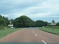
 Road (A149) at the Jolly Sailors PH, Brancaster Staithe - geograph.org.uk - 4253348.jpg 4,000 × 3,000; 2.3 MB
-

-
 Rotting hull in Brancaster Staithe harbour - geograph.org.uk - 5176950.jpg 4,320 × 3,240; 5.87 MB
-
 Rustic sundial, Brancaster Staithe - geograph.org.uk - 4170433.jpg 1,306 × 1,600; 883 KB
-

-
 Saltmarsh and boats at Brancaster Staithe - geograph.org.uk - 5178743.jpg 4,175 × 3,131; 2.78 MB
-
 Saltmarsh at Brancaster Staithe - geograph.org.uk - 852574.jpg 640 × 427; 111 KB
-
 Sea Dog BN2 Trawler.jpg 5,184 × 3,888; 8.76 MB
-
 Sea mist rolling in at Brancaster Staithe harbour - geograph.org.uk - 5176861.jpg 4,320 × 3,240; 5.77 MB
-

-
 Sitting in a bed of mud - geograph.org.uk - 838417.jpg 640 × 480; 160 KB
-
 Terraced cottages - geograph.org.uk - 838399.jpg 640 × 445; 195 KB
-

-
 The harbour at Brancaster Staithe - geograph.org.uk - 5588619.jpg 800 × 602; 120 KB
-
 The Jolly Sailors pub, Brancaster Staithe - geograph.org.uk - 4134173.jpg 4,320 × 3,240; 3.94 MB
-
 The Jolly Sailors, Brancaster Staithe - geograph.org.uk - 1959261.jpg 1,600 × 1,200; 215 KB
-

-

-
 The Lookout - geograph.org.uk - 838430.jpg 480 × 640; 160 KB
-
 The Lookout at Brancaster Staithe - geograph.org.uk - 490953.jpg 640 × 480; 152 KB
-
 The tide is out - geograph.org.uk - 838403.jpg 640 × 480; 194 KB
-
 The White Horse at Brancaster Staithe in Norfolk - geograph.org.uk - 6018301.jpg 4,032 × 3,024; 1.82 MB
-
 The White Horse, Brancaster Staithe - geograph.org.uk - 5578012.jpg 640 × 480; 55 KB
-
 Tidal Creek, Brancaster Staithe - geograph.org.uk - 1822506.jpg 640 × 480; 76 KB
-
 Tidal Creek, Brancaster Staithe - geograph.org.uk - 1822548.jpg 640 × 480; 82 KB
-
 Tidal Creek, Brancaster Staithe - geograph.org.uk - 1822566.jpg 640 × 480; 68 KB
-
 Tidal Creek, Brancaster Staithe - geograph.org.uk - 1822606.jpg 640 × 480; 49 KB
-
 Tidal Creek, Brancaster Staithe - geograph.org.uk - 1822645.jpg 640 × 480; 129 KB
-
 Tidal creek, Brancaster Staithe - geograph.org.uk - 4170438.jpg 1,024 × 683; 247 KB
-
 Tidal Pond - geograph.org.uk - 950103.jpg 640 × 480; 93 KB
-
 Tide out at Brancaster Staithe - geograph.org.uk - 4170455.jpg 1,024 × 683; 277 KB
-
 Town Lane, Brancaster Staithe - geograph.org.uk - 6328290.jpg 1,600 × 1,067; 438 KB
-
 Unloading mussels at Brancaster Staithe - geograph.org.uk - 2118326.jpg 2,592 × 1,944; 2.54 MB
-
 Unloading Mussels at Brancaster Staithe. - geograph.org.uk - 1680154.jpg 2,048 × 1,536; 1.45 MB
-
 Unloading Mussels at Brancaster Staithe. - geograph.org.uk - 2118335.jpg 2,592 × 1,944; 2.69 MB
-
 Valley Farm near Brancaster Staithe - geograph.org.uk - 3137420.jpg 4,320 × 3,240; 5.64 MB
-
-
 Village sign, Brancaster Staithe - geograph.org.uk - 4170421.jpg 683 × 1,024; 253 KB
-
 Waiting for the tide to come in - geograph.org.uk - 838409.jpg 640 × 480; 161 KB
-

-
 White Horse car park, Brancaster Staithe - geograph.org.uk - 4670476.jpg 2,560 × 1,920; 1.09 MB
-
 WW2 Radar Station at Barrow Common. - geograph.org.uk - 1527320.jpg 640 × 480; 119 KB
-
 A tranquil afternoon at the staithe - geograph.org.uk - 838405.jpg 480 × 640; 136 KB
-
 All quiet in the staithe - geograph.org.uk - 838413.jpg 480 × 640; 179 KB
-
 Blue house - geograph.org.uk - 838400.jpg 640 × 459; 165 KB
-
 Boat at Brancaster Staithe - geograph.org.uk - 661381.jpg 640 × 427; 53 KB
-
 Boats at Brancaster Staithe - geograph.org.uk - 1517678.jpg 640 × 480; 229 KB
-
 Boats at Brancaster Staithe - geograph.org.uk - 659213.jpg 427 × 640; 61 KB
-
 Boats at Brancaster Staithe - geograph.org.uk - 659214.jpg 640 × 420; 61 KB
-
 Boats at Brancaster Staithe - geograph.org.uk - 659215.jpg 411 × 640; 89 KB
-
 Boats at Brancaster Staithe - geograph.org.uk - 661380.jpg 640 × 427; 50 KB
-
 Boats at Brancaster Staithe - geograph.org.uk - 661388.jpg 640 × 427; 68 KB
-
 Boats at Brancaster Staithe - geograph.org.uk - 661474.jpg 640 × 429; 74 KB
-
 Boats at Brancaster Staithe - geograph.org.uk - 661475.jpg 640 × 429; 65 KB
-
 Boats at Brancaster Staithe - geograph.org.uk - 661476.jpg 640 × 429; 60 KB
-
 Brancaster Staithe from Barrow Common - geograph.org.uk - 1517712.jpg 640 × 480; 265 KB
-
 Brancaster Staithe harbour entrance - geograph.org.uk - 293844.jpg 640 × 480; 57 KB
-
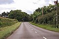
 Country lane south of Brancaster Staithe - geograph.org.uk - 177788.jpg 640 × 428; 124 KB
-
 Jolly Sailor, Brancaster Staithe - geograph.org.uk - 11543.jpg 640 × 480; 82 KB
-
 National Trust Sign at Brancaster Staithe - geograph.org.uk - 661477.jpg 402 × 600; 104 KB
-
 Sailing at Brancaster Staithe - geograph.org.uk - 661382.jpg 427 × 640; 47 KB
-
 Sailing at Brancaster Staithe - geograph.org.uk - 661383.jpg 426 × 640; 53 KB
-
 Sailing at Brancaster Staithe - geograph.org.uk - 661384.jpg 411 × 640; 62 KB
-
 Sailing at Brancaster Staithe - geograph.org.uk - 661385.jpg 426 × 640; 57 KB
-
 Sailing at Brancaster Staithe - geograph.org.uk - 661386.jpg 640 × 427; 46 KB
-
 Sailing at Brancaster Staithe - geograph.org.uk - 661387.jpg 640 × 427; 54 KB
-
 Tidal marshes, Brancaster Staithe - geograph.org.uk - 228594.jpg 640 × 480; 52 KB


_at_the_Jolly_Sailors_PH,_Brancaster_Staithe_-_geograph.org.uk_-_4253348.jpg)


