Category:Branderijstraat 24, Vlissingen
Jump to navigation
Jump to search
| Object location | | View all coordinates using: OpenStreetMap |
|---|
 | |||||
| Upload media | |||||
| Instance of |
| ||||
|---|---|---|---|---|---|
| Location | Vlissingen, Zeeland, Netherlands | ||||
| Street address |
| ||||
| Located on street | |||||
| Heritage designation |
| ||||
 | |||||
|
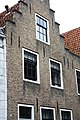
This is a category about rijksmonument number 37775
|
| Address |
|
Media in category "Branderijstraat 24, Vlissingen"
The following 5 files are in this category, out of 5 total.
-
 37775 Branderijstraat 24 1e.jpg 2,848 × 4,272; 5.72 MB
-
 37775 Branderijstraat 24 bg.jpg 2,848 × 4,272; 4.3 MB
-
 37775 Branderijstraat 24 boven.jpg 2,848 × 4,272; 3.91 MB
-
 Exterieur VOORGEVELS - Vlissingen - 20301530 - RCE.jpg 960 × 1,200; 292 KB
-
 Exterieur VOORGEVELS - Vlissingen - 20301531 - RCE.jpg 955 × 1,200; 253 KB


