Category:Brant Fell, Windermere
Jump to navigation
Jump to search
English: Brant Fell is a hill in the civil parish of Windermere, in the South Lakeland district, in the county of Cumbria, England.
hill in Windermere, Cumbria, England | |||||
| Upload media | |||||
| Instance of | |||||
|---|---|---|---|---|---|
| Location | Lake District, North Yorkshire, Yorkshire and the Humber, England | ||||
 | |||||
Media in category "Brant Fell, Windermere"
The following 16 files are in this category, out of 16 total.
-
 A cairn on Brant Fell - geograph.org.uk - 2940990.jpg 800 × 600; 167 KB
-
 Brant Fell - geograph.org.uk - 1418988.jpg 640 × 480; 85 KB
-
 Brant Fell - geograph.org.uk - 5563921.jpg 2,592 × 1,944; 1.19 MB
-
 Cairn on Brant Fell - geograph.org.uk - 3536748.jpg 640 × 480; 77 KB
-
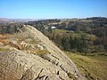
 Crag on Brant Fell - geograph.org.uk - 1543798.jpg 640 × 480; 58 KB
-
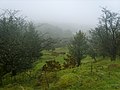
 Fields and woods below Brant Fell - geograph.org.uk - 3537060.jpg 640 × 480; 84 KB
-
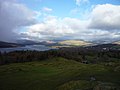
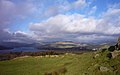 Lakeland views from Brant Fell - geograph.org.uk - 2774906.jpg 640 × 401; 42 KB
-
 On Brant Fell - geograph.org.uk - 1543782.jpg 640 × 480; 66 KB
-
 On Brant Fell - geograph.org.uk - 1543789.jpg 640 × 480; 50 KB
-
 On top of Brant Fell - geograph.org.uk - 5696396.jpg 960 × 720; 216 KB
-
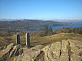
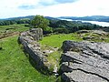
 Rock slab, Brant Fell - geograph.org.uk - 5696363.jpg 960 × 720; 276 KB
-
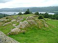
 Rocks at the summit of Brant Fell - geograph.org.uk - 3536750.jpg 640 × 480; 102 KB
-

-
 View north from Brant Fell - geograph.org.uk - 2774912.jpg 640 × 480; 43 KB
-
 View north from Brant Fell - geograph.org.uk - 3536744.jpg 640 × 480; 84 KB
-
 West flank of Brant Hill - geograph.org.uk - 795523.jpg 640 × 499; 62 KB


