Category:Brassington
Jump to navigation
Jump to search
village and civil parish in Derbyshire Dales district, Derbyshire, England  | |||||
| Upload media | |||||
| Instance of | |||||
|---|---|---|---|---|---|
| Location | Derbyshire Dales, Derbyshire, East Midlands, England | ||||
| Population |
| ||||
 | |||||
Subcategories
This category has the following 7 subcategories, out of 7 total.
B
G
- The Gate Inn, Brassington (5 F)
H
- Harboro' Rocks (28 F)
J
L
M
- The Miners Arms, Brassington (8 F)
Media in category "Brassington"
The following 200 files are in this category, out of 363 total.
(previous page) (next page)-
 A disused section of Wirksworth Dale - geograph.org.uk - 4809540.jpg 1,280 × 960; 498 KB
-
 A5012 approaching Pikehall from the east - geograph.org.uk - 3765216.jpg 4,000 × 2,248; 4.4 MB
-
 A5012 west of the Moor Lane junction - geograph.org.uk - 2362731.jpg 950 × 689; 403 KB
-

-
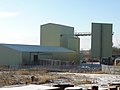 Aggregate Works, on High Peak Trail - geograph.org.uk - 1625924.jpg 640 × 480; 56 KB
-
 Along the track - geograph.org.uk - 2362655.jpg 950 × 713; 415 KB
-
 Art or what? - geograph.org.uk - 3183196.jpg 3,000 × 4,000; 3.52 MB
-
 At Rainster Rocks - geograph.org.uk - 5588731.jpg 5,184 × 3,888; 5.07 MB
-
 Atlas Rocket nose cone ? - geograph.org.uk - 1196244.jpg 640 × 480; 112 KB
-

-
 Barn between Brassington and Carsington - geograph.org.uk - 5047997.jpg 1,800 × 1,350; 398 KB
-
 Beardley Plantation from the B5056 - geograph.org.uk - 625408.jpg 473 × 640; 149 KB
-
 Beardsley Plantation - geograph.org.uk - 272458.jpg 480 × 640; 134 KB
-
 Bend on the High Peak Trail - geograph.org.uk - 3266959.jpg 800 × 533; 87 KB
-
 Between Brassington and Aldwark - geograph.org.uk - 6520820.jpg 4,032 × 3,024; 5.39 MB
-

-
 Bisected field near Brassington - geograph.org.uk - 3183214.jpg 4,000 × 3,000; 2.79 MB
-
 Border Country - geograph.org.uk - 1196186.jpg 640 × 480; 87 KB
-
 Brackendale countryside - geograph.org.uk - 5588699.jpg 5,067 × 3,630; 3.92 MB
-
 Brassington - 373997.jpg 640 × 480; 95 KB
-
 Brassington - Cliff Cottage and Village Hall - geograph.org.uk - 2339530.jpg 1,600 × 1,229; 547 KB
-
 Brassington - Dragon Hill - geograph.org.uk - 872394.jpg 640 × 480; 64 KB
-
 Brassington - Dragon House and Dragon Cottage - geograph.org.uk - 2339548.jpg 1,600 × 1,065; 485 KB
-
 Brassington - Entering the Village - geograph.org.uk - 871957.jpg 640 × 480; 108 KB
-
 Brassington - Footpath View - geograph.org.uk - 872364.jpg 640 × 480; 84 KB
-
 Brassington - geograph.org.uk - 5271761.jpg 1,800 × 1,350; 522 KB
-
 Brassington - Hillside Lane - geograph.org.uk - 872192.jpg 640 × 480; 100 KB
-
 Brassington - Hillside Lane - geograph.org.uk - 872280.jpg 640 × 480; 97 KB
-
 Brassington - houses on north side of Maddock Lane - geograph.org.uk - 2338643.jpg 1,600 × 1,200; 492 KB
-

-
 Brassington - Leamington Cottage - geograph.org.uk - 2339550.jpg 1,600 × 1,217; 574 KB
-

-

-
 Brassington - Middle Lane - geograph.org.uk - 872241.jpg 640 × 480; 94 KB
-
 Brassington - Miners Hill - geograph.org.uk - 872382.jpg 640 × 480; 80 KB
-
 Brassington - Nether Lane View - geograph.org.uk - 872215.jpg 640 × 480; 88 KB
-
 Brassington - Nether Lane View - geograph.org.uk - 872224.jpg 640 × 480; 113 KB
-

-
 Brassington - Primary School - geograph.org.uk - 2339554.jpg 1,600 × 1,200; 420 KB
-

-
 Brassington - Town Street - geograph.org.uk - 872373.jpg 640 × 480; 90 KB
-
 Brassington - Town Street - geograph.org.uk - 873112.jpg 480 × 640; 94 KB
-
 Brassington - Tudor House - geograph.org.uk - 2339543.jpg 1,600 × 1,200; 376 KB
-
 Brassington - View from Jaspers Lane - geograph.org.uk - 872324.jpg 640 × 480; 103 KB
-

-

-
 Brassington - View opposite Kings Hill - geograph.org.uk - 872355.jpg 640 × 480; 100 KB
-
 Brassington - Village Scene - geograph.org.uk - 872471.jpg 640 × 480; 104 KB
-
 Brassington - Well Street - geograph.org.uk - 872875.jpg 640 × 480; 76 KB
-
 Brassington - Well Street - geograph.org.uk - 873069.jpg 640 × 480; 83 KB
-
 Brassington - Well Street - geograph.org.uk - 873075.jpg 640 × 480; 83 KB
-

-
 Brassington - West End - geograph.org.uk - 872246.jpg 640 × 480; 70 KB
-
 Brassington - West End - geograph.org.uk - 872255.jpg 640 × 480; 102 KB
-
 Brassington - West End - geograph.org.uk - 872271.jpg 640 × 480; 92 KB
-

-
 Brassington Manor.jpg 3,456 × 2,304; 3.1 MB
-
 Brassington sewage works - geograph.org.uk - 272924.jpg 640 × 480; 128 KB
-
 Brassington Sewage Works - geograph.org.uk - 3183941.jpg 800 × 600; 122 KB
-
 Brassington Village - geograph.org.uk - 3090690.jpg 4,000 × 3,000; 3.28 MB
-
 Brassington village - geograph.org.uk - 3183933.jpg 800 × 345; 89 KB
-
 Brassington Village - geograph.org.uk - 5351520.jpg 2,048 × 1,360; 1.87 MB
-
 Brassington Village - geograph.org.uk - 5358503.jpg 2,000 × 1,333; 2.06 MB
-
 Brassington Village - geograph.org.uk - 6520856.jpg 4,032 × 3,024; 4.8 MB
-
 Brassington village church, Derbyshire - geograph.org.uk - 4275174.jpg 1,024 × 768; 199 KB
-
 Brassington Village Hall - geograph.org.uk - 871964.jpg 480 × 640; 89 KB
-
 Brassington Village Hall - geograph.org.uk - 872341.jpg 480 × 640; 109 KB
-

-
 Bridge near Longcliffe - geograph.org.uk - 1914221.jpg 1,024 × 768; 168 KB
-
 Bridge repair on the Pennine Bridleway near Longcliffe - geograph.org.uk - 6319659.jpg 4,000 × 3,000; 4.9 MB
-
 Bridleway into Gratton Dale - geograph.org.uk - 3433154.jpg 640 × 427; 200 KB
-
 Bridleways in Gratton Dale - geograph.org.uk - 3433164.jpg 640 × 427; 223 KB
-
 Buildings of Griffe Walk Farm - geograph.org.uk - 1625283.jpg 640 × 480; 89 KB
-
 Butterfly heaven - geograph.org.uk - 6216521.jpg 2,000 × 1,333; 2.4 MB
-
 By the former High Peak Railway - geograph.org.uk - 5589064.jpg 4,641 × 3,495; 3.76 MB
-
 Carsington Pasture - geograph.org.uk - 1349852.jpg 640 × 480; 64 KB
-
 Carsington Pastures - geograph.org.uk - 1892095.jpg 1,024 × 768; 168 KB
-
 Cattle in Long Dale - geograph.org.uk - 5598679.jpg 4,820 × 3,469; 4.07 MB
-
 Church Gate Cottage, Brassington.jpg 1,800 × 1,350; 487 KB
-
 Closed section of Wirksworth Dale - geograph.org.uk - 4809608.jpg 1,280 × 960; 503 KB
-
 Cold and wet - geograph.org.uk - 455271.jpg 640 × 480; 171 KB
-
 Cottage at Harboro Rocks - geograph.org.uk - 6520810.jpg 4,032 × 3,024; 4.55 MB
-
 Cottages on Hillside - geograph.org.uk - 6520840.jpg 4,032 × 3,024; 4.16 MB
-
 Countryside off Brackendale Lane - geograph.org.uk - 273019.jpg 640 × 473; 112 KB
-
 Countryside to the south west of Brassington - geograph.org.uk - 5588708.jpg 5,039 × 3,684; 4.85 MB
-
 Cow and calves - geograph.org.uk - 2361331.jpg 950 × 528; 312 KB
-
 Cows at Peak Quarry Farm - geograph.org.uk - 6520825.jpg 4,032 × 3,024; 5.12 MB
-
 Cross paths - geograph.org.uk - 3265763.jpg 4,000 × 2,248; 1.93 MB
-
 Crossroads at Longcliffe - geograph.org.uk - 3445712.jpg 3,848 × 2,792; 1.82 MB
-
 Curzon Lodge from Limestone Way - geograph.org.uk - 1625258.jpg 640 × 480; 85 KB
-
 Cyclists on the High peak trail. - geograph.org.uk - 5392115.jpg 640 × 427; 74 KB
-

-
 Derbyshire UK parish map highlighting Brassington.svg 888 × 1,308; 2.34 MB
-
 Derelict Barn on Manystones Lane - geograph.org.uk - 6469167.jpg 4,608 × 3,090; 4.15 MB
-
 Derelict Building - geograph.org.uk - 2992036.jpg 4,000 × 3,000; 2.51 MB
-
 Descent to Brassington - geograph.org.uk - 5048033.jpg 1,350 × 1,800; 524 KB
-
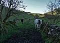
 Disturbing the sheep - geograph.org.uk - 6520832.jpg 4,032 × 3,024; 3.3 MB
-
 Disused Building - geograph.org.uk - 366936.jpg 640 × 480; 66 KB
-
 Dolomitic limestone outcrop - geograph.org.uk - 5271804.jpg 1,800 × 1,350; 715 KB
-
 Downhill track to Pasture Lane - geograph.org.uk - 2361371.jpg 950 × 662; 381 KB
-
 Dragon Cottages, Brassington.jpg 3,141 × 4,105; 1.46 MB
-
 Dry Valley Below Mouldridge Grange - geograph.org.uk - 2466903.jpg 640 × 427; 266 KB
-
 Embankment, Hoe Grange - geograph.org.uk - 2863025.jpg 640 × 425; 226 KB
-
 EngineeringTools In Relief - geograph.org.uk - 959465.jpg 640 × 480; 132 KB
-
 Entering Brassington - geograph.org.uk - 5271774.jpg 1,350 × 1,800; 435 KB
-
 Entering Brassington from the south - geograph.org.uk - 5588706.jpg 5,184 × 3,888; 5.04 MB
-
 Entering Longcliffe - geograph.org.uk - 6520826.jpg 4,032 × 3,024; 4.46 MB
-
 Entrance gate at Wall Lands - geograph.org.uk - 1922120.jpg 640 × 480; 90 KB
-
 Farm at Astonhill - geograph.org.uk - 2362658.jpg 950 × 693; 382 KB
-
 Farm buildings - geograph.org.uk - 6520998.jpg 4,032 × 3,024; 2.34 MB
-
 Farm buildings opposite Tithe Farm - geograph.org.uk - 1623847.jpg 640 × 480; 58 KB
-
 Farm buildings, Longcliffe Dale Farm - geograph.org.uk - 2361325.jpg 950 × 560; 243 KB
-
 Farm track. - geograph.org.uk - 153204.jpg 640 × 480; 90 KB
-

-
 Farmland at Astonhill - geograph.org.uk - 3373124.jpg 640 × 427; 233 KB
-
 Farmland south of Elton - geograph.org.uk - 1623858.jpg 640 × 480; 40 KB
-
 Field Barn near Clipshead Farm - geograph.org.uk - 4339779.jpg 3,847 × 2,793; 3.42 MB
-

-
 Fields above the Griffe Grange valley - geograph.org.uk - 2361271.jpg 950 × 674; 294 KB
-
 Fields and yet more quarrying - geograph.org.uk - 2361290.jpg 950 × 568; 295 KB
-
 Fields near Clipshead Farm - geograph.org.uk - 4339801.jpg 4,000 × 3,000; 2.75 MB
-
 Fields south of Astonhill - geograph.org.uk - 2362662.jpg 950 × 713; 412 KB
-
 Flowers everywhere - geograph.org.uk - 6216531.jpg 2,000 × 1,333; 3.11 MB
-
 Footpath junction - geograph.org.uk - 3266965.jpg 800 × 533; 86 KB
-
 Footpath junction east of Longcliffe - geograph.org.uk - 4076705.jpg 2,440 × 1,830; 2.16 MB
-
 Footpath to Brassington - geograph.org.uk - 5271757.jpg 1,800 × 1,350; 424 KB
-
 Footpath to Brassington - geograph.org.uk - 6520859.jpg 4,032 × 3,024; 3.18 MB
-
 Footpath to Harboro' Rocks - geograph.org.uk - 4809573.jpg 1,280 × 940; 580 KB
-
 Footpath to Longcliffe - geograph.org.uk - 5043961.jpg 1,280 × 960; 500 KB
-
 Footpath-Bridleway junction. - geograph.org.uk - 5392104.jpg 640 × 427; 122 KB
-
 For Sale - geograph.org.uk - 4489021.jpg 4,320 × 3,240; 4.61 MB
-
 Former Primitive Methodist Chapel, Brassington.jpg 4,032 × 3,024; 5.93 MB
-

-
 From St James' Churchyard - geograph.org.uk - 6520838.jpg 4,032 × 3,024; 5.34 MB
-
 Gallowlow Lane - geograph.org.uk - 997348.jpg 640 × 480; 98 KB
-
 Gloomy harrow - geograph.org.uk - 3265764.jpg 4,000 × 2,248; 1.49 MB
-
 Going around the bend on the High Peak Trail - geograph.org.uk - 4569973.jpg 1,024 × 768; 201 KB
-
 Grassland to the East of Longcliffe - geograph.org.uk - 3445684.jpg 4,000 × 3,000; 2.43 MB
-
 Gratton Dale - geograph.org.uk - 3162134.jpg 4,298 × 3,070; 2.9 MB
-
 Gratton Dale and Long Dale Junction - geograph.org.uk - 59770.jpg 640 × 480; 168 KB
-
 Gratton Dale north of Mouldridge Grange - geograph.org.uk - 5598671.jpg 5,184 × 3,888; 5.18 MB
-
 Griffe Walk Farm - geograph.org.uk - 1625311.jpg 640 × 480; 93 KB
-
 Griffe Walk Farm - geograph.org.uk - 2894526.jpg 1,024 × 595; 139 KB
-
 Haven Hoe Farm near Longcliffe - geograph.org.uk - 3099473.jpg 4,000 × 3,000; 2.38 MB
-
 Haytime west of Griffe Walk Farm - geograph.org.uk - 4076682.jpg 2,592 × 1,944; 2.47 MB
-
 Heading to Brassington - geograph.org.uk - 1196398.jpg 640 × 480; 62 KB
-
 Hedgerow and meadow - geograph.org.uk - 1349795.jpg 640 × 480; 109 KB
-
 High Peak Trail - geograph.org.uk - 2026520.jpg 640 × 426; 89 KB
-
 High Peak Trail - geograph.org.uk - 3265758.jpg 4,000 × 2,248; 1.52 MB
-
 High Peak Trail - geograph.org.uk - 4489027.jpg 4,320 × 3,240; 4.79 MB
-
 High Peak Trail - geograph.org.uk - 4489030.jpg 4,320 × 3,240; 4.95 MB
-
 High Peak Trail - geograph.org.uk - 4569970.jpg 1,024 × 768; 209 KB
-
 High Peak Trail - geograph.org.uk - 5018021.jpg 5,184 × 3,325; 1.69 MB
-
 High Peak Trail - geograph.org.uk - 5018032.jpg 5,184 × 3,264; 1.54 MB
-
 High Peak Trail - geograph.org.uk - 5271807.jpg 1,800 × 1,350; 775 KB
-
 High Peak Trail - geograph.org.uk - 6520812.jpg 4,032 × 3,024; 5.09 MB
-
 High Peak Trail - geograph.org.uk - 6520815.jpg 4,032 × 3,024; 7.63 MB
-

-
 High Peak Trail in the mists - geograph.org.uk - 3265749.jpg 4,000 × 2,248; 2.04 MB
-
 High Peak Trail near Longcliffe - geograph.org.uk - 4569964.jpg 1,024 × 768; 189 KB
-
 Hillside Lane, Brassington - geograph.org.uk - 3183189.jpg 4,000 × 3,000; 2.99 MB
-
 Hipley Farm, Brassington - geograph.org.uk - 6520834.jpg 4,032 × 3,024; 2.71 MB
-
 Hipley Hill - geograph.org.uk - 2835645.jpg 640 × 426; 67 KB
-
 Hoe Grange - geograph.org.uk - 5064302.jpg 5,059 × 2,963; 1.66 MB
-

-
 Hot-air balloon over Longcliffe Quarry, Derbyshire - geograph.org.uk - 1874726.jpg 1,500 × 996; 1.09 MB
-
 House adjoining the Miners Arms, Brassington.jpg 4,032 × 3,024; 4.37 MB
-
 House opposite the church (Do you have the time).JPG 3,840 × 2,880; 2.42 MB
-

-
 In the quarry - geograph.org.uk - 6216515.jpg 2,000 × 1,330; 1.67 MB
-
 Industry on Manystones Lane - geograph.org.uk - 3144409.jpg 3,764 × 2,308; 2.16 MB
-
 Inside the cave on Harborough Rocks - geograph.org.uk - 4971578.jpg 1,800 × 1,350; 450 KB
-
 Into the distance - geograph.org.uk - 2362614.jpg 950 × 690; 326 KB
-
 Jacks Cottage - geograph.org.uk - 6520851.jpg 4,032 × 3,024; 4.92 MB
-
 Junction of Long Dale and Gratton Dale. - geograph.org.uk - 2358899.jpg 950 × 654; 403 KB
-

-

-
 Junction of two dry valleys below Pikehall in Long Dale - geograph.org.uk - 3762724.jpg 4,000 × 2,248; 5.51 MB
-
 Kings Hill, Brassington - geograph.org.uk - 5271793.jpg 1,800 × 1,350; 523 KB
-
 Landscape - Brassington - geograph.org.uk - 1454713.jpg 640 × 425; 86 KB
-
 Landscape around Mouldridge Grange - geograph.org.uk - 2358878.jpg 950 × 713; 409 KB
-
 Lane Junction near Haven Hoe Farm - geograph.org.uk - 997344.jpg 640 × 480; 50 KB
-
 Lane leading to Brassington - geograph.org.uk - 1196153.jpg 640 × 480; 56 KB
-
 Lane outside Brassington - geograph.org.uk - 1196158.jpg 640 × 480; 57 KB
-
 Lane Passing Tithe Farm near Aldwark - geograph.org.uk - 3099479.jpg 3,858 × 2,800; 1.71 MB
-
 Lane to Brassington from Longcliffe - geograph.org.uk - 2361351.jpg 950 × 720; 413 KB
-
 Lane to Sacheveral Farm - geograph.org.uk - 2361170.jpg 950 × 449; 267 KB
-
 Limestone hillside and mossy wall - geograph.org.uk - 625413.jpg 427 × 640; 125 KB
-
 Limestone railway embankment near Hoe Grange - geograph.org.uk - 5588880.jpg 4,929 × 3,689; 4.29 MB
-
 Limestone Way Landscape - geograph.org.uk - 4077281.jpg 1,944 × 2,592; 2.6 MB
-

-
 Little Wisels Wood - geograph.org.uk - 2466880.jpg 640 × 427; 264 KB
-
 Longcliffe Tops - geograph.org.uk - 1914240.jpg 768 × 1,024; 182 KB
-
 Looking down on the B5056 - geograph.org.uk - 2361409.jpg 713 × 950; 462 KB
-
 Looking out from Longcliffe - geograph.org.uk - 6216511.jpg 2,000 × 1,330; 1.91 MB
-
 Looking through the tunnel - geograph.org.uk - 1958603.jpg 2,736 × 3,648; 3.71 MB
-
 Maddock Lane, Brassington - geograph.org.uk - 5271791.jpg 1,800 × 1,350; 369 KB
-
 Making hay - geograph.org.uk - 1920279.jpg 640 × 480; 62 KB
-
 Miner's Arms, Brassington - geograph.org.uk - 6520849.jpg 4,032 × 3,024; 4.19 MB
-
 Mineral extraction side - geograph.org.uk - 6520808.jpg 4,032 × 3,024; 4.07 MB


.JPG)


