Category:Braunarlspitze
Jump to navigation
Jump to search
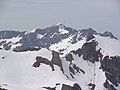
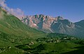
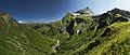
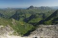
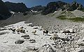
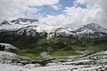
Deutsch: Die Braunarlspitze ist der höchste Gipfel in der Nordhälfte des Lechquellengebirges und daher vor allem aus dem Bregenzerwald sehr auffällig.
mountain  | |||||
| Upload media | |||||
| Instance of | |||||
|---|---|---|---|---|---|
| Location | Vorarlberg, Austria | ||||
| Mountain range | |||||
| Topographic prominence |
| ||||
| Topographic isolation |
| ||||
| Elevation above sea level |
| ||||
 | |||||
Subcategories
This category has the following 3 subcategories, out of 3 total.
Media in category "Braunarlspitze"
The following 51 files are in this category, out of 51 total.
-
 03 Braunarl vom Westgipfel, Madlochspitze links davor.jpg 3,648 × 2,736; 1.88 MB
-
 360º Pano Auenfeld Hochtannberg.jpg 21,239 × 4,402; 29.45 MB
-
 51 Braunarl.jpg 3,648 × 2,736; 1.39 MB
-
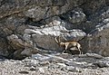 Alpensteinbock Butzenspitze.JPG 2,504 × 1,734; 3.09 MB
-
 ANTONY GORMLEY Widderstein 02.JPG 4,110 × 2,846; 6.25 MB
-
 ANTONY GORMLEY Widderstein 03.JPG 4,288 × 2,848; 6.2 MB
-
 ANTONY GORMLEY Widderstein 09.JPG 4,288 × 2,848; 6.71 MB
-
 ANTONY GORMLEY Widderstein 10.JPG 4,288 × 2,848; 3.32 MB
-
 Braunarlspitze 5°° Uhr.JPG 3,261 × 2,258; 4.64 MB
-
 Braunarlspitze from Widderstein.JPG 3,264 × 2,448; 3.04 MB
-
 Braunarlspitze Fürggele Hochbergsattel Widderstein.jpg 6,565 × 2,099; 4.05 MB
-
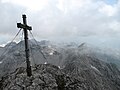 Braunarlspitze Gipfelkreuz.JPG 3,264 × 2,448; 3.11 MB
-
 Braunarlspitze Gipfelruecken.JPG 3,264 × 2,448; 3.67 MB
-
 Braunarlspitze Hochgletscher.JPG 3,264 × 2,448; 4.12 MB
-
 Braunarlspitze NO.JPG 3,264 × 2,448; 2.92 MB
-
 Braunarlspitze Nordflanke Hochgletscher.JPG 3,264 × 2,448; 4.04 MB
-
 Braunarlspitze Nordflanke Hochgletscher02.JPG 3,264 × 2,448; 3.67 MB
-
 Braunarlspitze vom Diedamskopf.JPG 2,468 × 1,709; 2.66 MB
-
 Braunarlspitze, Butzenspitze S.JPG 4,320 × 2,532; 8.57 MB
-
 Braunarlspitze, Rote Wand.JPG 4,272 × 2,848; 8.14 MB
-
 Braunarlspitze.jpg 2,048 × 1,536; 349 KB
-
 Butzensee Butzen Spitze.JPG 4,110 × 2,846; 6.87 MB
-
 Butzenspitze 2547m Panorama.jpg 4,729 × 2,328; 2.37 MB
-
 Butzenspitze und Braunarlspitze von Nordosten.jpg 4,000 × 2,250; 700 KB
-
-

-
 ETH-BIB-Braunarlspitze, Lechtaler Alpen-LBS H1-020308.tif 6,318 × 5,014; 90.71 MB
-
 ETH-BIB-Braunarlspitze-LBS H1-020307.tif 5,028 × 6,369; 91.71 MB
-
 Fellbachtal Mohnenfluh.jpg 6,752 × 2,851; 6.52 MB
-
 Geislinger, Jäger Steig Hochtannbergpass.JPG 4,272 × 2,848; 7.89 MB
-
 Hochgletscheralpe Butzenspitze 1.jpg 5,245 × 3,235; 4.42 MB
-
 Hochgletscheralpe Butzenspitze 2.JPG 4,272 × 2,848; 10.06 MB
-
 Hochgletscheralpe Juppenspitze Mohnenfluh 1.JPG 4,272 × 2,848; 3.09 MB
-
 Hochgletscheralpe Juppenspitze Mohnenfluh.jpg 5,065 × 3,272; 6.13 MB
-
 Hochplateau Braunarlspitze.jpg 5,092 × 2,591; 10.11 MB
-
 Hochtannbergpass Saloberkopf.JPG 4,288 × 2,848; 6.8 MB
-
 Höfergrat Panorama.jpg 9,059 × 2,374; 14.91 MB
-
 Kanisfluh Antony Gormley Horizon Field.JPG 3,648 × 2,736; 2.63 MB
-
 Kranzenzian, Gentianella.JPG 1,848 × 2,669; 2.56 MB
-
 Kriegeralpe Butzenspitze.JPG 4,288 × 2,848; 9.47 MB
-
 KörberseeJuppenspitze.JPG 2,000 × 2,000; 882 KB
-
 Madlochjoch Panorama.jpg 9,766 × 2,153; 15.9 MB
-
 Mohnenfluhsattel Panorama.jpg 8,649 × 2,054; 13.84 MB
-
 Nesslegg, Schröcken 3.jpg 6,126 × 2,572; 9.09 MB
-
 Rundblättrige Glockenblume, Campanula rotundifolia 1.JPG 2,134 × 2,846; 3.1 MB
-
 Sonnenaufgang Felletal 1.JPG 4,272 × 2,848; 6.72 MB
-
 Sonnenaufgang Felletal 2.JPG 4,272 × 2,848; 6.27 MB
-
 Sonnenaufgang Felletal 3.JPG 2,848 × 2,848; 1.04 MB
-
 Unterstandshütte Hintere Felle.JPG 2,848 × 4,272; 2.73 MB
-
 Weimarer Steig vom Gipfel.jpg 2,048 × 1,536; 1,010 KB
-
 Zustieg Südwand Braunarlspitze.JPG 4,272 × 2,848; 12.48 MB


