Category:Braunkohlentiefbaugrube Schacht Dölitz
Jump to navigation
Jump to search
| Object location | | View all coordinates using: OpenStreetMap |
|---|
former mine in Leipzig, Germany | |||||
| Upload media | |||||
| Instance of | |||||
|---|---|---|---|---|---|
| Location | Leipzig, Saxony, Germany | ||||
 | |||||
Subcategories
This category has the following 3 subcategories, out of 3 total.
Media in category "Braunkohlentiefbaugrube Schacht Dölitz"
The following 26 files are in this category, out of 26 total.
-
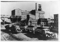
 Anlage nw ansicht 1932.jpg 2,025 × 1,398; 1.42 MB
-
 Anlage nw ansicht 1932.TIF 2,100 × 1,485; 2.98 MB
-
 Denkmalsteile Schachtförderanlage.svg 1,052 × 744; 488 KB
-
 Doelitz-Mai-2009 037.jpg 1,500 × 1,125; 456 KB
-
-

-

-

-
 Leipzig - Friederikenstraße + 62BG RCI + Schacht Dölitz 01 ies.jpg 5,616 × 3,744; 15.08 MB
-
 Leipzig - Friederikenstraße + Schacht Dölitz 01 ies.jpg 5,616 × 3,744; 12.5 MB
-
 Leipzig - Friederikenstraße + Schacht Dölitz 02 ies.jpg 3,744 × 5,616; 15.63 MB
-
 Leipzig - Friederikenstraße - Schacht Dölitz 01 ies.jpg 5,616 × 3,744; 12.77 MB
-
 Leipzig - Friederikenstraße - Schacht Dölitz 02 ies.jpg 5,616 × 3,744; 15.72 MB
-
 Leipzig - Friederikenstraße - Schacht Dölitz 03 ies.jpg 5,616 × 3,744; 15.7 MB
-
 Leipzig - Friederikenstraße - Schacht Dölitz 04 ies.jpg 5,616 × 3,744; 12.54 MB
-
 Leipzig - Friederikenstraße - Schacht Dölitz 05 ies.jpg 3,744 × 5,616; 15.74 MB
-
 Leipzig - Friederikenstraße - Schacht Dölitz 06 ies.jpg 3,744 × 5,616; 16.04 MB
-
 Leipzig Friederikenstrasse Schacht Doelitz-01.jpg 6,000 × 4,000; 2.58 MB
-
 Leipzig Friederikenstrasse Schacht Doelitz.jpg 5,871 × 3,914; 2.71 MB
-
 Schacht-Doelitz Modell.jpg 910 × 709; 144 KB
-
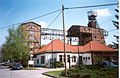 Schacht-Doelitz.jpg 1,562 × 1,015; 1.74 MB
-
 SchachtDoelitz Westseite low.jpg 902 × 600; 715 KB
-
 SchachtDoelitzSuedOst.jpg 2,362 × 1,577; 3.87 MB
-
 SchachtDoelitzSuedOstLOW.jpg 2,338 × 1,426; 974 KB
-
 SchachtSüdOst Low.jpg 1,000 × 668; 98 KB
-
 Seigerriß Schacht Dölitz.svg 744 × 1,052; 697 KB


