Category:Breck Road bridge, Liverpool
Jump to navigation
Jump to search
| Object location | | View all coordinates using: OpenStreetMap |
|---|
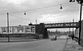
Although this bridge is on Townsend Lane, Network Rail still call it Breck Road bridge, presumably because it was next to the defunct Breck Road station. It is bridge SCT1/17 and carries the Canada Dock Branch; it is 2.41 miles from Edge Hill junction.
Media in category "Breck Road bridge, Liverpool"
The following 7 files are in this category, out of 7 total.
-
 Breck Road railway station 1971977 02a4cf11.jpg 640 × 393; 108 KB
-
 Townsend Lane bridge 1.jpg 5,152 × 3,864; 6.97 MB
-
 Townsend Lane bridge 2.jpg 4,949 × 3,246; 7.19 MB
-
 Townsend Lane bridge 3.jpg 3,894 × 3,060; 5.2 MB
-
 Townsend Lane bridge 4.jpg 5,152 × 3,864; 9.42 MB
-
 Townsend Lane bridge 5.jpg 4,941 × 3,515; 8.49 MB
-
 Townsend Lane bridge 6.jpg 4,974 × 3,702; 10.31 MB


