Category:Breitestraße 6 (Mahlberg)
Jump to navigation
Jump to search
| Object location | | View all coordinates using: OpenStreetMap |
|---|
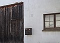
| This category shows a heritage building in Germany, located in the North Rhine-Westphalian city Bad Münstereifel (no. 292). |
Media in category "Breitestraße 6 (Mahlberg)"
The following 4 files are in this category, out of 4 total.
-
 Mahlberg Breitestraße 6 (01).jpg 4,812 × 3,870; 4.9 MB
-
 Mahlberg Breitestraße 6 (02).jpg 5,004 × 3,648; 4.5 MB
-
 Mahlberg Breitestraße 6 (03).jpg 5,010 × 3,798; 3.7 MB
-
 Mahlberg Breitestraße 6 (04).jpg 5,178 × 3,726; 3.61 MB
.jpg)
.jpg)
.jpg)
.jpg)