Category:Bridges in Elland
Jump to navigation
Jump to search
Subcategories
This category has the following 3 subcategories, out of 3 total.
E
- Elland Viaduct (5 F)
R
- Rawroyds Viaduct (9 F)
Media in category "Bridges in Elland"
The following 36 files are in this category, out of 36 total.
-

-
 Abutment of former footbridge over the canal at Elland - geograph.org.uk - 4803498.jpg 2,048 × 1,536; 812 KB
-
 Bridge carrying Ellistones Lane over Black Brook - geograph.org.uk - 3708955.jpg 2,000 × 1,500; 1.11 MB
-
 Bridge over Dewsbury Road - geograph.org.uk - 3773842.jpg 640 × 480; 71 KB
-
 Bridge over the Calder and Hebble Navigation at Elland (14447111295).jpg 4,454 × 3,360; 13.11 MB
-
 Bridges old and new, Wistons Lane, Elland - geograph.org.uk - 1874302.jpg 2,000 × 1,459; 691 KB
-
 Bridges over the River Calder, Elland - geograph.org.uk - 250133.jpg 640 × 480; 168 KB
-
 Calderdale Way Bridge 14 - geograph.org.uk - 2533989.jpg 800 × 563; 105 KB
-
 Calderdale Way, Canal and Railway, alongside Park Road - geograph.org.uk - 4205390.jpg 4,608 × 3,456; 3.27 MB
-
 Century Road road closure - geograph.org.uk - 3711205.jpg 2,000 × 1,461; 887 KB
-
 Construction of Lowfields Bridge - geograph.org.uk - 1249126.jpg 640 × 480; 131 KB
-
 Elland Lane Bridge and water mains over Canker Dike - geograph.org.uk - 3405586.jpg 2,000 × 1,449; 1.02 MB
-
 Field access bridge over Black Brook - geograph.org.uk - 3709157.jpg 2,000 × 1,500; 1.31 MB
-
 Footbridge over Black Brook - geograph.org.uk - 3709266.jpg 3,072 × 2,304; 3.36 MB
-
 Footbridge over Black Brook - geograph.org.uk - 3709279.jpg 2,304 × 3,072; 3.38 MB
-
 Footbridge over mill race on Elland FP36 - geograph.org.uk - 3709286.jpg 3,072 × 2,304; 3.36 MB
-
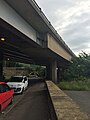
 Footbridge over the M62 near Ainley Top - geograph.org.uk - 5756283.jpg 1,600 × 1,065; 484 KB
-
 Former railway bridge on Clay House Lane - geograph.org.uk - 4412338.jpg 2,000 × 1,500; 1.73 MB
-
 Park Road under the A629 Calderdale Way - geograph.org.uk - 5005429.jpg 960 × 1,280; 250 KB
-
 Pipe bridge over the River Calder, Elland - geograph.org.uk - 1874104.jpg 2,000 × 1,500; 1.14 MB
-
 Public footpath off Shaw Lane - geograph.org.uk - 5760213.jpg 1,600 × 1,065; 1.02 MB
-
 Railway Bridge - geograph.org.uk - 2533984.jpg 800 × 600; 175 KB
-
 Railway Bridge 169A - Lowfields Way - geograph.org.uk - 1451735.jpg 640 × 480; 250 KB
-
 Railway bridge over Lowfields Way - geograph.org.uk - 1751459.jpg 640 × 480; 123 KB
-
 Repairs to a gas main, Elland canal bridge - geograph.org.uk - 4794075.jpg 2,048 × 1,536; 785 KB
-
 River Calder - geograph.org.uk - 2171444.jpg 480 × 640; 112 KB
-
 River Calder Bridge, Elland By-pass - geograph.org.uk - 629406.jpg 640 × 427; 55 KB
-
 Scaffolding support for the temporary footbridge, Elland - geograph.org.uk - 4803489.jpg 2,048 × 1,536; 817 KB
-
 Stabilised slope over the railway tunnel portal, Elland - geograph.org.uk - 5625797.jpg 1,840 × 1,340; 1,002 KB
-
 Stile on Elland FP36 - geograph.org.uk - 3709275.jpg 3,072 × 2,304; 3.47 MB
-
 Tag Cut Entrance from River Calder - geograph.org.uk - 729856.jpg 640 × 427; 129 KB
-
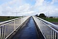
 Temporary footbridge over the canal at Elland - geograph.org.uk - 4803445.jpg 2,013 × 1,491; 882 KB
-
 The Black Brook Footpath at a bridge over the stream - geograph.org.uk - 3709121.jpg 2,000 × 1,500; 1.28 MB
-
 The Calder and Hebble Navigations at Elland Wood Viaduct - geograph.org.uk - 5346291.jpg 4,722 × 2,393; 2.19 MB
-
 Woodside Mills Bridge - geograph.org.uk - 2533986.jpg 800 × 511; 177 KB
-
 Woodside Mills footbridge - geograph.org.uk - 2049337.jpg 640 × 480; 204 KB
,_Elland_-_geograph.org.uk_-_6407838.jpg)


.jpg)


