Category:Bridgeton, Glasgow
Jump to navigation
Jump to search
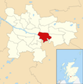
district of Glasgow, Scotland, UK  | |||||
| Upload media | |||||
| Instance of | |||||
|---|---|---|---|---|---|
| Location |
| ||||
 | |||||
Subcategories
This category has the following 11 subcategories, out of 11 total.
B
- Bridgeton Olympia Building (35 F)
- Bridgeton Public Library (9 F)
- Bridgeton railway station (50 F)
D
G
R
- Rutherglen Bridge (7 F)
S
- Sacred Heart Church, Glasgow (1 F)
Media in category "Bridgeton, Glasgow"
The following 37 files are in this category, out of 37 total.
-
 A Glasgow doo hut (geograph 3064038).jpg 640 × 480; 115 KB
-
 Abercromby Street (geograph 5202625).jpg 640 × 480; 139 KB
-
 Baltic Street (geograph 3683537).jpg 640 × 396; 110 KB
-
 Bernard Terrace (geograph 3062417).jpg 640 × 480; 116 KB
-
 Bernard Terrace (geograph 3062477).jpg 640 × 444; 99 KB
-
 Bridgeton Convenience Store - geograph.org.uk - 5446408.jpg 640 × 480; 64 KB
-
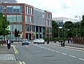
 Bridgeton Health Centre - geograph.org.uk - 3496881.jpg 640 × 309; 73 KB
-
 Bridgeton Health Centre mosaic - geograph.org.uk - 3496880.jpg 427 × 640; 155 KB
-

-
 Construction site, Barrowfield Street (geograph 6195209).jpg 1,024 × 683; 123 KB
-
 Dalmarnock from Whitevale Tower.JPG 2,848 × 2,136; 2.84 MB
-
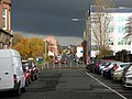
 Dalmarnock Road (A749) (geograph 5446412).jpg 640 × 480; 71 KB
-
 Dalmarnock Road (geograph 3497033).jpg 640 × 480; 134 KB
-
 Dalmarnock Road, Bridgeton (geograph 4173993).jpg 2,048 × 1,536; 1.53 MB
-
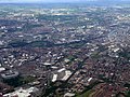
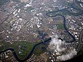 East Glasgow from the air - geograph.org.uk - 5374226.jpg 640 × 480; 198 KB
-
 Eastgate on London Road - geograph.org.uk - 3062351.jpg 640 × 487; 136 KB
-
 Eastgate on London Road - geograph.org.uk - 3062359.jpg 640 × 480; 116 KB
-
 Eastgate on London Road - geograph.org.uk - 3062386.jpg 640 × 480; 117 KB
-
 Fielden Place (geograph 6195218).jpg 1,024 × 683; 142 KB
-
 Flats on Dalmarnock Road, Glasgow (geograph 3629213).jpg 1,024 × 768; 172 KB
-
 Former Howe's Machine Works Bridgeton, Glasgow.jpg 4,405 × 2,025; 1.36 MB
-
 Former Queen Mary Street school (geograph 3064312).jpg 640 × 480; 165 KB
-
 From whitevale south.jpg 4,752 × 3,168; 3.03 MB
-
 Glasgow wards 2017 no09 Calton.png 2,000 × 2,040; 504 KB
-
 Houses on Barrowfield Gate (geograph 5446418).jpg 640 × 480; 66 KB
-
 London Road (geograph 3182114).jpg 640 × 477; 87 KB
-
 London Road Police Station (geograph 3062488).jpg 640 × 480; 112 KB
-
 Main Street - geograph.org.uk - 3497051.jpg 640 × 480; 153 KB
-
 Main Street Bridgeton - geograph.org.uk - 3064422.jpg 640 × 480; 138 KB
-
 Mile End Quarter (geograph 3062302).jpg 640 × 480; 130 KB
-
 Mile End Quarter Marker, Fordneuk Street (geograph 3483284).jpg 640 × 480; 121 KB
-
 Old factory on Fielden Street (geograph 3064185).jpg 640 × 480; 132 KB
-
 Olympia Street (geograph 3061893).jpg 640 × 480; 130 KB
-
 Parkhead and the River Clyde from the air (geograph 2987426).jpg 640 × 480; 187 KB
-
 Parkhead from the air (geograph 2987425).jpg 640 × 480; 183 KB
-
 Tower Block UK photo glw1-21 (Ruby Street, Bridgeton 1981).jpg 2,628 × 1,739; 848 KB
-
 West of Scotland Housing Association, Glasgow (geograph 3750272).jpg 5,184 × 3,456; 6.84 MB
.jpg)
.jpg)
.jpg)
.jpg)
.jpg)


.jpg)

_(geograph_5446412).jpg)
.jpg)
.jpg)


.jpg)
.jpg)

.jpg)


.jpg)
.jpg)
.jpg)


.jpg)
.jpg)
.jpg)
.jpg)
.jpg)
.jpg)
.jpg)
.jpg)