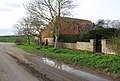
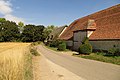
Category:Brightwell-cum-Sotwell
Jump to navigation
Jump to search
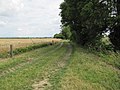
English: Brightwell-cum-Sotwell is a twin- village and civil parish in the Upper Thames Valley, in South Oxfordshire. It lies between Didcot to the west and the historic market town of Wallingford to the east. In 1974 it was transferred from Berkshire.
village and civil parish in South Oxfordshire, England  | |||||
| Upload media | |||||
| Instance of |
| ||||
|---|---|---|---|---|---|
| Location | South Oxfordshire, Oxfordshire, South East England, England | ||||
| Area |
| ||||
| official website | |||||
 | |||||
Subcategories
This category has the following 12 subcategories, out of 12 total.
B
- Brightwell Barrow (9 F)
- Brightwell Village Hall (8 F)
G
H
I
- Island Farm Donkey Sanctuary (8 F)
M
S
- Shillingford Bridge (42 F)
- Shillingford Bridge Hotel (6 F)
- St James' Church, Sotwell (7 F)
V
Media in category "Brightwell-cum-Sotwell"
The following 200 files are in this category, out of 397 total.
(previous page) (next page)-
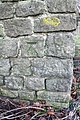
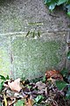 20th century benchmark on Shillingford Bridge - geograph.org.uk - 3759643.jpg 683 × 1,024; 270 KB
-
 A gate on the Thames Path - geograph.org.uk - 2382731.jpg 1,500 × 1,000; 388 KB
-
 A Muddy Stream, Brightwell - geograph.org.uk - 2495122.jpg 2,592 × 3,888; 1.49 MB
-
 A Roman Line - geograph.org.uk - 2729983.jpg 1,600 × 1,193; 472 KB
-
 A stile by the Thames Path - geograph.org.uk - 1960142.jpg 1,500 × 1,000; 320 KB
-
 A Thames Conservancy Boundary Marker - geograph.org.uk - 2382724.jpg 1,000 × 1,500; 307 KB
-
 A wet day on Shillingford Bridge - geograph.org.uk - 4690263.jpg 2,592 × 1,944; 1.46 MB
-
 A4130 Calvin-Thomas Way - geograph.org.uk - 6191058.jpg 1,024 × 684; 292 KB
-
 A4130 north of Slade End Farm - geograph.org.uk - 2804283.jpg 3,444 × 2,508; 1.19 MB
-
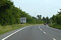
 A4130 northeast of Brightwell-cum-Sotwell - geograph.org.uk - 2804194.jpg 3,543 × 2,552; 1.17 MB
-
 A4130 northwest of Brightwell-cum-Sotwell - geograph.org.uk - 2804182.jpg 3,594 × 2,670; 1.22 MB
-
 A4130 roundabout near Sotwell Hill - geograph.org.uk - 3671630.jpg 640 × 506; 94 KB
-
 Aldgate at Benson - geograph.org.uk - 2330686.jpg 3,420 × 2,468; 2.46 MB
-
 Angel in the churchyard - geograph.org.uk - 2321796.jpg 977 × 1,500; 177 KB
-
 Arable farmland southwest of the Sinodun Hills - geograph.org.uk - 3516009.jpg 3,648 × 2,736; 2.16 MB
-
 Arable field at Mackney - geograph.org.uk - 3694284.jpg 1,500 × 999; 259 KB
-
 Arable field by Mackney Court - geograph.org.uk - 3694299.jpg 1,500 × 999; 214 KB
-
 Around 57 Metres - geograph.org.uk - 2274407.jpg 3,888 × 2,592; 1.76 MB
-
 At the top of Shillingford Hill - geograph.org.uk - 6191091.jpg 1,024 × 684; 334 KB
-
 Back to a bridge - geograph.org.uk - 2515146.jpg 600 × 800; 142 KB
-
 Bakers Lane - geograph.org.uk - 1672217.jpg 1,024 × 683; 119 KB
-
 Bakers Lane - geograph.org.uk - 1672223.jpg 1,024 × 683; 163 KB
-
 Barge moored at Shillingford - geograph.org.uk - 2536399.jpg 1,024 × 680; 207 KB
-
 Barn at Smalls Farm, Mackney - geograph.org.uk - 5311193.jpg 1,024 × 694; 242 KB
-
 Barn on Mackney Lane - geograph.org.uk - 3694289.jpg 1,500 × 999; 230 KB
-
 Benchmark at Highlands Farm - geograph.org.uk - 2030494.jpg 768 × 1,024; 275 KB
-
 Benchmark on Bell Cottage, High Road - geograph.org.uk - 2850439.jpg 683 × 1,024; 183 KB
-
 Benchmark on Church House, Sotwell Street - geograph.org.uk - 2376398.jpg 683 × 1,024; 140 KB
-
 Benchmark on farm building on Sotwell Hill - geograph.org.uk - 2819393.jpg 683 × 1,024; 217 KB
-
 Benchmark on North Farm - geograph.org.uk - 2850366.jpg 683 × 1,024; 200 KB
-
 Benchmark on pump house, Shillingford Road - geograph.org.uk - 2813710.jpg 683 × 1,024; 229 KB
-
 Benchmark on Spring Cottage - geograph.org.uk - 4643941.jpg 683 × 1,024; 197 KB
-
 Benchmark on St Agatha's Church - geograph.org.uk - 2030631.jpg 768 × 1,024; 304 KB
-
 Benchmark on St James Church - geograph.org.uk - 4644002.jpg 683 × 1,024; 359 KB
-
 Benchmark on the Red Lion public house - geograph.org.uk - 4643438.jpg 662 × 1,024; 159 KB
-
 Benchmark on wall of Shillingford Road - geograph.org.uk - 2819317.jpg 683 × 1,024; 287 KB
-
 Benchmark on ^6 Severalls Cottages - geograph.org.uk - 2819477.jpg 683 × 1,024; 187 KB
-
 Bend in the track - geograph.org.uk - 2512296.jpg 1,024 × 768; 278 KB
-
 Benson Lock - geograph.org.uk - 4688117.jpg 2,592 × 1,944; 1.44 MB
-
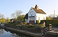 Benson Lock - geograph.org.uk - 5581844.jpg 1,024 × 653; 133 KB
-
 Benson Lock and weir - geograph.org.uk - 1960087.jpg 1,500 × 1,000; 188 KB
-
 Bike at number five - geograph.org.uk - 2504972.jpg 1,024 × 768; 278 KB
-
 Bike at the gate - geograph.org.uk - 2504734.jpg 1,024 × 768; 294 KB
-
 Block by the gate - geograph.org.uk - 1749872.jpg 1,024 × 768; 274 KB
-
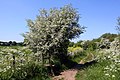
 Blossom by the Thames - geograph.org.uk - 1960095.jpg 1,500 × 1,000; 287 KB
-
 Boats on the River Thames - geograph.org.uk - 2382687.jpg 1,500 × 1,000; 280 KB
-
 Brethren's Meeting Room - geograph.org.uk - 1734885.jpg 1,600 × 1,200; 504 KB
-
 Brethren's Meeting Room. Way In - geograph.org.uk - 1734926.jpg 1,600 × 1,200; 597 KB
-
 Bridge on Mackney Lane - geograph.org.uk - 2515144.jpg 1,024 × 768; 359 KB
-
 Bridge to the cricket field - geograph.org.uk - 2520317.jpg 600 × 800; 193 KB
-
 Bridleway by a field - geograph.org.uk - 2382590.jpg 1,500 × 1,000; 354 KB
-
 Bridleway to North Farm - geograph.org.uk - 2382601.jpg 1,500 × 1,000; 400 KB
-
 Bridleway to North Moreton - geograph.org.uk - 3694295.jpg 1,500 × 999; 243 KB
-
 Bridleway to Shillingford Bridge - geograph.org.uk - 2382606.jpg 1,500 × 1,000; 353 KB
-
 Bridleway to the Thames Path - geograph.org.uk - 2382588.jpg 1,500 × 1,000; 354 KB
-
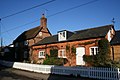 Bakers and pub - geograph.org.uk - 1671455.jpg 1,024 × 683; 144 KB
-
 Brightwell West End - geograph.org.uk - 921284.jpg 640 × 351; 63 KB
-
 Disc on the wall - geograph.org.uk - 1671118.jpg 533 × 800; 106 KB
-
 Door on the end - geograph.org.uk - 1672188.jpg 1,024 × 683; 113 KB
-
 Local builder - geograph.org.uk - 1671124.jpg 1,024 × 683; 208 KB
-
 Mark on the stone - geograph.org.uk - 1670082.jpg 533 × 800; 158 KB
-
 Postbox by the footpath - geograph.org.uk - 1671368.jpg 533 × 800; 74 KB
-
 Rectory on Brightwell Street - geograph.org.uk - 1672182.jpg 533 × 800; 107 KB
-
 Woodman on Brightwell Street - geograph.org.uk - 1671435.jpg 533 × 800; 98 KB
-
 Brightwell Barrow - geograph.org.uk - 2733308.jpg 1,600 × 1,067; 474 KB
-
 Brightwell cum Sotwell from A4130 - geograph.org.uk - 3671621.jpg 640 × 430; 61 KB
-
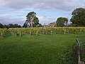 Brightwell Vineyard, Wallingford - geograph.org.uk - 72607.jpg 640 × 480; 97 KB
-
 Discs along the wall - geograph.org.uk - 1671120.jpg 1,024 × 683; 168 KB
-
 Garage along Brightwell Street - geograph.org.uk - 1671386.jpg 1,024 × 683; 131 KB
-
 Inscription over the window - geograph.org.uk - 1670099.jpg 533 × 800; 113 KB
-

-
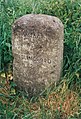
 Parish stone, Brightwell-cum-Sotwell - geograph.org.uk - 920105.jpg 640 × 480; 116 KB
-
 Small sign on the wall - geograph.org.uk - 1671444.jpg 1,024 × 683; 172 KB
-
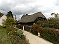
 Thatched cottage on Church Lane - geograph.org.uk - 1671342.jpg 1,024 × 683; 98 KB
-
 The school - geograph.org.uk - 1671130.jpg 1,024 × 683; 192 KB
-
 Brightwell-Cum-Sotwell - geograph.org.uk - 1751044.jpg 1,024 × 768; 114 KB
-
 Brightwell-Cum-Sotwell cricket pavilion - geograph.org.uk - 2520325.jpg 1,024 × 768; 214 KB
-
 Brightwell-cum-Sotwell, Fence post - geograph.org.uk - 1871809.jpg 1,024 × 768; 268 KB
-
 BT hut on Shillingford Road - geograph.org.uk - 2813723.jpg 683 × 1,024; 284 KB
-
 Buildings at Highlands Farm - geograph.org.uk - 2030515.jpg 1,024 × 768; 175 KB
-
 Bus stop on the street - geograph.org.uk - 1671585.jpg 1,024 × 683; 280 KB
-
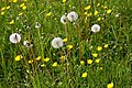 Buttercups and dandelions in a field - geograph.org.uk - 2382705.jpg 1,500 × 1,000; 296 KB
-
 Byway to Brightwell-cum-Sotwell - geograph.org.uk - 2321876.jpg 1,500 × 1,000; 392 KB
-
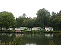 Caravan Park by the River Thames - geograph.org.uk - 4690255.jpg 2,592 × 1,944; 955 KB
-
 Caravan park near Shillingford - geograph.org.uk - 2535173.jpg 1,024 × 680; 261 KB
-
 Cars on the Wantage Road - geograph.org.uk - 1736408.jpg 1,024 × 683; 159 KB
-
 Cats in the garden - geograph.org.uk - 1671532.jpg 1,024 × 683; 235 KB
-
 Chapel by the road - geograph.org.uk - 2520439.jpg 1,024 × 768; 178 KB
-
-
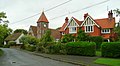
 Houses past the tree - geograph.org.uk - 1671139.jpg 1,024 × 683; 143 KB
-
 Church Lane - geograph.org.uk - 1671356.jpg 1,024 × 683; 221 KB
-

-
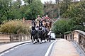 Coach ^ Horses on Shillingford Bridge - geograph.org.uk - 2664563.jpg 3,612 × 2,380; 1.53 MB
-
 Cob wall in St Agatha's churchyard - geograph.org.uk - 2321849.jpg 1,500 × 1,000; 303 KB
-
 Cold Moggy - geograph.org.uk - 1671376.jpg 1,024 × 683; 148 KB
-
 Cottage off the lane - geograph.org.uk - 2515309.jpg 1,024 × 768; 302 KB
-
 Country lane, Brightwell-Cum-Sotwell, Oxfordshire - geograph.org.uk - 4700941.jpg 4,953 × 3,407; 5.47 MB
-
 Crop in the ground - geograph.org.uk - 2652533.jpg 1,024 × 768; 185 KB
-
 Cycleway to Long Wittenham - geograph.org.uk - 2321887.jpg 1,500 × 1,000; 349 KB
-
 Cycleway to Long Wittenham - geograph.org.uk - 2321888.jpg 1,500 × 1,000; 440 KB
-
 Didcot Power Station - geograph.org.uk - 1750993.jpg 1,024 × 768; 83 KB
-
 Didcot Road - geograph.org.uk - 2679893.jpg 640 × 480; 96 KB
-
 Didcot Road at junction with closed road - geograph.org.uk - 4644198.jpg 1,024 × 683; 233 KB
-
 Ditch and culvert beside North Farm access road - geograph.org.uk - 2850418.jpg 1,024 × 683; 262 KB
-
 Diverted Footpath by North Farm - geograph.org.uk - 2754553.jpg 1,600 × 1,067; 431 KB
-

-
 Dried reeds by the Thames - geograph.org.uk - 1960136.jpg 1,500 × 1,000; 301 KB
-
 Entrance to Highlands Farm - geograph.org.uk - 1749902.jpg 1,024 × 768; 254 KB
-
 Farm building on Sotwell Hill - geograph.org.uk - 2819423.jpg 1,024 × 683; 141 KB
-
 Farm track in Mackney - geograph.org.uk - 3694282.jpg 1,500 × 999; 215 KB
-
 Farm track, Brightwell-cum-Sotwell - geograph.org.uk - 6157133.jpg 1,024 × 768; 205 KB
-
 Farmland Near Brightwell - geograph.org.uk - 2555358.jpg 3,648 × 2,736; 2.57 MB
-
 Farmland, Brightwell - geograph.org.uk - 2817519.jpg 640 × 480; 111 KB
-
 Farmland, Brightwell-cum-Sotwell - geograph.org.uk - 2680062.jpg 640 × 427; 165 KB
-
 Farmland, Brightwell-cum-Sotwell - geograph.org.uk - 2680070.jpg 640 × 480; 134 KB
-
 Farmland, Brightwell-cum-Sotwell - geograph.org.uk - 5934492.jpg 1,024 × 768; 231 KB
-
 Farmland, Sotwell - geograph.org.uk - 2817535.jpg 640 × 480; 164 KB
-
 Farmland, Sotwell - geograph.org.uk - 2817537.jpg 640 × 480; 193 KB
-
-
 Field at Slade End - geograph.org.uk - 2504949.jpg 1,024 × 768; 190 KB
-
 Field by the hedge - geograph.org.uk - 2512275.jpg 1,024 × 768; 226 KB
-
 Field by the River Thames - geograph.org.uk - 2382631.jpg 1,500 × 1,000; 278 KB
-
 Field edge on the Bypass - geograph.org.uk - 2652553.jpg 1,024 × 768; 201 KB
-
 Field towards Mackney - geograph.org.uk - 2512307.jpg 1,024 × 768; 190 KB
-
 Field towards Slade End - geograph.org.uk - 2515123.jpg 1,024 × 768; 192 KB
-
 Flat Field with Dead Weeds - geograph.org.uk - 2274361.jpg 3,560 × 2,456; 1.36 MB
-
 Flooded Furrows - geograph.org.uk - 3268921.jpg 2,199 × 1,671; 1.09 MB
-
 Footpath heading to Sires Hill - geograph.org.uk - 2769691.jpg 640 × 480; 88 KB
-
 Footpath in Slade End - geograph.org.uk - 2321826.jpg 1,500 × 1,000; 322 KB
-
 Footpath past the house - geograph.org.uk - 2511360.jpg 1,024 × 768; 243 KB
-
 Footpath past the house - geograph.org.uk - 2515986.jpg 1,024 × 768; 372 KB
-
 Footpath sign beside Shillingford Road - geograph.org.uk - 2819284.jpg 683 × 1,024; 298 KB
-
 Footpath through the churchyard - geograph.org.uk - 2321598.jpg 1,500 × 1,000; 256 KB
-
 Footpath to High Road - geograph.org.uk - 2321869.jpg 1,500 × 1,000; 290 KB
-
 Footpath to Mackney - geograph.org.uk - 2504013.jpg 1,024 × 787; 309 KB
-
 Footpath to Mackney - geograph.org.uk - 2769774.jpg 640 × 480; 103 KB
-
 Footpath to North Moreton - geograph.org.uk - 2515317.jpg 1,024 × 768; 201 KB
-
 Footpath to Slade End - geograph.org.uk - 2504944.jpg 1,024 × 768; 300 KB
-
 Footpath to Sotwell - geograph.org.uk - 2515132.jpg 600 × 800; 158 KB
-
 Footpath to the River Thames - geograph.org.uk - 2382610.jpg 1,500 × 1,000; 181 KB
-
 Footpath to Wallingford - geograph.org.uk - 2321591.jpg 1,500 × 1,000; 293 KB
-
 Footpath to Wallingford - geograph.org.uk - 2679859.jpg 640 × 480; 94 KB
-
 Gate the other side - geograph.org.uk - 2504739.jpg 1,024 × 768; 284 KB
-
 Gateway beside Shillingford Road - geograph.org.uk - 2818703.jpg 1,024 × 683; 285 KB
-
 Gateway in Brightwell-cum-Sotwell - geograph.org.uk - 2321818.jpg 1,500 × 1,000; 357 KB
-
 Gateway to the church - geograph.org.uk - 2321859.jpg 1,500 × 995; 373 KB
-
 Greenmere, Brightwell - geograph.org.uk - 2727614.jpg 3,584 × 2,620; 1.41 MB
-
 Hagbourne hill direction - geograph.org.uk - 1750954.jpg 600 × 800; 101 KB
-
 Halfway along the track - geograph.org.uk - 1655167.jpg 640 × 480; 80 KB
-
 Heavy Metal Stile - geograph.org.uk - 2461189.jpg 1,856 × 1,438; 1.01 MB
-
 Hedge on Sotwell Street - geograph.org.uk - 1672147.jpg 1,024 × 683; 148 KB
-
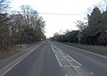
 High Road - geograph.org.uk - 2679903.jpg 640 × 480; 79 KB
-
 High Road past Brightwell-cum-Sotwell - geograph.org.uk - 2321880.jpg 1,500 × 1,000; 149 KB
-
 High Road, Brightwell-cum-Sotwell - geograph.org.uk - 4972670.jpg 2,048 × 1,536; 1.07 MB
-
 High Road, Brightwell-cum-Sotwell - geograph.org.uk - 913205.jpg 640 × 480; 109 KB
-
 Highlands Farm - geograph.org.uk - 1750970.jpg 1,024 × 768; 185 KB
-
 Highlands Farm - geograph.org.uk - 1751081.jpg 1,024 × 768; 201 KB
-
 Highlands Farm and Brightwell Barrow - geograph.org.uk - 912326.jpg 640 × 286; 45 KB
-
 Hithercroft direction - geograph.org.uk - 2514247.jpg 1,024 × 768; 236 KB
-
 House and Chapel - geograph.org.uk - 2520434.jpg 1,024 × 768; 159 KB
-
 House at junction of High Road and Bell Lane - geograph.org.uk - 2850451.jpg 1,024 × 683; 126 KB
-
 House at North Farm - geograph.org.uk - 2850381.jpg 1,024 × 683; 142 KB
-
 House at North Farm - geograph.org.uk - 2850394.jpg 1,024 × 683; 184 KB
-
 Houses off Sotwell Street - geograph.org.uk - 1672160.jpg 1,024 × 683; 181 KB
-
 Houses on Brightwell Street - geograph.org.uk - 1671480.jpg 1,024 × 683; 122 KB
-
 Housing at Slade End Farm - geograph.org.uk - 5311167.jpg 1,024 × 649; 222 KB
-
 Impressive looking mooring - geograph.org.uk - 1219548.jpg 640 × 426; 81 KB
-
 Junction of routes at North Farm - geograph.org.uk - 2850424.jpg 1,024 × 683; 237 KB
-
 King's Meadow, Wallingford - geograph.org.uk - 4688103.jpg 2,592 × 1,944; 1.96 MB
-
 Lake by Bishops court - geograph.org.uk - 1751018.jpg 1,024 × 768; 137 KB
-
 Lamb on a log - geograph.org.uk - 2382593.jpg 1,500 × 1,014; 355 KB
-
 Land at Slade end - geograph.org.uk - 2511362.jpg 1,024 × 768; 215 KB
-
 Lawn by the river - geograph.org.uk - 1220890.jpg 640 × 426; 81 KB
-
 Looking across the Thames at Benson - geograph.org.uk - 1960702.jpg 1,000 × 1,500; 347 KB
-
 Looking across the Thames at Preston Crowmarsh - geograph.org.uk - 1960131.jpg 1,500 × 1,000; 208 KB
-
 Looking past Wallingford - geograph.org.uk - 1750965.jpg 600 × 800; 129 KB
-
 Looking towards Hithercroft - geograph.org.uk - 2514250.jpg 1,024 × 768; 199 KB
-
 Looking towards Slade End - geograph.org.uk - 1736403.jpg 1,024 × 683; 117 KB
-
 Looking up to Brightwell Barrow - geograph.org.uk - 1751069.jpg 1,024 × 768; 140 KB
-
 Lucks All - geograph.org.uk - 2520314.jpg 1,024 × 768; 250 KB
-
 Mackney Field with Bird House - geograph.org.uk - 2274422.jpg 3,888 × 2,592; 1.38 MB
-
 Mackney Lane - geograph.org.uk - 1671601.jpg 533 × 800; 95 KB
-
 Mackney Lane - geograph.org.uk - 2769790.jpg 640 × 480; 138 KB
-
 Mackney Lane - geograph.org.uk - 3694278.jpg 1,500 × 999; 217 KB
-
 Mackney Lane - geograph.org.uk - 3694287.jpg 1,500 × 999; 280 KB
-
 Mackney Lane - geograph.org.uk - 920113.jpg 640 × 480; 151 KB
-
 Markers on the footpath - geograph.org.uk - 1749936.jpg 600 × 800; 122 KB
-
 Middle Farm Barn Brightwell cum Sotwell(1).jpg 3,264 × 2,448; 2.11 MB
-
 Mill Brook Footpath - geograph.org.uk - 2083567.jpg 1,728 × 1,339; 743 KB
-
 Mill Brook in the Frost - geograph.org.uk - 2083579.jpg 2,048 × 1,536; 957 KB
-

-
 Molehills in the Meadow - geograph.org.uk - 2727822.jpg 1,600 × 1,200; 819 KB
-
 No Path Here - geograph.org.uk - 2764825.jpg 1,024 × 655; 122 KB
-
 Old Didcot Road - geograph.org.uk - 2512673.jpg 3,760 × 2,232; 1.21 MB
-
 Old Milestone by High Road, Brightwell-cum-Sotwell (geograph 5383479).jpg 1,050 × 1,543; 310 KB
-
 Old Nursery lane - geograph.org.uk - 1671110.jpg 1,024 × 683; 128 KB
-
 Old pear orchard - geograph.org.uk - 754349.jpg 640 × 480; 90 KB
-
 Open Air Pool, Shillingford - geograph.org.uk - 3101240.jpg 4,288 × 3,216; 3.62 MB
-
 Orange tip butterfly on yellow flowers - geograph.org.uk - 2382715.jpg 1,500 × 1,043; 108 KB
-
 Ordnance Survey triangulation station - geograph.org.uk - 2819260.jpg 1,024 × 683; 288 KB


.jpg)


.jpg)


