Category:Brinton, Norfolk
Jump to navigation
Jump to search
English: Brinton is a village and a civil parish in the English county of Norfolk. The village is 10.8 miles east north east of the town of Fakenham, 13.1 miles west south west of Cromer and 125 miles north north east of London. The nearest railway station is at Sheringham for the Bittern Line which runs between Sheringham, Cromer and Norwich. The nearest airport is Norwich International Airport.
village and civil parish in Norfolk, United Kingdom | |||||
| Upload media | |||||
| Instance of | |||||
|---|---|---|---|---|---|
| Location | North Norfolk, Norfolk, East of England, England | ||||
| Area |
| ||||
 | |||||
Subcategories
This category has the following 2 subcategories, out of 2 total.
A
S
Media in category "Brinton, Norfolk"
The following 80 files are in this category, out of 80 total.
-
 A section of the old Holt Road - geograph.org.uk - 3975562.jpg 640 × 480; 214 KB
-
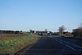
 A148 near Sharrington - geograph.org.uk - 3835053.jpg 640 × 430; 90 KB
-
 A148 near Sharrington - geograph.org.uk - 4644154.jpg 640 × 480; 338 KB
-

-
 A148, eastbound - geograph.org.uk - 3835057.jpg 640 × 430; 38 KB
-
 All Saints Church, Sharrington - geograph.org.uk - 2737723.jpg 4,320 × 3,240; 4.79 MB
-
 All Saints, Sharrington - Brass WWII - geograph.org.uk - 4168245.jpg 900 × 613; 185 KB
-
 All Saints, Sharrington - Corbel - geograph.org.uk - 4168250.jpg 900 × 747; 175 KB
-
 All Saints, Sharrington - Corbel - geograph.org.uk - 4168254.jpg 900 × 754; 221 KB
-
 All Saints, Sharrington - Corbel - geograph.org.uk - 4168256.jpg 900 × 813; 204 KB
-
 All Saints, Sharrington - Corbel - geograph.org.uk - 4168258.jpg 900 × 763; 231 KB
-
 All Saints, Sharrington - Corbel - geograph.org.uk - 4168259.jpg 900 × 859; 186 KB
-
 All Saints, Sharrington - Corbel - geograph.org.uk - 4168263.jpg 900 × 775; 204 KB
-
 All Saints, Sharrington - Corbel - geograph.org.uk - 4168266.jpg 900 × 780; 244 KB
-
 All Saints, Sharrington - Corbel - geograph.org.uk - 4168268.jpg 900 × 762; 208 KB
-
 All Saints, Sharrington - Corbel - geograph.org.uk - 4168270.jpg 900 × 744; 209 KB
-
 All Saints, Sharrington - East end - geograph.org.uk - 4168239.jpg 900 × 598; 164 KB
-
 All Saints, Sharrington - East end - geograph.org.uk - 4168241.jpg 900 × 612; 151 KB
-
 All Saints, Sharrington - Font - geograph.org.uk - 4168271.jpg 627 × 900; 136 KB
-
 All Saints, Sharrington - Gravestone - geograph.org.uk - 4147478.jpg 668 × 1,000; 323 KB
-
 All Saints, Sharrington - Gravestone - geograph.org.uk - 4147481.jpg 664 × 1,000; 278 KB
-
 All Saints, Sharrington - Gravestone - geograph.org.uk - 4147482.jpg 678 × 1,000; 298 KB
-
 All Saints, Sharrington - Gravestone - geograph.org.uk - 4147484.jpg 648 × 1,000; 227 KB
-
 All Saints, Sharrington - Pulpit - geograph.org.uk - 4168247.jpg 600 × 900; 153 KB
-
 All Saints, Sharrington - Royal Arms - geograph.org.uk - 4168236.jpg 900 × 776; 293 KB
-

-

-
 An old hand pump at Brinton Hall - geograph.org.uk - 4581338.jpg 480 × 640; 196 KB
-
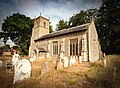
 Brinton St Andrew's church - geograph.org.uk - 2261708.jpg 640 × 480; 137 KB
-
 Brinton Village by the church - geograph.org.uk - 1565298.jpg 640 × 426; 60 KB
-
 Brinton Village by the Church - geograph.org.uk - 1565301.jpg 640 × 427; 79 KB
-
 Brinton Village Post Box - geograph.org.uk - 2213525.jpg 1,024 × 768; 199 KB
-
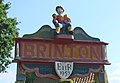 Brinton village sign (detail) - geograph.org.uk - 4418564.jpg 1,024 × 711; 185 KB
-
 Brinton village sign - geograph.org.uk - 3014665.jpg 480 × 640; 121 KB
-
 Brinton Village Sign - geograph.org.uk - 5584121.jpg 480 × 640; 100 KB
-
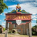 Brinton Village Sign.jpg 3,878 × 3,908; 4.35 MB
-
 Brinton, Norfolk 2022.jpg 6,375 × 4,554; 9.65 MB
-

-
 Crop field beside the B1156 - geograph.org.uk - 4160014.jpg 1,600 × 1,066; 678 KB
-
 Crop field with distant trees - geograph.org.uk - 3851425.jpg 3,088 × 2,056; 3.63 MB
-
 Crossroads in the village of Brinton - geograph.org.uk - 2270439.jpg 640 × 478; 183 KB
-
 Disused section of Holt Road - geograph.org.uk - 3975555.jpg 640 × 480; 212 KB
-
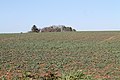
 Farm buildings in the village of Brinton - geograph.org.uk - 2270440.jpg 640 × 480; 159 KB
-

-
 Fields north of the A148 road - geograph.org.uk - 3975557.jpg 640 × 480; 180 KB
-
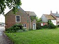 Houses in Brinton - geograph.org.uk - 3014679.jpg 640 × 480; 100 KB
-
 Ivy-clad oak tree - geograph.org.uk - 4057472.jpg 1,024 × 636; 284 KB
-
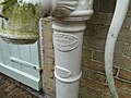 Manufacturer's nameplate on village pump - geograph.org.uk - 4628475.jpg 3,456 × 2,592; 3.95 MB
-
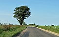
 Mature trees by the roadside - geograph.org.uk - 6229987.jpg 1,767 × 1,144; 446 KB
-
 Minor road from Brinton to Sharrington - geograph.org.uk - 2270442.jpg 640 × 480; 150 KB
-
 Norfolk County Council Signpost - geograph.org.uk - 914444.jpg 640 × 427; 216 KB
-
 Norfolk signpost - geograph.org.uk - 1565274.jpg 640 × 528; 86 KB
-
 Permissive Path Markers - geograph.org.uk - 914468.jpg 427 × 640; 195 KB
-
 Remains of an ancient cross - geograph.org.uk - 3014683.jpg 640 × 480; 112 KB
-
 Right turn to Langham and Blakeney - geograph.org.uk - 3161340.jpg 640 × 425; 88 KB
-

-
-

-
-

-
 Sharrington All Saints' church - geograph.org.uk - 2263535.jpg 640 × 480; 279 KB
-
 Sharrington All Saints' church - geograph.org.uk - 2270125.jpg 640 × 480; 108 KB
-
 Sharrington village sign (detail) - geograph.org.uk - 4581337.jpg 640 × 480; 195 KB
-
 Sharrington village sign - geograph.org.uk - 4581332.jpg 640 × 480; 217 KB
-
 St Andrew Parish Church Brinton Norfolk 2022.jpg 5,403 × 3,958; 8.91 MB
-
 The A148 - geograph.org.uk - 6229691.jpg 2,000 × 1,333; 2.23 MB
-
 The church of All Saints in Sharrington - geograph.org.uk - 2270438.jpg 565 × 640; 155 KB
-
 The old preaching cross at Sharrington - geograph.org.uk - 5616263.jpg 2,592 × 3,456; 3.06 MB
-
 The Street, Brinton - geograph.org.uk - 5584137.jpg 640 × 480; 91 KB
-
 The War Memorial in Brinton church - geograph.org.uk - 4586706.jpg 3,456 × 2,592; 1.87 MB
-
 To Dereham 15 - geograph.org.uk - 1639873.jpg 640 × 480; 129 KB
-
 Valley Farm - geograph.org.uk - 3014649.jpg 640 × 480; 75 KB
-
 Valley Farm - geograph.org.uk - 550644.jpg 640 × 480; 67 KB
-

-

-
 View towards Bullfer Grove - geograph.org.uk - 550672.jpg 640 × 480; 86 KB
-

-
 Brinton - geograph.org.uk - 120103.jpg 640 × 426; 101 KB
-
 Brinton - geograph.org.uk - 120106.jpg 640 × 423; 117 KB
-
 Brinton - geograph.org.uk - 120109.jpg 640 × 425; 103 KB


_-_geograph.org.uk_-_4418564.jpg)


_-_geograph.org.uk_-_4581337.jpg)


