Category:Brisley
Jump to navigation
Jump to search
English: Brisley is a village in the English county of Norfolk located about halfway between Fakenham and East Dereham. It covers an area of and had a population of 276 in 117 households as of the
village in the United Kingdom .JPG) | |||||
| Upload media | |||||
| Instance of | |||||
|---|---|---|---|---|---|
| Location | Breckland, Norfolk, East of England, England | ||||
| Area |
| ||||
| official website | |||||
 | |||||
Subcategories
This category has the following 4 subcategories, out of 4 total.
B
- Brisley War Memorial (3 F)
T
- The Bell, Brisley (6 F)
Media in category "Brisley"
The following 39 files are in this category, out of 39 total.
-
 Alms Cottages, Brisley - geograph.org.uk - 451676.jpg 640 × 480; 148 KB
-
 B1146 with 7 miles to Fakenham - geograph.org.uk - 5015228.jpg 1,987 × 1,338; 1.77 MB
-
 Bilney Hall - geograph.org.uk - 505070.jpg 640 × 427; 85 KB
-
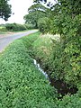
 Bridge over Panford Beck - geograph.org.uk - 523467.jpg 640 × 480; 136 KB
-
 Brisley almshouses - geograph.org.uk - 4128029.jpg 4,320 × 3,240; 2.87 MB
-
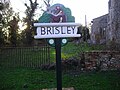
 Brisley village sign - geograph.org.uk - 4128081.jpg 4,320 × 3,240; 2.92 MB
-
 Brisley Village Sign 7th November 2007 (1).JPG 2,560 × 1,920; 954 KB
-
 Brisley, 'Alms Cottage', Church Street - geograph.org.uk - 6177933.jpg 6,349 × 4,232; 6.07 MB
-
 Brisley, 'Oak House, Church Street - geograph.org.uk - 6177931.jpg 6,590 × 4,394; 7.39 MB
-
 Brisley, A field of buttercups - geograph.org.uk - 6177928.jpg 6,753 × 4,502; 5.56 MB
-

-
 Brisley, The junction of School Road and Gately Road - geograph.org.uk - 6177623.jpg 7,010 × 4,673; 6.99 MB
-
 Driveway to Old Hall Farm - geograph.org.uk - 574758.jpg 640 × 480; 64 KB
-

-
 Gateley, Farmland - geograph.org.uk - 6092181.jpg 6,258 × 4,171; 7.2 MB
-
 Gateley, Farmland - geograph.org.uk - 6092184.jpg 5,596 × 3,730; 6.48 MB
-
 Gateley, Gateley Road - geograph.org.uk - 6092185.jpg 5,095 × 3,397; 4.74 MB
-
-
 Manor Farm, Brisley Green - geograph.org.uk - 5978691.jpg 1,600 × 1,064; 790 KB
-
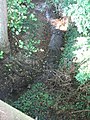 Panford Beck gathers strength.jpg 480 × 640; 163 KB
-
 Pillbox on Elmham Road, Brisley Green - geograph.org.uk - 5978689.jpg 1,600 × 1,064; 925 KB
-
 View NE towards The Green - geograph.org.uk - 574772.jpg 640 × 480; 91 KB
-
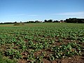
 View north across farmland - geograph.org.uk - 574751.jpg 640 × 480; 61 KB
-
 Village Sign - geograph.org.uk - 1269241.jpg 480 × 640; 112 KB
-
 Water tower - geograph.org.uk - 383783.jpg 480 × 640; 96 KB
-
 Where the B1145 becomes the B1146 - geograph.org.uk - 4562253.jpg 640 × 480; 123 KB
-
 WW2 pillbox, Brisley - geograph.org.uk - 4128116.jpg 4,320 × 3,240; 3.67 MB
-
 A perfectly round pond - geograph.org.uk - 574755.jpg 640 × 480; 95 KB
-
 Black Water from East Bilney Bridge - geograph.org.uk - 588315.jpg 640 × 425; 115 KB
-
 Black Water from East Bilney Bridge - geograph.org.uk - 588330.jpg 425 × 640; 112 KB
-
 Field boundary at Brisley - geograph.org.uk - 505036.jpg 640 × 427; 95 KB
-
 Footpath to Brisley. - geograph.org.uk - 505064.jpg 427 × 640; 111 KB
-
 Footpath to Broom Hill - geograph.org.uk - 574765.jpg 480 × 640; 105 KB
-

-
 Harper's Green pumping station - geograph.org.uk - 504991.jpg 640 × 427; 67 KB
-
 Heading south on Fludge's Lane - geograph.org.uk - 574757.jpg 640 × 480; 47 KB
-
 Old Hall Farm - geograph.org.uk - 574760.jpg 640 × 480; 79 KB
-
 Park Farm near Great Heath - geograph.org.uk - 525313.jpg 640 × 460; 50 KB
-
 Restricted Byway to Bilney Common - geograph.org.uk - 574749.jpg 480 × 640; 101 KB


