Category:Brompton Ralph
Jump to navigation
Jump to search
English: Brompton Ralph is a village and civil parish in the West Somerset district of Somerset, England, about north of Wiveliscombe. It is in a wooded district at the eastern extremity of the Brendon Hills. According to the 2002 population estimates it had a population of 245.
village and civil parish in Somerset, United Kingdom  | |||||
| Upload media | |||||
| Instance of | |||||
|---|---|---|---|---|---|
| Location | Somerset West and Taunton, Somerset, South West England, England | ||||
| Population |
| ||||
| Said to be the same as | Brompton Ralph (Wikimedia duplicated page, civil parish) | ||||
 | |||||
Subcategories
This category has only the following subcategory.
S
Media in category "Brompton Ralph"
The following 88 files are in this category, out of 88 total.
-
 A field above Elworthy - geograph.org.uk - 3116331.jpg 640 × 360; 237 KB
-
 A strip wood - geograph.org.uk - 3119300.jpg 640 × 360; 289 KB
-
 B3188 at Chilcombe Bridge - geograph.org.uk - 1843552.jpg 640 × 436; 107 KB
-
 B3188 at Chilcombe Bridge - geograph.org.uk - 1843593.jpg 640 × 480; 93 KB
-
 B3188 at Parks Cottage - geograph.org.uk - 1843602.jpg 528 × 640; 92 KB
-
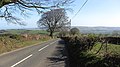
 B3188 heading south to Pitsford Hill - geograph.org.uk - 3936858.jpg 640 × 480; 189 KB
-
 B3188 near Pitsford Hill - geograph.org.uk - 1945595.jpg 640 × 469; 103 KB
-
 B3224 - geograph.org.uk - 3119309.jpg 640 × 360; 232 KB
-
 B3224 near Holcombe Water - geograph.org.uk - 1942506.jpg 640 × 480; 98 KB
-
 B3224, Elsworthy - geograph.org.uk - 3116337.jpg 640 × 360; 241 KB
-
 Bend near Elworthy Barrows - geograph.org.uk - 1902425.jpg 640 × 447; 71 KB
-
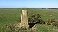 Brompton Ralph trig point - geograph.org.uk - 3119280.jpg 640 × 360; 229 KB
-
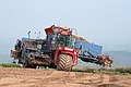 Brompton Ralph, beet crop harvester - geograph.org.uk - 157049.jpg 640 × 427; 123 KB
-

-

-
 Brompton Ralph, Rook's Nest - geograph.org.uk - 152274.jpg 640 × 427; 129 KB
-
 Brompton Ralph, swede crop - geograph.org.uk - 157044.jpg 640 × 427; 143 KB
-
 Combe Bottom - geograph.org.uk - 1902585.jpg 488 × 640; 118 KB
-
 Cording's Cleeve - geograph.org.uk - 1939620.jpg 480 × 640; 137 KB
-
 Cottage on Shurtland Lane - geograph.org.uk - 3393145.jpg 1,024 × 768; 250 KB
-
 Double bend on Cording's Ball - geograph.org.uk - 1956002.jpg 640 × 419; 73 KB
-
 Elsworthy Barrows - geograph.org.uk - 3116353.jpg 640 × 360; 182 KB
-
 Elsworthy Barrows triangulation pillar - geograph.org.uk - 3119253.jpg 640 × 360; 221 KB
-
 Elworthy , B3224 - geograph.org.uk - 6563222.jpg 5,847 × 3,899; 4.29 MB
-
 Elworthy , B3224 - geograph.org.uk - 6563223.jpg 6,000 × 4,000; 7.33 MB
-
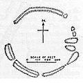 Elworthy Barrows Somerset Map.jpg 300 × 300; 16 KB
-

-
 Entrance to a field from the B3188 - geograph.org.uk - 3936864.jpg 640 × 480; 165 KB
-
 Field next to the B3188 - geograph.org.uk - 3936857.jpg 640 × 480; 129 KB
-
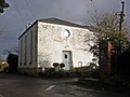 Former Chapel, Brompton Ralph - geograph.org.uk - 4275379.jpg 1,024 × 768; 181 KB
-
 Former quarry track - geograph.org.uk - 3908588.jpg 1,024 × 768; 263 KB
-
 Gandstone Cross - geograph.org.uk - 3458421.jpg 1,024 × 736; 161 KB
-
 Gated track - geograph.org.uk - 1491299.jpg 640 × 480; 84 KB
-
 Higher House Farm - geograph.org.uk - 3908621.jpg 1,024 × 768; 220 KB
-
 Hill by Cording's Cleeve - geograph.org.uk - 1939631.jpg 640 × 480; 109 KB
-
 Lane at Moor Mill - geograph.org.uk - 1745046.jpg 480 × 640; 107 KB
-
 Lane junction above Brompton Ralph - geograph.org.uk - 1902461.jpg 640 × 480; 95 KB
-
 Lane near Elworthy Barrows - geograph.org.uk - 1902415.jpg 640 × 480; 102 KB
-
 Lane near Glebe Farm - geograph.org.uk - 1902480.jpg 480 × 640; 125 KB
-
 Lane to Brompton Ralph - geograph.org.uk - 1902522.jpg 640 × 458; 79 KB
-
 Lane to Elworthy Barrows - geograph.org.uk - 1902445.jpg 640 × 438; 96 KB
-
 Lane to Northcombe Farm - geograph.org.uk - 3393154.jpg 1,024 × 768; 206 KB
-
 Looking down on Westcott Farm - geograph.org.uk - 4275355.jpg 1,024 × 768; 171 KB
-
 Lower Wedcombe Farm - geograph.org.uk - 3458314.jpg 1,024 × 788; 181 KB
-
 Marl pit at Elworthy Barrows - geograph.org.uk - 4187920.jpg 1,024 × 768; 193 KB
-
 Marl pit, Elsworthy Barrows - geograph.org.uk - 3119240.jpg 640 × 360; 221 KB
-
 Minor road to Brompton Ralph - geograph.org.uk - 3908593.jpg 1,024 × 800; 177 KB
-
 Minor road to Forche's Cross - geograph.org.uk - 4274896.jpg 1,024 × 768; 245 KB
-
 Molehills - geograph.org.uk - 3116358.jpg 640 × 360; 213 KB
-
 Oddwell Cottage, Brompton Ralph - geograph.org.uk - 3393161.jpg 1,024 × 768; 154 KB
-
 Parks Cottage - geograph.org.uk - 1843519.jpg 640 × 480; 99 KB
-
 Pitsford Hill - geograph.org.uk - 3459401.jpg 1,024 × 768; 153 KB
-
 Pitsford Hill - geograph.org.uk - 3908578.jpg 1,024 × 827; 152 KB
-
 Pool Mill - geograph.org.uk - 1902557.jpg 480 × 640; 135 KB
-
 Pool Mill - geograph.org.uk - 4275507.jpg 1,024 × 768; 237 KB
-
 Road junction, near Moor Hill Farm - geograph.org.uk - 4275814.jpg 1,024 × 808; 212 KB
-
 Road to Pitsford Hill - geograph.org.uk - 3936856.jpg 640 × 480; 138 KB
-
 Roadside cottage, near Chilcombe Farm - geograph.org.uk - 3458295.jpg 1,024 × 768; 172 KB
-

-
 The B3224 descending to Elworthy - geograph.org.uk - 5591047.jpg 2,592 × 1,944; 1.3 MB
-
 The Old Rectory, Brompton Ralph - geograph.org.uk - 3393115.jpg 1,024 × 768; 236 KB
-
 The Old School House, Brompton Ralph - geograph.org.uk - 3458327.jpg 1,024 × 768; 201 KB
-
 Track leading towards Elworthy Barrows - geograph.org.uk - 3625291.jpg 1,024 × 777; 256 KB
-
 Track through Stone Wood - geograph.org.uk - 4275484.jpg 1,024 × 768; 302 KB
-
 Track to Colwell Farm - geograph.org.uk - 3458302.jpg 1,024 × 768; 315 KB
-
 Track to Courtland Farm - geograph.org.uk - 3458368.jpg 1,024 × 786; 220 KB
-
 Track to Leigh's Cottages - geograph.org.uk - 4275372.jpg 1,024 × 768; 214 KB
-
 Tree on the B3224 - geograph.org.uk - 3908652.jpg 1,024 × 768; 221 KB
-
 Trig Point at Elworthy Barrows - geograph.org.uk - 4187916.jpg 1,024 × 768; 167 KB
-
 Turning for Brompton Ralph - geograph.org.uk - 3458320.jpg 1,024 × 768; 205 KB
-
 Turning for Lumey Farm - geograph.org.uk - 3908628.jpg 1,024 × 768; 255 KB
-
 Turning for Tolland - geograph.org.uk - 3458352.jpg 1,024 × 755; 165 KB
-
 Valley at Chilcombe Farm - geograph.org.uk - 1227907.jpg 640 × 480; 85 KB
-
 View towards Egypt Copse - geograph.org.uk - 3908610.jpg 1,024 × 768; 195 KB
-
 West Somerset , Mast ^ Countryside - geograph.org.uk - 2866995.jpg 4,288 × 2,848; 3.99 MB
-
 West Somerset , The B3224 - geograph.org.uk - 6107187.jpg 6,000 × 4,000; 2.78 MB
-
 West Somerset , The B3224 - geograph.org.uk - 6107189.jpg 6,000 × 4,000; 7.85 MB
-
 Wireless mast on Elworthy Barrows - geograph.org.uk - 3908633.jpg 1,024 × 761; 156 KB
-
 Wood Close Copse - geograph.org.uk - 4275495.jpg 1,024 × 768; 244 KB
-
 Above Moor Mill Farm - geograph.org.uk - 746839.jpg 640 × 480; 92 KB
-
 Brompton Ralph, approaching Lumey Farm - geograph.org.uk - 157031.jpg 640 × 427; 134 KB
-
 Brompton Ralph, lane near Glebe Farm - geograph.org.uk - 157026.jpg 640 × 427; 187 KB
-
 Brompton Ralph, Parks Cottage - geograph.org.uk - 152268.jpg 640 × 427; 129 KB
-
 Brompton Ralph, towards Willett Hill - geograph.org.uk - 157021.jpg 640 × 427; 165 KB
-

-
 Brompton Ralph, track to Leigh's Cottages - geograph.org.uk - 157057.jpg 640 × 427; 143 KB
-
 Burrow Hill - geograph.org.uk - 746829.jpg 640 × 480; 55 KB
-
 Cherry tree near Moor Mill Farm - geograph.org.uk - 746842.jpg 640 × 480; 127 KB


