Category:Bronllys
Jump to navigation
Jump to search
village and community in Powys, Wales   | |||||
| Upload media | |||||
| Instance of | |||||
|---|---|---|---|---|---|
| Location | Powys, Wales | ||||
| Population |
| ||||
| Area |
| ||||
 | |||||
Cymraeg: Pentref a chymuned ym Mhowys, yw Bronllys, weithiau Brwynllys. Saif i'r gogledd-orllewin o dref Talgarth ac ychydig i'r de o Afon Gwy. Ar un adeg roedd yn ganolfan weinyddol Cantref Selyf. Ceir castell mwnt a beili yma, ac mae gan yr eglwys dŵr ar wahan. Adeiladwyd Ysbyty Bronllys fel ysbyty ar gyfer y dicïau. Bu'r bardd Bedo Brwynllys yn byw yma yn y 15fed ganrif.
Subcategories
This category has the following 3 subcategories, out of 3 total.
Media in category "Bronllys"
The following 200 files are in this category, out of 352 total.
(previous page) (next page)-

-

-

-
-
 A4079 Approaching Junction with A479 - geograph.org.uk - 5327977.jpg 640 × 480; 389 KB
-
 A4079 at Boxbush - geograph.org.uk - 4803849.jpg 1,600 × 901; 665 KB
-
 A4079 at Pipton - geograph.org.uk - 4803866.jpg 1,600 × 901; 653 KB
-
 A4079, Pipton - geograph.org.uk - 5327929.jpg 640 × 480; 382 KB
-
 A438 at Pontithel - geograph.org.uk - 318101.jpg 640 × 480; 98 KB
-
 A438 at West Lodge - geograph.org.uk - 4333202.jpg 800 × 451; 177 KB
-
 A438 leaves Bronllys - geograph.org.uk - 2553372.jpg 614 × 640; 82 KB
-
 A438 looking east - geograph.org.uk - 3286259.jpg 640 × 481; 51 KB
-
 A470 at Fforddfawr - geograph.org.uk - 4803827.jpg 1,600 × 901; 651 KB
-
 A470 at Llangoed Farm - geograph.org.uk - 3132367.jpg 640 × 437; 103 KB
-
 A470 at Maes-Megan - geograph.org.uk - 3132233.jpg 640 × 456; 55 KB
-
 A470 at Stockley Cottages - geograph.org.uk - 3132376.jpg 487 × 640; 63 KB
-
 A470 at Stockley Wood - geograph.org.uk - 5328014.jpg 640 × 427; 388 KB
-
 A470 entering Llyswen - geograph.org.uk - 3132234.jpg 640 × 435; 102 KB
-

-
 A470 looking north - geograph.org.uk - 2224782.jpg 640 × 480; 62 KB
-
 A470 near Boughrood - geograph.org.uk - 5328008.jpg 640 × 480; 414 KB
-
 A470 near Llangoed Hall - geograph.org.uk - 3286316.jpg 640 × 480; 68 KB
-
 A470 near The Shrubbery - geograph.org.uk - 3286305.jpg 640 × 481; 70 KB
-
 A470, Llyswen - geograph.org.uk - 2423819.jpg 640 × 480; 115 KB
-
 A470, Llyswen - geograph.org.uk - 2427365.jpg 3,504 × 2,336; 1.37 MB
-
 A470, near Llyswen - geograph.org.uk - 2474920.jpg 640 × 480; 114 KB
-
 A470-A479 junction at Llyswen - geograph.org.uk - 2224777.jpg 640 × 480; 59 KB
-
 A479 at Dderw Wood - geograph.org.uk - 3286294.jpg 640 × 480; 63 KB
-
 A479 at Llyswen, 1 - geograph.org.uk - 4803829.jpg 1,600 × 901; 670 KB
-
 A479 at Llyswen, 2 - geograph.org.uk - 4803830.jpg 1,600 × 901; 708 KB
-
 A479 continues ahead as the A438 - geograph.org.uk - 3286281.jpg 640 × 480; 44 KB
-
 A479 heads from Bronllys to Talgarth - geograph.org.uk - 2658422.jpg 640 × 465; 76 KB
-
 A479 junction at Bronllys - geograph.org.uk - 3286274.jpg 640 × 480; 45 KB
-
 A479 looking north - geograph.org.uk - 3286289.jpg 640 × 481; 70 KB
-
 A479 towards Llyswen - geograph.org.uk - 5327982.jpg 640 × 427; 368 KB
-
 A479, Llyswen - geograph.org.uk - 5327986.jpg 640 × 480; 425 KB
-
 Abersgithwen - geograph.org.uk - 5716456.jpg 640 × 480; 131 KB
-
 Access road for farm from A438 layby - geograph.org.uk - 3070447.jpg 3,648 × 2,736; 3.18 MB
-
 Across Boughrood Bridge - geograph.org.uk - 3506713.jpg 800 × 640; 156 KB
-
 Across Boughrood Bridge to Llyswen - geograph.org.uk - 3506836.jpg 800 × 785; 195 KB
-
 Afon Gwy - River Wye - geograph.org.uk - 5716433.jpg 640 × 480; 107 KB
-
 Afon Llynfi at Pontithel (downstream) - geograph.org.uk - 2473339.jpg 1,280 × 960; 690 KB
-
 Afon Llynfi at Pontithel (upstream) - geograph.org.uk - 2473346.jpg 1,280 × 960; 530 KB
-
 Approaching New Garden Cottages - geograph.org.uk - 4063383.jpg 2,816 × 2,112; 1.22 MB
-
 Approaching the A470 at Llangoed - geograph.org.uk - 4818912.jpg 1,600 × 901; 723 KB
-

-

-
 Arundel, Bronllys - geograph.org.uk - 2558814.jpg 640 × 343; 44 KB
-
 Barn at Pipton - geograph.org.uk - 4803860.jpg 1,600 × 901; 663 KB
-
 Bench and War Memorial, Llyswen - geograph.org.uk - 3492082.jpg 751 × 800; 193 KB
-
 Boughrood across the Wye from Llyswen - geograph.org.uk - 3506754.jpg 800 × 561; 111 KB
-
 Boughrood Bridge - geograph.org.uk - 3496569.jpg 800 × 600; 122 KB
-
 Bridge End Inn at Llyswen - geograph.org.uk - 3132238.jpg 640 × 411; 54 KB
-

-

-
 Bridleway down the hill - geograph.org.uk - 4815230.jpg 1,600 × 901; 690 KB
-
 Bridleway heading out of Llyswen - geograph.org.uk - 2899447.jpg 640 × 480; 90 KB
-
 Bronllys Ambulance Station - geograph.org.uk - 2553573.jpg 640 × 448; 64 KB
-
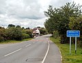
 Bronllys bypass - geograph.org.uk - 2553716.jpg 640 × 425; 57 KB
-
 Bronllys bypass - SE side - geograph.org.uk - 2658388.jpg 640 × 411; 63 KB
-
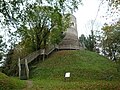
 Bronllys Castle (Keep) - geograph.org.uk - 5961781.jpg 3,648 × 2,736; 4.86 MB
-
 Bronllys Castle (Keep) - geograph.org.uk - 5961879.jpg 2,736 × 3,648; 4.9 MB
-
 Bronllys Castle (Keep) - geograph.org.uk - 5962053.jpg 3,648 × 2,736; 4.4 MB
-
 Bronllys Castle (Keep) - geograph.org.uk - 5962059.jpg 3,648 × 2,736; 4.86 MB
-
 Bronllys Castle (Keep) - geograph.org.uk - 5962067.jpg 3,648 × 2,736; 5.01 MB
-
 Bronllys Castle - geograph.org.uk - 5961779.jpg 3,648 × 2,736; 4.95 MB
-
 Bronllys Castle - geograph.org.uk - 5962071.jpg 3,648 × 2,736; 5.1 MB
-
 Bronllys Court - geograph.org.uk - 5799432.jpg 3,264 × 2,448; 2.89 MB
-
 Bronllys Court farm buildings - geograph.org.uk - 2560951.jpg 640 × 480; 78 KB
-
 Bronllys Hospital - geograph.org.uk - 3651679.jpg 4,320 × 3,240; 3.06 MB
-
 Bronllys Hospital buildings - geograph.org.uk - 2553561.jpg 640 × 395; 57 KB
-
 Bronllys Hospital chapel - geograph.org.uk - 2553428.jpg 640 × 480; 55 KB
-
 Bronllys House B^B, Bronllys - geograph.org.uk - 2558652.jpg 640 × 519; 73 KB
-
 Bronllys Mica hardware store - geograph.org.uk - 2561030.jpg 640 × 380; 61 KB
-
 Bronllys moated site - geograph.org.uk - 346753.jpg 640 × 480; 126 KB
-

-
 Bronllys, children's playground - geograph.org.uk - 2471839.jpg 1,280 × 960; 414 KB
-
-

-
 Castle House (Bronllys) - geograph.org.uk - 5962010.jpg 3,648 × 2,736; 4.71 MB
-
 Cefn-Gafros Common - geograph.org.uk - 2474546.jpg 1,280 × 960; 374 KB
-

-
 Chapel, Bronllys Hospital - geograph.org.uk - 3241183.jpg 2,592 × 1,944; 1.49 MB
-
 Chapel, Bronllys Hospital - geograph.org.uk - 3651680.jpg 4,320 × 3,240; 2.68 MB
-
 Chapel, Bronllys Hospital - geograph.org.uk - 3651681.jpg 4,320 × 3,240; 2.59 MB
-
 Children's playground, Bronllys - geograph.org.uk - 3651678.jpg 4,320 × 3,240; 2.84 MB
-
 Churchyard at St. Mary's Church (Bronllys) - geograph.org.uk - 5961379.jpg 3,648 × 2,736; 4.82 MB
-
 Churchyard at St. Mary's Church (Bronllys) - geograph.org.uk - 5961388.jpg 3,648 × 2,736; 4.57 MB
-
 Churchyard at St. Mary's Church (Bronllys) - geograph.org.uk - 5961472.jpg 3,648 × 2,736; 4.63 MB
-
 Cleared forestry, Llangoed Wood - geograph.org.uk - 4818911.jpg 1,600 × 901; 734 KB
-
 Cleared woodland above Llangoed Hall - geograph.org.uk - 4818277.jpg 1,600 × 904; 663 KB
-
-
 Day hospital, Bronllys - geograph.org.uk - 2553605.jpg 640 × 480; 85 KB
-
 Do not hit this house - geograph.org.uk - 318134.jpg 640 × 480; 81 KB
-
 Earthworks in the wood - geograph.org.uk - 2899659.jpg 640 × 480; 167 KB
-
 East side of Fosse Way,Bronllys - geograph.org.uk - 2558638.jpg 640 × 480; 66 KB
-

-
 Edge of Dderw Wood - geograph.org.uk - 4803842.jpg 1,600 × 901; 677 KB
-

-
 Entrance to Bronllys Castle - geograph.org.uk - 5961775.jpg 3,648 × 2,736; 4.96 MB
-

-

-
 Farm buildings, Bronllys - geograph.org.uk - 3651682.jpg 4,320 × 3,240; 2.93 MB
-
 Farm buildings, Llyswen - geograph.org.uk - 3493539.jpg 800 × 516; 111 KB
-
 Farm lane near Bronllys - geograph.org.uk - 2473409.jpg 1,280 × 960; 345 KB
-
 Fforddfwar, A470 - geograph.org.uk - 2474930.jpg 640 × 480; 115 KB
-

-
 Field and chapel, Bronllys Hospital - geograph.org.uk - 2553433.jpg 640 × 466; 72 KB
-

-
 Field edge above Cae'r-wyn Wood - geograph.org.uk - 2903283.jpg 640 × 480; 110 KB
-
 Fields above Bryndu farm - geograph.org.uk - 2903304.jpg 640 × 480; 97 KB
-
 Fields adjacent to Bronllys Hospital - geograph.org.uk - 2553418.jpg 640 × 480; 60 KB
-
 Fields south of Llangoed Hall Hotel - geograph.org.uk - 2946762.jpg 2,592 × 1,944; 1.83 MB
-
 Filling Station and shop Bronllys - geograph.org.uk - 2013517.jpg 2,048 × 1,536; 740 KB
-
 Fir Tree Cottages, Bronllys - geograph.org.uk - 2558803.jpg 640 × 487; 62 KB
-
 Footpath near Three Cocks - geograph.org.uk - 2473388.jpg 1,280 × 960; 458 KB
-
 Footpath on the field edge - geograph.org.uk - 2903334.jpg 640 × 480; 120 KB
-

-
 Footpath towards Llyswen - geograph.org.uk - 2903383.jpg 640 × 480; 149 KB
-
 Former churchyard, Llyswen - geograph.org.uk - 3493577.jpg 800 × 617; 208 KB
-

-
 Fort ditch - geograph.org.uk - 2899651.jpg 640 × 480; 156 KB
-
 Gates on the River Wye footpath - geograph.org.uk - 4063378.jpg 2,816 × 2,112; 1.1 MB
-

-
 Grassland south of Llyswen (clover mix) - geograph.org.uk - 2474575.jpg 1,280 × 960; 386 KB
-
 Grazing sheep, Llyswen - geograph.org.uk - 3496672.jpg 800 × 600; 138 KB
-
 Green lane in spring sunshine - geograph.org.uk - 2903393.jpg 640 × 480; 139 KB
-
 Green lane in springtime - geograph.org.uk - 2903347.jpg 640 × 480; 161 KB
-
 Griffin Inn, Llyswen - geograph.org.uk - 3493734.jpg 800 × 590; 136 KB
-
 Hillside routeway above Llyswen - geograph.org.uk - 2899461.jpg 640 × 480; 158 KB
-

-
 Honey Cafe, Bronllys - geograph.org.uk - 318109.jpg 640 × 480; 77 KB
-

-

-
 In the fort above Llyswen - geograph.org.uk - 2899480.jpg 640 × 480; 101 KB
-
 Inside Bronllys Castle (Keep) - geograph.org.uk - 5961915.jpg 2,736 × 3,648; 3.11 MB
-
 Inside Bronllys Castle (Keep) - geograph.org.uk - 5961926.jpg 3,648 × 2,736; 2.84 MB
-
 Inside Bronllys Castle (Keep) - geograph.org.uk - 5961935.jpg 3,648 × 2,736; 3.17 MB
-
 Inside Bronllys Castle (Keep) - geograph.org.uk - 5961946.jpg 3,648 × 2,736; 2.59 MB
-
 Inside Bronllys Castle (Keep) - geograph.org.uk - 5961947.jpg 2,736 × 3,648; 4.27 MB
-
 Inside Bronllys Castle (Keep) - geograph.org.uk - 5961950.jpg 3,648 × 2,736; 3.65 MB
-
 Inside Bronllys Castle (Keep) - geograph.org.uk - 5962012.jpg 3,648 × 2,736; 4.08 MB
-
 Inside Bronllys Castle (Keep) - geograph.org.uk - 5962035.jpg 3,648 × 2,736; 4.76 MB
-
 Inside Bronllys Castle (Keep) - geograph.org.uk - 5962042.jpg 3,648 × 2,736; 4.4 MB
-
 Into Llyswen from the NW - geograph.org.uk - 3496663.jpg 800 × 621; 187 KB
-
 Island in the Wye, Boughrood - geograph.org.uk - 3521976.jpg 800 × 600; 193 KB
-
 Ivy-clad Griffin Inn, Llyswen - geograph.org.uk - 3492066.jpg 800 × 530; 138 KB
-
 Junction on Pont-y-Wal Lane, Bronllys - geograph.org.uk - 3651677.jpg 4,320 × 3,240; 2.96 MB
-
 Lane from Bronllys, nearing the A479 - geograph.org.uk - 4803847.jpg 1,600 × 901; 630 KB
-
 Lay-by on the A470 - geograph.org.uk - 6295814.jpg 3,979 × 2,794; 3.17 MB
-

-
 Llangoed Hall - geograph.org.uk - 4818281.jpg 1,600 × 1,200; 1.3 MB
-
 Llangoed Hall Hotel, the Drive - geograph.org.uk - 1922034.jpg 1,024 × 768; 159 KB
-
 Llangoed Hall Hotel, the main front - geograph.org.uk - 1926047.jpg 1,024 × 686; 108 KB
-
 Llangoed Hall Hotel, the south-east front - geograph.org.uk - 1926055.jpg 1,024 × 636; 113 KB
-
 Llangoed Hall.jpg 2,977 × 1,979; 1.12 MB
-
 Llangoed Hotel Entrance - geograph.org.uk - 5328011.jpg 640 × 480; 525 KB
-
 Llwybr Cefngafros - Cefngafros Path - geograph.org.uk - 5716468.jpg 640 × 480; 131 KB
-
 Llwybr Dyffryn Gwy - Way Valley Walk - geograph.org.uk - 5716414.jpg 640 × 480; 115 KB
-
 Llwybr Dyffryn Gwy - Wye Valley Walk - geograph.org.uk - 5716430.jpg 640 × 480; 149 KB
-
 Llwybr Dyffryn Gwy - Wye Valley Walk - geograph.org.uk - 5716443.jpg 640 × 480; 120 KB
-

-
 Llys Meillion, Llyswen - geograph.org.uk - 3493522.jpg 800 × 537; 118 KB
-
 Llyswen - geograph.org.uk - 5328001.jpg 640 × 480; 389 KB
-
-
 Llyswen houses - geograph.org.uk - 3494592.jpg 800 × 568; 113 KB
-
 Llyswen Sewage Pumping Station - geograph.org.uk - 3494478.jpg 800 × 600; 153 KB
-
 Llyswen village - geograph.org.uk - 2903404.jpg 640 × 480; 78 KB
-
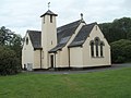
 Llyswen, St Gwendoline's Church - geograph.org.uk - 1921301.jpg 1,024 × 768; 165 KB
-
 Llyswen, St Gwendoline's Church tower - geograph.org.uk - 1921298.jpg 1,280 × 1,028; 576 KB
-
 Llyswen, the Griffin Inn - geograph.org.uk - 1921290.jpg 1,280 × 960; 293 KB
-

-
 Low gear now, Llyswen - geograph.org.uk - 3492000.jpg 752 × 800; 184 KB
-
 Lower House, Bronllys - geograph.org.uk - 2560969.jpg 640 × 462; 60 KB
-
 Lychgate at St. Mary's Church (Bronllys) - geograph.org.uk - 5961383.jpg 3,648 × 2,736; 4.97 MB
-
 Main Lodge, Bronllys - geograph.org.uk - 2553385.jpg 640 × 434; 78 KB
-
 Miniature House at Bronllys - geograph.org.uk - 5962056.jpg 3,648 × 2,736; 3.29 MB
-
 Minor lane to Bronllys - geograph.org.uk - 4803832.jpg 1,600 × 901; 712 KB
-
 Movable goalposts, Bronllys - geograph.org.uk - 2553400.jpg 640 × 480; 69 KB
-
 Mynydd Troed (Viewed from the keep at Bronllys Castle) - geograph.org.uk - 5962045.jpg 1,920 × 1,080; 869 KB
-
 Narrow pavement alongside A438, Bronllys - geograph.org.uk - 2553360.jpg 640 × 547; 111 KB
-
 NE boundary of Bronllys - geograph.org.uk - 2561045.jpg 640 × 491; 80 KB
-

-

-
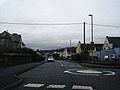 Neuadd Terrace mini-roundabout - geograph.org.uk - 3286268.jpg 640 × 480; 44 KB
-
 New housing development at Llyswen - geograph.org.uk - 2899439.jpg 640 × 480; 75 KB
-
 Northbound A470 at Llyswen - geograph.org.uk - 5328003.jpg 640 × 427; 455 KB
-
 Northbound A470 near Llyswen - geograph.org.uk - 5328006.jpg 640 × 427; 410 KB
-
 Northbound A470, Trericket Bridge - geograph.org.uk - 5330624.jpg 640 × 480; 435 KB
-
 NW boundary of Llyswen - geograph.org.uk - 3496641.jpg 800 × 500; 126 KB
-
 Office building, Bronllys Hospital - geograph.org.uk - 2553693.jpg 640 × 488; 83 KB
-

-

-

-
-
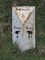 Old Milestone by the former A438, Bronllys - geograph.org.uk - 6044774.jpg 954 × 1,266; 369 KB
-
 Old Post Office Cottage, Llyswen - geograph.org.uk - 3492157.jpg 800 × 645; 117 KB
-
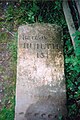
 Ordnance Survey 1GL Bolt - geograph.org.uk - 5363057.jpg 640 × 368; 110 KB
-
 Ordnance Survey Cut Mark - geograph.org.uk - 4500718.jpg 480 × 640; 125 KB
-
 Outdoor riding school on the edge of Bronllys - geograph.org.uk - 2471825.jpg 1,280 × 960; 547 KB


_-_geograph.org.uk_-_2473339.jpg)
_-_geograph.org.uk_-_2473346.jpg)


_-_geograph.org.uk_-_5961781.jpg)
_-_geograph.org.uk_-_5961879.jpg)
_-_geograph.org.uk_-_5962053.jpg)
_-_geograph.org.uk_-_5962059.jpg)
_-_geograph.org.uk_-_5962067.jpg)


_-_geograph.org.uk_-_5962010.jpg)


_-_geograph.org.uk_-_5961379.jpg)
_-_geograph.org.uk_-_5961388.jpg)
_-_geograph.org.uk_-_5961472.jpg)


_at_Llangoed_-_geograph.org.uk_-_1926073.jpg)


_-_geograph.org.uk_-_2474575.jpg)


_-_geograph.org.uk_-_5961915.jpg)
_-_geograph.org.uk_-_5961926.jpg)
_-_geograph.org.uk_-_5961935.jpg)
_-_geograph.org.uk_-_5961946.jpg)
_-_geograph.org.uk_-_5961947.jpg)
_-_geograph.org.uk_-_5961950.jpg)
_-_geograph.org.uk_-_5962012.jpg)
_-_geograph.org.uk_-_5962035.jpg)
_-_geograph.org.uk_-_5962042.jpg)


_-_geograph.org.uk_-_5961383.jpg)


_-_geograph.org.uk_-_5962045.jpg)


_used_-_geograph.org.uk_-_2474540.jpg)