Category:Brookenby
Jump to navigation
Jump to search
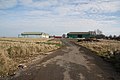
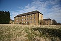
English: Brookenby is a village and civil parish in the West Lindsey district of Lincolnshire, England. According to the 2001 census, it had a population of 742. The village is situated 9 miles northeast of Market Rasen.
village and civil parish in Lincolnshire, England  | |||||
| Upload media | |||||
| Instance of | |||||
|---|---|---|---|---|---|
| Location | West Lindsey, Lincolnshire, East Midlands, England | ||||
| Population |
| ||||
 | |||||
Subcategories
This category has only the following subcategory.
Media in category "Brookenby"
The following 97 files are in this category, out of 97 total.
-
 460 Squadron (RAAF) Memorial Ident Square - geograph.org.uk - 2659910.jpg 1,024 × 768; 135 KB
-
 460 Squadron memorial at the former RAF Binbrook - geograph.org.uk - 5804782.jpg 1,600 × 1,065; 1.09 MB
-
 A building at the former RAF Binbrook - geograph.org.uk - 563377.jpg 640 × 427; 72 KB
-
 A road leading to Binbrook Airfield - geograph.org.uk - 2745085.jpg 800 × 600; 137 KB
-
 Abandoned buildings, Brookenby - geograph.org.uk - 2663676.jpg 1,024 × 768; 160 KB
-

-
 Arriving at Brookenby from Swinhope - geograph.org.uk - 3496300.jpg 640 × 427; 87 KB
-
 Autumn at Brookenby - geograph.org.uk - 2659923.jpg 1,024 × 768; 341 KB
-
 Big bird at Binbrook - geograph.org.uk - 3496359.jpg 640 × 427; 57 KB
-
 Binbrook airfield - geograph.org.uk - 3008639.jpg 640 × 427; 49 KB
-
 Binbrook Airfield, QRA Area - geograph.org.uk - 5125038.jpg 1,280 × 960; 549 KB
-
 Binbrook hangar - geograph.org.uk - 1199520.jpg 640 × 426; 58 KB
-
 Binbrook hangars - geograph.org.uk - 1199629.jpg 640 × 426; 65 KB
-

-

-
 Brookenby, former R.A.F. Binbrook - geograph.org.uk - 3496306.jpg 640 × 427; 75 KB
-
 Brookenby, former R.A.F. Binbrook - geograph.org.uk - 3496313.jpg 640 × 427; 72 KB
-
 Brookenby, former R.A.F. Binbrook - geograph.org.uk - 3496315.jpg 640 × 427; 50 KB
-
 Brookenby, former R.A.F. Binbrook - geograph.org.uk - 3496320.jpg 640 × 427; 52 KB
-
 Brookenby, former R.A.F. Binbrook - geograph.org.uk - 3496324.jpg 640 × 427; 108 KB
-
 Brookenby, former R.A.F. Binbrook - geograph.org.uk - 3496332.jpg 640 × 427; 95 KB
-
 Brookenby, former R.A.F. Binbrook - geograph.org.uk - 3496335.jpg 640 × 427; 106 KB
-
 Brookenby, former R.A.F. Binbrook - geograph.org.uk - 3496338.jpg 640 × 427; 105 KB
-
 Brookenby, former R.A.F. Binbrook - geograph.org.uk - 3496343.jpg 640 × 427; 78 KB
-

-

-
 C type aeroplane hangars at ex RAF Binbrook - geograph.org.uk - 6251392.jpg 4,608 × 3,072; 4.78 MB
-
 Cut Mark, Binbrook Airfield, Gatehouse - geograph.org.uk - 4758089.jpg 960 × 1,280; 1.32 MB
-
 Cut Mark, Binbrook Airfield, QRA Area - geograph.org.uk - 5125029.jpg 960 × 1,280; 493 KB
-
 Detail of the Station memorial at RAF Binbrook - geograph.org.uk - 6251794.jpg 4,608 × 3,072; 5.61 MB
-
 Entry through the roof - geograph.org.uk - 2663695.jpg 1,024 × 768; 345 KB
-
 Ex RAF Binbrook - geograph.org.uk - 560172.jpg 640 × 427; 63 KB
-
 Fire damaged former hangar - geograph.org.uk - 2663685.jpg 1,024 × 768; 98 KB
-
 First Avenue - geograph.org.uk - 1199530.jpg 640 × 426; 79 KB
-
 Fly tipped track - geograph.org.uk - 2663739.jpg 1,024 × 768; 294 KB
-
 Former gatehouse of RAF Binbrook - geograph.org.uk - 4758093.jpg 1,280 × 960; 1.79 MB
-
 Former hangars - geograph.org.uk - 2663687.jpg 1,024 × 768; 96 KB
-
 Former R.A.F. Binbrook (Brookenby) - geograph.org.uk - 3496352.jpg 640 × 427; 104 KB
-
 Former R.A.F. Binbrook (Brookenby) - geograph.org.uk - 3496365.jpg 640 × 427; 76 KB
-
 Former R.A.F. Binbrook (Brookenby) - geograph.org.uk - 3496390.jpg 640 × 427; 64 KB
-
 Former R.A.F. Binbrook (Brookenby) - geograph.org.uk - 3496395.jpg 640 × 427; 48 KB
-
 Former R.A.F. Binbrook (Brookenby) - geograph.org.uk - 3496399.jpg 640 × 427; 57 KB
-
 Former R.A.F. Binbrook (Brookenby) - geograph.org.uk - 3496406.jpg 640 × 427; 48 KB
-
 Former R.A.F. Binbrook (Brookenby) - geograph.org.uk - 3496415.jpg 640 × 427; 39 KB
-
 Former R.A.F. Binbrook (Brookenby) - geograph.org.uk - 3496437.jpg 640 × 427; 99 KB
-

-
 Former RAF Binbrook - geograph.org.uk - 1199561.jpg 640 × 426; 73 KB
-
 Former RAF Binbrook - geograph.org.uk - 1199573.jpg 640 × 426; 65 KB
-

-
 Hangar at former R.A.F. Binbrook - geograph.org.uk - 3496405.jpg 640 × 427; 52 KB
-
 Heading east towards Binbrook - geograph.org.uk - 4637888.jpg 640 × 480; 66 KB
-
 Housing and road in Brookenby - geograph.org.uk - 1959221.jpg 640 × 480; 65 KB
-
 Leaving Brookenby for Swinhope - geograph.org.uk - 3496297.jpg 640 × 427; 72 KB
-

-

-

-
 Looking down the main runway - geograph.org.uk - 714606.jpg 640 × 409; 188 KB
-
 Memorial Garden at the former RAF Binbrook - geograph.org.uk - 5776723.jpg 1,600 × 1,065; 493 KB
-
 Minor road towards Binbrook - geograph.org.uk - 4637885.jpg 640 × 480; 62 KB
-
 Minor road towards Binbrook - geograph.org.uk - 4637891.jpg 640 × 480; 92 KB
-
 Minor road towards Binbrook - geograph.org.uk - 4637906.jpg 640 × 480; 87 KB
-

-
 New houses, Brookenby - geograph.org.uk - 4637915.jpg 640 × 480; 75 KB
-
 New housing, Brookenby - geograph.org.uk - 4637919.jpg 640 × 480; 67 KB
-
 No bombers, just crows - geograph.org.uk - 2659904.jpg 1,024 × 768; 150 KB
-
 Officer's Mess - geograph.org.uk - 1199480.jpg 640 × 426; 74 KB
-
 Old Orford Road - geograph.org.uk - 1199670.jpg 640 × 426; 84 KB
-
 Old Road - geograph.org.uk - 1199623.jpg 640 × 426; 53 KB
-
 Old taxiway - geograph.org.uk - 711492.jpg 640 × 410; 284 KB
-
 Orford House - geograph.org.uk - 1199398.jpg 640 × 426; 76 KB
-
 Perimeter road - geograph.org.uk - 714565.jpg 640 × 426; 250 KB
-
 RAF Binbrook Battle HQ - geograph.org.uk - 714665.jpg 640 × 426; 287 KB
-
 Road from Thoresway to Binbrook - geograph.org.uk - 6069857.jpg 4,000 × 3,000; 4.11 MB
-
 Salisbury Avenue, Brookenby - geograph.org.uk - 4637923.jpg 640 × 480; 69 KB
-
 St Michael ^ All Angels Church, Brookenby - geograph.org.uk - 5776715.jpg 1,600 × 1,065; 685 KB
-
 Station HQ ex RAF Binbrook - geograph.org.uk - 6251833.jpg 4,441 × 2,831; 2.5 MB
-
 Station memorial at RAF Binbrook - geograph.org.uk - 6251397.jpg 4,608 × 3,072; 5.9 MB
-
 Surveillance post - geograph.org.uk - 2659872.jpg 1,024 × 768; 256 KB
-
 Swinhope Road at Kent Road, Brookenby - geograph.org.uk - 2745125.jpg 800 × 600; 171 KB
-
 Swinhope Road, Brookenby - geograph.org.uk - 2745113.jpg 800 × 600; 197 KB
-
 Swinhope Road, Brookenby - geograph.org.uk - 4637917.jpg 640 × 480; 69 KB
-
 Swinhope Road, Brookenby - geograph.org.uk - 4637921.jpg 640 × 480; 72 KB
-
 The edge of the airfield - geograph.org.uk - 2663743.jpg 1,024 × 768; 175 KB
-

-
 This road terminates at (former) R.A.F, Binbrook - geograph.org.uk - 3888878.jpg 1,024 × 683; 202 KB
-
 Thorganby, aerial 2016 - geograph.org.uk - 5093883.jpg 640 × 427; 58 KB
-
 Turning point at end of subsidiary runway - geograph.org.uk - 711522.jpg 640 × 426; 239 KB
-
 View from Brookenby - geograph.org.uk - 2663679.jpg 1,024 × 768; 179 KB
-
 View from within the surveillance post - geograph.org.uk - 2659886.jpg 1,024 × 768; 61 KB
-
 Who put the Bin in Binbrook^ - geograph.org.uk - 3496371.jpg 640 × 427; 60 KB
-
 Wolds avenue - geograph.org.uk - 2659898.jpg 1,024 × 768; 383 KB
-
 XR724 F6 English Electric Lightning - geograph.org.uk - 6251412.jpg 4,608 × 3,072; 5.39 MB
-
 Demolition - geograph.org.uk - 714575.jpg 640 × 426; 250 KB
-
 Graded Grains - geograph.org.uk - 714535.jpg 640 × 426; 186 KB
-
 Hangar - geograph.org.uk - 714589.jpg 640 × 373; 208 KB
-
 Linking track - geograph.org.uk - 714613.jpg 640 × 426; 197 KB
-
 Road Junction near Binbrook - geograph.org.uk - 612865.jpg 640 × 480; 76 KB
_Memorial_Ident_Square_-_geograph.org.uk_-_2659910.jpg)


_and_Orford,_aerial_2018_-_geograph.org.uk_-_5246501.jpg)


_-_geograph.org.uk_-_3496352.jpg)
_-_geograph.org.uk_-_3496365.jpg)
_-_geograph.org.uk_-_3496390.jpg)
_-_geograph.org.uk_-_3496395.jpg)
_-_geograph.org.uk_-_3496399.jpg)
_-_geograph.org.uk_-_3496406.jpg)
_-_geograph.org.uk_-_3496415.jpg)
_-_geograph.org.uk_-_3496437.jpg)


_R.A.F,_Binbrook_-_geograph.org.uk_-_3888878.jpg)


