Category:Broomfield, Somerset
Jump to navigation
Jump to search
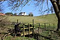
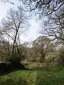
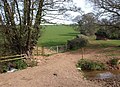
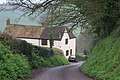
English: Broomfield is a village and civil parish in the Sedgemoor district of Somerset, England, situated about five miles north of Taunton. According to the 2001 census it had a population of 208.
village and civil parish in Somerset, UK  | |||||
| Upload media | |||||
| Instance of | |||||
|---|---|---|---|---|---|
| Location | Sedgemoor, Somerset, South West England, England | ||||
| Said to be the same as | Broomfield (Wikimedia duplicated page, civil parish) | ||||
 | |||||
Media in category "Broomfield, Somerset"
The following 200 files are in this category, out of 285 total.
(previous page) (next page)-

-
 Ancient pond at Courtway - geograph.org.uk - 5273730.jpg 1,024 × 768; 218 KB
-
 Approaching Buncombe Wood - geograph.org.uk - 3520666.jpg 1,024 × 768; 170 KB
-
 Approaching Rooks Castle Farm - geograph.org.uk - 2298308.jpg 1,024 × 768; 174 KB
-
 At The Pines junction Buncombe Hill - geograph.org.uk - 5113887.jpg 3,648 × 2,432; 3.26 MB
-
 Barns, Cheddon Down - geograph.org.uk - 1128197.jpg 640 × 480; 101 KB
-
 Below Rook's Castle Farm - geograph.org.uk - 5691186.jpg 3,456 × 2,304; 1.16 MB
-
 Bluebells in Woodland - geograph.org.uk - 1331883.jpg 640 × 480; 142 KB
-
 Boundary wall at Binford House - geograph.org.uk - 5691176.jpg 3,456 × 2,304; 710 KB
-
 Bridleway above Raswell - geograph.org.uk - 1129317.jpg 497 × 640; 110 KB
-

-
 Bridleway near Owls Hill Farm - geograph.org.uk - 1211105.jpg 640 × 480; 150 KB
-
 Bridleway, Broomfield - geograph.org.uk - 1129299.jpg 640 × 480; 126 KB
-
 Broomfield church from the West - geograph.org.uk - 5422576.jpg 3,456 × 2,304; 720 KB
-
 Broomfield Ford - geograph.org.uk - 5135073.jpg 1,440 × 960; 2.25 MB
-
 Broomfield Ford - geograph.org.uk - 5272931.jpg 1,024 × 768; 294 KB
-
 Broomfield from the South - geograph.org.uk - 5422577.jpg 3,456 × 2,304; 454 KB
-
 Broomfield Hill - geograph.org.uk - 2509455.jpg 1,024 × 768; 203 KB
-
 Broomfield. Church of St.Mary ^ All Saints - geograph.org.uk - 5834530.jpg 683 × 1,024; 230 KB
-
 Buildings at Fyne Court - geograph.org.uk - 5490576.jpg 6,000 × 4,000; 7.75 MB
-
 Buncombe Wood - geograph.org.uk - 3114923.jpg 640 × 480; 363 KB
-
 Car park, Cothelstone Hill - geograph.org.uk - 2885072.jpg 640 × 480; 252 KB
-
 Cattle and calves, Stream Farm - geograph.org.uk - 1833584.jpg 640 × 480; 118 KB
-
 Christmas trees near Durrett's Farm - geograph.org.uk - 4144520.jpg 3,968 × 2,976; 2.89 MB
-
 Church gate - geograph.org.uk - 5082156.jpg 1,024 × 768; 292 KB
-
 Clump of trees, Rooks Castle - geograph.org.uk - 1833908.jpg 640 × 411; 81 KB
-
 Cold War relic - geograph.org.uk - 4120751.jpg 800 × 532; 265 KB
-
 Conference of horses near Broomfield - geograph.org.uk - 5491646.jpg 4,957 × 3,485; 7.05 MB
-
 Corrugated iron barn, Wood's Farm - geograph.org.uk - 4434152.jpg 1,024 × 768; 208 KB
-
 Cothelstone Hill - geograph.org.uk - 3114965.jpg 640 × 360; 236 KB
-
 Cottage, Broomfield - geograph.org.uk - 4432534.jpg 1,024 × 768; 261 KB
-
 Cottages along the lane - geograph.org.uk - 5113675.jpg 2,970 × 1,928; 3.33 MB
-
 Cottages on Broomfield village green - geograph.org.uk - 1197329.jpg 640 × 480; 155 KB
-
 Cottages, Broomfield - geograph.org.uk - 1440583.jpg 640 × 469; 106 KB
-
 Countryside near Ivyton Farm - geograph.org.uk - 1129531.jpg 640 × 480; 100 KB
-
 Crop near Owls Hill Farm - geograph.org.uk - 5956639.jpg 4,288 × 2,848; 2.53 MB
-
 Cross at Broomfield.jpg 1,478 × 2,410; 710 KB
-
 Crossroads, at Rose Hill - geograph.org.uk - 2297602.jpg 640 × 480; 105 KB
-
 Cyclists approaching Kingston Cross - geograph.org.uk - 1129155.jpg 425 × 640; 91 KB
-
 Derelict medieval farm near Broomfield - geograph.org.uk - 5422581.jpg 3,456 × 2,304; 725 KB
-
 Derelict medieval farm near Broomfield - geograph.org.uk - 5422582.jpg 3,456 × 2,304; 777 KB
-
 Derelict medieval farm near Broomfield - geograph.org.uk - 5422583.jpg 3,456 × 2,304; 595 KB
-
 Derelict mill stream, centre, at Rook's Castle Mill - geograph.org.uk - 5691138.jpg 3,456 × 2,304; 995 KB
-
 Descending Shellthorn Hill - geograph.org.uk - 1835873.jpg 640 × 425; 77 KB
-

-

-
 Entrance drive, Westleigh Manor - geograph.org.uk - 3714477.jpg 1,024 × 768; 172 KB
-
 Estate building at Fyne Court - geograph.org.uk - 4433597.jpg 1,024 × 768; 214 KB
-
 Exposed slates in Quarryland, Fyne Court - geograph.org.uk - 5781201.jpg 1,600 × 1,200; 828 KB
-
 Farm track - geograph.org.uk - 4434127.jpg 768 × 1,024; 266 KB
-
 Farmland around Rose Hill - geograph.org.uk - 5956673.jpg 3,282 × 2,155; 1.05 MB
-
 Field beside Rose Hill - geograph.org.uk - 1129115.jpg 640 × 480; 100 KB
-
 Field near Fyne Court - geograph.org.uk - 5491566.jpg 6,000 × 4,000; 6.03 MB
-
 Field north of Buncombe Wood - geograph.org.uk - 1828335.jpg 640 × 473; 110 KB
-
 Fingerpost, The Pines - geograph.org.uk - 3114915.jpg 480 × 640; 292 KB
-
 Folly at Fyne Court - geograph.org.uk - 5781214.jpg 1,600 × 1,200; 858 KB
-
 Footbridge in Fyne Court estate - geograph.org.uk - 5781200.jpg 1,200 × 1,600; 856 KB
-
 Footpath and tree with twisted roots, Fyne Court - geograph.org.uk - 5781207.jpg 1,600 × 1,200; 801 KB
-
 Footpath below Rooks Castle Farm - geograph.org.uk - 1833803.jpg 480 × 640; 127 KB
-
 Footpath by a stream in Fyne Court estate - geograph.org.uk - 5781206.jpg 1,600 × 1,200; 745 KB
-
 Footpath from Broomfield - geograph.org.uk - 5491620.jpg 6,000 × 4,000; 5.52 MB
-
 Footpath to Broomfield from Kingston Cross - geograph.org.uk - 5781366.jpg 1,600 × 1,200; 830 KB
-
 Ford at Broomfield - geograph.org.uk - 5135078.jpg 1,440 × 960; 2.32 MB
-
 Ford below Raswell House - geograph.org.uk - 1129481.jpg 640 × 480; 94 KB
-
 Ford near Tirelands Farm - geograph.org.uk - 5464201.jpg 3,456 × 2,304; 2.26 MB
-
 Ford, Raswell Farm - geograph.org.uk - 3714290.jpg 1,024 × 768; 243 KB
-
 Forestry Commission tracks - geograph.org.uk - 1197398.jpg 640 × 480; 154 KB
-
 Former service buildings, Fyne Court - geograph.org.uk - 4433583.jpg 1,024 × 768; 224 KB
-
 Fyne Court, Building in the Grounds - geograph.org.uk - 2989307.jpg 900 × 596; 712 KB
-
 Fyne Court, Castle Folly - geograph.org.uk - 2989355.jpg 899 × 604; 886 KB
-
 Fyne Court, Felled Tree Trunk - geograph.org.uk - 2989321.jpg 900 × 596; 779 KB
-
 Fyne Court, Path through Gardens - geograph.org.uk - 2989377.jpg 596 × 900; 842 KB
-
 Fyne Court, Walled Garden - geograph.org.uk - 2989326.jpg 900 × 596; 818 KB
-
 Fyne Court, Water Garden - geograph.org.uk - 2989310.jpg 900 × 596; 771 KB
-
 Gardens at Fyne Court - geograph.org.uk - 5490592.jpg 6,000 × 4,000; 7.42 MB
-
 Gate into the Dell, Fyne Court - geograph.org.uk - 5781204.jpg 1,600 × 1,200; 770 KB
-
 Gate into woodland on Fyne Court - geograph.org.uk - 5781202.jpg 1,200 × 1,600; 915 KB
-
 Gate on Cothelstone Hill - geograph.org.uk - 3114980.jpg 640 × 360; 231 KB
-
 Grassland and tree at Fyne Court - geograph.org.uk - 5781203.jpg 1,600 × 1,200; 841 KB
-
 Grazing at Rooks Castle - geograph.org.uk - 1833873.jpg 640 × 427; 65 KB
-
 Hillside above Raswell Farm - geograph.org.uk - 1082875.jpg 640 × 480; 206 KB
-
 House at Higher Heathcombe Farm - geograph.org.uk - 4434146.jpg 1,024 × 768; 206 KB
-
 Ivyton Farm - geograph.org.uk - 3712909.jpg 1,024 × 768; 160 KB
-
 Ivyton Farm - geograph.org.uk - 5272955.jpg 1,024 × 783; 245 KB
-
 Junction at the Pines Café - geograph.org.uk - 1196548.jpg 640 × 480; 99 KB
-
 Junction on the Enmore road - geograph.org.uk - 1197395.jpg 640 × 480; 128 KB
-
 Junction, Courtway - geograph.org.uk - 1975462.jpg 640 × 480; 101 KB
-
 Kingston Cross - geograph.org.uk - 4432522.jpg 1,024 × 768; 215 KB
-
 Lambridge Farm - geograph.org.uk - 1828303.jpg 640 × 401; 65 KB
-
 Lane above Andersfield - geograph.org.uk - 1835779.jpg 640 × 444; 99 KB
-
 Lane approaching Rose Hill - geograph.org.uk - 1128876.jpg 640 × 480; 96 KB
-
 Lane junction above Rose Hill - geograph.org.uk - 1128986.jpg 640 × 480; 104 KB
-
 Lane junction in the Quantocks - geograph.org.uk - 1835830.jpg 640 × 509; 112 KB
-
 Lane junction on the Quantocks - geograph.org.uk - 1835839.jpg 640 × 491; 134 KB
-
 Lane near Broomfield - geograph.org.uk - 1129244.jpg 490 × 640; 147 KB
-
 Lane near Owls Hill Farm - geograph.org.uk - 5956611.jpg 3,872 × 2,481; 1.28 MB
-
 Lane near Rockhouse Farm - geograph.org.uk - 1828494.jpg 480 × 640; 126 KB
-
 Lane near Rockhouse Farm - geograph.org.uk - 1828498.jpg 500 × 640; 129 KB
-
 Lane north of Lydeard Cross - geograph.org.uk - 1904077.jpg 480 × 640; 103 KB
-
 Lane passing Westleigh Farm - geograph.org.uk - 1196572.jpg 640 × 480; 130 KB
-
 Lane past the entrance to Fyne Court - geograph.org.uk - 5491654.jpg 6,000 × 4,000; 6.16 MB
-
 Lane to Broomfield - geograph.org.uk - 1130143.jpg 640 × 453; 101 KB
-
 Lane to Rooks Castle - geograph.org.uk - 1835816.jpg 512 × 640; 102 KB
-
 Lane to Tirelands Farm, Enmore - geograph.org.uk - 5464206.jpg 2,304 × 3,456; 2.25 MB
-
 Macmillan Way West - geograph.org.uk - 1833627.jpg 640 × 471; 92 KB
-
 MacMillan Way West - geograph.org.uk - 5273505.jpg 1,024 × 768; 252 KB
-
 MacMillan Way West - geograph.org.uk - 5273511.jpg 1,024 × 768; 283 KB
-
-
 Manor Farm - geograph.org.uk - 1828387.jpg 508 × 640; 117 KB
-
 Manor Farm - geograph.org.uk - 1828406.jpg 640 × 484; 139 KB
-
 Merridge Hill - geograph.org.uk - 2885393.jpg 640 × 360; 275 KB
-
 Merridge Hill - geograph.org.uk - 2885410.jpg 640 × 360; 271 KB
-
 Merridge Hill - geograph.org.uk - 2885418.jpg 640 × 360; 283 KB
-
 Minor road at Broomfield, Somerset - geograph.org.uk - 3434451.jpg 1,024 × 773; 243 KB
-
 Minor road junction, near Bloomfield - geograph.org.uk - 2297862.jpg 1,024 × 768; 201 KB
-
 Minor road to Broomfield - geograph.org.uk - 3830157.jpg 1,024 × 768; 185 KB
-
 Minor road to Enmore - geograph.org.uk - 4434134.jpg 768 × 1,024; 326 KB
-
 Minor road to North Petherton - geograph.org.uk - 4434112.jpg 1,024 × 768; 317 KB
-
 Minor road to Timbercombe - geograph.org.uk - 3714514.jpg 1,024 × 768; 292 KB
-
 Minor road, near Rooks Castle Farm - geograph.org.uk - 2298632.jpg 1,024 × 768; 243 KB
-
 Muddy gateway, Cheddon Down - geograph.org.uk - 1128186.jpg 640 × 480; 92 KB
-
 Newly cut hedgerow, Westleigh Farm - geograph.org.uk - 1196568.jpg 640 × 480; 137 KB
-
 Oak tree near The Thickets - geograph.org.uk - 1835787.jpg 640 × 480; 99 KB
-
 Old barn at Duck's Pool - geograph.org.uk - 1196577.jpg 640 × 480; 104 KB
-
 Old boundary, Wind Down Plantation - geograph.org.uk - 2885030.jpg 640 × 480; 354 KB
-

-

-

-
 Old Lane in Wort Wood - geograph.org.uk - 5422575.jpg 3,456 × 2,304; 1.05 MB
-
 Old mill pond at Rook's Castle Mill - geograph.org.uk - 5691129.jpg 3,456 × 2,304; 1.08 MB
-
 Open area, Cothelstone Hill - geograph.org.uk - 2885083.jpg 640 × 360; 216 KB
-
 Ordnance Survey Cut Mark - geograph.org.uk - 5617532.jpg 640 × 401; 88 KB
-
 Outbuilding, Broomfield Hall - geograph.org.uk - 4434158.jpg 1,024 × 768; 226 KB
-
 Outbuildings, Oggshole Farm - geograph.org.uk - 3830172.jpg 1,024 × 768; 111 KB
-
 Overgrown pond at Fyne Court - geograph.org.uk - 4433580.jpg 1,024 × 768; 308 KB
-
 Owl's Street disused trackway - geograph.org.uk - 4144532.jpg 2,976 × 3,968; 2.64 MB
-
 Park End - geograph.org.uk - 2885426.jpg 640 × 360; 271 KB
-
 Patcombe Farm - geograph.org.uk - 4603232.jpg 1,024 × 768; 213 KB
-
 Path at Rook's Castle Wood - geograph.org.uk - 5691191.jpg 3,456 × 2,304; 1.37 MB
-

-
 Path intersection, Merridge Hill - geograph.org.uk - 4431331.jpg 1,024 × 768; 343 KB
-
 Path junction in Buncombe Wood - geograph.org.uk - 3714521.jpg 1,024 × 768; 257 KB
-
 Path on Broomfield Hill - geograph.org.uk - 1077110.jpg 640 × 480; 156 KB
-
 Path on Cothelstone Hill - geograph.org.uk - 3114960.jpg 640 × 360; 229 KB
-
 Path on Merridge Hill - geograph.org.uk - 3114975.jpg 640 × 360; 235 KB
-
 Path to Cothelstone Hill - geograph.org.uk - 4431335.jpg 1,024 × 768; 348 KB
-
 Path up Cothelstone Hill - geograph.org.uk - 2885079.jpg 640 × 480; 280 KB
-
 Path up Cothelstone Hill - geograph.org.uk - 3114948.jpg 640 × 480; 300 KB
-
 Path, Broomfield Hill - geograph.org.uk - 2885046.jpg 640 × 360; 217 KB
-
 Path, leading towards Fyne Court - geograph.org.uk - 3714307.jpg 1,024 × 768; 311 KB
-
 Path, Wind Down Plantation - geograph.org.uk - 3109559.jpg 640 × 480; 376 KB
-
 Path, Wind Down Plantation - geograph.org.uk - 3109565.jpg 640 × 480; 346 KB
-
 Pond in grounds of Fyne Court - geograph.org.uk - 5781212.jpg 1,200 × 1,600; 786 KB
-
 Pub for a pub - geograph.org.uk - 3114989.jpg 640 × 360; 252 KB
-
 Quantock View Near Timberscombe - geograph.org.uk - 4819791.jpg 1,024 × 768; 134 KB
-
 Quarry workings, Wind Down Plantation - geograph.org.uk - 2885038.jpg 640 × 480; 369 KB
-
 Quiet valley in the Quantocks - geograph.org.uk - 1077104.jpg 640 × 480; 199 KB
-
 Raswell Farm - geograph.org.uk - 3520648.jpg 1,024 × 768; 185 KB
-
 Raswell House - geograph.org.uk - 3714318.jpg 1,024 × 768; 223 KB
-
 Restoration of the walled garden at Fyne Court - geograph.org.uk - 4433567.jpg 1,024 × 768; 290 KB
-
 Ridge road near Rooks Castle Farm - geograph.org.uk - 1833946.jpg 480 × 640; 139 KB
-
 Road above Raswell - geograph.org.uk - 1129487.jpg 640 × 480; 72 KB
-
 Road across valley bottom - geograph.org.uk - 2255344.jpg 640 × 480; 140 KB
-
 Road drops towards Spring Cottage - geograph.org.uk - 2255341.jpg 640 × 480; 102 KB
-
 Road junction at Kingston Cross - geograph.org.uk - 1211084.jpg 640 × 480; 155 KB
-
 Road junction at Kingston Cross - geograph.org.uk - 1211087.jpg 640 × 480; 135 KB
-
 Road junction at Kingston Cross - geograph.org.uk - 5781362.jpg 1,600 × 1,200; 878 KB
-
 Road junction in the Quantocks - geograph.org.uk - 1235333.jpg 640 × 480; 252 KB
-
 Road Junction near Travellers Rest - geograph.org.uk - 5113858.jpg 3,648 × 2,432; 5.52 MB
-
 Road junction, near Broomfield - geograph.org.uk - 3714467.jpg 1,024 × 768; 206 KB
-
 Road junction, top of Rose Hill - geograph.org.uk - 1211097.jpg 640 × 480; 99 KB
-
 Road junction, top of Rose Hill - geograph.org.uk - 1211100.jpg 640 × 480; 111 KB
-
 Road past Newlands Farm - geograph.org.uk - 1986197.jpg 515 × 640; 137 KB
-
 Road rises to pass Owls Barton - geograph.org.uk - 2255348.jpg 640 × 480; 112 KB
-
 Road south of Westleigh Farm - geograph.org.uk - 5778961.jpg 1,600 × 1,200; 769 KB
-
-
 Road to Kingston St Mary, near Bradford Mill - geograph.org.uk - 3520636.jpg 1,024 × 768; 197 KB
-
 Road to North Petherton - geograph.org.uk - 1211109.jpg 640 × 480; 79 KB
-
 Road to Waterpits Farm - geograph.org.uk - 5778953.jpg 1,600 × 1,200; 801 KB
-
 Robin with lunch in Woods Lane - geograph.org.uk - 5422585.jpg 1,478 × 1,109; 174 KB
-
 Rooks Castle Farm - geograph.org.uk - 1833893.jpg 640 × 480; 132 KB
-
 Rose Hill - geograph.org.uk - 1129045.jpg 640 × 480; 91 KB
-
 Ruin below Rook's Castle Farm - geograph.org.uk - 5691122.jpg 3,456 × 2,304; 1,013 KB
-
 Ruin below Rook's Castle Farm - geograph.org.uk - 5691134.jpg 3,456 × 2,304; 1.07 MB
-
 Ruins of Ball Cottages - geograph.org.uk - 1130055.jpg 640 × 480; 149 KB
-
 Ruins of Binford House - geograph.org.uk - 5691160.jpg 2,304 × 3,456; 590 KB
-
 Ruins of Binford House - geograph.org.uk - 5691166.jpg 3,456 × 2,304; 808 KB
-
 Ruins of Binford House - geograph.org.uk - 5691173.jpg 2,304 × 3,456; 631 KB
-
 Ruins of Rook's Castle Mill - geograph.org.uk - 5691152.jpg 3,456 × 2,304; 1.39 MB
-
 Secluded valley, near Ivyton Farm - geograph.org.uk - 3713189.jpg 1,024 × 768; 209 KB
-
 Shellthorn chapel - geograph.org.uk - 1835855.jpg 513 × 640; 127 KB
-
 Signpost at Kingston Cross - geograph.org.uk - 5781368.jpg 1,600 × 1,195; 806 KB
-
 Signpost near Fyne Court - geograph.org.uk - 5778963.jpg 1,600 × 1,200; 809 KB
-
 Small car park in Buncombe Wood - geograph.org.uk - 5778957.jpg 1,600 × 1,200; 813 KB
-
 Small shed, Manor Farm near Courtway - geograph.org.uk - 3434445.jpg 1,600 × 1,138; 395 KB
-
 Spring Cottage - geograph.org.uk - 157366.jpg 640 × 426; 155 KB
-
 Spring Cottage, near Broomfield - geograph.org.uk - 1240324.jpg 640 × 480; 127 KB
-
 St Mary ^ All Saints, Broomfield - geograph.org.uk - 5491608.jpg 6,000 × 4,000; 6.54 MB
-
 St Mary's and All Saints Church, Broomfield - geograph.org.uk - 4433554.jpg 1,024 × 768; 212 KB
-
 St Mary's and All Saints Church, Broomfield. - geograph.org.uk - 2053180.jpg 1,024 × 629; 153 KB


