Category:Broomfleet
Jump to navigation
Jump to search
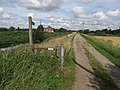
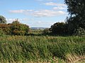
English: Broomfleet is a village and civil parish in the East Riding of Yorkshire, England. It is situated on the Humber estuary approximately 4 miles (6.4 km) west of Brough.
village in the East Riding of Yorkshire, England, UK  | |||||
| Upload media | |||||
| Instance of | |||||
|---|---|---|---|---|---|
| Location | East Riding of Yorkshire, Yorkshire and the Humber, England | ||||
| Said to be the same as | Broomfleet (Wikimedia duplicated page, civil parish) | ||||
 | |||||
Subcategories
This category has the following 3 subcategories, out of 3 total.
Media in category "Broomfleet"
The following 200 files are in this category, out of 274 total.
(previous page) (next page)-
 "The Red Lion" in Broomfleet - another lost pub - geograph.org.uk - 3133090.jpg 4,608 × 3,072; 3.54 MB
-
 A Cottage - geograph.org.uk - 629468.jpg 640 × 492; 82 KB
-

-
 A farm building at Laxton Grange - geograph.org.uk - 2208573.jpg 800 × 600; 211 KB
-
 A footpath to the South of Broomfleet - geograph.org.uk - 2106362.jpg 800 × 600; 247 KB
-

-
 A grid ref check please - geograph.org.uk - 2106369.jpg 800 × 600; 318 KB
-

-

-
 A shed with its own story - geograph.org.uk - 3141637.jpg 640 × 427; 74 KB
-
 A Short Drain - geograph.org.uk - 250287.jpg 640 × 480; 102 KB
-
 Across the field to Northfield House - geograph.org.uk - 6182092.jpg 1,024 × 768; 172 KB
-
 Alternative Heritage Blue Plaque - geograph.org.uk - 6182100.jpg 1,024 × 768; 274 KB
-
 Another Wet Square - geograph.org.uk - 11721.jpg 640 × 480; 37 KB
-

-
 Approaching Landing Lane - geograph.org.uk - 3688162.jpg 1,024 × 768; 192 KB
-
 Approaching Weighton Lock and Humber Lock Farm - geograph.org.uk - 5282077.jpg 5,256 × 2,792; 2.16 MB
-
 Barrier down train not stopping - geograph.org.uk - 2186149.jpg 4,000 × 3,000; 2.01 MB
-
 Biomass freight train load heading west - geograph.org.uk - 5282224.jpg 5,376 × 3,024; 4.72 MB
-

-

-
 Brick ruin at Humber Lock Farm - geograph.org.uk - 3133085.jpg 4,327 × 2,885; 2.7 MB
-
 Brickyard workers' cottages - geograph.org.uk - 3141163.jpg 640 × 427; 70 KB
-
 Brickyard workers' cottages - geograph.org.uk - 3141171.jpg 640 × 427; 74 KB
-
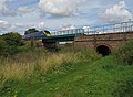 Bridge over the canal, near Broomfleet - geograph.org.uk - 4609846.jpg 640 × 472; 391 KB
-
 Bridge over the Market Weighton Canal - geograph.org.uk - 5437750.jpg 800 × 600; 136 KB
-
 Broomfleet.jpg 640 × 480; 112 KB
-
 Broomfleet - geograph.org.uk - 235987.jpg 640 × 426; 130 KB
-
 Broomfleet - geograph.org.uk - 235988.jpg 640 × 426; 124 KB
-
 Broomfleet - geograph.org.uk - 236031.jpg 640 × 426; 138 KB
-
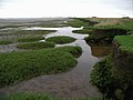
 Broomfleet Beck - geograph.org.uk - 2186112.jpg 4,000 × 3,000; 2.46 MB
-
 Broomfleet Beck - geograph.org.uk - 2186121.jpg 4,000 × 3,000; 3.3 MB
-
 Broomfleet Carr - geograph.org.uk - 4558559.jpg 640 × 426; 42 KB
-
 Broomfleet Carr Lane junction - geograph.org.uk - 1466217.jpg 640 × 480; 62 KB
-
 Broomfleet Hope - geograph.org.uk - 584767.jpg 467 × 640; 93 KB
-
 Broomfleet Hope Farm. - geograph.org.uk - 2186070.jpg 4,000 × 3,000; 3.45 MB
-
 Broomfleet Island - geograph.org.uk - 584769.jpg 640 × 479; 82 KB
-
 Broomfleet Island - geograph.org.uk - 584771.jpg 640 × 480; 100 KB
-
 Broomfleet Level Crossing - geograph.org.uk - 6062988.jpg 4,717 × 3,197; 2.59 MB
-
 Broomfleet Level Crossing - geograph.org.uk - 6062989.jpg 5,184 × 3,888; 4.57 MB
-
 Broomfleet Level Crossing - geograph.org.uk - 6063048.jpg 4,641 × 3,089; 2.36 MB
-

-
 Broomfleet Main Street - geograph.org.uk - 629594.jpg 640 × 469; 72 KB
-
 Broomfleet Railway Station - geograph.org.uk - 6063045.jpg 640 × 480; 82 KB
-
 Broomfleet Railway Station - geograph.org.uk - 6063055.jpg 640 × 480; 85 KB
-
 Broomfleet Railway Station - geograph.org.uk - 6065038.jpg 3,632 × 2,463; 1.88 MB
-
 Broomfleet railway station, Yorkshire - geograph.org.uk - 3258620.jpg 1,024 × 768; 221 KB
-
 Broomfleet School for the Confused - geograph.org.uk - 3141144.jpg 640 × 427; 78 KB
-
 Broomfleet Signal Box and Platform Information - geograph.org.uk - 2186159.jpg 3,000 × 4,000; 2.01 MB
-
 Broomfleet signal box from the north - geograph.org.uk - 2478271.jpg 1,024 × 768; 131 KB
-
 Broomfleet signal box from the south-east - geograph.org.uk - 2478270.jpg 1,024 × 768; 123 KB
-
 Broomfleet signal box from the south-west - geograph.org.uk - 2478267.jpg 1,024 × 768; 130 KB
-
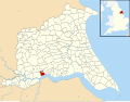 Broomfleet UK parish locator map.svg 1,425 × 1,107; 1.68 MB
-
 Broomfleet Village Hall 1956 - geograph.org.uk - 3141094.jpg 640 × 427; 93 KB
-
 Broomfleet village sign - geograph.org.uk - 6021848.jpg 640 × 480; 93 KB
-

-
 Broomfleet, Windmill Hill - geograph.org.uk - 3141549.jpg 640 × 427; 78 KB
-
 By Broomfleet Drain - geograph.org.uk - 4342156.jpg 640 × 505; 176 KB
-
 Cave Crossing, Hull Direction - geograph.org.uk - 4506310.jpg 640 × 427; 50 KB
-
 Cave level crossing at broomfleet - geograph.org.uk - 2106352.jpg 800 × 600; 195 KB
-
 Church Farm - geograph.org.uk - 4558524.jpg 640 × 426; 43 KB
-
 Church of St Mary - geograph.org.uk - 6021843.jpg 640 × 477; 124 KB
-

-
 Clegdike Bridge - geograph.org.uk - 1466221.jpg 640 × 480; 46 KB
-
 Clegdike Drain - geograph.org.uk - 733097.jpg 480 × 640; 152 KB
-
 Clegdike Drain from Wallingfen Lane - geograph.org.uk - 5059968.jpg 4,608 × 3,456; 5.78 MB
-
 Close up, Elizabeth II postbox on Main Street, Broomfleet - geograph.org.uk - 6063015.jpg 2,666 × 5,101; 2.92 MB
-
 Common Road - geograph.org.uk - 1603753.jpg 640 × 480; 44 KB
-
 Common Road junction - geograph.org.uk - 3141015.jpg 640 × 427; 67 KB
-
 Common Road, Broomfleet - geograph.org.uk - 1466219.jpg 640 × 480; 53 KB
-
 Cottage in Broomfleet - geograph.org.uk - 3133089.jpg 4,205 × 3,004; 2.74 MB
-
 Cottages in Broomfleet - geograph.org.uk - 3133091.jpg 4,608 × 3,072; 3.42 MB
-
 Crossing the railway near Broomfleet - geograph.org.uk - 5437755.jpg 800 × 600; 142 KB
-
 Cutting To The Wolds - geograph.org.uk - 250293.jpg 640 × 480; 101 KB
-

-
 Derelict Building at Weighton Lock - geograph.org.uk - 235990.jpg 640 × 426; 138 KB
-
 Dragonfly on grass stems - geograph.org.uk - 4609830.jpg 548 × 640; 513 KB
-
 Drain across Broomfleet Hope - geograph.org.uk - 5282215.jpg 5,376 × 3,024; 5.6 MB
-
 Drain near Prospect Farm, Broomfleet - geograph.org.uk - 6063034.jpg 640 × 394; 42 KB
-
 Drain, Broomfleet - geograph.org.uk - 6062992.jpg 640 × 480; 70 KB
-
 Elizabeth II postbox on Main Street, Broomfleet - geograph.org.uk - 6063011.jpg 5,184 × 3,888; 5.05 MB
-
 Elizabeth II postbox on Main Street, Broomfleet - geograph.org.uk - 6063013.jpg 4,166 × 3,409; 4.71 MB
-

-
 Farm Near Laxton Grange, Walling Fen - geograph.org.uk - 235404.jpg 640 × 427; 151 KB
-
 Farmhouse, Church Farm, Broomfleet - geograph.org.uk - 6063030.jpg 5,184 × 3,888; 4.62 MB
-
 Farmland near Laxton Grange - geograph.org.uk - 4489073.jpg 1,024 × 768; 143 KB
-
 Faxfleet Main Drain outflow - geograph.org.uk - 3141310.jpg 640 × 427; 94 KB
-
 Field And Hedging - geograph.org.uk - 250322.jpg 640 × 480; 104 KB
-
 Field by the railway at Broomfleet - geograph.org.uk - 5972745.jpg 1,024 × 768; 173 KB
-
 Field path at Outler Clough - geograph.org.uk - 6021841.jpg 640 × 480; 107 KB
-
 Field path near Providence Farm - geograph.org.uk - 5972738.jpg 1,024 × 768; 219 KB
-
 Fields at Broomfleet Hope. - geograph.org.uk - 2186065.jpg 4,000 × 3,000; 3.46 MB
-

-
 Flatlands - geograph.org.uk - 250306.jpg 640 × 480; 95 KB
-

-
 Footpath near Broomfleet - geograph.org.uk - 1603348.jpg 640 × 480; 84 KB
-
 Footpath near Broomfleet - geograph.org.uk - 4342325.jpg 640 × 480; 166 KB
-
 Footpath near Providence Farm - geograph.org.uk - 1603288.jpg 640 × 480; 90 KB
-
 Footpath South of Broomfleet - geograph.org.uk - 629543.jpg 640 × 480; 102 KB
-
 Footpath through the Fields - geograph.org.uk - 629551.jpg 640 × 480; 86 KB
-
 Footpath to Broomfleet - geograph.org.uk - 629561.jpg 640 × 480; 125 KB
-
 Footpath to Broomfleet Dam - geograph.org.uk - 629568.jpg 640 × 480; 111 KB
-
 Footpath Towards Provence - geograph.org.uk - 250201.jpg 640 × 480; 98 KB
-
 Former Red Lion Inn, Broomfleet - geograph.org.uk - 6063006.jpg 640 × 480; 62 KB
-
 Gate to the Ponds - geograph.org.uk - 6363780.jpg 4,431 × 3,232; 3.8 MB
-
 Geese and waders at Whitton Sand, River Humber - geograph.org.uk - 5515076.jpg 1,024 × 768; 156 KB
-
 Grange Farm - geograph.org.uk - 6063053.jpg 640 × 432; 46 KB
-
 Grange Farm near Broomfleet - geograph.org.uk - 1603327.jpg 640 × 480; 51 KB
-
 Grange Farm on Ponds Lane - geograph.org.uk - 6182089.jpg 1,024 × 768; 207 KB
-
 Grazing, Town's Corner, Broomfleet - geograph.org.uk - 6063036.jpg 640 × 480; 83 KB
-
 Heading down The Landing - geograph.org.uk - 2106410.jpg 800 × 600; 301 KB
-
 Heading North near Providence Farm - geograph.org.uk - 2106341.jpg 800 × 600; 277 KB
-
 Heart-shaped pipes - geograph.org.uk - 4609834.jpg 524 × 640; 496 KB
-
 Hedgerow on White Ings - geograph.org.uk - 3688116.jpg 1,024 × 768; 152 KB
-
 Higham Grange, near Newport (E Yorks) - geograph.org.uk - 4609821.jpg 480 × 640; 487 KB
-
 House next to the church - geograph.org.uk - 3141631.jpg 640 × 427; 78 KB
-
 Houses at Weighton Lock - geograph.org.uk - 3133083.jpg 4,608 × 3,072; 3.46 MB
-
 Houses on Main Street, Broomfleet - geograph.org.uk - 6063021.jpg 640 × 480; 71 KB
-
 Houses on Main Street, Broomfleet - geograph.org.uk - 6063028.jpg 640 × 480; 49 KB
-
 Hull bound train near Cave Crossing - geograph.org.uk - 2478279.jpg 1,024 × 768; 147 KB
-

-
 Humber Lock Farm - geograph.org.uk - 11699.jpg 640 × 480; 44 KB
-
 Humber Lock Farm - geograph.org.uk - 5974939.jpg 1,024 × 768; 178 KB
-
 Humber Lock Farm - geograph.org.uk - 629588.jpg 640 × 480; 124 KB
-
 Ingram House, Broomfleet - geograph.org.uk - 3133092.jpg 4,298 × 3,070; 2.87 MB
-
 Interesting sheds at Broomfleet - geograph.org.uk - 3141671.jpg 640 × 427; 66 KB
-

-
 K6 telephone box on Main Street, Broomfleet - geograph.org.uk - 6063029.jpg 4,141 × 3,169; 3.02 MB
-
 Landing Lane - geograph.org.uk - 1466248.jpg 640 × 480; 61 KB
-
 Landing Lane - geograph.org.uk - 250310.jpg 640 × 480; 101 KB
-
 Lane beside Market Weighton Canal - geograph.org.uk - 1603365.jpg 640 × 480; 95 KB
-
 Lane to Broomfleet - geograph.org.uk - 2186231.jpg 4,000 × 3,000; 3.28 MB
-
 Lantern Lane - geograph.org.uk - 629589.jpg 640 × 416; 65 KB
-
 Little Lane - geograph.org.uk - 629471.jpg 640 × 482; 65 KB
-
-
 Looking Towards Broomfleet Hope - geograph.org.uk - 235401.jpg 640 × 426; 137 KB
-

-
 Looking towards Cave Crossing - geograph.org.uk - 2478276.jpg 1,024 × 768; 129 KB
-
 Looking Towards Providence Farm - geograph.org.uk - 250324.jpg 640 × 480; 98 KB
-
 Main line from Hull crosses Market Weighton Canal - geograph.org.uk - 2186240.jpg 4,000 × 3,000; 2.88 MB
-
 Main Line toward Brough - geograph.org.uk - 2186086.jpg 4,000 × 3,000; 2.89 MB
-
 Main Street, Broomfleet - geograph.org.uk - 6063017.jpg 4,381 × 3,108; 3.04 MB
-
 Main Street, Broomfleet - geograph.org.uk - 907482.jpg 640 × 440; 151 KB
-
 Main Street. Broomfleet - geograph.org.uk - 3133095.jpg 4,169 × 2,978; 2.64 MB
-
 Market Weighton Canal near Broomfleet - geograph.org.uk - 4610057.jpg 640 × 517; 419 KB
-
 Market Weighton Canal near Broomfleet - geograph.org.uk - 4610089.jpg 480 × 640; 392 KB
-
 Market Weighton Canal.jpg 640 × 536; 175 KB
-
 Muddy Track - geograph.org.uk - 6363774.jpg 4,608 × 3,456; 4.64 MB
-
 Muddy Track - geograph.org.uk - 6363782.jpg 4,608 × 3,456; 4.11 MB
-
 Muddy Track - geograph.org.uk - 6363785.jpg 4,608 × 3,456; 4.19 MB
-
 Muddy Track - geograph.org.uk - 6363787.jpg 4,398 × 3,258; 4.58 MB
-
 Near Cave Crossing - geograph.org.uk - 4558526.jpg 640 × 426; 42 KB
-
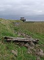
 Non-path near Broomfleet - geograph.org.uk - 5699619.jpg 640 × 480; 124 KB
-
 North of Broomfleet Crossing - geograph.org.uk - 115325.jpg 640 × 480; 116 KB
-
 North West Footpath - geograph.org.uk - 629455.jpg 640 × 415; 81 KB
-

-

-
 Northfield House Farm - geograph.org.uk - 4558748.jpg 640 × 281; 26 KB
-
 Northfield House Farm - geograph.org.uk - 4558751.jpg 640 × 274; 25 KB
-
 Northfield House Farm, Broomfleet - geograph.org.uk - 6062974.jpg 640 × 435; 81 KB
-
 Not in the south of France - geograph.org.uk - 5439309.jpg 800 × 600; 91 KB
-
 Not much sign of a path here - geograph.org.uk - 5282123.jpg 5,376 × 3,024; 5.96 MB
-
 Oilseed rape and Provence - geograph.org.uk - 2477953.jpg 1,024 × 768; 217 KB
-
 Old school and schoolhouse, Broomfleet - geograph.org.uk - 3133094.jpg 4,411 × 2,941; 2.68 MB
-
 Old sign on the front wall of Broomfleet schoolhouse - geograph.org.uk - 3133096.jpg 3,072 × 4,608; 3.44 MB
-
 Over Market Weighton Canal farm vehicles - geograph.org.uk - 5059909.jpg 4,608 × 3,456; 5.02 MB
-
 Overgrown Path - geograph.org.uk - 2477283.jpg 1,024 × 768; 205 KB
-
 Passing place on a minor road - geograph.org.uk - 5439305.jpg 800 × 600; 128 KB
-
 Path by Market Weighton Canal - geograph.org.uk - 4610098.jpg 640 × 480; 430 KB
-
 Path over the Railway - geograph.org.uk - 6363777.jpg 4,608 × 3,456; 5.11 MB
-
 Path to Crabley Creek - geograph.org.uk - 4506304.jpg 640 × 427; 53 KB
-
 Pigeon Cote Farm, Broomfleet - geograph.org.uk - 880943.jpg 640 × 427; 185 KB
-

-

-

-
 Ponds Lane, Broomfleet, E Yorks - geograph.org.uk - 4342165.jpg 640 × 458; 185 KB
-
 Power over the Wolds - geograph.org.uk - 5849109.jpg 4,298 × 3,329; 2.35 MB
-
 Power over the Yorkshire Wolds - geograph.org.uk - 5849111.jpg 3,114 × 4,064; 2.11 MB
-
 Power to the West - geograph.org.uk - 5849114.jpg 4,446 × 3,306; 2.22 MB
-
 Prospect Farm - geograph.org.uk - 4558528.jpg 640 × 298; 38 KB
-
 Prospect Farm - geograph.org.uk - 4558530.jpg 640 × 426; 42 KB
-
 Prospect Farm, Broomfleet - geograph.org.uk - 6063037.jpg 640 × 365; 57 KB
-
 Provence Farm - geograph.org.uk - 1466186.jpg 640 × 480; 52 KB
-
 Provence Farm for sale, Broomfleet - geograph.org.uk - 4506294.jpg 640 × 427; 63 KB
-
 Public Footpath off Ings Lane - geograph.org.uk - 1466188.jpg 640 × 480; 70 KB
-

-
 Pylon, Broomfleet Carr - geograph.org.uk - 4558531.jpg 640 × 426; 36 KB
-
 Pylons near Broomfleet - geograph.org.uk - 4610073.jpg 444 × 640; 375 KB
-
 Rail bridge over the Market Weighton Canal - geograph.org.uk - 6182063.jpg 1,024 × 768; 218 KB
-
 Railway bridge over the Market Weighton Canal - geograph.org.uk - 3688195.jpg 1,024 × 768; 128 KB
-
 Railway Crossing Gate - geograph.org.uk - 1603341.jpg 640 × 480; 123 KB
-

-
 Railway Line towards Hull - geograph.org.uk - 1603334.jpg 640 × 480; 74 KB
-
 Railway near Broomfleet - geograph.org.uk - 4342314.jpg 640 × 474; 173 KB
-
 Railway towards Hull - geograph.org.uk - 6063047.jpg 640 × 375; 36 KB
-
 Reeds, Wood And Wold - geograph.org.uk - 250291.jpg 640 × 480; 105 KB
-
 Road Junction at SE880286 - geograph.org.uk - 115326.jpg 640 × 480; 97 KB
-
 Ruined building at Humber Lock Farm - geograph.org.uk - 6021839.jpg 640 × 480; 122 KB
-
 Sandtoft Entrance Bridge - geograph.org.uk - 250308.jpg 640 × 480; 96 KB
-
 Scarfflands, Broomfleet - geograph.org.uk - 446864.jpg 640 × 462; 124 KB


_-_geograph.org.uk_-_6062996.jpg)


_-_geograph.org.uk_-_4609821.jpg)


_-_geograph.org.uk_-_4609842.jpg)


