Category:Broughton, Milton Keynes
Vai alla navigazione
Vai alla ricerca
English: Broughton is the name of a historic village in North Buckinghamshire that has been a constituent element of Milton Keynes since the latter's designation in 1967; a civil parish; and modernly a suburb and new district of the 'city'.
Norsk bokmål: Broughton er en landsby i Buckinghamshire, England, nær grensen til Bedfordshire. Den ligger i den enhetlige myndigheten Milton Keynes.
village and civil parish in Milton Keynes, Buckinghamshire, UK  | |||||
| Carica un file multimediale | |||||
| Istanza di | |||||
|---|---|---|---|---|---|
| Luogo | Milton Keynes, Buckinghamshire, Sud Est dell'Inghilterra, Inghilterra | ||||
 | |||||
Sottocategorie
Questa categoria contiene un'unica sottocategoria, indicata di seguito.
L
- St Lawrence's Church, Broughton (10 F)
File nella categoria "Broughton, Milton Keynes"
Questa categoria contiene 115 file, indicati di seguito, su un totale di 115.
-
 'City Street', Broughton Gate, Milton Keynes.jpg 4 320 × 2 938; 1,47 MB
-
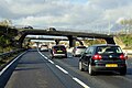
 A wet day at J14, M1 - geograph.org.uk - 4699116.jpg 640 × 357; 27 KB
-
 A wet day on the M1, southbound - geograph.org.uk - 4699119.jpg 640 × 357; 22 KB
-

-
 Bike sharing station by Warwick Avenue - geograph.org.uk - 5044775.jpg 1 600 × 1 066; 312 KB
-
 Borough of Milton Keynes , Broughton Interchange - geograph.org.uk - 5979874.jpg 6 000 × 4 000; 5,96 MB
-
 Borough of Milton Keynes , M1 Motorway - geograph.org.uk - 5979086.jpg 6 000 × 4 000; 6,05 MB
-
 Borough of Milton Keynes , M1 Motorway - geograph.org.uk - 5979093.jpg 6 000 × 4 000; 6,64 MB
-
 Borough of Milton Keynes , M1 Motorway - geograph.org.uk - 5979873.jpg 6 000 × 4 000; 6,21 MB
-
 Bridge in Broughton, Milton Keynes in 2006.jpg 480 × 640; 81 KB
-
 Bridge over the M11 - geograph.org.uk - 4725666.jpg 640 × 426; 50 KB
-
 Brooklands Farm business centre, Broughton - geograph.org.uk - 2476118.jpg 1 024 × 682; 119 KB
-
 Brooklands Farm Primary School - geograph.org.uk - 2949784.jpg 640 × 428; 65 KB
-

-
 Broughton Gate - geograph.org.uk - 1692253.jpg 640 × 430; 72 KB
-
 Broughton Gate development - geograph.org.uk - 1692236.jpg 640 × 413; 59 KB
-
 Broughton Grounds Lane - geograph.org.uk - 1692261.jpg 640 × 470; 85 KB
-
 Broughton milestone.JPG 2 064 × 3 521; 1 010 KB
-
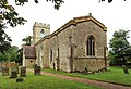
 Broughton parish church - geograph.org.uk - 2930213.jpg 640 × 428; 134 KB
-
 Broughton Pavilion - geograph.org.uk - 4984104.jpg 1 600 × 1 066; 425 KB
-
 Broughton Road - geograph.org.uk - 4729186.jpg 640 × 480; 60 KB
-
 Broughton Road Bridge, M1 - geograph.org.uk - 4699121.jpg 640 × 372; 28 KB
-
 Broughton Road Bridge, M1 - geograph.org.uk - 4730014.jpg 640 × 426; 45 KB
-
 Broughton Road goes over the M1 - geograph.org.uk - 3007460.jpg 1 600 × 1 069; 385 KB
-

-
 Broughton, St Lawrence - geograph.org.uk - 5472862.jpg 4 608 × 3 456; 5,24 MB
-
 Community Sports Facility - geograph.org.uk - 1692237.jpg 640 × 512; 90 KB
-
 Construction site east of Broughton - geograph.org.uk - 4729188.jpg 640 × 480; 89 KB
-
 Countess or Chaffron Way H7.JPG 2 560 × 1 920; 988 KB
-
 Development site - geograph.org.uk - 3610254.jpg 640 × 421; 53 KB
-

-
 Houses on Oxenhope Way Broughton - geograph.org.uk - 1692247.jpg 640 × 477; 113 KB
-
 Houses on Oxenhope Way, Broughton - geograph.org.uk - 5150196.jpg 5 184 × 3 888; 3,62 MB
-
 Interior of St Lawrence Broughton - geograph.org.uk - 4984157.jpg 1 600 × 1 200; 407 KB
-
 Junction 14 overbridges, M1 - geograph.org.uk - 4725651.jpg 640 × 426; 45 KB
-
 Junction with Newport Road, Broughton - geograph.org.uk - 2476114.jpg 1 024 × 663; 95 KB
-
 Landscaping for Brooklands Meadow Park - geograph.org.uk - 4951668.jpg 1 600 × 1 066; 369 KB
-
 Letter Box MK16 144 at Broughton - geograph.org.uk - 1692246.jpg 475 × 640; 108 KB
-
 London Road Broughton - geograph.org.uk - 1692245.jpg 640 × 442; 103 KB
-
 London Road crossing the M1 below, Northfield - geograph.org.uk - 3073629.jpg 1 600 × 1 200; 541 KB
-
 M1 - Northbound - geograph.org.uk - 2336797.jpg 2 272 × 1 704; 1,63 MB
-

-
 M1 motorway - Broughton Road bridge - geograph.org.uk - 2897362.jpg 640 × 480; 56 KB
-
 M1 motorway - junction 14 bridges - geograph.org.uk - 2897376.jpg 640 × 480; 57 KB
-
 M1 motorway at junction 14 (A509) - geograph.org.uk - 2897375.jpg 640 × 480; 48 KB
-
 M1 motorway in rural surroundings - geograph.org.uk - 2897361.jpg 640 × 480; 60 KB
-
 M1 near Milton Keynes - geograph.org.uk - 4327112.jpg 640 × 480; 65 KB
-
 M1 northbound near Milton Keynes - geograph.org.uk - 4729194.jpg 640 × 480; 46 KB
-
 M1, Junction 14 - geograph.org.uk - 4324949.jpg 640 × 441; 63 KB
-
 M1, southbound - geograph.org.uk - 4725669.jpg 640 × 426; 54 KB
-
 Medieval wall painting in St Lawrence Broughton - geograph.org.uk - 4984221.jpg 1 600 × 1 199; 479 KB
-
 Medieval wall painting in St Lawrence Broughton - geograph.org.uk - 4984225.jpg 1 600 × 1 196; 528 KB
-
 Medieval wall painting in St Lawrence Broughton - geograph.org.uk - 4984229.jpg 1 066 × 1 600; 310 KB
-
 Milton Keynes - panoramio.jpg 3 072 × 2 304; 1,73 MB
-
 Milton Keynes Broughton - panoramio - stone40.jpg 1 600 × 1 200; 425 KB
-
 Milton Keynes Broughton - panoramio.jpg 3 072 × 2 304; 1,55 MB
-
 Milton Keynes from the air - geograph.org.uk - 2053282.jpg 2 592 × 1 944; 3,95 MB
-
 Milton Keynes from the air - geograph.org.uk - 2053286.jpg 2 592 × 1 944; 4,01 MB
-
 Milton Keynes, Xscape - panoramio - stone40.jpg 3 072 × 2 304; 1,26 MB
-
 Minor road towards Salford - geograph.org.uk - 4729191.jpg 640 × 480; 57 KB
-
 MK Charging Hub - geograph.org.uk - 6010214.jpg 1 600 × 953; 243 KB
-

-

-
 New houses this way - geograph.org.uk - 1692238.jpg 640 × 563; 87 KB
-

-
 New housing on the Newport Road - geograph.org.uk - 2949783.jpg 640 × 427; 63 KB
-

-
 New road and new houses - geograph.org.uk - 1692254.jpg 640 × 519; 34 KB
-
 Newport Road (A5130), Broughton - geograph.org.uk - 4628444.jpg 640 × 480; 71 KB
-
 Newport Road, Broughton - geograph.org.uk - 3073628.jpg 1 600 × 1 200; 585 KB
-
-
 Northbound M1 near Milton Keynes - geograph.org.uk - 6262009.jpg 800 × 533; 509 KB
-
 Oxenhope Way Broughton - geograph.org.uk - 1692248.jpg 640 × 407; 59 KB
-

-
 Playground at Broughton - geograph.org.uk - 1692249.jpg 640 × 424; 106 KB
-
 Prehistoric Park Broughton - geograph.org.uk - 5044769.jpg 1 600 × 1 066; 392 KB
-
 Road and culvert - geograph.org.uk - 1692257.jpg 640 × 524; 96 KB
-
 Road to nowhere - geograph.org.uk - 1692255.jpg 640 × 428; 57 KB
-

-
 Sign for the Broughton - geograph.org.uk - 4628437.jpg 540 × 640; 54 KB
-
 Slip road closed - geograph.org.uk - 878481.jpg 640 × 480; 104 KB
-
 St Lawrence's Church, Broughton - geograph.org.uk - 5150188.jpg 4 948 × 3 563; 4,01 MB
-
 St Lawrence, Broughton - Chancel - geograph.org.uk - 5115245.jpg 900 × 606; 540 KB
-
 St Lawrence, Broughton - geograph.org.uk - 5115235.jpg 900 × 613; 614 KB
-
 St Lawrence, Broughton - geograph.org.uk - 5115239.jpg 900 × 585; 586 KB
-
 St Lawrence, Broughton - geograph.org.uk - 5115240.jpg 900 × 648; 619 KB
-
 St Lawrence, Broughton - geograph.org.uk - 5115241.jpg 900 × 589; 541 KB
-
 St Lawrence, Broughton - geograph.org.uk - 5115243.jpg 900 × 603; 560 KB
-
 St Lawrence, Broughton - Hatchment - geograph.org.uk - 5115277.jpg 900 × 900; 552 KB
-
 St Lawrence, Broughton - Sanctuary - geograph.org.uk - 5115247.jpg 900 × 631; 544 KB
-

-

-

-

-
 St Lawrence, Broughton - Wall painting - geograph.org.uk - 5115249.jpg 900 × 607; 590 KB
-
 St Lawrence, Broughton - Wall painting - geograph.org.uk - 5115250.jpg 661 × 900; 558 KB
-
 St Lawrence, Broughton - Wall painting - geograph.org.uk - 5115252.jpg 900 × 801; 739 KB
-
 St Lawrence, Broughton - Wall painting - geograph.org.uk - 5115253.jpg 900 × 656; 646 KB
-
 St Lawrence, Broughton - Wall painting - geograph.org.uk - 5115258.jpg 498 × 900; 520 KB
-
 St Lawrence, Broughton - Wall painting - geograph.org.uk - 5115261.jpg 900 × 820; 816 KB
-
 St Lawrence, Broughton - Wall painting - geograph.org.uk - 5115263.jpg 600 × 900; 480 KB
-
 St Lawrence, Broughton - West end - geograph.org.uk - 5115246.jpg 900 × 609; 613 KB
-
 Stained glass window at St Lawrence Broughton - geograph.org.uk - 4984212.jpg 1 066 × 1 600; 360 KB
-
 Stained glass window in St Lawrence Broughton - geograph.org.uk - 4984186.jpg 1 066 × 1 600; 464 KB
-
 Stained glass windows of St Lawrence Broughton - geograph.org.uk - 4984178.jpg 1 066 × 1 600; 465 KB
-
 Stream near Broughton - geograph.org.uk - 4729183.jpg 640 × 480; 97 KB
-
 Telephone kiosk in Broughton - geograph.org.uk - 5150186.jpg 5 069 × 3 656; 4,23 MB
-

-
 The Broughton public house - geograph.org.uk - 4628435.jpg 640 × 480; 78 KB
-
 The M1 junction 14 exit sliproad - geograph.org.uk - 5431723.jpg 2 048 × 1 536; 1 009 KB
-

-
 View across motorway - geograph.org.uk - 5822174.jpg 640 × 480; 44 KB
-

-
 Wenford facing Newport Road, Broughton - geograph.org.uk - 3073626.jpg 1 600 × 1 200; 569 KB
-
 Wenford local park - geograph.org.uk - 2949796.jpg 640 × 427; 62 KB


_-_geograph.org.uk_-_2897375.jpg)


,_Broughton_-_geograph.org.uk_-_4628443.jpg)


,_Broughton_-_geograph.org.uk_-_4628444.jpg)

_-_geograph.org.uk_-_6262991.jpg)


