Category:Milton Keynes
Jump to navigation
Jump to search
city in Buckinghamshire, England, United Kingdom  | |||||
| Upload media | |||||
| Pronunciation audio | |||||
|---|---|---|---|---|---|
| Instance of | |||||
| Location | City of Milton Keynes, Buckinghamshire, South East England, England | ||||
| Located in or next to body of water | |||||
| Inception |
| ||||
| Population |
| ||||
| Area |
| ||||
| Elevation above sea level |
| ||||
| Different from | |||||
| official website | |||||
 | |||||
English: Milton Keynes is a city in the Milton Keynes district, in the county of Buckinghamshire, England.
Main Wikipedia article: Milton Keynes.
Subcategories
This category has the following 30 subcategories, out of 30 total.
A
- Abbey Hill (52 F)
B
- Blue Lagoon, Milton Keynes (2 F)
C
G
- Gulliver's Land (6 F)
K
L
M
- Milton Keynes College (1 F)
N
O
- Old Woughton (82 F)
- Oxley Mead (6 F)
S
- Santander Cycles MK (3 F)
W
Media in category "Milton Keynes"
The following 166 files are in this category, out of 166 total.
-

-
 "Stonehengie" - panoramio.jpg 3,520 × 1,779; 3.27 MB
-
 1--Milton Keynes-CROPPED.jpg 3,938 × 3,637; 6.3 MB
-
 2014-365-127 Pervasive Interaction. With Lasers (13946759659).jpg 2,611 × 1,957; 1.02 MB
-
 2014-365-128 Stick Bloke in Peril (14141713364).jpg 2,724 × 2,043; 1.17 MB
-
 2019 Seat Leon Cupra 1.jpg 2,351 × 1,591; 747 KB
-
 20190325-1-RJPLancaster-MiltonKeynes.jpg 2,596 × 2,132; 5.66 MB
-
 2021 Mercedes EQV 300 Sport Premium 1.jpg 3,307 × 2,238; 1.56 MB
-
 2023 BMW M2 1.jpg 3,419 × 2,603; 1.68 MB
-
 2023 BMW M3 Competition xDrive Auto.jpg 4,080 × 2,559; 2.33 MB
-
 2023 BMW M3 Touring.jpg 4,080 × 2,496; 1.76 MB
-
 2023 BMW M5.jpg 4,080 × 2,789; 1.61 MB
-
 2023 Mercedes A Class Saloon.jpg 2,993 × 1,487; 1,005 KB
-
 2023 Mercedes A200e AMG LINE Executive MHEV Auto.jpg 2,741 × 1,450; 2.1 MB
-
 2023 Mercedes E Class.jpg 3,069 × 1,589; 1.04 MB
-
 2023 Mercedes EQC.jpg 2,308 × 1,603; 923 KB
-
 2023 Mercedes EQE 300 AMG Line Premium.jpg 3,647 × 2,096; 2.13 MB
-
 2023 Mercedes GLA45S 4MATIC+ Auto.jpg 3,563 × 2,320; 1.7 MB
-
 2023 Mercedes GLB.jpg 2,273 × 1,453; 699 KB
-
 2023 Mercedes GLC Coupe.jpg 2,281 × 1,477; 869 KB
-
 2023 Skoda Octavia VRS.jpg 3,717 × 2,451; 2.15 MB
-
 Alle We Love The English Countryside (65413463).jpeg 2,048 × 1,365; 1.34 MB
-
 ARRIVA ELECTRIC BUS (14288878309).jpg 4,896 × 3,672; 6.26 MB
-
 ARRIVA PLATINUM MILTON KEYNES (14495639503).jpg 4,896 × 3,672; 5.43 MB
-
 Autumn Cygnets. Ouse Valley Park. - panoramio.jpg 2,766 × 2,946; 1.59 MB
-
 Autumn Day in the City.jpg 3,648 × 2,736; 2.94 MB
-
 Be Happy - panoramio.jpg 2,592 × 1,944; 979 KB
-
 Bletchley Road Senior School Athletics Team.png 583 × 359; 222 KB
-
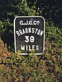
 Broughton Road bridge - geograph.org.uk - 1692235.jpg 640 × 463; 58 KB
-
 Childs way Milton Keynes - geograph.org.uk - 878487.jpg 640 × 480; 63 KB
-
 Civic Offices, 1 Saxon Gate East, Milton Keynes.jpg 3,032 × 2,274; 2.2 MB
-
 CMK from Great Holm (April 23).jpg 1,600 × 1,049; 441 KB
-
 Davey Avenue, Milton Keynes - panoramio.jpg 3,264 × 3,264; 6.46 MB
-
 DCFC0023.jpg 2,592 × 1,936; 1.57 MB
-
 DCFC0024.jpg 2,592 × 1,936; 1.51 MB
-
 Denbigh School 2013.png 1,280 × 949; 1.27 MB
-
 Denbigh School 2017.png 1,620 × 1,080; 1.43 MB
-
 EaglestonePark.JPG 2,816 × 2,112; 2.72 MB
-
 Flag of Milton Keynes.png 4,128 × 2,475; 1.78 MB
-
 Former Urban District Council Offices, 263 Queensway, Bletchley, Buckinghamshire.jpg 2,698 × 2,024; 839 KB
-
 Frozen Grand Union Canal. View towards Wolverton. - panoramio.jpg 3,950 × 2,445; 1.78 MB
-
 Glastonbury Thorn First School - geograph.org.uk - 1101276.jpg 640 × 480; 149 KB
-
 Gloomy subway (50715539078).jpg 3,648 × 2,736; 1.82 MB
-
 GOC Milton Keynes 001 Grand Union Canal (32548784253).jpg 4,288 × 3,216; 3.97 MB
-
 GOC Milton Keynes 002 Grand Union Canal (32548788923).jpg 4,143 × 3,109; 4.1 MB
-
 GOC Milton Keynes 003 Grand Union Canal (32548793113).jpg 4,288 × 3,216; 3.88 MB
-
 GOC Milton Keynes 007 Grand Union Canal (33362924495).jpg 4,288 × 3,216; 4.54 MB
-
 GOC Milton Keynes 013 Grand Union Canal (33340947276).jpg 4,143 × 3,109; 3.79 MB
-
 GOC Milton Keynes 019 Grand Union Canal (33381515165).jpg 4,156 × 3,121; 4.52 MB
-
 GOC Milton Keynes 049 Grand Union Canal (33526876856).jpg 4,288 × 3,216; 3.7 MB
-
 GOC Milton Keynes 055 Grand Union Canal (33430020152).jpg 4,288 × 3,216; 4.45 MB
-
 GOC Milton Keynes 058 Grand Union Canal (32772439873).jpg 4,288 × 3,216; 4.1 MB
-
 GOC Milton Keynes 059 Grand Union Canal (32772443323).jpg 4,288 × 3,216; 4.17 MB
-
 GOC Milton Keynes 060 Grand Union Canal (32772447173).jpg 4,288 × 3,216; 4.42 MB
-

-
 Great Holm Milton Keynes at night.jpg 5,184 × 3,456; 22.17 MB
-
 Horse Tunnel under Grand Union Canal. Cosgrove. - panoramio.jpg 3,000 × 4,000; 4.17 MB
-
 Hotel LaTour completed.jpg 5,184 × 3,456; 21.89 MB
-
 Inside the Milton Keynes Shopping Mall on Christmas Eve.jpg 5,184 × 3,456; 21.38 MB
-
 John ('Jock') Middleton Campbell, Baron Campbell of Eskan.jpg 582 × 800; 81 KB
-
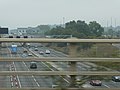
 Junction 14 southbound M1 motorway - geograph.org.uk - 878477.jpg 640 × 352; 48 KB
-
 KH58NCO 53616 MILTON KEYNES (14288918928).jpg 4,896 × 3,672; 4.83 MB
-
 Kiln Farm Building.jpg 1,599 × 1,199; 244 KB
-
 KP63TDU ARRIVA BATTERY BUS (14474214102).jpg 4,896 × 3,672; 5.05 MB
-
 KP63TDU MILTON KEYNES (14288936448).jpg 4,896 × 3,672; 5.68 MB
-
 KP63TEV ARRIVA ELECTRIC BUS MILTON KEYNES (14288903580).jpg 4,896 × 3,672; 6.41 MB
-
 Lambs -)cambell park - panoramio.jpg 2,048 × 1,536; 704 KB
-
 Location map United Kingdom Milton Keynes 2020.png 2,230 × 1,767; 3.28 MB
-
 Lord Grey Academy Logo.png 250 × 250; 36 KB
-
 Lord Grey School.png 1,379 × 1,080; 1.42 MB
-
 Lord of cambell park - panoramio.jpg 2,048 × 1,536; 630 KB
-
 M1 at Milton Keynes.jpg 5,184 × 3,888; 8.08 MB
-
 McDonald's (38238709432).jpg 2,560 × 1,920; 931 KB
-
 Medale Road, Beanhill, Milton Keynes. - geograph.org.uk - 1509365.jpg 640 × 360; 142 KB
-
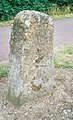
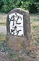
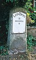
 Milemarker by the Grand Union Canal, Bletchley (geograph 6095577).jpg 1,151 × 1,530; 224 KB
-
 Milepost next to Isworth Farm Bridge No 63 (geograph 4745960).jpg 800 × 600; 204 KB
-
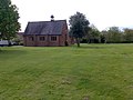
 Milton Court Care Home Milton Keynes.jpg 774 × 518; 95 KB
-
 Milton Court Care Home Milton Keynes1.jpg 259 × 387; 45 KB
-
 MILTON KEYNES (14289057417).jpg 4,896 × 3,672; 5.33 MB
-
 Milton Keynes Banner.jpg 5,178 × 740; 1.64 MB
-
 Milton Keynes Boundary Walk - geograph.org.uk - 809382.jpg 640 × 480; 146 KB
-
 Milton Keynes Boundary Walk, Aspley Heath - geograph.org.uk - 809341.jpg 480 × 640; 100 KB
-
 Milton Keynes Built-up Area 2011 map.png 830 × 758; 808 KB
-
 Milton Keynes Community Transport (13560865013).jpg 3,157 × 2,233; 760 KB
-
Milton keynes engb.ogg 1.4 s; 38 KB
-
 Milton Keynes UK ward map 2022.svg 1,055 × 1,266; 349 KB
-
 Milton Keynes UK ward map 2023.svg 1,055 × 1,266; 350 KB
-
 Milton Keynes Village - panoramio - stone40 (1).jpg 1,600 × 1,200; 1.14 MB
-
 Milton Keynes Village - panoramio - stone40.jpg 1,600 × 1,200; 1.09 MB
-
 Milton Keynes Village - panoramio.jpg 1,600 × 1,200; 552 KB
-
 Milton Keynes windmill - geograph.org.uk - 878520.jpg 640 × 480; 77 KB
-
 Milton Keynes, UK - panoramio (1).jpg 5,184 × 3,456; 6.37 MB
-
 Milton Keynes, UK - panoramio (2).jpg 5,184 × 3,456; 8.75 MB
-
 Milton Keynes, UK - panoramio (3).jpg 5,184 × 3,456; 8.16 MB
-
 Milton Keynes, UK - panoramio (4).jpg 5,184 × 3,456; 8.51 MB
-
 Milton Keynes, UK - panoramio (5).jpg 4,256 × 2,400; 4.13 MB
-
 Milton Keynes, UK - panoramio (6).jpg 3,856 × 2,176; 2.22 MB
-
 Milton Keynes, UK - panoramio.jpg 5,184 × 3,456; 6.93 MB
-
 MK Montage.jpg 4,367 × 6,761; 5.64 MB
-
 MK skyline.jpg 4,333 × 1,370; 4.08 MB
-
 MK Snap Learners with David Martin, MK Dons FC.jpg 720 × 478; 77 KB
-
 MK, Campbell Park - panoramio.jpg 1,120 × 629; 255 KB
-
 MK, Willen Lake - panoramio (1).jpg 1,229 × 922; 469 KB
-
 MK, Willen Lake - panoramio.jpg 2,105 × 1,215; 708 KB
-
 NAH 137P.jpg 4,278 × 2,852; 8.94 MB
-

-
 New Nature Reserve. Wolverton. Ouse Valley. - panoramio.jpg 3,612 × 1,900; 1.17 MB
-
 Old milemarker by the Grand Union Canal, (geograph 6076770).jpg 480 × 720; 106 KB
-

-
 Old Milepost by former A422, on Chicheley Hill (geograph 5622550).jpg 965 × 1,629; 207 KB
-
 Old Milepost by High Street, Newport Pagnell (geograph 5622464).jpg 975 × 1,672; 199 KB
-
 Old Milepost by Newport Road, New Bradwell (geograph 5622463).jpg 729 × 1,243; 133 KB
-
 Old Milepost by Stratford Road, Wolverton (geograph 5622462).jpg 697 × 1,125; 110 KB
-
 Old Milepost by the A422 in Astwood (geograph 5622552).jpg 740 × 1,382; 129 KB
-
 Old Milepost by the A422, north east of Chicheley (geograph 5622551).jpg 772 × 1,125; 117 KB
-
 Old Milepost by the A509 near Emberton Country Park (geograph 5622558).jpg 761 × 1,168; 124 KB
-
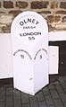 Old Milepost by the A509, High Street, Olney (geograph 5622559).jpg 900 × 1,447; 112 KB
-
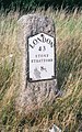
 Old Milepost by the A509, north of Olney (geograph 5622560).jpg 954 × 1,372; 221 KB
-
 Old Milepost by the A509, south of Emberton (geograph 5622557).jpg 890 × 1,447; 184 KB
-
 Old Milepost by the A509, south of Newport Pagnell (geograph 5622562).jpg 1,050 × 1,575; 298 KB
-
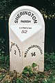
 Old Milepost by the A5130 in Broughton, Milton Keynes (geograph 5622563).jpg 932 × 1,425; 183 KB
-
 Old Milepost by the B526 near Gayhurst (geograph 5622554).jpg 825 × 1,490; 210 KB
-
 Old Milepost by the B526, south of Stoke Goldington (geograph 5622555).jpg 783 × 1,232; 130 KB
-
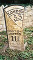
 Old Milepost by the former A509, north of Sherington (geograph 5622556).jpg 868 × 1,307; 138 KB
-
 Old Milepost on Newport Road, Woolstone (geograph 5622553).jpg 997 × 1,532; 203 KB
-
 Old Milepost on Tickford Street, Newport Pagnell (geograph 5622561).jpg 890 × 1,243; 205 KB
-
 Old Milestone by the A5, west of Little Brickhill (geograph 5622518).jpg 825 × 1,318; 215 KB
-

-
-
 Old Milestone by the former A5 in Denbigh West, Bletchley (geograph 5622520).jpg 879 × 1,350; 187 KB
-
 Old Milestone by the former A5 in Loughton, Milton Keynes (geograph 5622522).jpg 825 × 1,307; 165 KB
-
 Old Milestone by the former A5 in Loughton, Milton Keynes (geograph 5622523).jpg 793 × 1,232; 159 KB
-
 Old Milestone by the former A5 in Milton Keynes (geograph 5622521).jpg 879 × 1,265; 200 KB
-
 Old Milestone by the former A5 in Stony Stratford (geograph 5622526).jpg 793 × 1,318; 162 KB
-

-
 On-line shopping in the physical world (50003994868).jpg 4,032 × 3,016; 2.44 MB
-
 Ordnance Survey Sheet SP 83 Bletchley, Published 1956.jpg 7,404 × 7,536; 4.18 MB
-
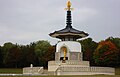 Peace pagoda in autumn colours.jpg 3,838 × 2,461; 2.7 MB
-
 Redway for walkers and cyclists - geograph.org.uk - 1582053.jpg 640 × 360; 195 KB
-
 Replica milemarker by the Grand Union Canal, Bletchley (geograph 6076666).jpg 1,181 × 1,562; 233 KB
-
 Sanctuary Music Arena.jpg 800 × 600; 454 KB
-
 Shenley Brook End at Dawn.jpg 5,184 × 3,456; 23.49 MB
-
 Shenley Brook End School.png 1,280 × 949; 978 KB
-
 Shenley Church End corner.jpg 5,184 × 3,456; 24.65 MB
-
 Shenley roundabout - geograph.org.uk - 1144748.jpg 600 × 480; 94 KB
-
 Shops, Oldbrook, Milton Keynes - geograph.org.uk - 774732.jpg 640 × 480; 52 KB
-
 Snowy Glastonbury Thorn First School - geograph.org.uk - 1144712.jpg 600 × 480; 115 KB
-
 Sodium glow in Great Holm Milton Keynes.jpg 5,184 × 3,456; 19.89 MB
-
 St Pauls School Milton Keynes.jpg 3,998 × 2,367; 1.32 MB
-
 Starship on a mission Feb 2019.jpg 1,676 × 996; 1.33 MB
-
 Starships at Kingston 15.2.19.jpg 2,164 × 1,272; 1.42 MB
-
 Stonton Barry.png 513 × 141; 74 KB
-
 Swan in willen lake - panoramio.jpg 2,048 × 1,536; 579 KB
-
 The bend before snowfall - geograph.org.uk - 1151454.jpg 640 × 480; 195 KB
-
 The last remains of Milepost (geograph 5314209).jpg 4,128 × 2,322; 6.66 MB
-
 The M1 - geograph.org.uk - 209334.jpg 640 × 480; 120 KB
-
 The Mini Bowl (11759076214).jpg 5,184 × 3,456; 5.39 MB
-
 The Toot Motte - geograph.org.uk - 209575.jpg 640 × 480; 121 KB
-
 Theatre District, Milton Keynes - geograph.org.uk - 746461.jpg 640 × 480; 81 KB
-
 Tis the season to be jolly - geograph.org.uk - 1101177.jpg 640 × 480; 162 KB
-
 Waitrose and Sainsbury Building - geograph.org.uk - 746503.jpg 640 × 480; 78 KB
-
 Walnut Tree Building.JPG 640 × 426; 231 KB
-
 Willen lake - panoramio.jpg 2,048 × 1,536; 769 KB
-
 Willen Lake North.jpg 5,184 × 3,456; 18.46 MB
-
 Willen Lake South at dawn facing city.jpg 5,184 × 3,456; 17.96 MB
-
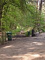
 New playground - geograph.org.uk - 208796.jpg 640 × 480; 144 KB


.jpg)
.jpg)


.jpeg)
.jpg)
.jpg)


.jpg)


.jpg)
.jpg)
.jpg)
.jpg)
.jpg)
.jpg)
.jpg)
.jpg)
.jpg)
.jpg)
.jpg)
.jpg)
.jpg)


_Middleton_Campbell,_Baron_Campbell_of_Eskan.jpg)

.jpg)

.jpg)
.jpg)
.jpg)
cambell_park_-_panoramio.jpg)


.jpg)

.jpg)
.jpg)


.jpg)


.jpg)


.jpg)
.jpg)
.jpg)
.jpg)
.jpg)
.jpg)


.jpg)


.jpg)
.jpg)
.jpg)
.jpg)
.jpg)
.jpg)
.jpg)
.jpg)
.jpg)
.jpg)
.jpg)
.jpg)
.jpg)
.jpg)
.jpg)
.jpg)
.jpg)
.jpg)
.jpg)
.jpg)
.jpg)
.jpg)
.jpg)
.jpg)
.jpg)
.jpg)
.jpg)
.jpg)
.jpg)


.jpg)


.jpg)

.jpg)


.jpg)