Category:Brunnenstraße 48 (Nöthen)
Jump to navigation
Jump to search
| Object location | | View all coordinates using: OpenStreetMap |
|---|
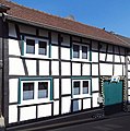
| This category shows a heritage building in Germany, located in the North Rhine-Westphalian city Bad Münstereifel (no. 311). |
Media in category "Brunnenstraße 48 (Nöthen)"
The following 2 files are in this category, out of 2 total.
-
 Nöthen Brunnenstraße 48 (01).jpg 3,366 × 3,402; 2.17 MB
-
 Nöthen Brunnenstraße 48 (02).jpg 2,922 × 3,216; 1.63 MB
.jpg)
.jpg)