Category:Building construction in the East Riding of Yorkshire
Jump to navigation
Jump to search
Subcategories
This category has only the following subcategory.
Media in category "Building construction in the East Riding of Yorkshire"
The following 21 files are in this category, out of 21 total.
-
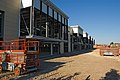
 Building site, Walkington (geograph 6468565).jpg 1,024 × 816; 1.24 MB
-
 Concrete Block Construction - geograph.org.uk - 178671.jpg 640 × 480; 80 KB
-
 Ferry Road, Wawne (geograph 5954894).jpg 1,600 × 1,064; 813 KB
-
 Fire damaged house on Common Lane, Welton (geograph 4956886).jpg 1,600 × 1,065; 622 KB
-
 House building, Kirk Ella (geograph 6889879).jpg 1,024 × 705; 1.13 MB
-
 Infill Development on Woodfield Lane - geograph.org.uk - 706216.jpg 640 × 407; 135 KB
-
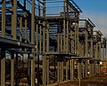
 Leisure centre extension work, Haltemprice (geograph 6756219).jpg 1,024 × 809; 1.35 MB
-
 Little and Large - geograph.org.uk - 400745.jpg 640 × 406; 137 KB
-
 More new houses (geograph 1981845).jpg 800 × 600; 152 KB
-
 New Building - geograph.org.uk - 408482.jpg 640 × 480; 105 KB
-
 New Haltemprice Farm? (geograph 6894083).jpg 1,024 × 786; 1.2 MB
-
 New House on Woodfield Lane - geograph.org.uk - 862527.jpg 640 × 480; 362 KB
-
 New Houses on Woodfield Lane - geograph.org.uk - 862534.jpg 640 × 480; 398 KB
-
 New housing on Saunders Lane, Walkington (geograph 6360827).jpg 800 × 455; 140 KB
-
 Springfield Way development, Anlaby - geograph.org.uk - 1195244.jpg 640 × 519; 213 KB
-
 Springfield Way development, Anlaby - geograph.org.uk - 1195249.jpg 425 × 640; 198 KB
-
 Springfield Way development, Anlaby - geograph.org.uk - 1195262.jpg 429 × 640; 221 KB
-
 Springfield Way development, Anlaby - geograph.org.uk - 1336754.jpg 640 × 426; 217 KB
-
 West Farm Holmpton.jpg 640 × 432; 97 KB
-

-
 Woodmansey Mile, Beverley (geograph 6358217).jpg 5,184 × 3,888; 3.58 MB
.jpg)

.jpg)
.jpg)
.jpg)

.jpg)

.jpg)

.jpg)


.jpg)


.jpg)
.jpg)