Category:Buildings in Douglas, Man
Jump to navigation
Jump to search
Wikimedia category | |||||
| Upload media | |||||
| Instance of | |||||
|---|---|---|---|---|---|
| Category combines topics | |||||
| Category contains |
| ||||
| |||||
Subcategories
This category has the following 19 subcategories, out of 19 total.
A
- All Saints Church, Douglas (5 F)
C
D
- Douglas Head Lighthouse (29 F)
- Douglas railway station (137 F)
- Douglas Red Pier Lighthouse (5 F)
- Douglas Tower (4 F)
G
- Gaiety Theatre, Douglas (19 F)
H
- Hotel The British, Douglas (7 F)
L
- Legislative Buildings, Douglas (11 F)
- Douglas Lifeboat Station (10 F)
M
N
S
- St Ninian's Church, Douglas (5 F)
- St. Mary’s Isle (83 F)
V
- Villa Marina, Douglas (40 F)
Media in category "Buildings in Douglas, Man"
The following 200 files are in this category, out of 326 total.
(previous page) (next page)-

-
 'We're all domed' - geograph.org.uk - 5662430.jpg 480 × 640; 99 KB
-
 1886 and Nosh - geograph.org.uk - 6283319.jpg 683 × 1,024; 188 KB
-
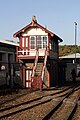 1892 36-lever frame signal box, Douglas Station - geograph.org.uk - 6280919.jpg 2,561 × 3,841; 3.01 MB
-
 50 St Catherine’s Drive, childhood home of the Bee Gees.jpg 3,024 × 4,032; 2.7 MB
-
 Admiral House Hotel, Douglas - geograph.org.uk - 4897707.jpg 640 × 437; 68 KB
-
 Amphitheatre on Douglas Head - geograph.org.uk - 1916895.jpg 1,600 × 1,200; 430 KB
-
 Amphitheatre stage and Marine Drive arch - geograph.org.uk - 1916903.jpg 1,600 × 1,200; 441 KB
-
 Anagh Coar Stores - geograph.org.uk - 2468272.jpg 640 × 512; 63 KB
-
 Avondale House and Beresford House - geograph.org.uk - 3143262.jpg 3,648 × 2,736; 6.34 MB
-
 AXA building, Douglas - geograph.org.uk - 2145306.jpg 1,024 × 768; 164 KB
-
 Bath Place, Douglas - geograph.org.uk - 5732009.jpg 1,600 × 1,065; 386 KB
-
 Broadway Baptist Church - geograph.org.uk - 2389713.jpg 1,280 × 960; 617 KB
-
 Bucks Road, Douglas - geograph.org.uk - 5728953.jpg 1,600 × 1,065; 453 KB
-
 Captain Teare's House.jpg 168 × 320; 28 KB
-
 Castle Mona, Douglas Isle of Man.jpg 1,216 × 869; 271 KB
-
 Castle Mona, Douglas, Isle of Man.jpg 668 × 431; 42 KB
-
 Castle Mona, hotel.JPG 2,272 × 1,704; 1.55 MB
-
 Castle Mona.jpg 960 × 705; 116 KB
-
 Central Fire Headquarters - geograph.org.uk - 5722543.jpg 1,600 × 1,065; 474 KB
-
 Chesterhouse Hotel, 37-42 Loch Promenade, Douglas - geograph.org.uk - 6279551.jpg 3,680 × 2,454; 2.91 MB
-
 Christian Road, Douglas - geograph.org.uk - 5728962.jpg 1,600 × 1,065; 407 KB
-
 Church in a pub^ - geograph.org.uk - 4401389.jpg 3,685 × 2,764; 1.7 MB
-
 Clinch Tower Clinchtowersm.jpg 600 × 902; 211 KB
-
 Clinch's - North Quay Douglas - geograph.org.uk - 3123710.jpg 600 × 800; 126 KB
-
 Clinch's Bar and Grill - geograph.org.uk - 4401381.jpg 4,608 × 3,456; 4.19 MB
-
 Clinch's Brewery - geograph.org.uk - 1961401.jpg 1,024 × 768; 184 KB
-
 Clinch's Courtyard, Douglas - geograph.org.uk - 6176957.jpg 5,202 × 3,465; 3.75 MB
-
 Clinch's of Douglas - geograph.org.uk - 3136040.jpg 1,936 × 2,592; 2.55 MB
-
 Clinch's on North Quay, Douglas - geograph.org.uk - 5734188.jpg 1,067 × 1,600; 401 KB
-
 Clinch's on North Quay, Douglas - geograph.org.uk - 5734189.jpg 1,272 × 1,600; 583 KB
-
 Clinches Building North Quay.JPG 4,608 × 3,072; 3.51 MB
-
 Conister Bank, Victoria street - geograph.org.uk - 3710010.jpg 1,200 × 1,600; 538 KB
-
 Control Centre - geograph.org.uk - 1820568.jpg 640 × 428; 65 KB
-
 Crosby Terrace Post Office - geograph.org.uk - 2389728.jpg 1,280 × 960; 541 KB
-

-
 Darragh Avenue - geograph.org.uk - 1963855.jpg 1,024 × 768; 210 KB
-
 Dealz store Douglas - geograph.org.uk - 2742981.jpg 3,296 × 2,472; 1.91 MB
-
 Department of Education ^ Children - geograph.org.uk - 3410337.jpg 640 × 424; 77 KB
-
 Derby Castle station - geograph.org.uk - 3133800.jpg 2,592 × 1,936; 1.74 MB
-
 Derby Castle station - Manx Electric Railway - geograph.org.uk - 6178194.jpg 5,202 × 3,465; 3.5 MB
-
 Derelict buildings opposite Tesco's - geograph.org.uk - 4375997.jpg 640 × 480; 63 KB
-
 DHSS , Market Street - geograph.org.uk - 1974760.jpg 2,816 × 2,112; 995 KB
-
 Displays at 'This Terrible Ordeal' - geograph.org.uk - 3845238.jpg 640 × 480; 93 KB
-
 Doolish 2013 21.jpg 2,442 × 3,692; 1.35 MB
-
 Doolish 2013 27.jpg 3,359 × 2,752; 2.02 MB
-
 Doolish 2013 28.jpg 2,899 × 3,617; 1.49 MB
-
 Doolish 2013 29.jpg 3,524 × 2,621; 1.33 MB
-
 Doolish 2013 31.jpg 3,703 × 2,904; 1.78 MB
-
 Doolish 2013 32.jpg 1,337 × 3,234; 818 KB
-
 Doolish 2013 33.jpg 3,941 × 2,947; 1.75 MB
-
 Doolish 2013 34.jpg 2,059 × 2,772; 1.33 MB
-
 Doolish 2013 35.jpg 2,965 × 3,639; 2.03 MB
-
 Doolish 2013 37.jpg 3,489 × 1,508; 845 KB
-
 Doolish 2013 41.jpg 2,256 × 3,687; 1,007 KB
-
 Doolish 2013 51.jpg 2,684 × 3,851; 2.26 MB
-
 Doolish 2013 52.jpg 3,918 × 2,881; 1.96 MB
-
 Doolish 2013 54.jpg 3,756 × 2,765; 1.6 MB
-
 Doolish 2013 57.jpg 2,507 × 3,595; 1.72 MB
-
 Doolish 2013 58.jpg 3,967 × 2,214; 1.9 MB
-
 Doolish 2013 59.jpg 2,904 × 3,956; 1.98 MB
-
 Doolish 2013 61.jpg 3,000 × 3,085; 1.71 MB
-
 Doolish 2013 65.jpg 3,436 × 1,772; 717 KB
-
 Doolish 2013 66.jpg 3,000 × 4,000; 2.42 MB
-
 Doolish 2013 67.jpg 3,000 × 4,000; 2.42 MB
-
 Doolish 2013 68.jpg 3,000 × 4,000; 2.51 MB
-
 Doolish 2013 69.jpg 2,463 × 3,362; 1.66 MB
-
 Douglas (2023-05-02) 01.jpg 5,568 × 3,712; 13.52 MB
-
 Douglas (2023-05-02) 06.jpg 3,712 × 5,568; 12.44 MB
-
 Douglas (2023-05-02) 07.jpg 5,568 × 3,712; 12.31 MB
-
 Douglas (2023-05-02) 08.jpg 3,712 × 5,568; 14.08 MB
-
 Douglas (2023-05-03) 03.jpg 3,712 × 5,568; 14.03 MB
-
 Douglas (2023-05-03) 04.jpg 3,712 × 5,568; 15.94 MB
-
 Douglas (2023-05-03) 05.jpg 3,712 × 5,568; 14.76 MB
-
 Douglas (2023-05-03) 06.jpg 5,568 × 3,712; 12.66 MB
-
 Douglas (2023-05-03) 07.jpg 5,568 × 3,712; 13.42 MB
-

-
 Douglas - Central Promenade - Building construction - geograph.org.uk - 1714953.jpg 1,035 × 1,556; 1.23 MB
-
 Douglas - Central Promenade - The Empress Hotel - geograph.org.uk - 1714957.jpg 1,644 × 1,096; 1.38 MB
-
 Douglas - Duke Street - Feegan's Lounge interior - geograph.org.uk - 1706846.jpg 1,672 × 1,115; 1.14 MB
-
 Douglas - North Quay - The British pub - geograph.org.uk - 1714794.jpg 1,703 × 1,135; 1.22 MB
-
 Douglas - Strand St - Copperfields Olde Tea Shoppe - geograph.org.uk - 1714830.jpg 1,764 × 1,176; 1.2 MB
-
 Douglas - Strand Street - Campbells Butchers - geograph.org.uk - 1714889.jpg 1,606 × 1,071; 1.37 MB
-
 Douglas - Strand Street - Duke Video store interior - geograph.org.uk - 1714873.jpg 1,676 × 1,117; 1.66 MB
-
 Douglas - Strand Street - Guinness and Bushmills bar - geograph.org.uk - 1714853.jpg 1,670 × 1,113; 1.21 MB
-
 Douglas - Victorian house fronts on seafront - geograph.org.uk - 2737015.jpg 1,024 × 768; 211 KB
-
 Douglas and Clarendon hotels - geograph.org.uk - 3107136.jpg 4,608 × 3,456; 5.58 MB
-
 Douglas Bay Yacht Club - geograph.org.uk - 143358.jpg 640 × 480; 269 KB
-
 Douglas Coastguard - geograph.org.uk - 4614320.jpg 1,024 × 768; 131 KB
-
 Douglas Coastguard Station - geograph.org.uk - 2386147.jpg 1,280 × 960; 491 KB
-
 Douglas Corporation Power Station - geograph.org.uk - 3133782.jpg 1,936 × 2,592; 2.39 MB
-
 Douglas Corporation Power Station - geograph.org.uk - 3160534.jpg 1,936 × 2,592; 2.03 MB
-
 Douglas Courthouse - geograph.org.uk - 110362.jpg 426 × 599; 71 KB
-
 Douglas Douglas Head 1.jpg 4,592 × 3,027; 6.46 MB
-
 Douglas Douglas Head 2.jpg 4,544 × 2,268; 1.38 MB
-
 Douglas Ferry Terminal - geograph.org.uk - 1122182.jpg 640 × 407; 101 KB
-
 Douglas Fire Station - geograph.org.uk - 2390059.jpg 1,280 × 960; 544 KB
-
 Douglas Fire Station - geograph.org.uk - 3408132.jpg 640 × 424; 69 KB
-
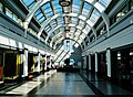 Douglas Gaiety Mall 1.jpg 4,434 × 3,249; 5.24 MB
-
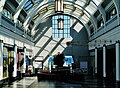 Douglas Gaiety Mall 2.jpg 4,443 × 3,276; 4.71 MB
-
 Douglas Head apartments - geograph.org.uk - 4305248.jpg 640 × 480; 48 KB
-

-
 Douglas Hotel - geograph.org.uk - 2387015.jpg 1,280 × 960; 710 KB
-
 Douglas Hotel - geograph.org.uk - 3160527.jpg 1,936 × 2,592; 2.26 MB
-
 Douglas Hotel 2015 - geograph.org.uk - 4302290.jpg 640 × 480; 62 KB
-
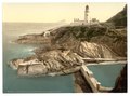 Douglas Lighthouse and bathing cove, Isle of Man-LCCN2002697030.tif 3,691 × 2,747; 29.01 MB
-
 Douglas Market Hall - geograph.org.uk - 4614269.jpg 1,024 × 723; 133 KB
-
 Douglas Market Hall 1.jpg 4,553 × 3,232; 5.25 MB
-
 Douglas Market Hall 2.jpg 4,584 × 3,438; 6.28 MB
-
 Douglas Market Hall 3.jpg 4,559 × 3,202; 5.08 MB
-
 Douglas police station - geograph.org.uk - 4382396.jpg 640 × 480; 61 KB
-
 Douglas Police Station - geograph.org.uk - 4881131.jpg 640 × 427; 53 KB
-
 Douglas Post Office - geograph.org.uk - 4298166.jpg 480 × 640; 83 KB
-
 Douglas Post Office, Strand Street, Douglas - geograph.org.uk - 5731890.jpg 1,600 × 1,065; 458 KB
-
 Douglas St. Thomas Church East Side.jpg 4,544 × 3,358; 1.34 MB
-
 Douglas St. Thomas Church Facade.jpg 3,384 × 4,589; 7.59 MB
-
 Douglas St. Thomas Church South Side 1.jpg 4,524 × 3,356; 6.38 MB
-
 Douglas St. Thomas Church South Side 2.jpg 4,570 × 3,418; 5.65 MB
-
 Douglas store front.jpg 250 × 167; 68 KB
-
 Douglas, Isle of Man - panoramio (18).jpg 3,648 × 2,736; 1.92 MB
-
 Douglas, Isle of Man - panoramio (19).jpg 3,648 × 2,736; 2.49 MB
-
 Douglas, Isle of Man - panoramio (31).jpg 4,176 × 2,784; 4.8 MB
-
 Douglas, Isle of Man - panoramio (8).jpg 4,320 × 3,240; 5.53 MB
-
 Douglas, MER depot - geograph.org.uk - 4613887.jpg 1,024 × 756; 162 KB
-
 Douglas, St. Matthew's - geograph.org.uk - 4614281.jpg 1,024 × 768; 146 KB
-
 Douglas, The Albert - geograph.org.uk - 4614261.jpg 750 × 1,024; 112 KB
-
 Drill Hall Armoury - Peel Road - geograph.org.uk - 4254416.jpg 1,600 × 1,200; 467 KB
-
 Electric railway sheds at Onchan - geograph.org.uk - 1878774.jpg 800 × 594; 137 KB
-
 Entrance to 2011 Commonwealth Youth Games Operations Centre - geograph.org.uk - 2594167.jpg 3,296 × 2,472; 1.89 MB
-
 Entrance to Douglas Golf Club - geograph.org.uk - 2633401.jpg 640 × 480; 57 KB
-
 Entrance to St. Mary's Catholic Church - geograph.org.uk - 3139089.jpg 1,936 × 2,592; 2.87 MB
-
 Exit Strategy, Peel Road, Douglas - geograph.org.uk - 5734233.jpg 1,600 × 1,065; 414 KB
-
 Former bank premises, North Quay, Douglas - geograph.org.uk - 5084661.jpg 1,024 × 768; 133 KB
-
 Former Drill Hall - Peel Road - geograph.org.uk - 4254409.jpg 1,600 × 1,200; 355 KB
-
 Former Nat West Bank, Douglas - geograph.org.uk - 4374928.jpg 480 × 640; 56 KB
-

-
 Fountain beside Salvation Army citadel - geograph.org.uk - 4383621.jpg 640 × 480; 105 KB
-
 Gateway to Learning^ - geograph.org.uk - 1821859.jpg 640 × 428; 77 KB
-

-
 Granville Hotel, Granville Street, Douglas - geograph.org.uk - 5731818.jpg 1,600 × 1,065; 347 KB
-
 Happy seamen - geograph.org.uk - 4639574.jpg 7,200 × 4,800; 5.31 MB
-

-
 Harbour Commissioners' Tower - geograph.org.uk - 3160516.jpg 3,648 × 2,736; 5.75 MB
-
 HBN library (28976618177).jpg 1,024 × 765; 482 KB
-
 Hooded Ram Brewery - geograph.org.uk - 4905878.jpg 640 × 424; 52 KB
-
 Hotels on Douglas sea front - geograph.org.uk - 783651.jpg 426 × 640; 54 KB
-
 House called Grianane - geograph.org.uk - 3167021.jpg 2,592 × 1,936; 2.03 MB
-
 Houses on Woodbourne Road - geograph.org.uk - 5480174.jpg 1,440 × 1,080; 1,016 KB
-
 I used to be an Alsatian^ - geograph.org.uk - 3274690.jpg 1,600 × 1,200; 799 KB
-
 Imperial Hotel, Douglas - geograph.org.uk - 5396598.jpg 640 × 427; 84 KB
-

-

-

-
 Inside Hooded Ram Brewery - geograph.org.uk - 4905893.jpg 424 × 640; 54 KB
-
 Inside Okells - geograph.org.uk - 1820500.jpg 640 × 428; 59 KB
-

-
 IOMSR Workshop machinery - geograph.org.uk - 4385617.jpg 640 × 480; 103 KB
-
 Isle of Man Bank, Douglas - geograph.org.uk - 4388189.jpg 640 × 480; 78 KB
-
 Isle of Man Bank.jpg 4,032 × 3,024; 2.26 MB
-
 Isle of Man Coastguard Rescue Station - geograph.org.uk - 3160464.jpg 2,592 × 1,936; 1.65 MB
-
 Isle of Man Courts of Justice building, Douglas.jpg 6,000 × 4,000; 10.06 MB
-
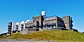
 Isle of Man Government Offices - geograph.org.uk - 2737180.jpg 1,024 × 768; 189 KB
-
 Isle of Man newspapers - geograph.org.uk - 3710084.jpg 1,600 × 1,200; 616 KB
-
 Isle of Man Office of Fair Trading - geograph.org.uk - 3142099.jpg 2,592 × 1,936; 2.1 MB
-
 Isle of Man TT VIP marquee - geograph.org.uk - 5787618.jpg 640 × 427; 65 KB
-
 Isle-of-Man--Douglas--The-Henry-Bloom-Noble-Library-1.JPG 1,152 × 1,536; 199 KB
-
 Joseph Bucknell Limited - geograph.org.uk - 3139095.jpg 1,936 × 2,592; 1.75 MB
-
 Lifeboat station - geograph.org.uk - 5127618.jpg 2,000 × 1,500; 335 KB
-
 Lloyds Bank Douglas - geograph.org.uk - 4302297.jpg 640 × 480; 78 KB
-
 Lloyds Bank, Douglas - geograph.org.uk - 4880151.jpg 640 × 427; 60 KB
-
 Lloyds Bank, Peveril Square, Douglas - geograph.org.uk - 5732021.jpg 1,600 × 1,065; 464 KB
-
 Manor Park School - geograph.org.uk - 1959825.jpg 1,024 × 768; 183 KB
-
 Manx Electric Railway sheds - geograph.org.uk - 4896641.jpg 640 × 419; 81 KB
-
 Manx Legion Club, Market Hill, Douglas - geograph.org.uk - 5732645.jpg 1,600 × 1,065; 396 KB
-
 Manx Legion Club, Market Hill, Douglas - geograph.org.uk - 5732677.jpg 1,600 × 1,065; 580 KB
-
 Manx TT grandstand - geograph.org.uk - 3717562.jpg 480 × 640; 78 KB
-
 Market Hall - geograph.org.uk - 1981564.jpg 2,816 × 2,112; 965 KB
-
 Market Hall Douglas - geograph.org.uk - 3107520.jpg 4,608 × 3,456; 5.53 MB
-
 McDonald's, Peel Road, Douglas - geograph.org.uk - 5734255.jpg 1,600 × 1,065; 604 KB
-
 Metropole Mansions, Queen's Parade - geograph.org.uk - 733549.jpg 640 × 434; 104 KB
-
 Mile End Court, Peel Road, Douglas - geograph.org.uk - 5734242.jpg 1,600 × 1,065; 615 KB
-
 Mill on the River Glass - geograph.org.uk - 3410230.jpg 640 × 424; 107 KB
-
 Modern property on Douglas Head - geograph.org.uk - 3160425.jpg 2,592 × 1,936; 1.95 MB
-
 Mormon Church - geograph.org.uk - 5480169.jpg 1,440 × 1,080; 1.1 MB
-
 Morning crown - geograph.org.uk - 4402488.jpg 4,608 × 3,456; 2.89 MB
-
 Mount Havelock, Douglas - geograph.org.uk - 5729113.jpg 1,600 × 1,065; 379 KB
-
 Mount Havelock, Douglas - geograph.org.uk - 5732637.jpg 1,600 × 1,065; 396 KB
-
 Municipal Buildings Douglas - geograph.org.uk - 4388167.jpg 640 × 480; 81 KB
-
 Municipal Buildings, Ridgeway Street, Douglas - geograph.org.uk - 6280229.jpg 3,714 × 2,477; 2.68 MB
-
 NatWest bank - geograph.org.uk - 3138157.jpg 2,592 × 1,936; 1.96 MB
-
 Nelly Brennan's House.jpg 640 × 480; 99 KB
-
 New roof for St. Thomas' Church - geograph.org.uk - 3142130.jpg 2,592 × 1,936; 2.19 MB
-
 Noble's Soup Dispensary, Douglas Isle of Man.jpg 320 × 240; 30 KB
-
 Nobles Hospital - geograph.org.uk - 3544477.jpg 3,648 × 2,736; 4.13 MB
-
 North Quay at Ridgeway Street, Douglas - geograph.org.uk - 5734183.jpg 1,600 × 1,065; 391 KB
-
 Okells Brewery - geograph.org.uk - 1819124.jpg 640 × 428; 42 KB
-
 Okells Lab - geograph.org.uk - 1820587.jpg 441 × 640; 58 KB
-
 Old Douglas Power Station - geograph.org.uk - 3107459.jpg 4,608 × 3,456; 5.4 MB
-
 Old Harbour Commissioners Building Douglas - geograph.org.uk - 1711148.jpg 3,296 × 2,472; 1.9 MB
-


_01.jpg)
_06.jpg)
_07.jpg)
_08.jpg)
_03.jpg)
_04.jpg)
_05.jpg)
_06.jpg)
_07.jpg)


.jpg)
.jpg)
.jpg)
.jpg)


.jpg)


