Category:Buildings in Standish, Greater Manchester
Jump to navigation
Jump to search
Subcategories
This category has the following 8 subcategories, out of 8 total.
B
- Boar's Head railway station (3 F)
E
- Eagle and Child, Standish (4 F)
R
- Red Rock railway station (3 F)
S
- Standish Hall (Lancashire) (4 F)
- Standish railway station (3 F)
Media in category "Buildings in Standish, Greater Manchester"
The following 14 files are in this category, out of 14 total.
-
 56 Wigan Road, Standish.jpg 4,608 × 2,304; 3.56 MB
-
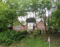
 Ashfield House, Standish - geograph.org.uk - 1764109.jpg 600 × 400; 55 KB
-
 Bradley Hall, Standish.jpg 1,471 × 1,150; 1.98 MB
-
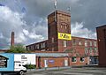 Douglas Mill, Standish.jpg 1,983 × 1,403; 1.78 MB
-
 Former Eagle and Child, Standish - geograph.org.uk - 954515.jpg 640 × 480; 159 KB
-
 Olive Garden Restaurant - Once a Pub - geograph.org.uk - 1948427.jpg 4,224 × 3,168; 4.64 MB
-
 Potters Bar - geograph.org.uk - 2086039.jpg 800 × 600; 231 KB
-
 Service station on the A49, Standish - geograph.org.uk - 3334695.jpg 640 × 480; 59 KB
-
 St Wilfrid's C of E Primary School, Standish.jpg 1,280 × 720; 400 KB
-
 St. Marie's Catholic Primary School.jpg 4,608 × 2,304; 3.29 MB
-
 Standish Police Station (geograph 2086033).jpg 800 × 600; 262 KB
-
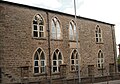 Standish Sunday School, Standish.jpg 2,907 × 2,031; 2.82 MB
-
 The Beeches, Standish (geograph 3334760).jpg 1,200 × 900; 314 KB
-
 Wood Fold Primary School (geograph 2081957).jpg 1,600 × 1,198; 350 KB


.jpg)

.jpg)
.jpg)