Category:Buitenhaven 29, Nieuwpoort
Jump to navigation
Jump to search
| Object location | | View all coordinates using: OpenStreetMap |
|---|
.jpg) | |||||
| Upload media | |||||
| Instance of | |||||
|---|---|---|---|---|---|
| Part of | |||||
| Location | Nieuwpoort, South Holland, Netherlands | ||||
| Street address |
| ||||
| Located on street | |||||
| Heritage designation |
| ||||
| Inception |
| ||||
| Date of official closure |
| ||||
 | |||||
|
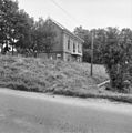
This is a category about rijksmonument number 510012
|
| Address |
|
Media in category "Buitenhaven 29, Nieuwpoort"
The following 5 files are in this category, out of 5 total.
-
 Nieuwpoort Buitenhaven 29 Veerhuis.jpg 3,327 × 4,138; 5.88 MB
-
 Overzicht - Nieuwpoort - 20165806 - RCE.jpg 3,058 × 3,076; 2.22 MB
-
 Overzicht - Nieuwpoort - 20165807 - RCE.jpg 3,052 × 3,076; 2.42 MB
-
 RM510012 Nieuwpoort - Buitenhaven 29 (foto 1).jpg 2,592 × 1,944; 1.73 MB
-
 RM510012 Nieuwpoort - Buitenhaven 29 (foto 2).jpg 2,592 × 1,944; 1.41 MB


.jpg)