Category:Burbage, Derbyshire
Jump to navigation
Jump to search
village in Derbyshire, United Kingdom  | |||||
| Upload media | |||||
| Instance of | |||||
|---|---|---|---|---|---|
| Location | High Peak, Derbyshire, East Midlands, England | ||||
 | |||||
Subcategories
This category has the following 4 subcategories, out of 4 total.
Media in category "Burbage, Derbyshire"
The following 64 files are in this category, out of 64 total.
-
 85 Green Lane, Buxton.jpg 1,000 × 666; 547 KB
-
 87 Green Lane, Buxton.jpg 1,000 × 666; 507 KB
-

-
 A53 Leek Road, Burbage - geograph.org.uk - 6296735.jpg 1,024 × 769; 121 KB
-
 A53 on Stanley Moor - geograph.org.uk - 5568126.jpg 1,600 × 1,066; 615 KB
-
 Behind the houses - geograph.org.uk - 5824338.jpg 10,000 × 2,830; 7.72 MB
-
 Berry Clough - geograph.org.uk - 1518941.jpg 640 × 479; 75 KB
-
-
 Burbage bridge.jpg 640 × 480; 132 KB
-
 Burbage houses and small red tent - geograph.org.uk - 1800715.jpg 640 × 480; 102 KB
-
 Burbage Plantation - geograph.org.uk - 1184596.jpg 640 × 450; 77 KB
-
 Burbage road junction - geograph.org.uk - 2859016.jpg 5,184 × 3,456; 3.41 MB
-
 Course of Former High Peak Railway near Burbage - geograph.org.uk - 3017379.jpg 3,296 × 2,472; 1.07 MB
-
 Dead wood and new growth - geograph.org.uk - 2312818.jpg 1,696 × 1,229; 449 KB
-
 Dew Pond - geograph.org.uk - 4573796.jpg 640 × 480; 110 KB
-
 Duke of York - Burbage - geograph.org.uk - 2940843.jpg 3,156 × 2,672; 2.59 MB
-
 Edge of Watford Wood - geograph.org.uk - 3515035.jpg 640 × 427; 207 KB
-
 Essar filling station, Leek Road - geograph.org.uk - 5568117.jpg 1,600 × 1,280; 656 KB
-
 Ford at Burbage near Cavendish Golf Club - geograph.org.uk - 3102108.jpg 3,872 × 2,592; 2.4 MB
-
 Gated Field on Bishop's Lane - geograph.org.uk - 6614069.jpg 3,264 × 1,468; 1.62 MB
-
 Green Lane and Buxton Community School - geograph.org.uk - 2632055.jpg 640 × 480; 131 KB
-
 Green Lane and Church View Cottages, Burbage - geograph.org.uk - 5568109.jpg 1,600 × 1,201; 739 KB
-
 House on Holmfirth - geograph.org.uk - 4660320.jpg 640 × 480; 127 KB
-
 Houses at Burbage - geograph.org.uk - 1800708.jpg 640 × 480; 74 KB
-
 Line of old railway, Burbage - geograph.org.uk - 159749.jpg 640 × 480; 154 KB
-

-
 Macclesfield Old Road, Burbage - geograph.org.uk - 159740.jpg 640 × 480; 130 KB
-
 Macclesfield Road - Buxton - geograph.org.uk - 2940838.jpg 3,929 × 2,264; 3.32 MB
-
 Moorland milestone (2) - geograph.org.uk - 1518800.jpg 479 × 640; 164 KB
-
 Mossy stick - geograph.org.uk - 2311480.jpg 2,048 × 1,536; 2.04 MB
-
 Obelisk, Burbage.jpg 1,280 × 960; 297 KB
-
 On the A54, leaving Canholes - geograph.org.uk - 1800699.jpg 640 × 480; 62 KB
-
 Ornamental Pond and Obelisk at Edgemoor - geograph.org.uk - 6614065.jpg 3,264 × 1,468; 1.79 MB
-
 OS Flush Bracket at Burbage - geograph.org.uk - 4055634.jpg 734 × 979; 492 KB
-
 Otter Hole - geograph.org.uk - 2934080.jpg 800 × 1,200; 99 KB
-
 Overlooking Buxton from the edge of the High Plantation - geograph.org.uk - 2763660.jpg 3,218 × 2,364; 1.24 MB
-
 Path across playing fields to Buxton - geograph.org.uk - 3133899.jpg 3,872 × 2,592; 5.1 MB
-
 Playground - geograph.org.uk - 4660331.jpg 640 × 480; 94 KB
-
 Plex Farm from Plex Lodge - geograph.org.uk - 176679.jpg 640 × 480; 136 KB
-
 Pond at Edgemoor - geograph.org.uk - 4573798.jpg 640 × 480; 140 KB
-
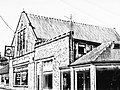 Public Hall at Burbage.jpg 1,579 × 1,183; 464 KB
-
 Railway embankment above Burbage - geograph.org.uk - 1518837.jpg 640 × 405; 76 KB
-
 Road Junction at Burbage - geograph.org.uk - 3012134.jpg 3,188 × 2,320; 1.09 MB
-
 Shay Lodge Plantation - geograph.org.uk - 1010934.jpg 640 × 427; 107 KB
-
 Shay Lodge Plantation - geograph.org.uk - 1010955.jpg 640 × 427; 135 KB
-
 Site of Burbage Reservoir - geograph.org.uk - 159737.jpg 640 × 480; 112 KB
-
 Smooth green grass on the fairway - geograph.org.uk - 3129751.jpg 3,872 × 2,592; 4.11 MB
-
 St. John's Road in Buxton - geograph.org.uk - 3012081.jpg 3,208 × 2,350; 1.58 MB
-
 Stanley Moor milepost - detail - geograph.org.uk - 1598259.jpg 480 × 640; 111 KB
-
 Stream and lane - geograph.org.uk - 972874.jpg 640 × 480; 84 KB
-
 The Duke inn, Macclesfield Road, Burbage - geograph.org.uk - 5568101.jpg 1,600 × 961; 602 KB
-
 The old turnpike - geograph.org.uk - 1518781.jpg 640 × 479; 146 KB
-
 Toadstools and moss - geograph.org.uk - 2311575.jpg 2,048 × 1,536; 2.29 MB
-
 Tree dressing (1) - geograph.org.uk - 2312458.jpg 2,048 × 1,536; 649 KB
-
 Tree dressing (2) - geograph.org.uk - 2312463.jpg 2,048 × 1,536; 520 KB
-
 Triangulation Pillar on Burbage Edge - geograph.org.uk - 3736969.jpg 3,832 × 2,762; 1.97 MB
-
 Trig point, Burbage Edge - geograph.org.uk - 98628.jpg 640 × 480; 135 KB
-
 View from Grin Low Road, Buxton - geograph.org.uk - 1672013.jpg 640 × 480; 63 KB
-
 View from the A54 - geograph.org.uk - 3514861.jpg 640 × 424; 240 KB
-
 View from Watford Farm - geograph.org.uk - 3515040.jpg 640 × 427; 242 KB
-
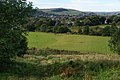
 View over Burbage - geograph.org.uk - 1518818.jpg 640 × 479; 147 KB
-
 View to a new housing estate at Burbage - geograph.org.uk - 5077413.jpg 4,758 × 3,540; 3.16 MB
-
 Walking to Buxton - geograph.org.uk - 1184591.jpg 640 × 431; 51 KB
-
 Wye Head - geograph.org.uk - 2934077.jpg 1,200 × 800; 99 KB


_-_geograph.org.uk_-_1518800.jpg)


_-_geograph.org.uk_-_2312458.jpg)
_-_geograph.org.uk_-_2312463.jpg)


