Category:Buren 2 (Hindeloopen)
Jump to navigation
Jump to search
| Object location | | View all coordinates using: OpenStreetMap |
|---|
 | |||||
| Upload media | |||||
| Instance of |
| ||||
|---|---|---|---|---|---|
| Location | Hindeloopen, Hindeloopen | ||||
| Located on street | |||||
| Heritage designation |
| ||||
 | |||||
|
This is a category about rijksmonument number 22166
|
| Address |
|
Media in category "Buren 2 (Hindeloopen)"
The following 16 files are in this category, out of 16 total.
-
 20140430 Buren 2 Hindeloopen Fr NL.jpg 3,000 × 2,400; 2.68 MB
-
 Achtergevel - Hindeloopen - 20113520 - RCE.jpg 805 × 1,200; 229 KB
-
 Brug voor de Buren naar het oosten gezien - Hindeloopen - 20113517 - RCE.jpg 1,200 × 965; 288 KB
-
 Brug voor De Buren vanuit het noorden - Hindeloopen - 20113518 - RCE.jpg 1,200 × 952; 257 KB
-
 Brug voor De Buren vanuit het zuiden - Hindeloopen - 20113516 - RCE.jpg 1,200 × 967; 266 KB
-
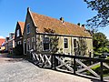 Buren2 Hindeloopen.jpg 3,648 × 2,736; 1.05 MB
-
 Deurtje - Hindeloopen - 20113600 - RCE.jpg 836 × 1,200; 286 KB
-
 Overzicht Kerkstraat naar het oosten - Hindeloopen - 20113429 - RCE.jpg 1,200 × 812; 234 KB
-
 Overzicht naar het oosten, Buren - Hindeloopen - 20113431 - RCE.jpg 1,200 × 816; 237 KB
-
 Overzicht Nieuweweg - Hindeloopen - 20113411 - RCE.jpg 1,200 × 821; 214 KB
-
 Voorgevel - Hindeloopen - 20113519 - RCE.jpg 805 × 1,200; 203 KB
-
 Voorgevel - Hindeloopen - 20502264 - RCE.jpg 1,200 × 900; 126 KB
-
 Zij- en voorgevel - Hindeloopen - 20502262 - RCE.jpg 1,200 × 900; 125 KB
-
 Zij- en voorgevel kleur (vn rood) - Hindeloopen - 20502263 - RCE.jpg 1,200 × 900; 233 KB
-
 Zijgevel - Hindeloopen - 20113521 - RCE.jpg 1,200 × 805; 214 KB
-
 Zomerhuisjes, woonhuizen - Hindeloopen - 20113599 - RCE.jpg 957 × 1,200; 305 KB


_-_Hindeloopen_-_20502263_-_RCE.jpg)

