Category:Burgerweeshuis (Amsterdam)
Jump to navigation
Jump to search
| Object location | | View all coordinates using: OpenStreetMap |
|---|
former city orphanage in Amsterdam  | |||||
| Upload media | |||||
| Instance of | |||||
|---|---|---|---|---|---|
| Location | Amsterdam, North Holland, Netherlands | ||||
| Occupant | |||||
| Heritage designation |
| ||||
| Replaces |
| ||||
| Replaced by | |||||
 | |||||
Former orphanage. The location in the Kalverstraat now houses the Amsterdam Museum.
|
This is a category about rijksmonument number 5467
|
| Address |
|
Subcategories
This category has the following 8 subcategories, out of 8 total.
Media in category "Burgerweeshuis (Amsterdam)"
The following 200 files are in this category, out of 326 total.
(previous page) (next page)-
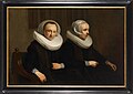
 "De regentessen Jacob Adriaansz. ca. 1634 - Amsterdam - 20014183 - RCE.jpg 1,200 × 957; 202 KB
-

-
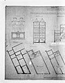 Kalverstraat 80-82, verbouwingsplan 1883 - Amsterdam - 20014290 - RCE.jpg 2,422 × 3,095; 4.94 MB
-
 Kalverstraat 104-106, verbouwingsplan 1916 - Amsterdam - 20014286 - RCE.jpg 2,398 × 3,066; 5.45 MB
-

-
 J. de Beijer Burgerweeshuis Amsterdam.jpg 3,827 × 2,413; 1.53 MB
-
 Exterieur - Amsterdam - 20014068 - RCE.jpg 3,052 × 3,029; 6.04 MB
-
 Inrijpoort Burgerweeshuis opmeting P.W.1942 - Amsterdam - 20014106 - RCE.jpg 3,059 × 2,439; 4.45 MB
-
 Amsterdam Zentrum 20091106 029.JPG 2,848 × 4,272; 4.08 MB
-
 Exterieur - Amsterdam - 20014069 - RCE.jpg 3,070 × 3,107; 6.88 MB
-
 Exterieur aan de kant van de N.W.zijdsvoorburgwal - Amsterdam - 20014070 - RCE.jpg 3,070 × 3,107; 6.22 MB
-
 Gevelsteen T GELOOF, in zijgevel - Amsterdam - 20403957 - RCE.jpg 962 × 1,200; 353 KB
-

-
 Aan de wegkant van de N.W.zijdsvoorburgwal - Amsterdam - 20014072 - RCE.jpg 3,065 × 3,094; 6.9 MB
-
 J.M.A. Rieke Afb 010120000011.jpg 5,181 × 3,464; 3.3 MB
-
 J.M.A. Rieke Afb KOG-AA-2-13-265.jpg 5,158 × 3,207; 1.83 MB
-

-
 Abraham de Vries - regents of the city orphanage in Amsterdam.jpg 2,101 × 1,381; 2.09 MB
-
 Achterzijde van een huis in het Noorse Bos - Amsterdam - 20014146 - RCE.jpg 1,200 × 957; 285 KB
-
 Allegorische voorstelling Jac. van der Sluis - Amsterdam - 20014155 - RCE.jpg 952 × 1,200; 236 KB
-
 Amsterdam - Burgerweeshuis - View South.jpg 2,592 × 3,915; 10.19 MB
-
 Amsterdam - Burgerweeshuis - View WSW.jpg 3,915 × 2,592; 10.42 MB
-
 Amsterdam - David & Goliath.jpg 2,592 × 3,915; 12.45 MB
-
 Amsterdam - Former Burgerweeshuis - City Orphanage - View East towards Kalverstraat.jpg 6,048 × 4,032; 17.41 MB
-

-

-
 Amsterdam gasthuis ontwerp voor een boerderij - Amsterdam - 20014130 - RCE.jpg 1,200 × 966; 206 KB
-

-

-

-

-

-

-

-

-

-
-

-
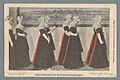
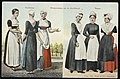
 Amsterdamsche Burgerweesmeisjes (ansichtkaart, kleur).jpg 999 × 650; 91 KB
-
 Amsterdamsche burgerweesmeisjes (titel op object), RP-F-F19253.jpg 3,528 × 2,360; 1.64 MB
-

-
 1291-Twee regentessen.jpg 1,400 × 987; 313 KB
-

-

-
 Boerderij aan de Amstelveenseweg - Amsterdam - 20014135 - RCE.jpg 1,200 × 960; 163 KB
-
 Boerderij tekening in de Beemster - Amsterdam - 20014131 - RCE.jpg 952 × 1,200; 287 KB
-
 Bovenstuk van wapenbord 1739 - Amsterdam - 20014269 - RCE.jpg 942 × 1,200; 250 KB
-
 Brouwerij - Amsterdam - 20014327 - RCE.jpg 960 × 1,200; 382 KB
-
 Burger-Weeshuis, Amsterdam (ansichtkaart, kleur).jpg 1,000 × 602; 298 KB
-

-
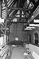
 De binnenplaats, Bestanddeelnr 922-5930.jpg 3,703 × 2,443; 1.77 MB
-

-

-
 De galerij met het restaurant en de vroegere kleedkastjes, Bestanddeelnr 922-5925.jpg 3,702 × 2,436; 1.65 MB
-

-
 De strijkzaal van het Burgerweeshuis, Kalverstraat 92. Uitgave N.J. Boon, Amsterdam.jpg 1,780 × 1,138; 256 KB
-
 De voormalige kleedkastjes worden voor een deel vitrines, Bestanddeelnr 922-5929.jpg 3,703 × 2,443; 1.51 MB
-
 De zaal voor het restaurant, Bestanddeelnr 922-5926.jpg 3,702 × 2,436; 1.39 MB
-
 Deel gevel - Amsterdam - 20403194 - RCE.jpg 1,013 × 1,200; 272 KB
-
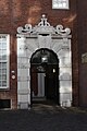
 Deurpartij - Amsterdam - 20014066 - RCE.jpg 1,177 × 1,200; 362 KB
-
-

-

-

-

-

-
 Enkele opgravingsspecialisten in actie, Bestanddeelnr 921-5803.jpg 3,679 × 2,413; 1.79 MB
-
 Enkele opgravingsspecialisten in actie, Bestanddeelnr 921-5804.jpg 3,694 × 2,425; 1.75 MB
-
 Enkele opgravingsspecialisten in actie, Bestanddeelnr 921-5805.jpg 3,673 × 2,428; 1.74 MB
-
 Exterieur - Amsterdam - 20014062 - RCE.jpg 1,190 × 1,200; 378 KB
-
 Exterieur - Amsterdam - 20014063 - RCE.jpg 1,192 × 1,200; 334 KB
-
 Exterieur - Amsterdam - 20014064 - RCE.jpg 1,185 × 1,200; 350 KB
-
 Exterieur aan de wegkant van de N.Z.voorburgwal - Amsterdam - 20014071 - RCE.jpg 1,188 × 1,200; 428 KB
-
 Exterieur gevel St. Luciënsteeg 27 - Amsterdam - 20014058 - RCE.jpg 1,188 × 1,200; 354 KB
-
 Exterieur gevel St. Luciënsteeg 27 - Amsterdam - 20014059 - RCE.jpg 1,185 × 1,200; 370 KB
-
 Exterieur gevel St. Luciënsteeg 27 - Amsterdam - 20014060 - RCE.jpg 1,181 × 1,200; 360 KB
-
 Exterieur GEVEL, GEDEELTE - Amsterdam - 20260219 - RCE.jpg 794 × 1,200; 169 KB
-
 Exterieur INGANGSPARTIJ, WAPENSCHILD - Amsterdam - 20260220 - RCE.jpg 1,200 × 786; 200 KB
-
 Fragment naambord 1818 - Amsterdam - 20014216 - RCE.jpg 1,192 × 1,200; 570 KB
-
 Fragment naambord 1818 - Amsterdam - 20014217 - RCE.jpg 1,195 × 1,200; 536 KB
-
 Fragment naambord 1818 - Amsterdam - 20014218 - RCE.jpg 1,197 × 1,200; 530 KB
-
 Galerij - Amsterdam - 20403193 - RCE.jpg 1,200 × 958; 253 KB
-
 Gedenkplaat J.C.J. van Speyk 1831 - Amsterdam - 20014103 - RCE.jpg 1,200 × 955; 201 KB
-
 Gedenksteen van Van Speyk 1831 - Amsterdam - 20014086 - RCE.jpg 1,200 × 954; 161 KB
-
 Gedenksteen van Van Speyk 1831 - Amsterdam - 20014087 - RCE.jpg 1,200 × 961; 255 KB
-
 Gevel - Amsterdam - 20014354 - RCE.jpg 1,181 × 1,200; 415 KB
-

-
 Gevel van wolwinkel en ziekenkeuken - Amsterdam - 20014346 - RCE.jpg 946 × 1,200; 284 KB
-
 Gevelsteen - Amsterdam - 20014028 - RCE.jpg 958 × 1,200; 351 KB
-

-

-

-
 Gravure - Amsterdam - 20014347 - RCE.jpg 1,200 × 877; 396 KB
-
 Gravures uit Casparus Crommelin - Amsterdam - 20014142 - RCE.jpg 1,200 × 956; 211 KB
-
 Gravures uit Crommelin 1693 - Amsterdam - 20014214 - RCE.jpg 1,200 × 943; 281 KB
-
 Gravures uit Crommelin 1728 - Amsterdam - 20014207 - RCE.jpg 1,200 × 942; 290 KB
-

-
 Herdenking van het overlijden van Van Speijk in het Burgerweeshuis.jpg 2,712 × 2,008; 714 KB
-
 Het binnenplein, Bestanddeelnr 916-1422.jpg 2,619 × 2,628; 1.28 MB
-
 Het binnenplein, Bestanddeelnr 916-1423.jpg 2,632 × 2,627; 1.31 MB
-
 Het binnenplein, Bestanddeelnr 916-1424.jpg 2,625 × 2,643; 1.65 MB
-
 Het binnenplein, Bestanddeelnr 916-1425.jpg 2,631 × 2,631; 1.28 MB
-
 Het binnenplein, Bestanddeelnr 916-1426.jpg 2,625 × 2,640; 996 KB
-
 Het binnenplein, Bestanddeelnr 916-1427.jpg 2,631 × 2,640; 1.15 MB
-
 Het binnenplein, Bestanddeelnr 916-1428.jpg 2,628 × 2,628; 1.48 MB
-
 Het binnenplein, Bestanddeelnr 916-1429.jpg 2,628 × 2,631; 1.47 MB
-

-
 Het oudste deel van het Burgerweeshuis, Bestanddeelnr 922-5928.jpg 3,702 × 2,436; 1.65 MB
-

-

-

-

-

-
 Hilverdink, Johannes J. A. (1813-1902), Afb 010097002765.jpg 2,060 × 2,763; 924 KB
-

-
 Ingang - Amsterdam - 20403192 - RCE.jpg 961 × 1,200; 291 KB
-
-
 Interieur en exterieur - Amsterdam - 20014016 - RCE.jpg 958 × 1,200; 246 KB
-
 Interieur en exterieur - Amsterdam - 20014017 - RCE.jpg 1,014 × 1,200; 298 KB
-
 Interieur en exterieur - Amsterdam - 20014019 - RCE.jpg 958 × 1,200; 231 KB
-
 Interieur en exterieur - Amsterdam - 20014021 - RCE.jpg 1,200 × 960; 269 KB
-
 Interieur en exterieur - Amsterdam - 20014022 - RCE.jpg 1,200 × 953; 204 KB
-
 Interieur en exterieur - Amsterdam - 20014023 - RCE.jpg 1,200 × 958; 252 KB
-
 Interieur en exterieur - Amsterdam - 20014025 - RCE.jpg 1,200 × 958; 267 KB
-

-
 Inventaris onbekend schilderij van man met hoed - Amsterdam - 20014175 - RCE.jpg 940 × 1,200; 248 KB
-

-
 J.M.A. Rieke Afb 010097015204.jpg 5,562 × 4,858; 5.79 MB
-
 J.M.A. Rieke Afb 010097015205.jpg 5,806 × 5,084; 4.31 MB
-
 J.M.A. Rieke Afb 010097015206.jpg 5,613 × 4,940; 4.32 MB
-
 Johan Conrad Greive jr (1837-1891), Afb 010097001109.jpg 2,247 × 1,516; 725 KB
-
 Johan Conrad Greive jr (1837-1891), Afb 010194000329.jpg 2,037 × 1,389; 998 KB
-
 Jongenshuis ingangsportaal - Amsterdam - 20014349 - RCE.jpg 955 × 1,200; 260 KB
-
 Kalverstraat 106, verbouwingsplan - Amsterdam - 20014294 - RCE.jpg 1,200 × 952; 223 KB
-
 Kalverstraat 106-94, overzicht - Amsterdam - 20014301 - RCE.jpg 950 × 1,200; 223 KB
-
 Kalverstraat 84, opmeting 1931 - Amsterdam - 20014278 - RCE.jpg 1,200 × 954; 204 KB
-
 Kalverstraat 84, opmeting gevel - Amsterdam - 20014287 - RCE.jpg 1,000 × 1,200; 396 KB
-
 Kalverstraat 86-88, verbouwingstekening - Amsterdam - 20014100 - RCE.jpg 956 × 1,200; 195 KB
-
 Kalverstraat 86-88-90, opmeting gevels - Amsterdam - 20014284 - RCE.jpg 948 × 1,200; 351 KB
-
 Kalverstraat 90-78, overzicht - Amsterdam - 20014299 - RCE.jpg 953 × 1,200; 234 KB
-

-
-
 Kalverstraat 92, de meisjes eetzaal van het burger weeshuis, Afb ANWU01699000007.jpg 1,678 × 1,106; 660 KB
-
 Kalverstraat 92, naailes van weesmeisjes in het burger weeshuis, Afb ANWU01699000006.jpg 1,665 × 1,086; 634 KB
-
 Kalverstraat, Burgerweeshuis.jpg 1,280 × 811; 220 KB
-
 Kapiteel - Amsterdam - 20014350 - RCE.jpg 1,185 × 1,200; 305 KB
-
 Kapiteel - Amsterdam - 20014351 - RCE.jpg 1,192 × 1,200; 301 KB
-
 Kapiteel - Amsterdam - 20014352 - RCE.jpg 1,197 × 1,200; 291 KB
-
 Kapiteel - Amsterdam - 20014353 - RCE.jpg 960 × 1,200; 261 KB
-
 Kapiteel in gevel, ramen met roedenverdeling - Amsterdam - 20398853 - RCE.jpg 1,195 × 1,200; 281 KB
-
 Kapiteel west vleugel - Amsterdam - 20014316 - RCE.jpg 1,200 × 961; 225 KB
-
 Kapiteel west vleugel - Amsterdam - 20014317 - RCE.jpg 1,200 × 954; 290 KB
-
 Kerkgang weesmeisjes.jpg 6,400 × 4,162; 1 MB
-
 Koninklijk paar in Amsterdam, bezoek aan Burgerweeshuis aankomst, Bestanddeelnr 903-6740.jpg 3,171 × 2,500; 1.49 MB
-
 Koninklijk paar in Amsterdam, bezoek aan Burgerweeshuis aankomst, Bestanddeelnr 903-6741.jpg 3,193 × 2,527; 1.52 MB
-
 Meisje in werkkleding door N.van der Waay - Amsterdam - 20014164 - RCE.jpg 948 × 1,200; 224 KB
-

-

-
 Model van de keuken uit 1928 - Amsterdam - 20014252 - RCE.jpg 1,200 × 947; 201 KB
-
 Monument to commemorate Jan van Speyk, in the Burgerweeshuis, Amsterdam.jpg 6,400 × 5,075; 2.53 MB
-
 Naambord regenten en regentessen (1708-1734) - Amsterdam - 20014200 - RCE.jpg 942 × 1,200; 162 KB
-
 Naambord van regenten (1735-1759) - Amsterdam - 20014162 - RCE.jpg 955 × 1,200; 241 KB
-
 Naambord van regenten (1828-1912) - Amsterdam - 20014202 - RCE.jpg 940 × 1,200; 219 KB
-

-
 Netherlands-4423 - Amsterdam City Orphanage (12082785565).jpg 6,035 × 4,053; 10.26 MB
-

-

-
 Ontwerp boerderij aan de Amstelveenseweg - Amsterdam - 20014137 - RCE.jpg 1,200 × 960; 214 KB
-

-

-
 Ontwerp voor een boerderij - Amsterdam - 20014136 - RCE.jpg 1,200 × 940; 172 KB
-

-
 Ontwerptekening (1696) Kalverstr.100-106 - Amsterdam - 20014109 - RCE.jpg 946 × 1,200; 198 KB
-

-
 Ontwerptekening voor een boerderij - Amsterdam - 20014108 - RCE.jpg 950 × 1,200; 229 KB
-

-

-
 Opmeting B.F. v.Berckenrode 1631 fragment - Amsterdam - 20014089 - RCE.jpg 1,200 × 956; 342 KB
-
 Opmeting fragment B.F. v.Berckenrode - Amsterdam - 20014093 - RCE.jpg 1,200 × 960; 290 KB
-

-

-

-
 Opmeting van B.F. v.Berckenrode fragment - Amsterdam - 20014092 - RCE.jpg 1,200 × 953; 320 KB
-

-

-
 Opmeting van de keukenvleugel - Amsterdam - 20014275 - RCE.jpg 1,200 × 944; 204 KB
-
 Opmeting van de keukenvleugel - Amsterdam - 20014280 - RCE.jpg 1,200 × 950; 248 KB
-

-
 Opmeting verbouwing van 1696 Kalverstr. 102-106 - Amsterdam - 20014116 - RCE.jpg 1,200 × 955; 214 KB
-
 Opmeting weeshuis A. Kok 1938 - Amsterdam - 20014270 - RCE.jpg 1,200 × 952; 391 KB
-
 Ornament jongensplaat boven zuil - Amsterdam - 20014334 - RCE.jpg 964 × 1,200; 208 KB
-
 Ornament voor deur of raam van Karinsche orde - Amsterdam - 20014344 - RCE.jpg 917 × 1,200; 264 KB
-

-
 Oud-wezenkamer van het Burgerweeshuis, Kalverstraat 92. Uitgave N.J. Boon, Amsterdam.jpg 1,756 × 1,132; 250 KB
-

-

-

-
 Oude afbeeldingen kaart van Pieter Bast 1599 - Amsterdam - 20014205 - RCE.jpg 935 × 1,200; 513 KB
-

-
 Oude tekeningen opmeting A.A.Kok 1938 - Amsterdam - 20014274 - RCE.jpg 1,200 × 905; 299 KB


.jpg)
,_RP-F-F19253.jpg)


.jpg)


,_RP-F-00-651.jpg)


_-_Amsterdam_-_20014210_-_RCE.jpg)
_-_Amsterdam_-_20014208_-_RCE.jpg)


,_Afb_010097002765.jpg)


,_Afb_010097001109.jpg)
,_Afb_010194000329.jpg)


_-_Amsterdam_-_20014200_-_RCE.jpg)
_-_Amsterdam_-_20014162_-_RCE.jpg)
_-_Amsterdam_-_20014202_-_RCE.jpg)

.jpg)


_-_Amsterdam_-_20014090_-_RCE.jpg)


_Kalverstr.100-106_-_Amsterdam_-_20014109_-_RCE.jpg)
_-_Amsterdam_-_20014111_-_RCE.jpg)


_-_Amsterdam_-_20014095_-_RCE.jpg)


_-_Amsterdam_-_20014201_-_RCE.jpg)
_-_Amsterdam_-_20014204_-_RCE.jpg)


&filefrom=Oudere+jongens+en+leidinggevenden+op+de+binnenplaats+van+het+Burgerweeshuis%2C+Kalverstraat+92.+Uitgave+N.J.+Boon%2C+Amsterdam%2C+Afb+PBKD00357000007.jpg#mw-category-media)