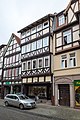
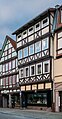
Category:Burgstraße 13, Hann. Münden
Jump to navigation
Jump to search
| Object location | | View all coordinates using: OpenStreetMap |
|---|
This is the category of the Baudenkmal (cultural heritage monument) according to the Cultural Heritage Protection Law of Lower Saxony with the ID 36477116 (Wikidata (P7900)).
|
| Upload media | |||||
| Instance of | |||||
|---|---|---|---|---|---|
| Location | Hann. Münden, Göttingen district, Lower Saxony, Germany | ||||
| Located on street |
| ||||
| Heritage designation | |||||
 | |||||
Media in category "Burgstraße 13, Hann. Münden"
The following 5 files are in this category, out of 5 total.
-
 Burgstraße 11, 13, 15 Hann. Münden 001 20171027.jpg 3,612 × 5,411; 14.72 MB
-
 Burgstraße 13 Hann. Münden 002 20171027.jpg 4,016 × 6,016; 16.22 MB
-
 Burgstraße 13 Hann. Münden 003 20171027.jpg 4,016 × 6,016; 17.88 MB
-
 Burgstrasse 13 in Hann. Muenden (1).jpg 2,395 × 5,900; 9.49 MB
-
 Burgstrasse 13 in Hann. Muenden (2).jpg 2,676 × 5,147; 8.79 MB


.jpg)
.jpg)