Category:Burneside
Jump to navigation
Jump to search
English: Burneside is a small village in Cumbria, England. It is located to the north of Kendal and to the southeast of Staveley, on the River Kent, just upstream from where the River Sprint joins it and has circa 2000 inhabitants.
village in Cumbria, United Kingdom  | |||||
| Upload media | |||||
| Instance of | |||||
|---|---|---|---|---|---|
| Location | Strickland Ketel, South Lakeland, Cumbria, North West England, England | ||||
 | |||||
Subcategories
This category has the following 3 subcategories, out of 3 total.
B
O
Media in category "Burneside"
The following 92 files are in this category, out of 92 total.
-

-
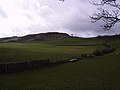
 Bannisdale Beck - geograph.org.uk - 441950.jpg 640 × 480; 104 KB
-
 Boathouse, Gurnal Dubs - geograph.org.uk - 507820.jpg 640 × 480; 96 KB
-
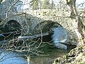
 Bowston Bridge - geograph.org.uk - 236297.jpg 600 × 450; 102 KB
-
 Bowston Bridge - geograph.org.uk - 92017.jpg 640 × 480; 186 KB
-
 Burneside Fungi - panoramio.jpg 3,072 × 2,304; 3.02 MB
-
 Burneside Mill Weir - geograph.org.uk - 91921.jpg 640 × 480; 125 KB
-
 Burneside railway tracks.jpg 2,448 × 3,264; 4.6 MB
-
 Cowan Head mill rapid - geograph.org.uk - 1716054.jpg 640 × 500; 129 KB
-
 Dales Way approaching Oakbank - geograph.org.uk - 1710532.jpg 2,816 × 2,112; 2.2 MB
-
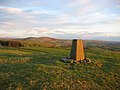
 Elba Monument - geograph.org.uk - 126597.jpg 640 × 427; 108 KB
-
 Elba Monument.jpg 480 × 640; 58 KB
-
 Fence, Capplebarrow - geograph.org.uk - 441907.jpg 640 × 480; 109 KB
-
 Garnett Bridge - geograph.org.uk - 361141.jpg 600 × 400; 91 KB
-
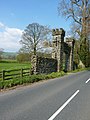 Gateway, Tolson Hall.jpg 1,920 × 2,560; 1.22 MB
-
 Gurnal Dubs - geograph.org.uk - 507824.jpg 640 × 480; 97 KB
-
 Hollins Lane, Burneside - panoramio.jpg 3,072 × 2,304; 3.03 MB
-
 Kendal Green - geograph.org.uk - 148113.jpg 640 × 480; 114 KB
-
 Looks like a Castle - panoramio.jpg 3,072 × 2,304; 3.05 MB
-
 Low Taggleshaw - geograph.org.uk - 507833.jpg 640 × 480; 96 KB
-
 Middle Taggleshaw - geograph.org.uk - 507817.jpg 640 × 480; 123 KB
-
 Minor road west of Burnside - geograph.org.uk - 1381822.jpg 1,000 × 669; 332 KB
-
 Nice spot for a farm - geograph.org.uk - 416461.jpg 600 × 400; 88 KB
-
 Old Wall, Swinklebank Crag - geograph.org.uk - 680713.jpg 640 × 480; 101 KB
-
 River Kent - geograph.org.uk - 236282.jpg 600 × 450; 98 KB
-
 River Sprint - geograph.org.uk - 361139.jpg 600 × 400; 94 KB
-
 River Sprint near Sprint Mill - geograph.org.uk - 148122.jpg 640 × 480; 120 KB
-
 Rock Slab, Bannisdale Beck - geograph.org.uk - 441937.jpg 480 × 640; 112 KB
-
 Romney's Kendal Mint Cake - geograph.org.uk - 261005.jpg 640 × 431; 61 KB
-
 Samica Kosa.JPG 3,218 × 2,307; 829 KB
-
 Sheep - geograph.org.uk - 263221.jpg 640 × 480; 130 KB
-
 Sheep or Goats - geograph.org.uk - 507849.jpg 640 × 480; 103 KB
-
 Sheep, Mere Crag - geograph.org.uk - 680679.jpg 640 × 480; 85 KB
-
 Stone Posts, Capplebarrow - geograph.org.uk - 441592.jpg 640 × 480; 94 KB
-
 The Elba Monument - geograph.org.uk - 1749495.jpg 2,848 × 2,136; 1.56 MB
-
 Tolson Hall.jpg 1,500 × 843; 1.4 MB
-
 View towards Burnside from near Gilpin Bank - geograph.org.uk - 1382096.jpg 1,000 × 669; 240 KB
-
 Wall, Ancrow Brow - geograph.org.uk - 680717.jpg 640 × 480; 88 KB
-
 Wall, Dryhowe Pasture - geograph.org.uk - 441261.jpg 640 × 480; 117 KB
-
 Walls above Mosergh Farm - geograph.org.uk - 441208.jpg 640 × 480; 91 KB
-
 A tight fit - geograph.org.uk - 416470.jpg 600 × 400; 94 KB
-
 Above East View - geograph.org.uk - 507858.jpg 640 × 480; 100 KB
-
 Ancrow Brow - geograph.org.uk - 680695.jpg 640 × 480; 101 KB
-
 Ancrow Brow, North Top - geograph.org.uk - 680688.jpg 640 × 480; 87 KB
-
 Bannisdale - geograph.org.uk - 441246.jpg 640 × 480; 144 KB
-
 Bannisdale Head - geograph.org.uk - 441920.jpg 640 × 480; 82 KB
-
 Bannisdale Head - geograph.org.uk - 441940.jpg 480 × 640; 122 KB
-
 Beck, Sleddale Fell - geograph.org.uk - 680671.jpg 640 × 480; 115 KB
-
 Blackcrag Plantation - geograph.org.uk - 441911.jpg 640 × 480; 103 KB
-
 Borrowdale Moss - geograph.org.uk - 680674.jpg 640 × 480; 72 KB
-
 Boundary Stone, Potter Fell - geograph.org.uk - 507837.jpg 480 × 640; 99 KB
-
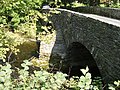
 Burneside Bridge - geograph.org.uk - 91910.jpg 640 × 480; 175 KB
-
 Cairn on Cunswick Fell - geograph.org.uk - 416433.jpg 600 × 400; 78 KB
-
 Cairn, Potter Fell - geograph.org.uk - 507831.jpg 640 × 480; 90 KB
-
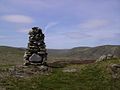 Cairn, Whiteside Pike - geograph.org.uk - 441214.jpg 640 × 480; 75 KB
-
 Cairn, Whiteside Pike - geograph.org.uk - 441895.jpg 640 × 480; 87 KB
-
 Close What^ - geograph.org.uk - 507839.jpg 640 × 480; 125 KB
-
 Crookdale Beck - geograph.org.uk - 686307.jpg 640 × 480; 96 KB
-
 Crookdale Beck - geograph.org.uk - 686333.jpg 480 × 640; 104 KB
-
 East View - geograph.org.uk - 507854.jpg 640 × 480; 121 KB
-
 Field and Hedge - geograph.org.uk - 168295.jpg 640 × 480; 82 KB
-
 Forget me Nots - geograph.org.uk - 441238.jpg 640 × 480; 135 KB
-
 From Mere Crag - geograph.org.uk - 680686.jpg 640 × 480; 96 KB
-
 From Potter Fell - geograph.org.uk - 507846.jpg 640 × 480; 90 KB
-
 From Todd Fell - geograph.org.uk - 441496.jpg 640 × 480; 61 KB
-
 Garnett Bridge - Bridge and village - geograph.org.uk - 307133.jpg 640 × 480; 107 KB
-
 Garnett Bridge Road - geograph.org.uk - 263231.jpg 640 × 480; 211 KB
-
 Green Lane - geograph.org.uk - 441888.jpg 640 × 480; 114 KB
-
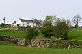
 Hill Fold Farm - geograph.org.uk - 263228.jpg 640 × 480; 212 KB
-
 Hollin Root Farm - geograph.org.uk - 126258.jpg 640 × 427; 156 KB
-
 Industrial estate north of Mintsfeet. - geograph.org.uk - 143161.jpg 640 × 480; 59 KB
-
 Kendal Fell - geograph.org.uk - 148120.jpg 640 × 480; 64 KB
-
 Light Water - geograph.org.uk - 441880.jpg 640 × 480; 112 KB
-
 Looking down to Potter Tarn - geograph.org.uk - 491554.jpg 640 × 480; 95 KB
-
 Madgegill Farm - geograph.org.uk - 416419.jpg 600 × 400; 100 KB
-
 Mere Crag - geograph.org.uk - 680676.jpg 640 × 480; 65 KB
-
 Moorland above Potter Tarn - geograph.org.uk - 491549.jpg 640 × 480; 107 KB
-
 Moorland above Potters Tarn - geograph.org.uk - 491547.jpg 640 × 480; 99 KB
-
 Old Quarry, Bannisdale - geograph.org.uk - 441914.jpg 480 × 640; 129 KB
-
 On Capplebarrow - geograph.org.uk - 441902.jpg 640 × 480; 98 KB
-
 Potter Fell Road - geograph.org.uk - 263225.jpg 640 × 480; 184 KB
-
 Road Junction - geograph.org.uk - 227200.jpg 640 × 480; 189 KB
-
 Spittal Farm - geograph.org.uk - 148148.jpg 640 × 480; 113 KB
-

-
 Summit, Todd Fell - geograph.org.uk - 441490.jpg 640 × 480; 88 KB
-
 Tarn, Whiteside - geograph.org.uk - 441890.jpg 640 × 480; 101 KB
-
 The end of the Lancaster Canal - geograph.org.uk - 71125.jpg 640 × 480; 80 KB
-
 Thornyslack - geograph.org.uk - 374867.jpg 640 × 480; 66 KB
-
 Two footpath signs - geograph.org.uk - 236302.jpg 600 × 450; 84 KB
-

-
 Whiteside Pike - geograph.org.uk - 441894.jpg 640 × 480; 99 KB
-
 Whiteside Ridge - geograph.org.uk - 441897.jpg 640 × 480; 85 KB


